The best walks and hikes around Area D (Falkland/Silver Creek)
4.7
(26)
230
hikers
15
hikes
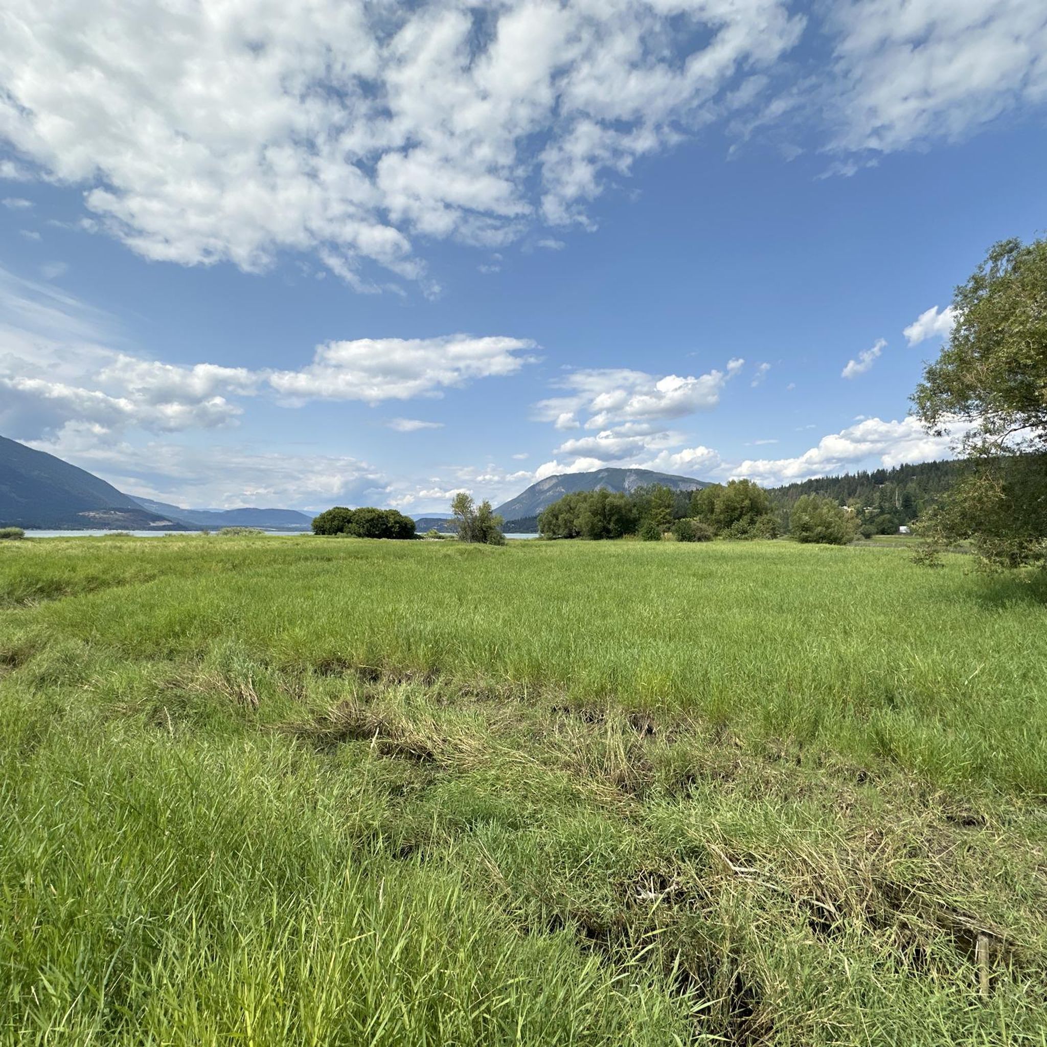
Hiking around Area D (Falkland/Silver Creek) offers diverse landscapes, including rolling farmland, meandering rivers, and forested hills. The region is characterized by numerous small lakes and is bordered by mountains such as Tuktakamin Mountain and Estekawalan Mountain. Varied terrain encompasses valleys, escarpment vistas, and paths leading to unique geological features like "The Pillar." This area provides a range of hiking experiences across its natural features.
Best hiking trails around Area D (Falkland/Silver Creek)
- The most popular hiking route is Margaret…
Last updated: September 2, 2026
4.9
(9)
49
hikers
5.18km
01:42
230m
220m
Easy hike. Great for any fitness level. Easily-accessible paths. Suitable for all skill levels.
4.5
(2)
15
hikers
5.99km
01:33
30m
30m
Easy hike. Great for any fitness level. Easily-accessible paths. Suitable for all skill levels.

Sign up for free
4.0
(1)
17
hikers
8.14km
02:35
310m
310m
Moderate hike. Good fitness required. Easily-accessible paths. Suitable for all skill levels.
5.0
(1)
16
hikers
4.81km
01:29
170m
170m
Easy hike. Great for any fitness level. Easily-accessible paths. Suitable for all skill levels.
11
hikers
3.65km
01:04
100m
100m
Easy hike. Great for any fitness level. Easily-accessible paths. Suitable for all skill levels.
Get access to more routes and recommendations from other explorers.
Sign up for free
Already have an account?
Our route recommendations are based on thousands of hikes, rides, and runs completed by other people on komoot.
Start today with a free account
Your next adventure awaits.
Login or Signup
Popular around Area D (Falkland/Silver Creek)
Tips from the Community

This viewpoint sits just below the summit of Mount Rose Swanson, giving you great views over the surrounding area. It's one of many viewpoints along the Jackpine Trail, though it's up to you to decide which one is your favourite.
0
0

A wonderful relatively easy hike, that's just one option amongst the extensive trail network through this forest. Keep an eye out for mountain bikers as these are multi-use trails.
0
0

The trail climbs steadily at a moderate grade before it turns west toward the overlooks and climbs Mount Rose. You descend a little between here and the tower lookout if you continue on the Centennial Trail.
0
0
There is a large crushed gravel lot at the trailhead, and the drive in is quite accessible. The trails here are a mix of moderate difficulty paths that take you up to panoramic views of the countryside. There is an outhouse at the overlook when you get there.
0
0
This wide trail follows along the shoreline of Shuswap Lake across boardwalks and through parklands. You'll pass by a viewing platform, benches, and picnic areas which will all invite you to stop for a while to enjoy the stunning views across the water.
0
0

Shuswap Lake, which has over 400 kilometers of navigable coastline, is home to several species of salmonids, such as chinook salmon, coho salmon, sockeye salmon, rainbow trout, and lake trout. These fish are of great importance for recreational fishing in the area.
0
0

From a viewing platform at the end of the trail, you can take in the majesty of the 90-foot, two-step Margaret Falls.
0
0
You can see a portion of the Salmon Arm of Shuswap Lake from this spot in the trees along the trail.
0
0
Frequently Asked Questions
How many hiking trails are available in Area D (Falkland/Silver Creek)?
Area D (Falkland/Silver Creek) offers a selection of hiking routes, with around 5-10 trails documented on komoot. These range from easy strolls to more challenging ascents, providing options for various skill levels.
What kind of terrain can I expect on hikes around Falkland and Silver Creek?
The terrain in Area D is quite diverse, featuring rolling farmland, meandering rivers, and forested hills. You'll find paths through valleys, along escarpment vistas, and leading to unique geological formations. Some trails offer easily accessible paths, while others are more strenuous and may require sure-footedness.
Are there any easy, family-friendly hikes in Area D?
Yes, there are several easy routes suitable for families. For instance, the Margaret Falls loop — Herald Provincial Park is an easy 3.2-mile trail that explores natural beauty. Another great option is the Mount Rose Swanson Trail: Aspen & Douglas Fir loop — Spallumcheen Valley, an easy 3.6-mile path winding through distinct tree stands.
Can I find trails with waterfalls in the Falkland/Silver Creek area?
Yes, the region is home to beautiful waterfalls. You can visit Margaret Falls, which is part of the Margaret Falls loop. Another notable waterfall in the area is Syphon Falls.
Are there any trails with good viewpoints or scenic overlooks?
Absolutely. The area is bordered by prominent peaks like Tuktakamin Mountain and Estekawalan Mountain, which offer panoramic views. Specific viewpoints include Tower Lookout and East Lookout, providing rewarding vistas of the surrounding landscapes.
What are some unique natural features to explore while hiking?
A truly unique natural feature is 'The Pillar' in Pillar Provincial Park, a 90-foot geological formation of dirt and rock. While not directly on a komoot route in this guide, it's a distinctive landmark in the broader Area D. The region also features numerous small lakes like Joyce Lake and Pillar Lake, and the Salmon River, adding to its natural beauty.
What do other hikers say about the trails in Area D (Falkland/Silver Creek)?
The hiking routes in Area D (Falkland/Silver Creek) are highly rated by the komoot community, with an average score of 4.9 stars from over 10 reviews. Hikers often praise the diverse landscapes, from forested hills to lake views, and the variety of options for different ability levels.
Are there any loop trails available for hiking?
Yes, several trails in Area D are designed as loops. Examples include the Margaret Falls loop and the Mount Rose Swanson Trail: Aspen & Douglas Fir loop. These circular routes allow you to experience varied scenery without retracing your steps.
What is the best time of year to go hiking in Area D?
Area D benefits from a moderate year-round climate, making it suitable for outdoor activities for much of the year. Spring and fall offer pleasant temperatures and vibrant scenery, while summer is ideal for combining hikes with water activities at the numerous lakes. Winter hiking is also possible, though conditions may vary and require appropriate gear.
Are there any challenging hikes for experienced hikers?
Yes, for those seeking a more strenuous experience, the East Peak Trail — Salmon Arm is a difficult 9.0-mile trail with significant elevation gain, typically taking over 5 hours to complete. Another challenging option is the View from Enderby Cliffs loop from Enderby, a moderate to difficult route with substantial elevation.
Is public transport available to reach trailheads in Area D?
Public transport options directly to specific trailheads within Area D (Falkland/Silver Creek) are generally limited. It is often recommended to use a personal vehicle to access many of the hiking routes and natural attractions in this region.
Where can I find parking for hikes near Falkland and Silver Creek?
Parking availability varies by trailhead. Many provincial parks and popular hiking areas, such as Herald Provincial Park for the Margaret Falls loop, typically offer designated parking facilities. For less frequented trails, roadside parking might be an option, but it's always advisable to check specific trail information or local signage before you go.
Most popular routes around Area D (Falkland/Silver Creek)
Most popular attractions around Area D (Falkland/Silver Creek)

Get inspired with the komoot mobile app


Explore more
Browse the best Hikes in other regions.
