The best walks and hikes around Muniesa
4.0
(5)
18
hikers
5
hikes
Hiking around Muniesa provides access to the diverse landscapes of the Teruel province in Spain. The terrain features a mix of red rock canyons, extensive pine forests, and river trails. The region offers varied elevations, with routes traversing alternating mountain ranges and lush pastures, providing a range of natural features for exploration.
Best hiking trails around Muniesa
- The most popular hiking route is Oliete and the Hermitage of the Virgin of Cantal Loop, a 3.4 miles (5.4 km) trail…
Last updated: July 7, 2026
1
hikers
5.44km
01:38
190m
180m
Moderate hike. Great for any fitness level. Mostly accessible paths. Sure-footedness required.
4
hikers
18.0km
05:06
380m
380m
Hard hike. Very good fitness required. Easily-accessible paths. Suitable for all skill levels.

Sign up for free
3.0
(1)
3
hikers
8.72km
02:23
130m
140m
Moderate hike. Good fitness required. Easily-accessible paths. Suitable for all skill levels.
4
hikers
20.0km
05:34
380m
380m
Hard hike. Very good fitness required. Easily-accessible paths. Suitable for all skill levels.
5.0
(4)
4
hikers
6.00km
01:40
110m
110m
Easy hike. Great for any fitness level. Easily-accessible paths. Suitable for all skill levels.
Our route recommendations are based on thousands of hikes, rides, and runs completed by other people on komoot.
Start today with a free account
Your next adventure awaits.
Login or Signup

Tips from the Community

The hermitage of San Miguel dates from the 17th century, although it has undergone subsequent reforms. Its location has a lot to do with the presence of a nearby spring, which also makes it possible to raft next to the hermitage. The hermitage is rectangular, very long, with a single nave, covered with a barrel vault. At the beginning of 2011 it was restored, painting the interior in blue. It goes in procession on the saint's festivities, on May 8 and September 29.
0
0

We are in a beautiful Teruel town located in the Cuencas Mineras region with about 81 inhabitants in 2020. Do you dare to discover the reason for the town's name? It is a curious story.
1
0

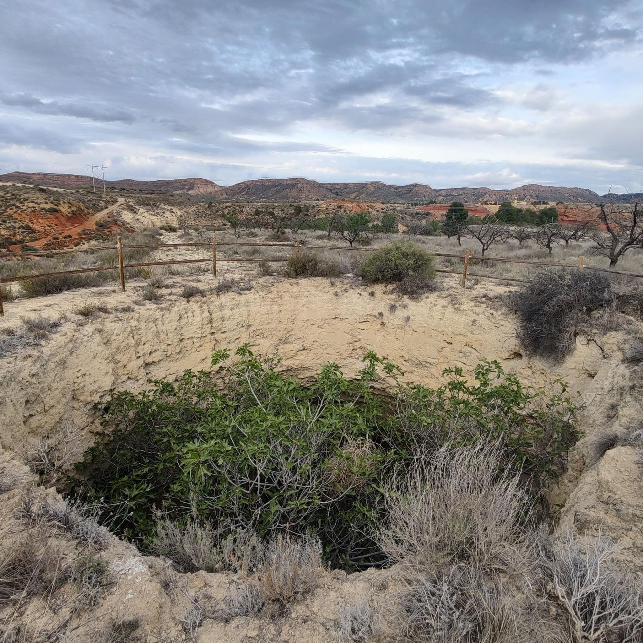
Just a couple of kilometers from the center of Oliete is this picturesque spot surrounded by a typical Teruel landscape. You can take the path to make a circular route passing by the Hermitage of the Virgen del Cantal.
2
1
On the bed of the Martín River and a few meters from the town of Oliete is the Cueva Foradada reservoir, a beautiful and quiet place ideal for hot days and spending time by the water.
2
1

The Cova Foradada swamp is a reservoir that collects the waters of the Río Martín and where it begins a few kilometers further up, in the town of Alcaine. This body of water meanders through the Sierra de los Moros.
0
0
Oliete is located above the riverbed of the Río Martín, where it is elevated from the rest of the land since the river has created a plain below the town, where there are currently agricultural fields.
0
0
Muniesa is a town that is located at the gates of the Iberian System, with small mountains around the town. As a curiosity, the term Muniesa comes from the Arabic MUNYA 'IṢA', the country house (with land) of Jesus.
0
0

The name of this locality has a very interesting etymological peculiarity. It really originates from the reddish material of the area, known as Rubiello, which in Aragonese resembles the word viello, old. For this reason and because of the sickle that crosses the town, it was renamed from Foz Rubiella to Foz la Viela, which was later castellanized as Hoz de la Vieja.
0
0
Frequently Asked Questions
What kind of hiking trails can I expect around Muniesa?
The Muniesa region, situated within the diverse landscapes of Teruel, Spain, offers a variety of trails. You'll find routes that traverse pine forests, explore river trails, and lead through areas with varied elevations. While the immediate vicinity of Muniesa features a mix of easy to difficult paths, the broader Teruel province is known for its dramatic red rock canyons and mountain ranges like the Sierra de Gúdar-Javalambre.
Are there any easy hiking trails suitable for beginners or a relaxed walk?
Yes, there is at least one easy trail available. For a relaxed walk, consider the Oliete – Cueva Foradada Reservoir loop from Oliete. This route covers approximately 6 km with a moderate elevation gain, offering a pleasant experience along the reservoir.
What are some of the more challenging hikes in the Muniesa area?
For those seeking a more demanding experience, two difficult routes stand out. The Hoz de la Vieja loop from La Hoz de la Vieja is a substantial 18 km trek with significant elevation changes. Another challenging option is the Muniesa loop from Muniesa, which spans nearly 20 km and also features considerable ascents and descents.
What natural features or landmarks can I see while hiking around Muniesa?
The area around Muniesa offers several points of interest. You can visit the serene Cueva Foradada Reservoir, explore the settlement of Hoz de la Vieja, or discover the historic Hermitage of Santa Ana. These highlights provide a glimpse into the natural beauty and cultural heritage of the region.
Are there any circular hiking routes available?
Yes, several circular routes are available, offering convenient starting and ending points. Examples include the Oliete and the Hermitage of the Virgin of Cantal Loop, the challenging Hoz de la Vieja loop from La Hoz de la Vieja, and the Hermitage of San Miguel loop from Alacón. These loops allow you to return to your starting point without retracing your steps.
What is the best time of year to go hiking in Muniesa?
The broader Teruel province, where Muniesa is located, experiences varied seasons. Spring and autumn generally offer the most pleasant hiking conditions with mild temperatures and vibrant landscapes. Summers can be hot, especially in open areas, while winters might bring colder temperatures, particularly in higher elevations. Always check local weather forecasts before heading out.
Is the Muniesa area suitable for dog-friendly hikes?
While specific regulations for all trails in Muniesa are not detailed, the 'Muniesa Multi Trail' itself is known to be dog-friendly. Generally, the Teruel region offers many natural areas where dogs are welcome, but it's always advisable to keep them on a leash and respect local signage, especially in protected areas or near livestock.
How do other hikers rate the trails around Muniesa?
The hiking trails around Muniesa are well-regarded by the komoot community, with an average rating of 4.0 out of 5 stars. Hikers often appreciate the diverse landscapes and the opportunity to explore the natural beauty of the Teruel region.
Are there any trails that offer viewpoints or scenic vistas?
While specific viewpoints are not detailed for every trail, the varied terrain of the Teruel province, with its mountain ranges and canyons, suggests many opportunities for scenic vistas. The region research mentions a 'Valloré Viewpoint Trail' in the broader Teruel area, indicating that finding elevated positions with panoramic views is a characteristic of the region's hiking offerings.
What are the typical terrain and elevation changes like on trails near Muniesa?
The terrain around Muniesa varies from relatively flat sections to more undulating paths with moderate to significant elevation changes. For instance, an easy route like the Oliete – Cueva Foradada Reservoir loop has about 110 meters of elevation gain, while more difficult trails such as the Muniesa loop from Muniesa can involve over 370 meters of ascent, traversing diverse landscapes including forests and open areas.
Are there any trails that pass through or near settlements where I can find amenities?
Yes, some trails are designed as loops from local towns or pass near them. For example, the Oliete and the Hermitage of the Virgin of Cantal Loop starts and ends near Oliete, and the Hermitage of San Miguel loop from Alacón begins in Alacón. These towns typically offer basic amenities like cafes or small shops.
Most popular attractions around Muniesa

Get inspired with the komoot mobile app


Explore more
Browse the best Hikes in other regions.
