The best running trails in Ann & Sandy Cross Conservation Area
5.0
(1)
37
runners
4
runs
Jogging routes in Ann & Sandy Cross Conservation Area traverse a landscape of rolling foothills, offering expansive views of the Rocky Mountains to the west and grasslands to the south and east. The area features a mix of open grasslands and serene aspen forests, providing varied terrain for runners. This conservation area is characterized by its hilly nature, contributing to an engaging running experience.
Best jogging routes in Ann & Sandy Cross Conservation Area
- The most popular jogging route is…
Last updated: October 15, 2026
8
runners
9.89km
01:17
210m
210m
Moderate run. Good fitness required. Mostly paved surfaces. Suitable for all skill levels.
5.0
(1)
14
runners
Hard run. Very good fitness required. Mostly paved surfaces. Suitable for all skill levels.

8
runners
6.90km
00:44
70m
70m
Moderate run. Good fitness required. Mostly paved surfaces. Suitable for all skill levels.
Our route recommendations are based on thousands of hikes, rides, and runs completed by other people on komoot.
Start today with a free account
Your next adventure awaits.
Popular around Ann & Sandy Cross Conservation Area
Tips from the Community

One of the most convenient access points for exploring Fish Creek Provincial Park, Glennfield West has a large parking area, modern washrooms, picnic sites, and direct access to both paved and natural-surface trails. From here, it's easy to reach Fish Creek, the Rotary Mattamy Greenway, and several forested sections of the park. Despite being within Calgary city limits, the surrounding cottonwood forest and creek valley create a surprisingly natural setting that's popular with walkers, cyclists, and wildlife enthusiasts.
0
0
Part of Calgary's 140-kilometre Rotary Mattamy Greenway, this paved multi-use pathway offers one of the easiest ways to explore Fish Creek Provincial Park. The route passes through a mix of forest, open grasslands, and creek-side scenery, with picnic areas and rest stops spread out along the way. Despite being within city limits, long stretches feel surprisingly removed from the surrounding neighbourhoods, making it a popular choice for walking, cycling, and wildlife spotting.
0
0

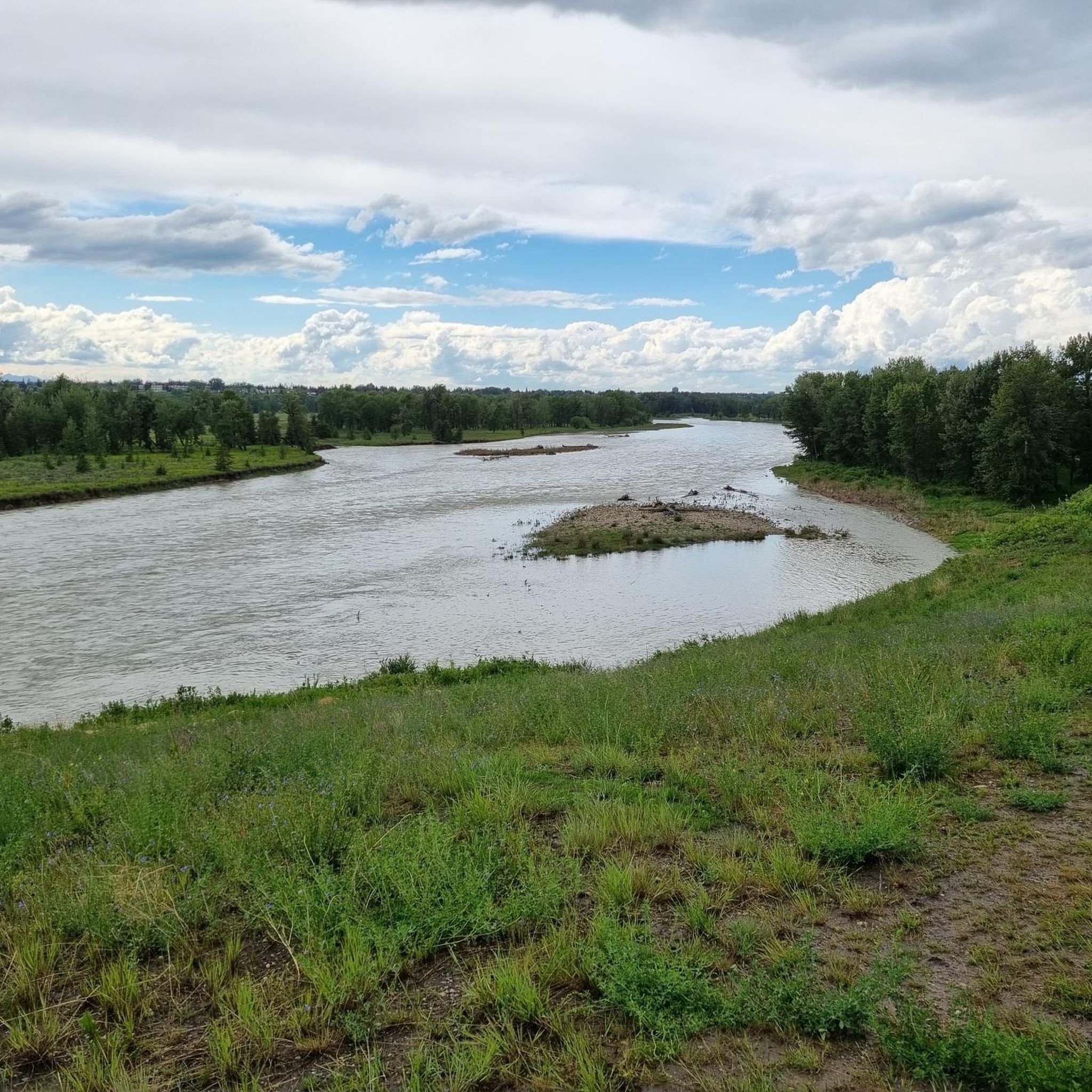
Fish Creek has maintained much of its natural state thanks to the large provincial park that surrounds it as it flows through southern Calgary. Providing vital habitat for a wide range of flora and fauna the creek is known for trout fishing and the over 200 bird species that have been spotted along its banks. The park that surrounds it as over 100 kilometres of trails ranging in difficulty and terrain type, so just about everyone is likely to find a stretch of trail that suits them.
0
0
This urban provincial park was set up in order to protect the vital habitat of the Fish Creek Valley. While the valley itself is mostly in its natural forested state, the park is bordered on three sides by the city of Calgary and by the Tsuu T’ina Nation (Sarcee) First Nation on the fourth side. You'll find a vast network of trails running through the park as well as a visitor's centre, picnic areas, swimming area, restaurants, and boat launches.
0
0
Frequently Asked Questions
How many running routes are available in the Ann & Sandy Cross Conservation Area?
The Ann & Sandy Cross Conservation Area offers several dedicated running routes. Our guide features four distinct trails, ranging from moderate to difficult, allowing you to choose based on your fitness level and desired challenge.
What kind of terrain can I expect on the jogging trails in Ann & Sandy Cross Conservation Area?
You'll experience a diverse landscape characterized by rolling foothills, open grasslands, and serene aspen forests. The area is generally hilly, providing an engaging and varied running experience with expansive views of the Rocky Mountains and grasslands.
Are there any challenging running routes for experienced runners?
Yes, for experienced runners seeking a challenge, consider the Stormwater Overflow Pond – Fish Creek Provincial Park loop from Fish Creek Provincial Park. This difficult 10.0-mile (16.1 km) path offers a longer, more demanding run through the natural environment.
Can I bring my dog on the running trails?
No, dogs are not permitted in the Ann & Sandy Cross Conservation Area. This policy helps protect the wildlife habitat and ensures a natural, undisturbed environment for all visitors.
What are the rules regarding bicycles on the trails?
Bicycles are not allowed in the Ann & Sandy Cross Conservation Area. The trails are designated for foot traffic only, ensuring a peaceful experience for runners and hikers.
Is there a fee to enter or park at the Ann & Sandy Cross Conservation Area?
Yes, visitors must register at the kiosk upon arrival, and a parking fee is required to access the conservation area.
What should I be aware of regarding wildlife when running in the area?
The Ann & Sandy Cross Conservation Area is home to various wildlife, including moose, deer, and small mammals. Bears and cougars are also present. It's advised to stay on marked trails, maintain a respectful distance from animals, and consider carrying bear spray during active wildlife months.
Are there any moderate-difficulty running loops suitable for a good workout?
Absolutely. A popular moderate option is the Running loop from Belvedere House Education Centre. This 6.2-mile (9.9 km) trail includes over 200 meters of elevation gain and typically takes about 1 hour 17 minutes to complete.
What do other runners say about the trails in Ann & Sandy Cross Conservation Area?
The running routes in Ann & Sandy Cross Conservation Area are highly rated by the komoot community, with an average score of 5.0 stars. Runners often praise the peaceful, natural environment and the variety of terrain.
Are there any shorter running routes for a quicker jog?
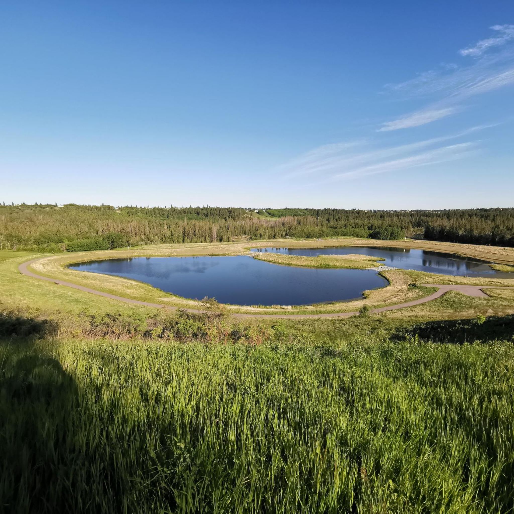
Yes, for a shorter, moderate jog, consider the Stormwater Overflow Pond loop from Fish Creek Provincial Park. This trail is 4.3 miles (6.9 km) long, leads through open areas and near water features, and can typically be completed in about 44 minutes.
What are the best times of year to go running in the Ann & Sandy Cross Conservation Area?
The Ann & Sandy Cross Conservation Area offers beautiful running conditions across multiple seasons. While specific conditions vary, spring and fall often provide pleasant temperatures and vibrant scenery. Be aware that trails can be remote and may present hazards like mud or ice depending on the season, so always check conditions before you go.
Are there any specific hazards to be aware of on the trails?
Beyond wildlife, runners should be mindful of potential hazards such as cattle, fallen trees, mud, and ice, especially during certain seasons. The entire area is hilly, and some trails can be remote, so preparedness is key.
Most popular routes in Ann & Sandy Cross Conservation Area

Get inspired with the komoot mobile app


Explore more
Browse the best Running Trails & Routes in other regions.
