The best running trails in Срп Сува Планина
4.0
(1)
42
runners
6
runs
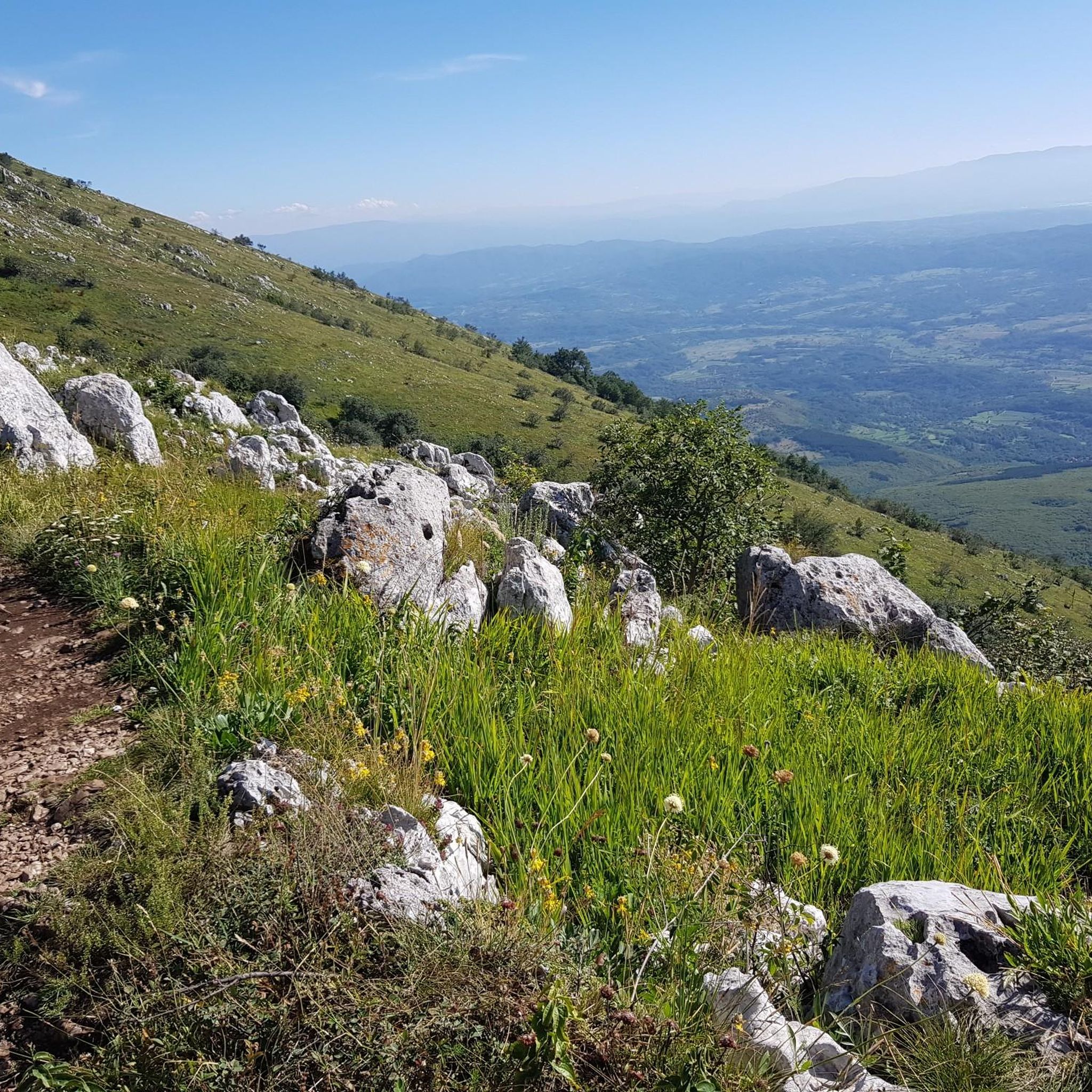
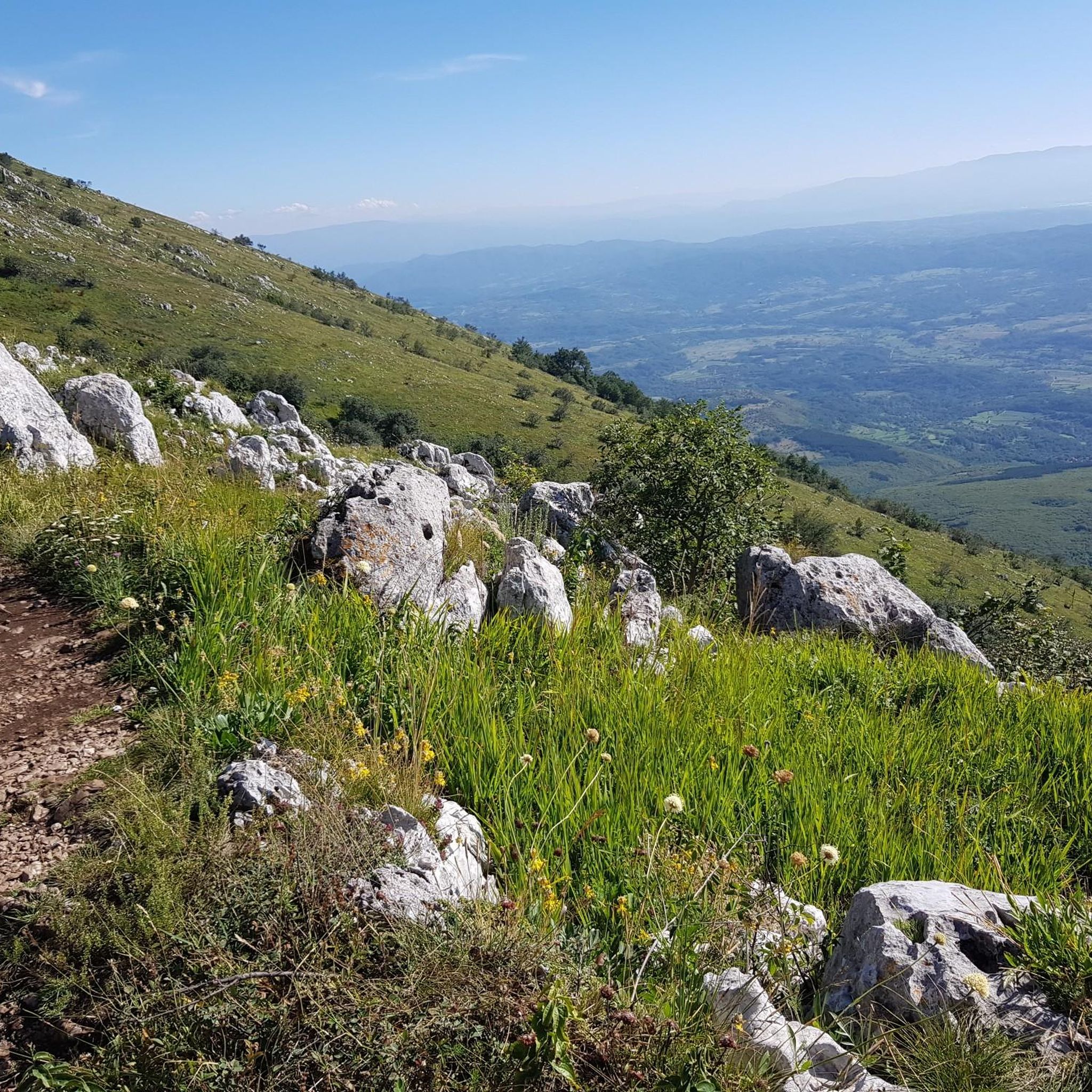
Jogging in Срп Сува Планина offers diverse terrain across a protected wilderness area in southeastern Serbia. The region is characterized by dramatic karst relief, an extensive 45-kilometer ridge, and a mix of deciduous and coniferous forests. Running routes here provide panoramic vistas as the landscape transitions from woodlands to higher elevations. Geologically significant, the mountain features varied sediments and rock formations, creating a unique environment for outdoor activities.
Best jogging routes in Срп Сува Планина
- The most popular jogging route…
Last updated: October 14, 2026
13
runners
14.4km
02:17
890m
890m
Hard run. Very good fitness required. Mostly paved surfaces. Suitable for all skill levels.
4
runners
12.8km
02:01
720m
710m
Hard run. Very good fitness required. Mostly paved surfaces. Suitable for all skill levels.

2
runners
5.00km
00:43
230m
230m
Moderate run. Good fitness required. Mostly paved surfaces. Suitable for all skill levels.
4.0
(1)
10
runners
16.6km
02:31
860m
860m
Hard run. Very good fitness required. Mostly paved surfaces. Suitable for all skill levels.
7
runners
41.2km
06:08
1,980m
1,980m
Hard run. Very good fitness required. Sure-footedness, sturdy shoes and alpine experience required.
Our route recommendations are based on thousands of hikes, rides, and runs completed by other people on komoot.
Start today with a free account
Your next adventure awaits.
Popular around Срп Сува Планина
Tips from the Community

Great picnic spot—this hill offers wide views of the spa town and the new aquapark; bring a mat and enjoy the sunset after your hike.
0
0
Frequently Asked Questions
How many running routes are available in Срп Сува Планина?
There are currently 7 running routes available in Срп Сува Планина on komoot, catering to various preferences. These include 2 moderate and 5 difficult trails, offering diverse challenges for runners.
What kind of terrain can I expect on the running trails in Suva Planina?
The running trails in Suva Planina feature a diverse and captivating terrain. You'll encounter dramatic karst relief, extensive mountain ridges, and a mix of deciduous forests (oak and beech) and coniferous belts. As you ascend, the forests often give way to wide panoramas of the mountain range, providing breathtaking views.
Are there any circular running routes in Срп Сува Планина?
Yes, several running routes in Срп Сува Планина are designed as loops. For example, you can explore the challenging Трем – Devojački grob loop from Bojanine vode, the scenic Радов камен – СРП Јелашничка клисура loop from Градска општина Нишка Бања, or the varied Пресклан loop from Niska Banja.
What are some notable landmarks or viewpoints along the running trails?
While running in Suva Planina, you can encounter several significant landmarks and enjoy stunning viewpoints. The Трем – Devojački grob loop from Bojanine vode passes by Trem Peak, the highest point of the mountain, and the historic Maiden's Grave. Other trails offer views of Radov Kamen and the Jelašnica Gorge, along with expansive panoramas as you gain elevation.
What do other runners say about the trails in Срп Сува Планина?
The running routes in Срп Сува Планина are highly regarded by the komoot community, holding an average rating of 4.0 stars. Over 50 runners have used komoot to explore the varied terrain, often praising the dramatic karst relief and the extensive mountain ridges that define the region's unique running experience.
Are there any longer distance running routes for experienced runners?
Yes, for experienced runners seeking a significant challenge, the Соколов камен – Трем loop from Нишка Бања is a demanding option. This difficult route spans over 47 kilometers with substantial elevation gain, offering a true endurance test through the mountain's rugged landscapes.
Are there any moderate running routes for those looking for a less strenuous run?
Certainly. For runners preferring a moderate challenge, the Running loop from Niska Banja is an excellent choice. This route covers approximately 10 kilometers with a more manageable elevation, providing a pleasant run through the region's natural beauty without the intensity of the more difficult trails.
Is public transport available to reach the running trails in Suva Planina?
Access to the running trails in Suva Planina primarily relies on personal transport. While some routes start from towns like Niska Banja, which may have public transport connections, direct public transport to specific trailheads within the Special Nature Reserve is limited. Planning for car access or local taxi services is generally recommended for reaching starting points like Bojanine Vode.
Are the running trails in Suva Planina suitable for families?
Suva Planina offers a range of trails, but many of the listed running routes are categorized as moderate to difficult due to significant elevation changes and distances. While some sections might be suitable for active families, it's important to check the specific route details for difficulty and length to ensure it aligns with your family's fitness level and experience. There are no specifically designated 'easy' running routes in the current selection.
Can I bring my dog on the running trails in Suva Planina?
Suva Planina is a Special Nature Reserve, known for its rich biodiversity, including wild animals like wolves, roe deer, and feral horses. While specific regulations for dogs on trails can vary, it's generally advisable to keep dogs on a leash to protect wildlife and ensure their safety, especially given the presence of animals like the horned viper. Always check local signage for any restrictions.
Are there any amenities like cafes or water sources near the running routes?
Amenities like cafes are generally scarce directly along the more remote running routes in Suva Planina. However, locations like Bojanine Vode, a popular starting point for trails including the Трем – Devojački grob loop, are known to have natural springs providing drinking water. It's always recommended to carry sufficient water and snacks, especially on longer runs, as services are limited once you are on the mountain.
What natural features can I expect to see while running in Suva Planina?
As you run through Suva Planina, you'll be immersed in an 'oasis of pristine and undisturbed nature'. Expect to see diverse forests, from oak and beech at lower altitudes to coniferous belts higher up. The mountain is home to 1,261 plant species, including endemic ones, and you might spot various wildlife, such as free-roaming horses in areas like Divna Gorica, or even golden eagles soaring above the dramatic karst landscape.
Most popular routes in Срп Сува Планина
Most popular attractions in Срп Сува Планина

Get inspired with the komoot mobile app


Explore more
Browse the best Running Trails & Routes in other regions.
