The best road cycling routes in Limeburners Creek National Park
5.0
(3)
89
riders
6
rides
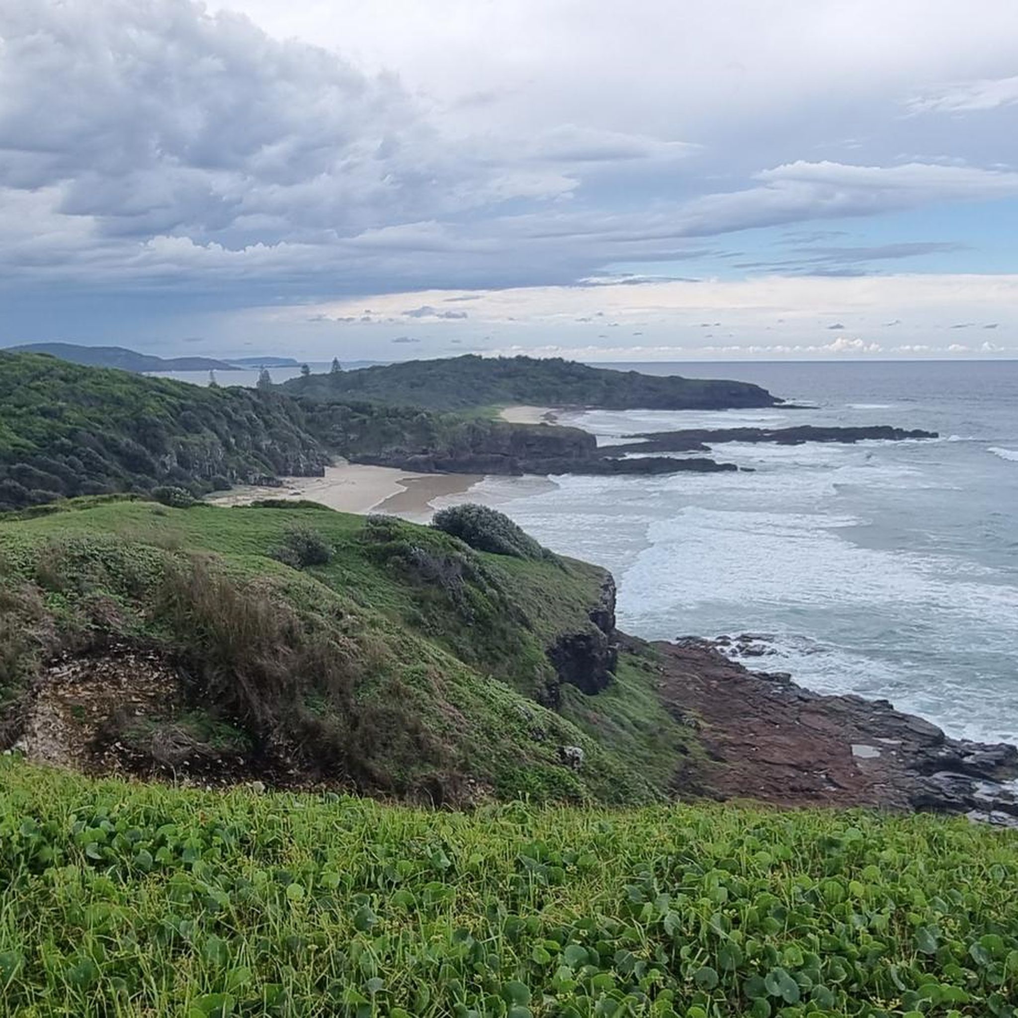
Road cycling in Limeburners Creek National Park offers a blend of coastal and inland terrain. The region features a sparkling coastline with golden sandy beaches and ocean views, transitioning to heathlands, banksia, and blackbutt forests further inland. Cyclists can expect varied road surface conditions, including paved sections and some unsealed or gravel roads, particularly along routes like Maria River Road. The landscape includes unique rock formations and areas of rare rainforest, providing diverse scenery for road cyclists.
Best road cycling…
Last updated: July 8, 2026
54
riders
22.5km
01:08
200m
200m
Moderate road ride. Great for any fitness level. Some segments of this route may be unpaved and difficult to ride.
10
riders
112km
05:02
780m
780m
Hard road ride. Very good fitness required. Some segments of this route may be unpaved and difficult to ride.

Sign up for free
14
riders
31.2km
01:18
190m
190m
Easy road ride. Great for any fitness level. Mostly well-paved surfaces and easy to ride.
5
riders
65.5km
02:53
570m
570m
Moderate road ride. Good fitness required. Mostly well-paved surfaces and easy to ride.
3
riders
90.3km
05:39
690m
690m
Hard road ride. Very good fitness required. Some segments of this route may be unpaved and difficult to ride.
Our route recommendations are based on thousands of hikes, rides, and runs completed by other people on komoot.
Start today with a free account
Your next adventure awaits.
Login or Signup
Popular around Limeburners Creek National Park
Tips from the Community

Quite busy with a tiny shoulder to ride on. Not great asphalt either
0
0

Port Macquarie breakwall lines the entrance to the Hastings River, originally constructed to improve navigation across the once-dangerous river bar. Built in stages from the late 1890s, with the southern wall completed in 1904 and the northern wall following in 1932, it was a major engineering effort designed to direct river flow and create a safer, deeper channel. Today, it is an iconic coastal walkway, known for its painted rocks, beautiful views, and strong connection to the town’s maritime history and community. It’s a long-standing local tradition here for visitors to paint messages and memorials on the rocks, creating a colourful and ever-changing feature along the wall.
0
0
Kooloonbung Creek flows through a 52-hectare nature reserve in central Port Macquarie, preserving wetlands, bushland, and diverse wildlife habitats. There are boardwalks and walking tracks that wind through mangroves and forest, connecting the reserve to the town centre and foreshore. This area also includes picnic areas and a historic cemetery, blending natural and cultural heritage in a peaceful urban setting.
0
0
Westport Park is one of Port Macquarie’s largest waterfront reserves, with plenty of open green space with direct access to the Hastings River and expansive views across the waterways. The park includes picnic areas, playgrounds, boat ramps, a bubbler, toilets and several benches throughout the grounds and regularly hosts major community events, markets, and festivals. It also runs along part of the foreshore walking network, connecting the town centre with riverside paths and recreational areas.
0
0


End point of the Port MacQuire Coastal Walk. Spectacular views of the cliffs and the ocean. The walk is not difficult but it is 15 km long, in 3 hours passing by numerous beaches (some for dogs). Best to do in Port MacQuire.
0
0
Frequently Asked Questions
How many road cycling routes are available in Limeburners Creek National Park?
There are over a dozen road cycling routes in and around Limeburners Creek National Park, offering diverse experiences for cyclists. These include routes ranging from easy coastal loops to more challenging rides with significant elevation.
What kind of terrain and road surfaces can I expect when road cycling in Limeburners Creek National Park?
The park and its surrounding areas offer a mix of terrain. You'll find sparkling coastlines, heathlands, and forests. Road surfaces vary, with many sections being well-paved, while others, like parts of Maria River Road or Point Plomer Road, may include unsealed or gravel sections. This provides options for both smooth rides and more adventurous cycling.
Are there any easy road cycling routes suitable for beginners or families in the area?
Yes, there are routes suitable for easier rides. For instance, the Rocky Beach loop from Port Macquarie is an easy 21.7 km route that takes about an hour to complete, offering coastal views and being suitable for most fitness levels. While the park itself has varied terrain, this route provides a gentle introduction to the area's cycling.
What are some challenging road cycling routes for experienced riders?
For more experienced riders seeking a challenge, routes with significant elevation and longer distances are available. The Roadbike loop from The Boom Reserve is a substantial 108.4 km trail with 760 meters of elevation gain, typically completed in under five hours. Another demanding option is the Roadbike loop from Port Macquarie, covering 88.3 km with over 680 meters of ascent.
What natural features or landmarks can I see along the road cycling routes?
Road cycling routes in the region often traverse areas rich in natural beauty. You can expect sparkling coastlines with golden sandy beaches and ocean views, transitioning to heathlands, banksia, and blackbutt forests. Unique rock formations, especially around Point Plomer, and rare rainforests near Big Hill are also notable features. Keep an eye out for diverse wildlife, including ospreys, pied oystercatchers, and even koalas.
What is the best time of year to go road cycling in Limeburners Creek National Park?
The Mid North Coast of New South Wales generally offers pleasant cycling conditions for much of the year. Spring and autumn typically provide mild temperatures and less rainfall, making them ideal for road cycling. Summer can be warm, especially inland, while winter offers cooler, often clear days. Always check local weather forecasts before heading out.
Are there any public transport options or parking facilities for cyclists visiting the park?
While direct public transport into the heart of the park for cyclists might be limited, the ferry crossing from Port Macquarie to North Shore is free for bikes and provides access to areas near the park's boundary. Parking is generally available at various access points and trailheads around the park's periphery, such as near Port Macquarie or The Boom Reserve, which serve as starting points for many routes.
Are permits required for road cycling within Limeburners Creek National Park?
Generally, permits are not required for cycling on public roads or designated trails within the park. However, for specific activities or if you plan to camp, you may need to check with the NSW National Parks and Wildlife Service. You can find detailed visitor information and any permit requirements on their official website: NSW National Parks.
What do other road cyclists say about their experience in Limeburners Creek National Park?
The road cycling routes in Limeburners Creek National Park are highly rated by the komoot community, with an average score of 5.0 stars. Cyclists often praise the diverse scenery, from coastal views to forest trails, and appreciate the variety of routes available for different fitness levels. The blend of sealed and unsealed roads also offers a unique adventure for those looking to explore.
Can I find food and accommodation options near the road cycling routes?
While Limeburners Creek National Park itself is a natural area with remote camping options like Point Plomer campground, nearby towns such as Port Macquarie offer a wide range of cafes, pubs, and accommodation. Many road cycling routes start or pass through areas close to these amenities, allowing cyclists to refuel and relax before or after their rides.
Are there any specific safety considerations for road cycling in this region?
When cycling in Limeburners Creek National Park and its surrounds, be aware of varied road surfaces, including potential gravel sections. Wildlife, such as kangaroos or dingoes, may be present, especially at dawn or dusk. Always wear appropriate safety gear, carry enough water, and inform someone of your route. Check weather conditions, as coastal weather can change rapidly.
Are dogs allowed on road cycling routes in Limeburners Creek National Park?
As a national park, Limeburners Creek National Park has strict regulations regarding pets to protect native wildlife. Generally, dogs are not permitted on walking tracks or in park areas, including most cycling routes, unless specifically signposted as dog-friendly. It's best to leave pets at home when visiting the park to comply with regulations and ensure the safety of local fauna.
Most popular routes in Limeburners Creek National Park

Get inspired with the komoot mobile app


Explore more
Browse the best Road cycling routes in other regions.
