The best mountain hikes in Sanddalstjedn Naturreservat
5.0
(4)
26
hikers
4
hikes
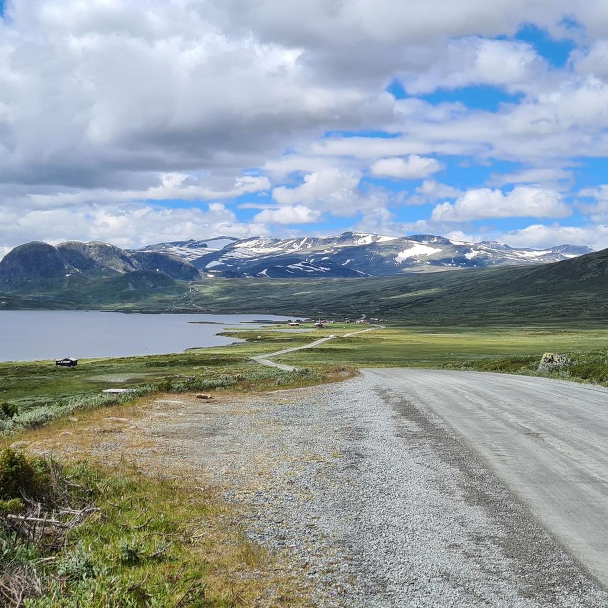
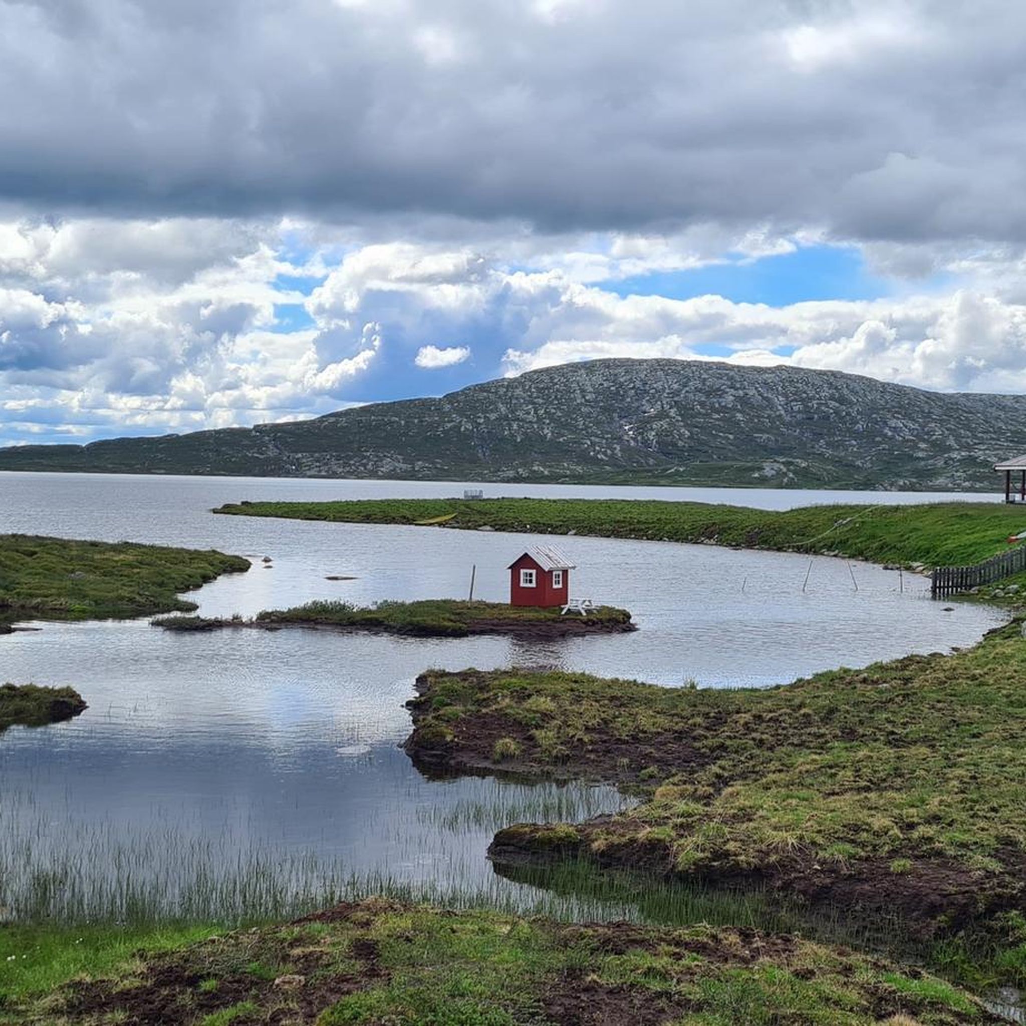
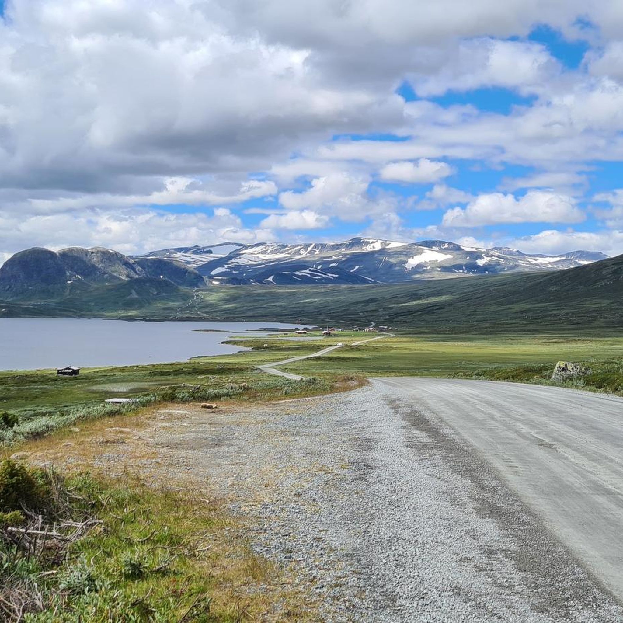
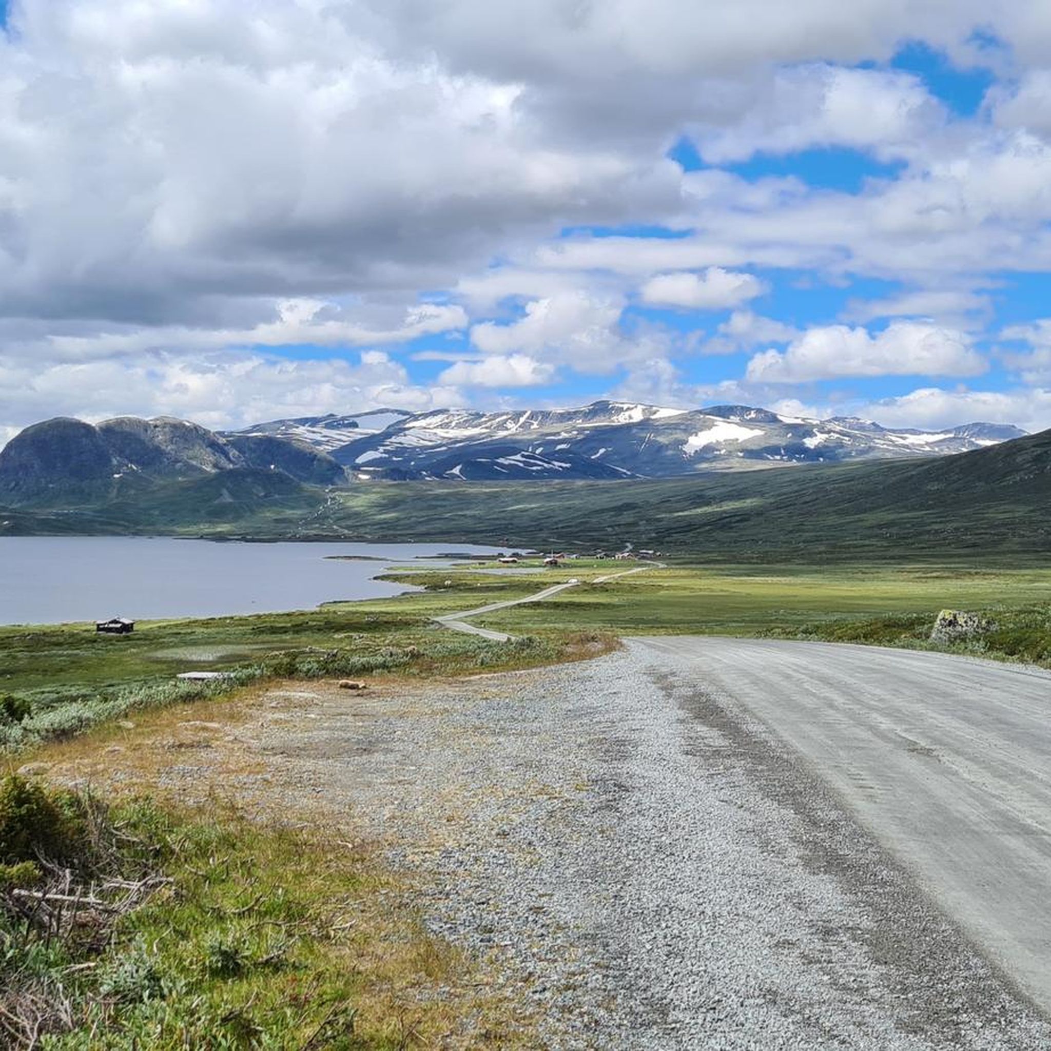
Mountaineering in Sanddalstjedn Naturreservat offers diverse terrain within Øystre Slidre kommune, Oppland. The region is characterized by a wetland environment, featuring bogs, marshes, and small lakes, alongside accessible mountainous areas. Surrounding the reserve, the landscape includes tall "fjells" and offers routes to summits with panoramic views, such as those overlooking Bygdin Lake. The area provides a scenic backdrop for outdoor enthusiasts, combining wetland ecosystems with mountainous terrain.
Best mountaineering routes in Sanddalstjedn Naturreservat
- The most popular mountaineering route is Bitihorn…
Last updated: June 30, 2026
5.0
(2)
10
hikers
7.14km
03:31
520m
520m
Hard mountaineering route. Good fitness required. Sure-footedness, sturdy shoes and alpine experience required.
5.0
(1)
7
hikers
4.67km
02:36
420m
420m
Hard mountaineering route. Good fitness required. Sure-footedness, sturdy shoes and alpine experience required.

Sign up for free
2
hikers
9.14km
03:57
530m
530m
Hard mountaineering route. Good fitness required. Sure-footedness, sturdy shoes and alpine experience required.
5.0
(1)
7
hikers
15.6km
05:21
760m
760m
Hard mountaineering route. Very good fitness required. Easily-accessible paths. Suitable for all skill levels.
Our route recommendations are based on thousands of hikes, rides, and runs completed by other people on komoot.
Start today with a free account
Your next adventure awaits.
Login or Signup
Popular around Sanddalstjedn Naturreservat
Tips from the Community


A fantastic mountain with a 360-degree view. The path to the north is easy and, because it's steeper, easier on the descent (easy on the knees). I would recommend ascending via the newly constructed path with steps from the south. However, there are some very exposed sections. It's not safe in wet conditions or even snow/ice.
1
0

The summit of Rasletinden is located along the trail to the Øystre Rasletinden and Vestre Kalvehøgde summits. The summit is 2,105 meters high.
0
0
A small lake where you can take a break and enjoy the view of the surrounding mountains.
0
0
Øystre Rasletinden is 2.010 metres high. From here you have a stunning view on glaciers.
1
0

When the weather is good, you have a wonderful panoramic view from up here. The wind can be extremely strong on this exposed mountain.
2
1

The view is indeed magnificent. The higher peaks of Jotunheimen are clearly visible on a clear day. Without major alpine experience, the ascent, even via the easy north route, is sometimes difficult, especially after the reindeer fence. In addition to the incline of over 30%, coarse scree must also be crossed. Especially when going downhill you shouldn't be afraid to use your hands for safety. But the effort is rewarded with a great all-round view.
3
1
A rewarding summit with a unique panoramic view when the weather is nice. The ascent is moderate, but you should be sure-footed.
6
0
Frequently Asked Questions
What is the general difficulty level of mountaineering routes in Sanddalstjedn Naturreservat?
The mountaineering routes in Sanddalstjedn Naturreservat are generally considered challenging. All four listed routes are rated as 'difficult', requiring good fitness and sure-footedness. For example, the Øystre Rasletinden – Rasletinden loop from Valdresflye involves over 750 meters of elevation gain over 15.5 km.
Are there any circular mountaineering routes available in the Sanddalstjedn Naturreservat area?
Yes, Sanddalstjedn Naturreservat offers several circular mountaineering routes. A popular option is the Bitihorn loop from Stavtjernet, which is 7.1 km long and takes approximately 3 hours 31 minutes to complete. Another circular route is the Bitihorn loop from Båtskardet, covering 9 km.
What kind of terrain can I expect on mountaineering routes in Sanddalstjedn Naturreservat?
You can expect a diverse landscape combining wetland environments with accessible mountainous terrain. While the reserve itself features bogs, marshes, and small lakes, the mountaineering routes lead to summits offering panoramic views, such as those overlooking Bygdin Lake. Trails often involve significant elevation gain and require sure-footedness.
What are some notable viewpoints or natural features along the mountaineering routes?
Many routes in the area offer stunning panoramic views, particularly from summits like Bitihorn and Rasletinden. The Bitihorn loop from Båtskaret sør, for instance, provides excellent views of the surrounding mountainous scenery. The region is also characterized by its wetland environment, offering unique flora and fauna.
Is Sanddalstjedn Naturreservat suitable for family-friendly mountaineering or hiking?
While the listed mountaineering routes are rated as 'difficult' and involve significant elevation, the broader Sanddalstjedn Naturreservat area and its surroundings offer a range of hiking opportunities. Some trails, like the Grønekinnkampen loop from Beito, are known to be easier and suitable for various fitness levels, though they may not be classified as mountaineering.
Are dogs allowed on the mountaineering routes in Sanddalstjedn Naturreservat?
Generally, dogs are permitted on hiking trails in Norwegian nature areas, but it's crucial to keep them on a leash, especially during lambing season (April 1 to October 31) and in areas with grazing livestock or wildlife. Always check local regulations for specific routes or protected areas within Sanddalstjedn Naturreservat to ensure compliance.
What is the best time of year to go mountaineering in Sanddalstjedn Naturreservat?
The best time for mountaineering in Sanddalstjedn Naturreservat is typically during the summer months, from late June to early September, when trails are generally free of snow and weather conditions are more stable. Outside of this period, you may encounter snow, ice, and more challenging conditions requiring specialized gear and experience.
How many mountaineering routes are available in Sanddalstjedn Naturreservat?
There are at least four distinct mountaineering routes detailed for Sanddalstjedn Naturreservat, all rated as difficult. These routes offer varied distances and elevation gains, providing challenging experiences for mountaineers.
What do other mountaineers enjoy most about the routes in Sanddalstjedn Naturreservat?
The area is highly rated by the komoot community, with an average score of 5.0 stars from 4 reviews. Mountaineers often praise the challenging nature of the routes, the significant elevation gains, and the rewarding panoramic views from the summits, particularly those overlooking Bygdin Lake.
Are there any permits required for mountaineering in Sanddalstjedn Naturreservat?
Generally, permits are not required for hiking or mountaineering on established trails in Norwegian nature reserves like Sanddalstjedn Naturreservat. However, it's always advisable to check for any specific local regulations or temporary restrictions, especially if you plan to camp or access particularly sensitive areas.
What kind of 'alpine experience' is needed for these routes?
The 'alpine experience' mentioned for this region refers to the demands of strenuous hiking in mountainous terrain, rather than technical rock or ice climbing. It implies the need for good physical fitness, sure-footedness, sturdy footwear, and an understanding of mountain weather and navigation, especially on routes with significant elevation gain and varied conditions.
Most popular routes in Sanddalstjedn Naturreservat

Get inspired with the komoot mobile app


Explore more
Browse the best Mountain Hikes & Routes in other regions.
