The best walks and hikes around Klingenberg
4.6
(3037)
10,595
hikers
253
hikes
Hiking around Klingenberg offers diverse landscapes, situated between the Main river valley and the Odenwald hills. The region features extensive vineyards, gentle hills, and dense forests, providing varied terrain for outdoor activities. Natural features like the Seltenbach Gorge are integrated into many routes, alongside views of the Main river. This geographical setting provides a range of hiking experiences for different ability levels.
Best hiking trails around Klingenberg
- The most popular hiking route is Water, Silver, Edle Krone – Ritter Theler…
Last updated: August 18, 2026
4.6
(41)
107
hikers
22.5km
06:06
320m
320m
Hard hike. Very good fitness required. Mostly accessible paths. Sure-footedness required.
4.8
(799)
2,250
hikers
14.5km
03:58
220m
220m
Moderate hike. Good fitness required. Easily-accessible paths. Suitable for all skill levels.

Sign up for free
4.6
(115)
339
hikers
Moderate hike. Good fitness required. Easily-accessible paths. Suitable for all skill levels.
4.5
(35)
113
hikers
13.6km
03:47
240m
240m
Moderate hike. Good fitness required. Mostly accessible paths. Sure-footedness required.
4.7
(37)
100
hikers
12.9km
03:31
190m
190m
Moderate hike. Good fitness required. Easily-accessible paths. Suitable for all skill levels.
Get access to more routes and recommendations from other explorers.
Sign up for free
Already have an account?
Our route recommendations are based on thousands of hikes, rides, and runs completed by other people on komoot.
Start today with a free account
Your next adventure awaits.
Login or Signup





Tips from the Community

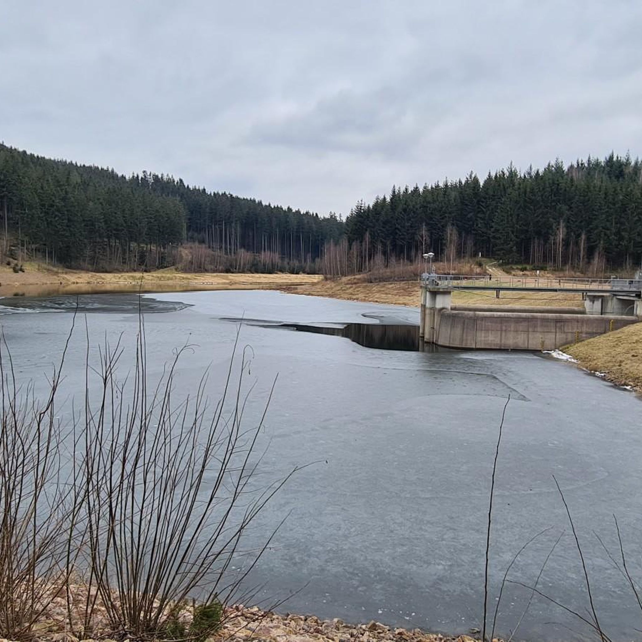
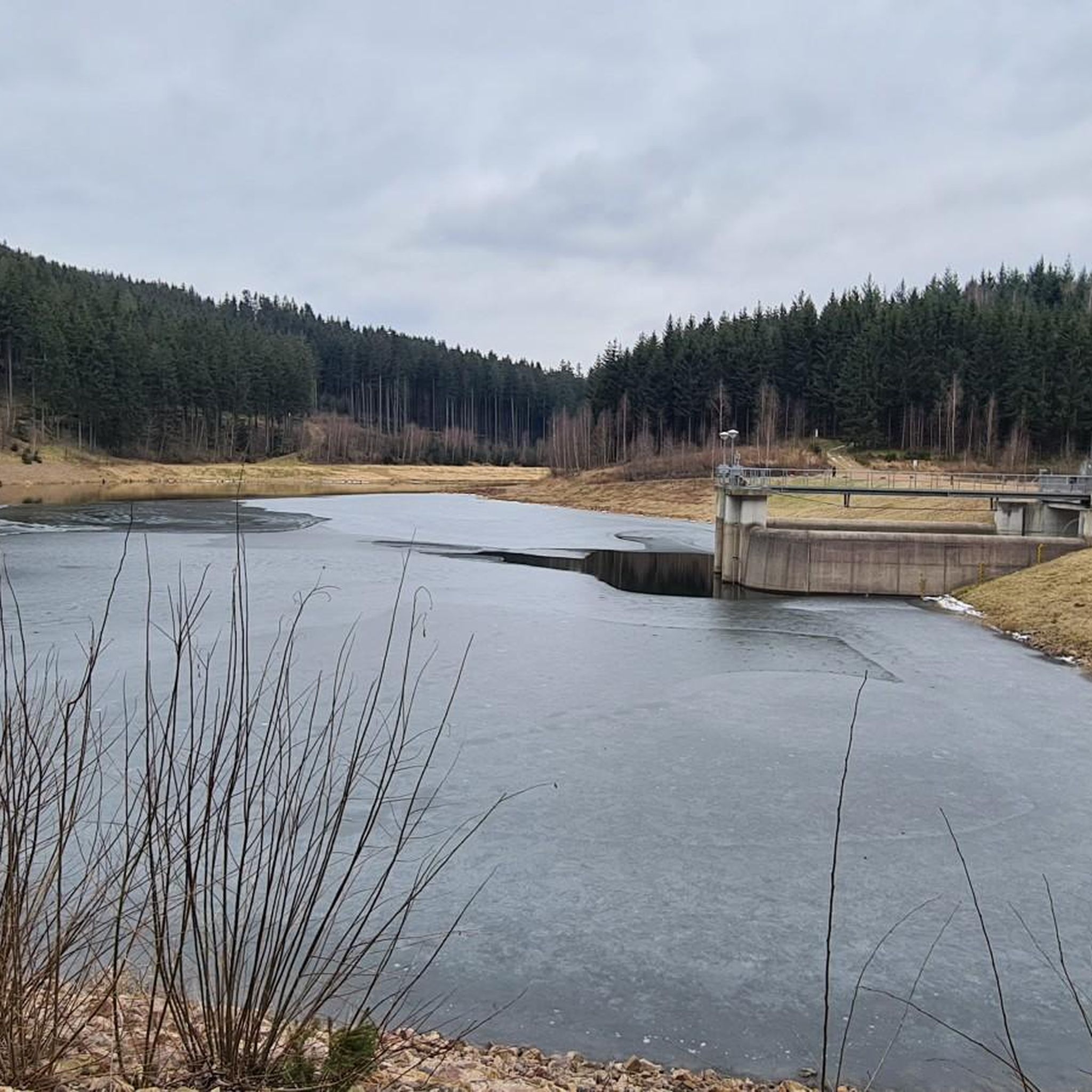
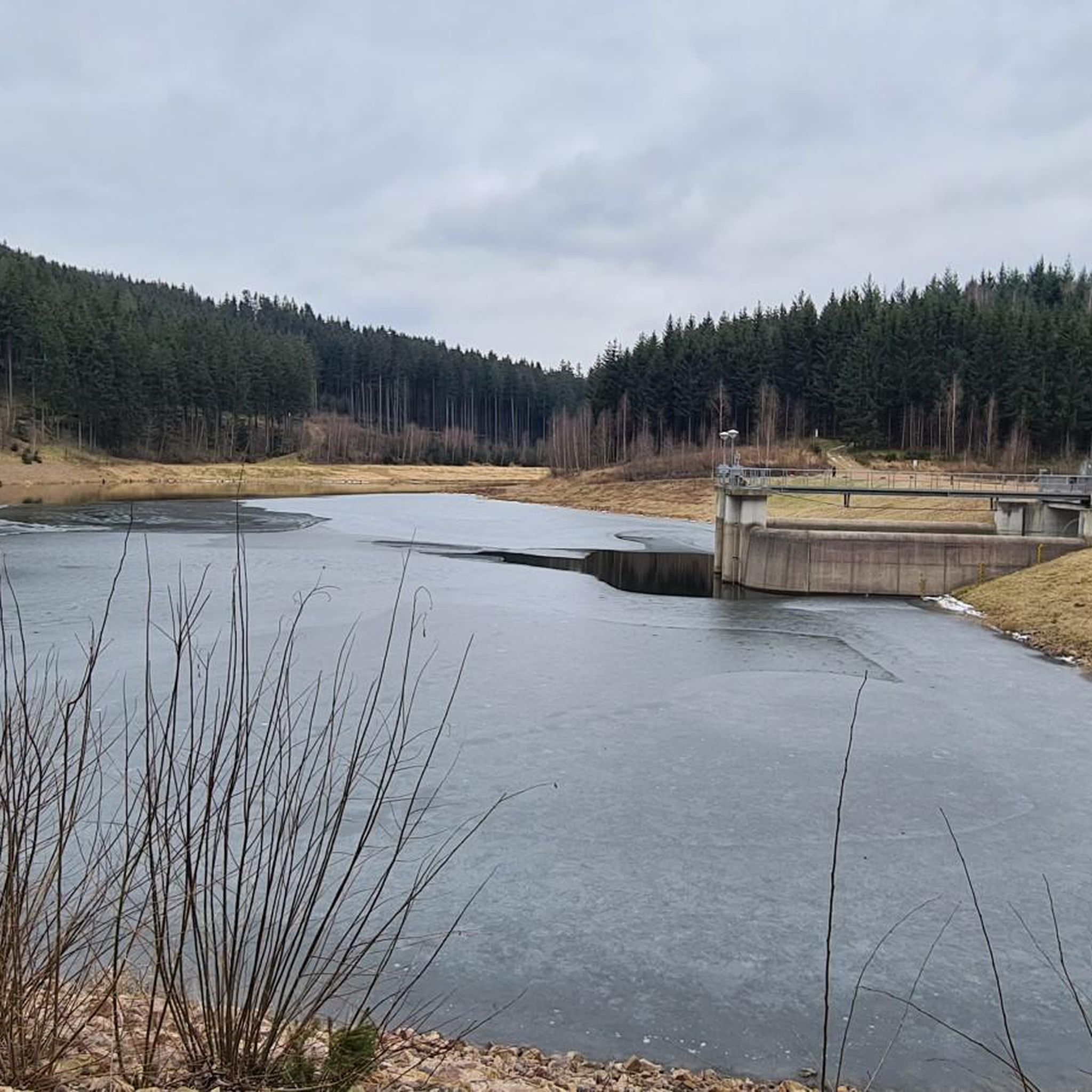
The 3.5 km long reservoir in the valley of the Wilden Weißeritz is surrounded by natural landscape and holds 16.4 million cubic meters of water. On an approximately 13 km long circular hiking trail along the shore and the romantic bays, the hiker will find peace and relaxation in the open nature. A varied circular hike through the forests around the Klingenberg drinking water reservoir, with connections to the Energy Experience Trail and the Drinking Water Educational Trail. ☝️The circular path runs mostly above on the slope. However, direct access to the water is possible in many places.☝️
0
0
Very nice break spot, directly with a view of the reservoir.
0
0
The Dorotheenfelsen is a rock outcrop on the eastern shore of the Klingenberg reservoir, consisting of orthogneiss. Mostly, gently sloping hills line the edges of the Klingenberg reservoir. But at one point, a large rock outcrop is located directly by the path. A small sign tells the hiker that this is the Dorotheenfelsen. According to legend, the beautiful miller's daughter from the Holzmühle is said to have met her lover here. The old mill is now hidden by the water of the reservoir, the rock still stands, and at its foot, you can take a seat on a bench. Those who wish can also climb up (attention, no path) and enjoy the wonderful view over the reservoir.
0
0
In the years 1910/11 it was built as a wooden bridge, hence the name, and allowed the works railway on its 3.7 km journey between the station and the dam construction to cross the "Langen Grund". The demolition of the wooden bridge and new construction in reinforced concrete took place in 1924 as the works railway line was used for the road layout. The bridge was technically checked and completely overhauled in 1992.
0
0
The Klingenberg dam in the eastern Ore Mountains is a picturesque reservoir and an important drinking water reserve. It was built between 1908 and 1914. The charming circular hiking trail is perfect for nature lovers, walkers, and families. The dam was built from 1908 near Klingenberg in the foothills of the Osterzgebirge according to an architectural design by Hans Poelzig. In 1914, the dam went into operation and was named after the last Saxon king: Friedrich-August-Talsperre. The impounded body of water is the Wilde Weißeritz. Its construction was part of a flood protection concept that was developed after the devastating flood of 1897 in the Dresden-Altstadt district under the leadership of district administrator and dam commissioner Arnold Streit. During construction, a standard-gauge works railway was laid from Klingenberg-Colmnitz station to the construction site, which operated from 1911 to 1914. The Höhenweg trail now runs along its route over the Streichholzbrücke (matchstick bridge).
0
0
The Aurora Erbstolln is an ideal hiking destination. Opening hours: April-October, every Saturday from 10:00 AM to 2:30 PM. Guided tour: Underground with helmet and lamp, duration approx. 35 to 60 minutes. Admission: Adults €4.50, children from 6 years €3.50. Special feature: Only walkable silver mine on the Silberstraße between Freiberg and Dresden.
1
0
The Reicher Silbersegen mine is a small, historic exploratory tunnel (operational period approx. 1866–1896) for silver ores in the valley of the Wilden Weißeritz. It is located south of Tharandt, on the municipal border between Dorfhain and Edle Krone. The tunnel, almost 35 m long, was economically insignificant. Today, the entrance is easily accessible from the Barthmühle during a hike, but it is not publicly accessible.
0
0

These buildings formerly belonged to the Klingenberg manor, later to the E. Mahn paper and cardboard factory in Klingenberg. Today they are privately owned and beautifully restored.
0
0
Frequently Asked Questions
How many hiking trails are available around Klingenberg?
Klingenberg offers a wide selection of hiking routes, with over 260 trails to explore. These range from easy strolls to more challenging treks, catering to various fitness levels.
What kind of terrain can I expect on hikes in Klingenberg?
The terrain around Klingenberg is quite varied, situated between the Main river valley and the Odenwald hills. You'll find extensive vineyards, gentle hills, and dense forests. Natural features like the Seltenbach Gorge are also integrated into many routes, providing diverse landscapes for your hike.
Are there any easy hiking trails suitable for beginners or leisurely walks?
Yes, Klingenberg has over 100 easy hiking routes. These trails are perfect for beginners, families, or anyone looking for a relaxed walk through the scenic Main valley or the gentler parts of the Odenwald foothills.
What are the best times of year to go hiking in Klingenberg?
The best seasons for hiking in Klingenberg are spring and autumn. In spring, the vineyards are in full bloom, and in autumn, the colorful foliage creates a beautiful backdrop. While summer can be warm, and winter paths might be slippery, the region offers opportunities throughout the year.
Are there any circular hiking routes in Klingenberg?
Many of the trails in Klingenberg are designed as circular routes, allowing you to start and end at the same point. An example is the moderate Klingenberg Dam – View of the Klingenberg Dam loop from Beerwalde, which offers scenic views and returns you to your starting point.
What natural attractions or landmarks can I see along the hiking trails?
Hiking trails around Klingenberg often lead to significant natural features and historical sites. You can explore areas like the Rabenauer Grund Nature Reserve, the dramatic Rabenauer Grund – Valley of the Red Weißeritz, or the unique Devil's Pulpit rock formation. The Seltenbach Gorge is also a recurring highlight in many local loops.
Are there any family-friendly hiking options in Klingenberg?
Yes, Klingenberg offers many family-friendly hiking options, particularly the easier routes along the Main river or in areas like Eulbacher Park, which features forest paths, meadows, and picnic facilities. These trails are generally less strenuous and suitable for all ages.
Can I bring my dog on the hiking trails in Klingenberg?
Most hiking trails in Klingenberg are dog-friendly, allowing you to enjoy the beautiful scenery with your canine companion. However, it's always advisable to keep your dog on a leash, especially in nature reserves or areas with livestock, and to respect local regulations.
What do other hikers say about the trails in Klingenberg?
The hiking trails in Klingenberg are highly regarded by the komoot community, with an impressive average rating of 4.7 out of 5 stars from over 2,500 reviews. Hikers often praise the diverse landscapes, well-maintained paths, and the blend of natural beauty with historical points of interest.
Are there any challenging hikes for experienced hikers?
For experienced hikers seeking a challenge, Klingenberg offers several difficult routes. One notable option is the Water, Silver, Edle Krone – Ritter Theler Tour, a 22.5 km trail that explores historical sites and varied, demanding terrain.
Where can I find viewpoints with panoramic views?
Many trails in Klingenberg offer stunning panoramic views, especially from the higher elevations in the Odenwald hills and along the Mainhöhenweg. The Klingenberg Observation Tower is a specific highlight known for its expansive vistas. You can also find great views from the Kaitzer Heights.
Are there any trails that pass through vineyards?
Absolutely. The region is characterized by extensive vineyards, and many trails, such as sections of the Franconian Red Wine Trail, wind through these picturesque landscapes. You'll enjoy breathtaking views of the Main valley and the vineyards, especially during spring bloom or autumn harvest.
Most popular routes around Klingenberg
Most popular attractions around Klingenberg

Get inspired with the komoot mobile app


Explore more
Browse the best Hikes in other regions.
