The best walks and hikes around Sons-Et-Ronchères
5.0
(2)
19
hikers
9
hikes
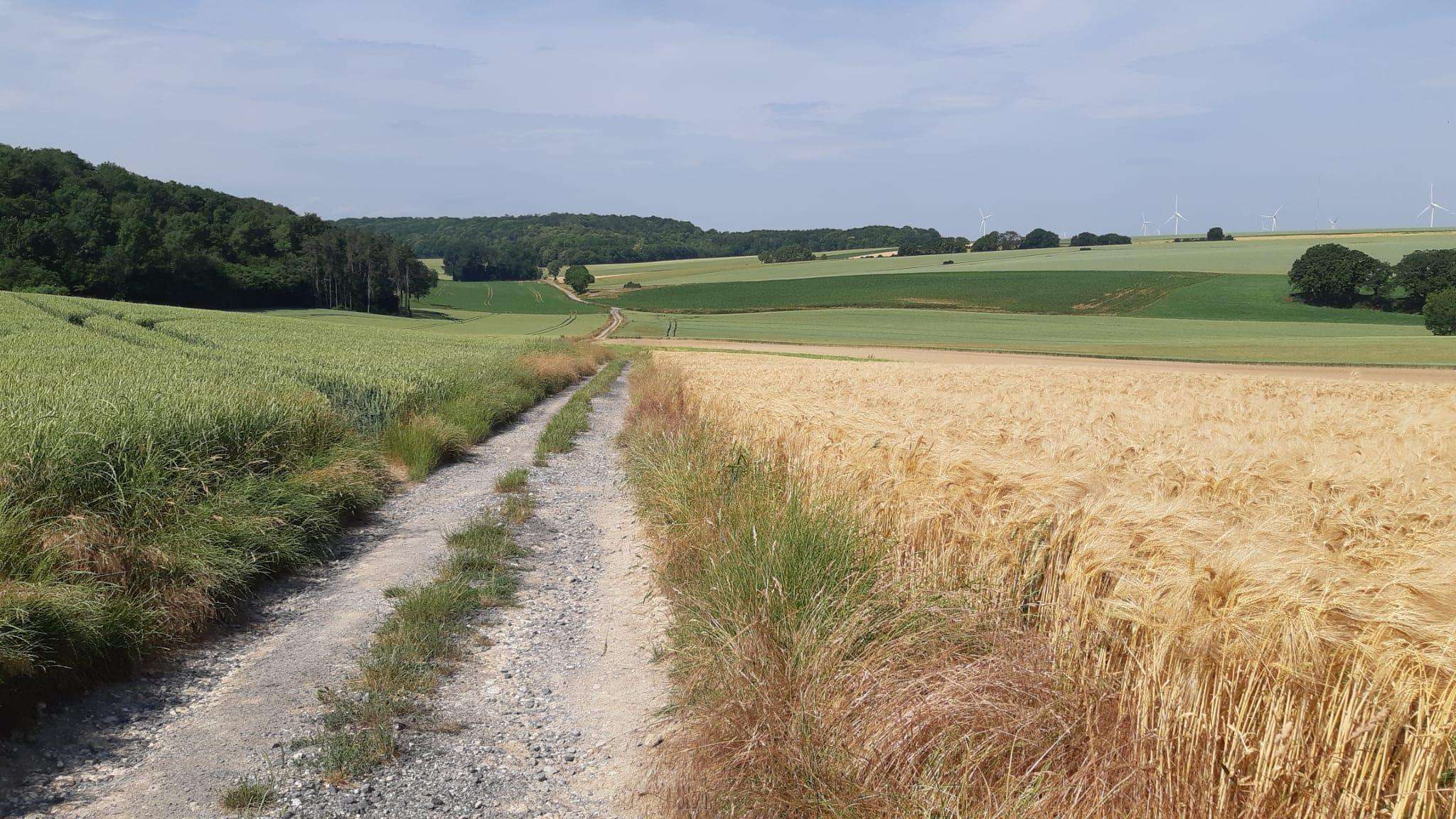
Hiking around Sons-Et-Ronchères offers access to diverse natural landscapes within the Aisne department of France. The region is characterized by a mix of woodlands and open countryside, providing varied terrain for exploration. Proximity to nature reserves like the Réserve naturelle du marais de Vesles-et-Caumont and the Réserve naturelle des Landes de Versigny indicates areas with unique ecosystems. The landscape includes rolling hills and ridges, such as those found in the Crêtes Préardennaises, offering scenic views.
Best hiking trails around Sons-Et-Ronchères
…Last updated: July 4, 2026
5.0
(2)
5
hikers
11.9km
03:10
120m
130m
Moderate hike. Good fitness required. Easily-accessible paths. Suitable for all skill levels.
3
hikers
7.49km
02:02
80m
80m
Moderate hike. Good fitness required. Mostly accessible paths. Sure-footedness required.

Sign up for free
1
hikers
Moderate hike. Great for any fitness level. Mostly accessible paths. Sure-footedness required.
3
hikers
6.78km
01:46
50m
50m
Easy hike. Great for any fitness level. Easily-accessible paths. Suitable for all skill levels.
2
hikers
3.90km
01:00
20m
20m
Easy hike. Great for any fitness level. Easily-accessible paths. Suitable for all skill levels.
Get access to more routes and recommendations from other explorers.
Sign up for free
Already have an account?
Our route recommendations are based on thousands of hikes, rides, and runs completed by other people on komoot.
Start today with a free account
Your next adventure awaits.
Login or Signup



Frequently Asked Questions
How many hiking trails are available around Sons-et-Ronchères?
There are currently 9 hiking trails documented around Sons-et-Ronchères on komoot, offering a variety of experiences for outdoor enthusiasts. These routes range from easy strolls to more moderate excursions.
What kind of terrain can I expect on hikes in this region?
The hiking trails around Sons-et-Ronchères primarily feature a mix of woodlands and open countryside, characteristic of the rural Aisne department. You'll encounter gentle elevation changes, rolling hills, and diverse natural landscapes, including agricultural lands and smaller wooded areas. Nearby natural reserves also offer unique wetland and heathland environments.
Are there any easy hiking trails suitable for beginners or a relaxed walk?
Yes, there are several easy trails perfect for a relaxed walk. For instance, the Église Saint-Rémi loop from Rougeries is an easy 5.5 km path. Another gentle option is the Église Saint-Quentin loop from Voharies, which is just under 4 km with minimal elevation gain.
Can I find circular hiking routes around Sons-et-Ronchères?
Absolutely. Many of the trails in the area are designed as circular routes, allowing you to start and end at the same point. Popular circular options include the Église Saint-Event loop from Marle sur Serre (11.7 km) and the Château de Marfontaine loop from Rougeries (7.5 km).
Are there any natural reserves or significant natural features to explore nearby?
Yes, the region is rich in natural diversity. You can explore the rare alkaline peat bogs of the Réserve naturelle du marais de Vesles-et-Caumont, located about 14 km away, which is home to diverse plant and bird species. Further afield, the Réserve naturelle des Landes de Versigny (21 km) offers unique heathland landscapes, and the Réserve naturelle des Marais d'Isle (28 km) provides crucial wetland habitats for migratory birds.
What are some points of interest or landmarks I might see on a hike?
Many routes incorporate local landmarks. For example, the Château de Marfontaine loop from Rougeries and the Bois de Marfontaine – Château de Marfontaine loop from Marfontaine both pass by the historic Château de Marfontaine, offering a glimpse into the local heritage amidst natural beauty.
Is the area suitable for family-friendly walks?
Yes, the tranquil and gentle nature of many trails makes them suitable for families. The easier routes, such as the Église Saint-Quentin loop from Voharies, are ideal for walks with children, offering manageable distances and minimal elevation.
What is the best season for hiking around Sons-et-Ronchères?
The region is enjoyable for hiking across multiple seasons. Spring brings blooming flora and pleasant temperatures, while autumn offers beautiful foliage. Summer is also popular, though it's advisable to start earlier in the day to avoid the midday heat. The rural landscape provides charm year-round.
What do other hikers say about the trails in Sons-et-Ronchères?
The trails around Sons-et-Ronchères are highly regarded by the komoot community, with an average rating of 5.0 stars. Hikers often praise the peaceful rural atmosphere, the well-maintained paths, and the opportunity to explore diverse natural settings.
Are there opportunities for longer hikes in the vicinity?
While many local trails are moderate in length, you can combine routes or explore the larger natural areas for extended adventures. The Église Saint-Event loop from Marle sur Serre is one of the longer local options at 11.7 km. For even more extensive walking, the nearby Forest of Mormal, though further afield, offers hundreds of kilometers of trails.
Is parking available at the trailheads?
As Sons-et-Ronchères and its surrounding villages are rural, parking is generally available in or near the starting points of the trails, often in village centers or designated small parking areas. It's always a good idea to check specific route details for precise parking information.
Can I reach hiking trails using public transport?
Public transport options directly to specific trailheads in this rural area may be limited. It's recommended to check local bus schedules for connections to the main villages like Marle sur Serre or Rougeries, which serve as starting points for some routes. However, a car often provides the most flexibility for accessing the diverse hiking opportunities.

Get inspired with the komoot mobile app


Explore more
Browse the best Hikes in other regions.
