The best road cycling routes around Cheyenne
19
riders
4
rides
Road cycling routes around Cheyenne offer a blend of urban and natural landscapes. The region is characterized by vast plains, rolling hills, and an extensive network of paved greenways. Surrounding areas include the foothills of the Laramie Mountains, featuring rolling meadows, granite outcrops, and pine forests. This diverse terrain provides varied options for road cyclists.
Best road cycling routes around Cheyenne
- The most popular road cycling route is Wyoming State Capitol loop from Locomotive, a 17.3 miles (27.9 km) trail that takes 1 hour 22 minutes to complete, offering views of the State Capitol.
- Another top favourite among local road cyclists is Peanut Pond loop from Cheyenne, an easy 10.7 miles (17.3 km) path leading through local park areas.
- Local road cyclists also love the Holliday Park – Holliday Park loop from bus stop at King Soopers, a 11.1 miles (17.9 km) trail leading through urban parklands and open spaces, often completed in about 54 minutes.
- Road cycling around Cheyenne is defined by urban greenways, open prairie, and the foothills of the Laramie Mountains, offering options for various ability levels.
- The guide includes highly-rated routes that showcase the best of the region's landscape. More than 19 road cyclists have used komoot to explore Cheyenne's varied terrain.
Last updated: June 28, 2026
10
riders
27.8km
01:22
120m
120m
The Wyoming State Capitol loop from Locomotive offers a delightful 17.3-mile (27.8 km) road cycling experience through Cheyenne, perfect for those who appreciate history and urban scenery. This easy route, with just 378 feet (115 metres) of elevation gain, guides you past the impressive Wyoming State Capitol building and through areas rich with the city's railroad heritage, including potential glimpses of the Union Pacific Depot or the famous "Big Boy Steam Engine." Expect a relatively flat, paved ride that takes around 1 hour and 22 minutes, making it an accessible option for all.
Planning your ride on this loop is straightforward, as it's designed for easy access within the city. While specific parking isn't detailed, the route's urban setting means you'll find various points to begin your journey. The ride is generally safe and enjoyable, likely utilizing sections of the Greater Cheyenne Greenway, which provides dedicated paths, underpasses, and overpasses to keep cyclists separated from traffic. It's a great way to see the city's highlights without needing extensive preparation.
What truly sets this route apart is its deep connection to Cheyenne's past. The city's identity is intertwined with the Union Pacific Railroad, a legacy you'll feel as you cycle. Beyond the Capitol, you'll encounter a blend of historic downtown architecture and mid-century Americana, offering a unique perspective on this frontier city. It's an excellent choice for anyone interested in exploring Cheyenne's historical essence by bike.
4
riders
16.7km
00:49
60m
60m
The Peanut Pond loop from Cheyenne, a 10.4-mile (16.7 km) road cycling route, offers a pleasant and easy ride through diverse landscapes. You'll cycle on a smooth, paved surface, passing through dense wooded areas, alongside landscaped properties, and across wide farmlands, providing a scenic mix of rural and suburban views. It's a flat route with only 193 feet (59 metres) of elevation gain, making it ideal for a relaxed outing.
Planning your visit is straightforward, with convenient access to amenities like restaurants and coffee shops located near various trailheads. Parking is generally available, and the route's easy difficulty means you can tackle it at any time of day that suits you. The trail's connectivity to other routes, such as the West Shore Trail, also allows for longer rides if you're looking to extend your time on the bike.
This route is part of a system known historically as the "Peanut Line," named for its former role as a minor railway line. Its flat profile and paved surface make it an excellent choice for beginners, families, or anyone seeking a leisurely ride without technical challenges. The trail's connection to the Clarence Pathways system highlights its role in providing accessible cycling options in the region.

Sign up for free
2
riders
17.9km
00:55
80m
80m
Easy road ride. Great for any fitness level. Mostly well-paved surfaces and easy to ride.
3
riders
16.6km
00:48
80m
80m
The Peanut Pond loop from Vandehei & Prairie Hills offers a delightful, easy road cycling experience, covering 10.3 miles (16.6 km) with a minimal 265 feet (81 metres) of elevation gain. You can expect to complete this ride in about 47 minutes, making it perfect for a quick spin. The route winds through classic prairie landscapes, potentially featuring open grasslands, and might offer glimpses of wetlands or even mature oak woodlands, providing a serene backdrop for your ride.
When planning your outing, be aware that while much of the route is likely paved, some sections, typical of multi-use trails in prairie regions, could be unpaved crushed limestone. Parking is generally available in these areas, and amenities like water fountains or restrooms might be found in nearby communities. The best time to cycle is often during the milder spring or fall months, though early summer mornings can also be very pleasant for this easy route.
This road cycling route is part of a broader network of trails often found in prairie-themed areas, many of which are successful rail-to-trail conversions. These conversions typically result in relatively flat paths that connect communities, making them excellent for accessible cycling. The varied surfaces mean you should consider your tire choice, but the overall experience is designed for enjoyment and ease, making it a great option for road cycling in Ranchettes Wyoming near Peanut Pond.
Our route recommendations are based on thousands of hikes, rides, and runs completed by other people on komoot.
Start today with a free account
Your next adventure awaits.
Login or Signup
Popular around Cheyenne


Tips from the Community

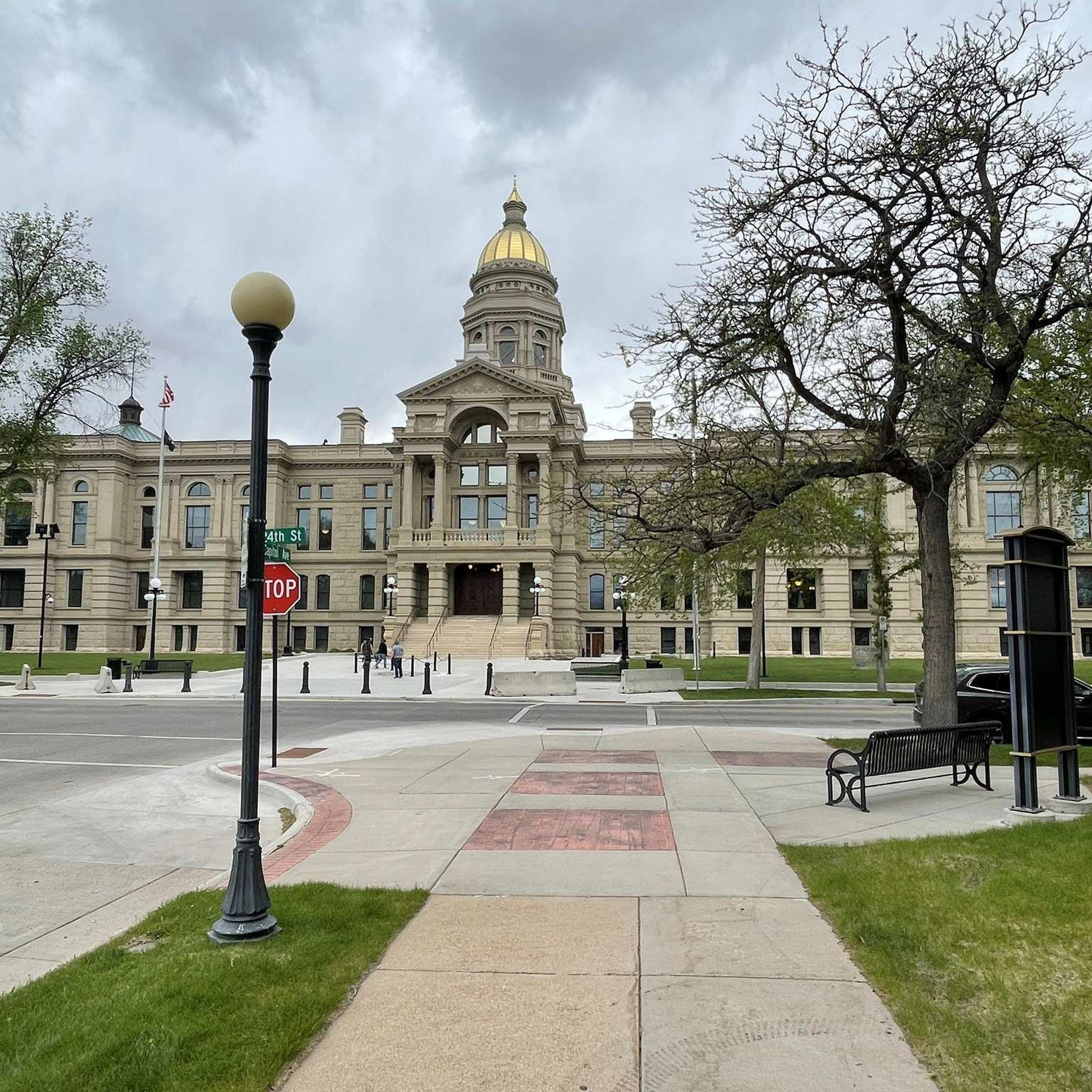
The Wyoming State Capitol stands as one of the oldest buildings in the state. Built in 1890, the same year Wyoming became the 44th state, the original dome was made of copper, gilded in gold leaf, and renovated in 2018 during a massive restoration project that ended in 2019.
0
0

Holliday Park is home to Lake Minnehaha, an art center, basketball courts, public restrooms, play areas, and picnic shelters. There is a multi-use path around the lake. There are also multiple historic trains in the park with informational signage.
0
0

Not only the Capitol, but Cheyenne itself is really worth a stopover! Nice little town with 50s charm!
3
0
Holliday Park is home to Lake Minnehaha, an art center, basketball courts, public restrooms, play areas, and picnic shelters. There is a multi-use path around the lake. There are also multiple historic trains in the park with informational signage.
0
0

The Cheyenne Union Pacific Railroad Depot is the former Union Pacific Railroad station building in Cheyenne, Wyoming. The building is now used as a railway museum.
3
0

Rather by coincidence, we drove out in Cheyenne and did a longer hike through the city. The State Capitol was so impressive that we decided to stay longer than just a tank stop.
2
0
Frequently Asked Questions
How many road cycling routes are available around Cheyenne?
There are several road cycling routes around Cheyenne, with five specifically highlighted in this guide. These routes primarily focus on easy-to-moderate terrain within the city and its immediate surroundings, offering a blend of urban exploration and natural scenery.
What kind of terrain can I expect on road cycling routes in Cheyenne?
Road cycling in Cheyenne offers a mix of terrain. Within the city, you'll find extensive paved greenways, such as the Greater Cheyenne Greenway, which provides smooth riding through open prairie and shaded sections. Routes often feature gentle elevation changes, making them accessible for various skill levels. For more adventurous rides, areas slightly outside the city, like the foothills leading to the Laramie Mountains, offer varied landscapes with rolling meadows and granite outcrops.
Are there any family-friendly road cycling routes in Cheyenne?
Yes, Cheyenne is well-suited for family-friendly road cycling, especially along its extensive paved greenway system. Routes like the Peanut Pond loop from Cheyenne or the Holliday Park loop from Cheyenne are relatively short, easy, and pass through local park areas, making them ideal for families with children or those seeking a relaxed ride.
What are some notable landmarks or attractions I can see while road cycling in Cheyenne?
Many routes in Cheyenne offer views of significant landmarks. For instance, the Wyoming State Capitol loop from Locomotive and the Wyoming State Capitol loop from N College Dr & Pershing Blvd (NE) both circle the impressive Wyoming State Capitol. Other routes might pass by the Cathedral of Saint Mary or the historic former Union Pacific Railroad station building, offering glimpses into the city's rich history and architecture.
Are there any circular road cycling routes in Cheyenne?
Yes, several popular road cycling routes in Cheyenne are designed as loops, allowing you to start and end at the same point. Examples include the Wyoming State Capitol loop from Locomotive, the Peanut Pond loop from Cheyenne, and the Holliday Park loop from Cheyenne. These circular routes are convenient for exploration without needing to retrace your path.
What is the best time of year for road biking in Cheyenne?
The best time for road biking in Cheyenne is generally during the spring, summer, and fall months when the weather is milder and more predictable. Summers are warm, while spring and fall offer pleasant temperatures and often beautiful scenery. Winters can bring snow and colder temperatures, making road cycling more challenging, though paved greenways might still be accessible depending on conditions.
Are there options for more challenging road cycling near Cheyenne?
While the routes highlighted in this guide are generally easy, the broader region around Cheyenne offers opportunities for more challenging rides. Areas like Curt Gowdy State Park, located west of the city, feature diverse terrain in the foothills of the Laramie Mountains, which can appeal to road and gravel cyclists seeking more strenuous climbs and varied landscapes. Vedauwoo Recreation Area also offers rugged, scenic roads for adventurous riders.
Where can I find parking for road cycling routes in Cheyenne?
Many road cycling routes in Cheyenne, especially those utilizing the Greater Cheyenne Greenway or passing through city parks, offer convenient parking options. For routes starting within the city, public parking lots or street parking near parks like Holliday Park or areas close to the State Capitol are typically available. For rides further afield, state parks like Curt Gowdy often have designated parking areas.
Can I combine road cycling with other outdoor activities in the Cheyenne area?
Absolutely! Cheyenne's diverse landscape makes it easy to combine road cycling with other outdoor pursuits. Curt Gowdy State Park, a short drive west, is renowned for its mountain biking trails, hiking, and water activities on its three reservoirs. Within Cheyenne, urban parks like Lions Park offer lakes and amenities, while the Cheyenne Botanic Gardens provide a serene environment for a post-ride stroll.
What are the typical distances and durations for road cycling routes in Cheyenne?
The road cycling routes around Cheyenne vary in length and duration, catering to different preferences. For example, the Peanut Pond loop from Cheyenne is about 10.7 miles (17.3 km) and takes approximately 49 minutes. Longer routes, such as the Wyoming State Capitol loop from N College Dr & Pershing Blvd (NE), cover around 19.2 miles (30.9 km) and can take about 1 hour 28 minutes to complete, offering a good workout while exploring the city.
Are there any specific natural features to look out for on Cheyenne's road cycling routes?
Cheyenne's road cycling routes often traverse areas showcasing the region's natural beauty. The Greater Cheyenne Greenway, for instance, winds through open prairie and shaded sections, offering views of local flora and fauna. While not directly on the city's paved routes, the nearby Curt Gowdy State Park features rolling meadows, granite outcrops, and pine forests, with three distinct ecosystems and reservoirs like Granite, Crystal, and North Crow, providing stunning natural backdrops for longer rides or explorations.
Most popular attractions around Cheyenne

Get inspired with the komoot mobile app


Explore more
Browse the best Road cycling routes in other regions.
