The best cycling routes in Saint Francis Dam National Monument
5.0
(1)
20
riders
4
rides
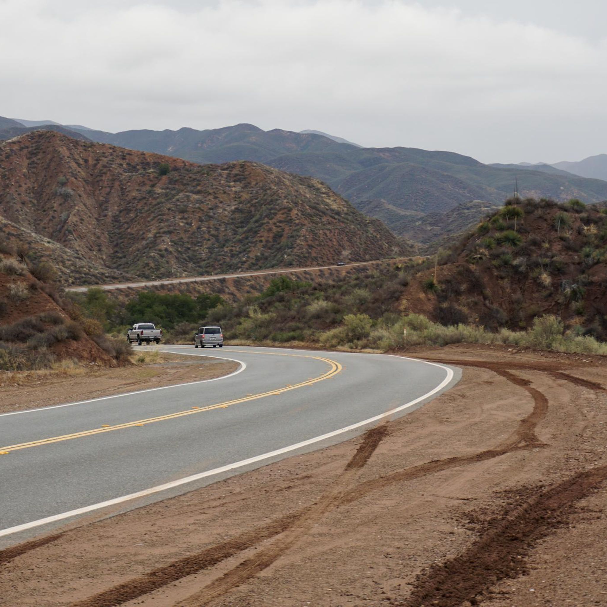
Touring cycling in Saint Francis Dam National Monument offers routes through a canyon environment within the Sierra Pelona Mountains. The terrain features elevations ranging from approximately 1,760 to 2,000 feet, with rugged canyons and rolling hills. San Francisquito Creek flows through the area, contributing to the scenic views and geological value. Paved roads, such as San Francisquito Canyon Road, provide varied gradients and well-maintained surfaces for cycling.
Best touring cycling routes in Saint Francis Dam National Monument
- The most popular…
Last updated: July 2, 2026
5.0
(1)
6
riders
81.1km
05:12
1,000m
1,000m
Hard bike ride. Very good fitness required. Mostly paved surfaces. Suitable for all skill levels.
4
riders
69.4km
04:50
790m
790m
Hard bike ride. Very good fitness required. Mostly paved surfaces. Suitable for all skill levels.

Sign up for free
4
riders
96.8km
06:18
1,260m
1,250m
Hard bike ride. Very good fitness required. Mostly paved surfaces. Suitable for all skill levels.
4
riders
18.3km
01:11
140m
140m
Easy bike ride. Great for any fitness level. Mostly paved surfaces. Suitable for all skill levels.
2
riders
41.9km
02:48
460m
460m
Hard bike ride. Very good fitness required. Mostly paved surfaces. Suitable for all skill levels.
Our route recommendations are based on thousands of hikes, rides, and runs completed by other people on komoot.
Start today with a free account
Your next adventure awaits.
Login or Signup
Popular around Saint Francis Dam National Monument

Tips from the Community

At about 84 miles long, the Santa Clara River is the largest natural river system in southern California remaining in a relatively undeveloped state. Along its length there is the 8 mile long Santa Clara River Trail, which is a paved bicycle and walking path in the city of Santa Clarita.
0
0

Central Park features a 3.1-mile cross-country trail at its heart, a hub for athletes to train and compete. The trail is great for hiking, dog walking, and biking. A recent addition includes the Central Park Trail, which extends the network by connecting the park to Newhall Ranch Road.
0
0

From this spot just off of the San Francisquito Creek Trail in Santa Clarita, CA, you get fantastic open views down the valley across the grasslands and of the powerlines. This is a nice place to stop and sip some water or snap a photo before continuing on your ride.
0
0

Golden Valley Bike Path is a great 5 mile popular paved path trail on the outskirts of Santa Clarita. It provides a great class I bike path. This means it is traffic free and has a lane for each direction of travel.
0
0
At about 84 miles long, the Santa Clara River is the largest natural river system in southern California remaining in a relatively undeveloped state. Along its length there is the 8 mile long Santa Clara River Trail, which is a paved bicycle and walking path in the city of Santa Clarita.
0
0

The San Francisquito Creek Trail travels through various parks and across different bridges on the banks of the Santa Clara River and San Francisquito Creek. The path is completely paved and goes on both sides of the creek, giving you the chance to run or cycle a loop depending on what trailhead you start at.
0
0
Central Park is often considered Santa Clarita's “crown jewel.” There is a 5k cross country running trail that is also open to bikers, dogs, and walkers when there aren't meets being held. There are also gardens and sporting fields at the main upper entrance of the park.
0
0
Frequently Asked Questions
How many touring cycling routes are available in Saint Francis Dam National Monument?
There are 5 touring cycling routes available in and around the Saint Francis Dam National Monument, offering a variety of distances and experiences for cyclists.
What is the typical difficulty level for touring cycling routes here?
Most of the touring cycling routes in the Saint Francis Dam National Monument area are rated as difficult, featuring significant elevation changes. For example, the Santa Clara River – Central Park Gardens loop from Santa Clarita covers over 81 km with more than 1000 meters of ascent. However, there is one easier option, the Central Park Gardens – Central Park Community Garden loop from Saugus, which is just over 18 km with 140 meters of elevation gain.
Are there any family-friendly touring cycling routes?
While many routes are challenging, the Central Park Gardens – Central Park Community Garden loop from Saugus is an easier option, suitable for families looking for a shorter ride. It's just over 18 km with moderate elevation, making it a good choice for those seeking a less strenuous experience.
Can I find loop routes for touring cycling in the monument?
Yes, all the touring cycling routes listed are loop routes, allowing you to start and end your ride at the same point. Examples include the challenging Iron Horse Bridge – Santa Clara River loop from Santa Clarita and the scenic Santa Clara River – Iron Horse Bridge loop from Santa Clarita.
What kind of scenery and natural features can I expect to see while cycling?
Cyclists can expect to traverse a canyon environment with elevations ranging from 1,760 to 2,000 feet. The routes offer diverse vegetation, including riparian zones, chaparral, and stands of hardwoods and cottonwoods. The San Francisquito Creek flows through the monument, adding to the scenic views, and in spring, wildflowers bloom vibrantly across the rugged canyons and rolling hills.
Are there any historical attractions or viewpoints along the routes?
The primary historical attraction is the site of the Saint Francis Dam itself, with visible remnants of the 1928 disaster, including large concrete pieces and steel reinforcements. While cycling along San Francisquito Canyon Road, you'll experience the unique backdrop of this historically significant area, offering a tangible link to the past.
What is the best time of year to go touring cycling in Saint Francis Dam National Monument?
Spring is particularly beautiful due to the vibrant wildflower blooms. However, the monument's terrain and paved roads make it accessible for touring cycling throughout much of the year. Be mindful of summer heat, as temperatures can be high in Los Angeles County.
Is parking available for cyclists?
While specific parking areas for cyclists are not detailed, the monument is accessible by car, and visitors typically find parking within or near the designated areas of the monument. For routes starting in Santa Clarita, local parking options would be available.
What wildlife might I encounter while cycling?
The area is home to various wildlife, including deer, coyotes, and a variety of bird species. Keep an eye out, especially in the quieter sections of the canyon, for opportunities to spot local fauna.
Do I need any special permits to cycle in the monument?
No special permits are generally required for touring cycling on the paved roads within the Saint Francis Dam National Monument. The monument aims to conserve resources for public enjoyment, and cycling is a recognized activity.
What do other cyclists enjoy most about touring cycling in Saint Francis Dam National Monument?
The komoot community rates the touring cycling experience in Saint Francis Dam National Monument highly, with an average score of 5.0 stars. Cyclists often praise the unique blend of historical significance and natural beauty, particularly the scenic views and steady climbs along the paved San Francisquito Canyon Road, which provides an immersive experience.
Are there any longer, more challenging touring routes for experienced cyclists?
Absolutely. Experienced cyclists will find several challenging routes, such as the Iron Horse Bridge – Santa Clara River loop from Santa Clarita, which spans nearly 97 km with over 1250 meters of elevation gain. Another demanding option is the Santa Clara River – Santa Clara River loop from Haskell Canyon Open Space, covering almost 42 km with significant climbs.
Most popular routes in Saint Francis Dam National Monument

Get inspired with the komoot mobile app


Explore more
Browse the best Cycling routes in other regions.
