The best waterfall hikes and walks around Kings, Subd. B
4.7
(68)
476
hikers
4
hikes
Waterfall hiking trails around Kings, Subd. B are primarily found within the Municipality of the County of Kings, Nova Scotia. This region is characterized by its dramatic coastal scenery overlooking the Bay of Fundy and forested environments. The landscape features rugged coastlines, offering picturesque views, alongside trails that wind through softwood forests and along raised dykes. Elevations are generally moderate, providing accessible hiking experiences.
Best waterfall hiking trails around Kings, Subd. B
- The most popular waterfall hiking route is Blomidon…
Last updated: June 23, 2026
4.9
(7)
36
hikers
Moderate hike. Good fitness required. Easily-accessible paths. Suitable for all skill levels.
9
hikers
Easy hike. Great for any fitness level. Easily-accessible paths. Suitable for all skill levels.

Sign up for free
6
hikers
Easy hike. Great for any fitness level. Easily-accessible paths. Suitable for all skill levels.
2
hikers
2.91km
00:58
130m
130m
Easy hike. Great for any fitness level. Easily-accessible paths. Suitable for all skill levels.
Our route recommendations are based on thousands of hikes, rides, and runs completed by other people on komoot.
Start today with a free account
Your next adventure awaits.
Login or Signup
Popular around Kings, Subd. B


Tips from the Community

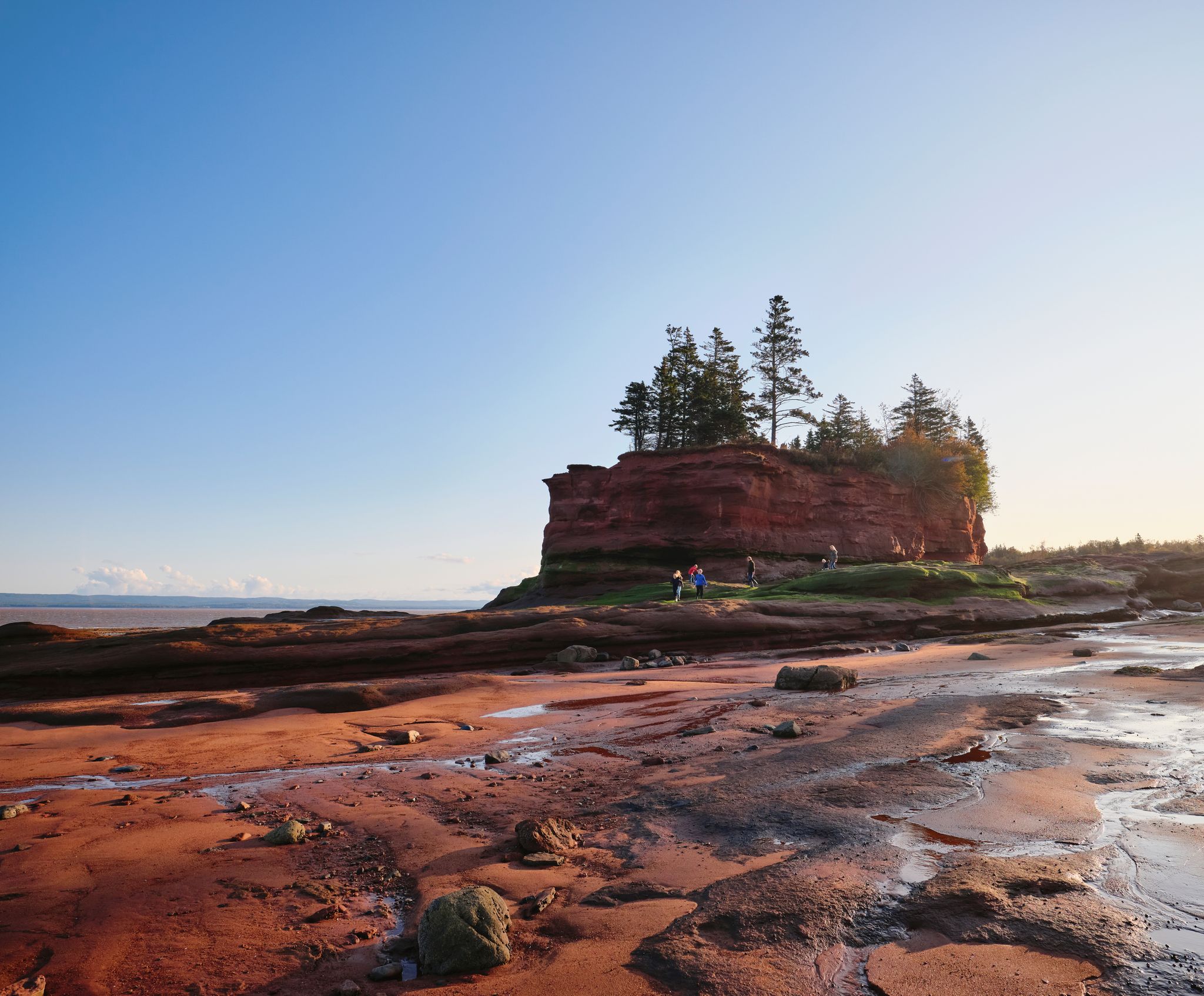
A very beautiful path south of Cape Split. Easy to walk paths through mixed forest and then a walk on red sand (at low tide).
0
0

The Blomidon campground is in a beautiful location with views to the Minas Basin. There are few facilities in park campsites. Apart from toilets and showers, there are water taps distributed over the area and mobile homes can dispose of their wastewater in a special facility.
3
0
Vernal pools are small, shallow wetlands that lack permanent inlet or outlet streams and often dry out in the summer. They provide critical breeding habitat for frogs, salamanders, insects and fairy shrimp, and feeding and drinking sites for birds, mammals, turtles and other wildlife. https://novascotia.ca/nse/wetland/vernal.pool.mapping.project.asp
3
0
The Minas Basin is an inlet of the Bay of Fundy in Nova Scotia. It is known for its extremely high tides. Minas Basin is the location of the highest tidal range ever recorded, exceeding 16 m and has one of the highest average tidal ranges every day. https://en.wikipedia.org/wiki/Minas_Basin
3
0
At the Look-Off there are marvellous views to the Minas Basin as well as the rock formation of the Blomidon Peninsula. The Look-Off is fixed by a wooden structure. Visitors should not get too close to the edge of the cliff as rock falls are possible at any time.
4
0
Along the Jodrey Trail, there are several Look-Off offering views to the Minas Basin.
4
0
Blomidon Provincial Park covers 759 ha, includes 180 m high cliffs and the world’s highest tides. The natural attractions provide excellent opportunities, among others for camping and hiking. https://www.novascotia.com/places-to-stay/campgrounds/blomidon-provincial-park/1248
4
0
Woodland Trail of 2.7 km begins at a grassy area where the park visitor centre and the campground are located. It ends at the Look-Off Trail. Connecting with three trails, Borden Brook, Look-Off and Jodrey, Woodland Trail forms a loop hike of about 12 km.
4
0
Frequently Asked Questions
How many waterfall hiking trails are available in Kings, Subd. B?
There are several waterfall hiking trails around Kings, Subd. B, with komoot featuring 4 distinct routes. These trails are primarily located within the Municipality of the County of Kings, Nova Scotia, offering diverse experiences from easy walks to more moderate hikes.
Are there easy waterfall hikes suitable for beginners or families?
Yes, Kings, Subd. B offers several easy waterfall hikes perfect for beginners and families. For instance, the Blomidon Provincial Park Red Cliffs – Lookoff loop from White Water is an easy 2.9 km trail that can be completed in about 1 hour, offering scenic views with moderate elevation changes.
Can I bring my dog on the waterfall trails in Kings, Subd. B?
Many trails in the Kings, Subd. B area, particularly within provincial parks like Blomidon, are generally dog-friendly, provided dogs are kept on a leash. It's always a good idea to check specific park regulations before heading out. The region's natural parks and trails are popular for walks with canine companions.
What other natural sights can I explore near the waterfall trails?
Beyond the waterfalls, the region boasts dramatic coastal scenery overlooking the Bay of Fundy. You can explore highlights like the Blomidon Provincial Park Red Cliffs, or enjoy breathtaking vistas from viewpoints such as the Minas Basin Lookout and Lobster Hole Lookoff. The Minas Basin Trail, Cape Split Provincial Park also offers stunning coastal views.
Are there any loop trails around the waterfalls?
Yes, several trails in the area are designed as loops, allowing you to experience diverse scenery without retracing your steps. An example is the Blomidon Provincial Park Red Cliffs – Blomidon Campground loop from White Water, which is a moderate 11.3 km route offering varied terrain and coastal views.
When is the best time of year to visit the waterfalls in Kings, Subd. B?
The best time to visit the waterfalls in Kings, Subd. B is typically during spring and early summer when snowmelt and rainfall contribute to higher water flow, making the waterfalls more impressive. Autumn also offers beautiful scenery with fall foliage, though water levels might be lower. Always check local conditions before your visit.
How long do waterfall hikes in this region usually take?
The duration of waterfall hikes varies depending on the trail's length and difficulty. For example, an easy route like the Blomidon Provincial Park Red Cliffs – Lookoff loop from White Water can take around 1 hour, while a more moderate trail such as the Blomidon Provincial Park Red Cliffs – Blomidon Campground loop from White Water might take over 3 hours.
Is parking available at the trailheads for waterfall hikes?
Yes, for trails located within provincial parks like Blomidon, designated parking areas are typically available at or near the trailheads. It's advisable to arrive early during peak seasons to secure a spot, especially for popular trails.
Are there any hidden gem waterfalls or wild swimming spots in the area?
The region is known for its natural beauty, and while specific 'hidden gem' waterfalls can be elusive, the 'Crystal Falls (Mumford Brook) Trail' mentioned in local research is a local favorite that leads to a swimming hole and old logging trails, offering a more secluded experience. Always exercise caution and check local regulations if considering wild swimming.
What should I wear for a waterfall hike in Kings, Subd. B?
For waterfall hikes, it's recommended to wear sturdy, waterproof hiking boots, as trails can be wet and muddy, especially near the falls. Dress in layers to adapt to changing weather conditions, and consider bringing rain gear, even on clear days, as mist from the falls can be significant. Insect repellent is also advisable, particularly during warmer months.
What do other hikers enjoy most about the waterfall trails in Kings, Subd. B?
The waterfall trails in Kings, Subd. B are highly rated by the komoot community, with an average score of 4.8 stars. Hikers often praise the dramatic coastal scenery, the peaceful forested sections, and the well-maintained paths that offer a rewarding outdoor experience with views of the Bay of Fundy.
Can I hike to waterfalls in Kings, Subd. B during winter?
Winter hiking to waterfalls can be a unique and beautiful experience, with frozen cascades creating stunning ice formations. However, conditions can be challenging with snow and ice, requiring appropriate gear like microspikes or snowshoes. Always check trail conditions and weather forecasts before attempting a winter hike, as some trails may be less accessible or closed.
Most popular attractions around Kings, Subd. B

Get inspired with the komoot mobile app


Explore more
Browse the best Hikes in other regions.
