The best waterfall hikes and walks around Breheimen
4.5
(1295)
6,875
hikers
27
hikes
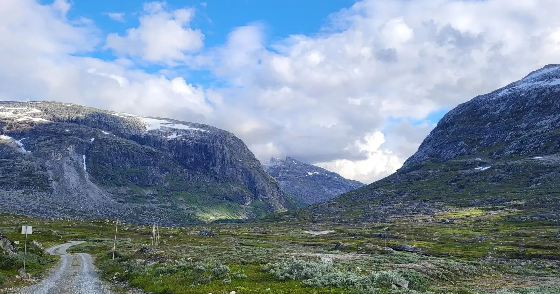
Waterfall hiking trails around Breheimen traverse a diverse mountain wilderness characterized by glacial landscapes, deep valleys, and numerous waterways. The region features extensive glacier systems, including parts of Jostedalsbreen, which carve dramatic U-shaped valleys and feed meltwater rivers. Hikers encounter a varied terrain ranging from lush alpine meadows to barren mountain areas, with peaks exceeding 2,000 meters. This environment provides a rich setting for exploring waterfalls and their surrounding natural features.
Best waterfall hiking trails around Breheimen
- The most popular…
Last updated: June 27, 2026
4.8
(32)
103
hikers
10.3km
03:16
410m
410m
Moderate hike. Good fitness required. Easily-accessible paths. Suitable for all skill levels.
4.0
(2)
14
hikers
Easy hike. Great for any fitness level. Easily-accessible paths. Suitable for all skill levels.

Sign up for free
18
hikers
Easy hike. Great for any fitness level. Easily-accessible paths. Suitable for all skill levels.
4
hikers
5.15km
01:22
50m
50m
Easy hike. Great for any fitness level. Easily-accessible paths. Suitable for all skill levels.
4.8
(36)
232
hikers
9.82km
05:00
870m
870m
Hard hike. Very good fitness required. Mostly accessible paths. Sure-footedness required.
Get access to more routes and recommendations from other explorers.
Sign up for free
Already have an account?
Our route recommendations are based on thousands of hikes, rides, and runs completed by other people on komoot.
Start today with a free account
Your next adventure awaits.
Login or Signup
Popular around Breheimen
Other adventures around Breheimen

Tips from the Community

An absolute must, absolutely delicious baked goods, both the bread and rolls, but also the sweet treats. That's how it should always taste. And the view from the small café onto the waterfall or from the first floor into the bakery, simply brilliant. And really don't let a queue put you off, you'll miss out on something.
0
0

Lom Stave Church is one of Norway's largest and most well-preserved stave churches, located in the village of Lom. Dating back to the 12th century, it is famous for its dragon-head carvings on the roof and its richly decorated interior, which includes intricate carvings and frescoes. Unlike many other stave churches, it has remained in continuous use for centuries and has been expanded over time, most notably with the addition of a transept in the 17th century.
1
0

The huge boulders in the riverbed are interesting to look at; in some places they are hollow or supported by tiny other stones; colossal and delicate at the same time.
0
0

Incredible water fall!!! wow! Such intense power coming down from the mountains. Especially interesting because as a hiker you can really get close to the waterfall without being in danger. Can only recommend!
0
0
great bridge over the river. just past the waterfall
0
0

Lomseggen (1,289 m) rises high above the Norwegian village of Lom, offering a spectacular panoramic view of the valley and surrounding mountain ranges. The ascent is challenging, with a steep and rocky trail that takes you through rugged terrain and along exposed ridges. Once at the top, you're rewarded with breathtaking views, including the snow-capped peaks of Jotunheimen.
0
0

Lom Stave Church is one of the largest and oldest stave churches in Norway. The church was built in the middle of the 12th century and is dedicated to St. Olav, the Virgin Mary and John the Baptist, and it is still the main church in the parish. The oldest part is built in Romanesque style. Lom was an important stop for pilgrims. For these reasons, the church was built extra large. In 1634 an extension was built to the west, and in 1663 the cross arms were added in half-timbering to the south and north. Most of the inventory dates from the 18th century, and it also has the largest collection of paintings in any Norwegian church.
5
0

Open-air museum with numerous historic houses
3
0
Frequently Asked Questions
How many waterfall hiking trails are available in Breheimen?
There are over 25 dedicated waterfall hiking trails in Breheimen, offering a wide range of experiences from easy strolls to more challenging ascents. The region's glacial landscapes and numerous waterways ensure a rich selection of routes featuring stunning waterfalls.
What is the general difficulty level of waterfall hikes in Breheimen?
The waterfall hikes in Breheimen cater to various skill levels. You'll find 9 easy routes, 12 moderate trails, and 5 more difficult options. This diversity allows hikers to choose paths that match their experience and fitness levels, from gentle walks to demanding multi-day expeditions.
Are there family-friendly waterfall hikes in Breheimen?
Yes, Breheimen offers several family-friendly waterfall hikes. For example, the The Bakery in Lom – Lom Stave Church loop from Lom stavkyrkje is an easy 5.2 km path, perfect for a gentle walk with children. These routes often feature less elevation gain and shorter distances.
When is the best time of year to hike to waterfalls in Breheimen?
The best time to hike to waterfalls in Breheimen is typically during the summer months (June to September). During this period, the weather is generally milder, trails are clear of snow, and the meltwater from the glaciers ensures the waterfalls are at their most impressive. The region's lush alpine meadows are also vibrant at this time.
What natural attractions or landmarks can I see along waterfall hikes in Breheimen?
Beyond the waterfalls themselves, Breheimen's trails often lead past stunning natural attractions. You might encounter majestic peaks like Lomseggen Summit (1,289 m), serene lakes such as Sottjønnin and Åsetevatnet, or even historic mountain passes like Gamle Strynefjellsvegen. These features add to the rich experience of hiking in this glacial landscape.
Are there circular waterfall hiking routes in Breheimen?
Yes, many waterfall hikes in Breheimen are designed as circular routes, allowing you to start and end at the same point. An example is the challenging Lomseggen Loop Trail, which offers a comprehensive experience of the area's diverse terrain and scenic views.
What do other hikers enjoy most about hiking in Breheimen?
The area is highly rated by the komoot community, with an average score of 4.5 stars from over 1200 reviews. Hikers frequently praise the stunning glacial landscapes, the tranquility of nature, and the diverse terrain that ranges from lush valleys to towering peaks. The well-maintained trails and the opportunity to witness impressive waterfalls are also commonly highlighted.
Is it possible to reach waterfall trails in Breheimen using public transport?
While specific public transport options to every trailhead can vary, some areas within Breheimen, such as Mørkridsdalen, are known as gateways to the park and may have more accessible public transport links. It's advisable to research specific routes and their starting points for the most up-to-date public transport information, as many trails require private vehicle access or local shuttle services.
What kind of wildlife might I encounter on waterfall hikes in Breheimen?
Breheimen is home to diverse wildlife adapted to mountain environments. Hikers might spot wild reindeer, red deer, or smaller mammals like red foxes. The park also supports various bird species, including golden eagles and rough-legged buzzards. Observing wildlife from a respectful distance adds to the natural experience of the trails.
Are there any challenging waterfall hikes for experienced hikers in Breheimen?
Absolutely. For experienced hikers seeking a challenge, Breheimen offers several demanding routes. These trails often feature significant elevation gain and rugged terrain, leading to spectacular viewpoints and more remote waterfalls. The region's high mountain peaks and glacial areas provide ample opportunities for strenuous and rewarding expeditions.
What should I wear for waterfall hiking in Breheimen?
Given Breheimen's varied terrain and often unpredictable mountain weather, it's essential to dress in layers. Waterproof and windproof outer shells are highly recommended, along with sturdy hiking boots with good grip, as trails can be wet and rocky near waterfalls. Even in summer, temperatures can drop, so bring warm layers, a hat, and gloves.
Are there any huts or shelters along the waterfall trails in Breheimen?
Yes, Breheimen has a network of huts and shelters, which can be particularly useful for longer hikes or multi-day expeditions. For instance, the Spørteggbu Hut (1560 m) provides a resting point in the higher elevations. It's always wise to check the availability and booking requirements for these facilities in advance.
Most popular routes around Breheimen
Most popular attractions around Breheimen

Get inspired with the komoot mobile app


Explore more
Browse the best Hikes in other regions.
