The best walks and hikes around Maatianjärvi
4.5
(2)
33
hikers
4
hikes
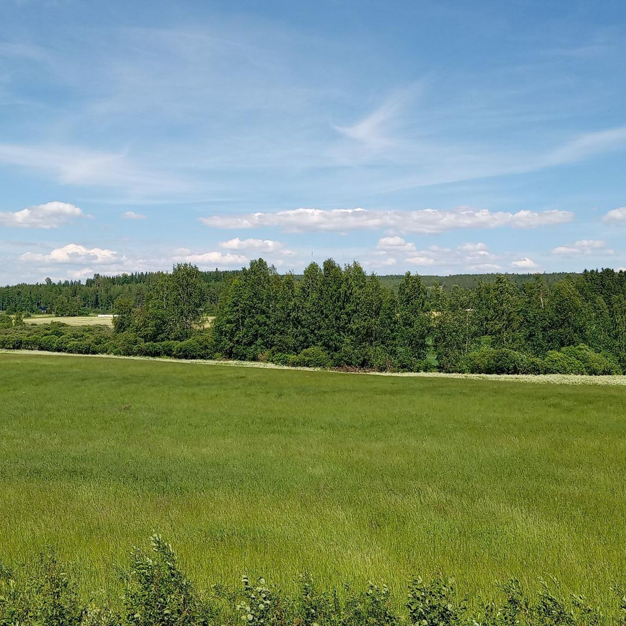
Hiking around Maatianjärvi offers opportunities to explore the natural landscapes of Central Finland, near Jyväskylä. The region is characterized by forests, varied terrain, and numerous bodies of water, typical of Finnish Lakeland scenery. Maatianjärvi itself is a lake featuring three islands and a shoreline of 3.4 miles (5.4 km). The surrounding area provides a mix of woodlands and lakeside views, with routes often including hills.
Best hiking trails around Maatianjärvi
- The most popular hiking route is Three Hills Conquest Trail…
Last updated: August 20, 2026
6
hikers
9.40km
02:37
170m
170m
The Falcon round, Korpilahti, Finland, is a difficult 5.8-mile hike with 547 feet of elevation gain, offering panoramic views over Lake Päij
4.5
(2)
8
hikers
15.5km
04:15
250m
250m
Hard hike. Good fitness required. Sure-footedness, sturdy shoes and alpine experience required.

Sign up for free
3
hikers
7.96km
02:12
130m
130m
Hard hike. Good fitness required. Sure-footedness, sturdy shoes and alpine experience required.
5
hikers
Easy hike. Great for any fitness level. Easily-accessible paths. Suitable for all skill levels.
10
hikers
9.47km
02:33
120m
120m
Hike the moderate 5.9-mile Muuramenharju Outdoor Trail through green forests and hills in the Jyväskylä Region, taking about 2.5 hours.
Our route recommendations are based on thousands of hikes, rides, and runs completed by other people on komoot.
Start today with a free account
Your next adventure awaits.
Login or Signup
Popular around Maatianjärvi

Tips from the Community

What a fantastic view! From the top, Lake Päijänne stretches wide below you, with islands and bays shimmering in the distance.
0
0
Southwest of Muurame, right on the shore of Lake Muuratjärvi, you step into a quiet forest that welcomes you with gentle hills and clearings. As you walk between birch and pine, small paths open up to views of the lake – perfect for pausing and soaking in the calm.
0
0

The gravel trail to Muuratharju, near Jyvaskyla, takes you through peaceful forests and natural landscapes, offering a relaxing escape into nature. Rising to an elevation of about 170 meters (558 feet) above sea level, Muuratharju provides stunning views of the surrounding lakes and forests.
0
0
Korpilahti lies on the shores of Lake Päijänne, one of Finland's largest lakes. Korpilahti offers a rich cultural experience with its 19th-century church, local artisan shops, and traditional Finnish festivals like Midsummer. Here, you can explore modern Finnish architecture, such as Alvar Aalto’s Säynätsalo Town Hall,
0
0

Frequently Asked Questions
How many hiking trails are there around Maatianjärvi?
There are over 6 hiking routes available around Maatianjärvi. These trails offer diverse experiences, ranging from easy walks to more challenging ascents, allowing you to explore the natural landscapes of Central Finland.
What kind of terrain can I expect on hikes around Maatianjärvi?
The terrain around Maatianjärvi is characteristic of the Finnish Lakeland, featuring a mix of woodlands, varied landscapes, and lakeside views. You can expect routes that include hills, forests, and shores of the lake, offering a diverse hiking experience.
Are there hiking trails for all skill levels around Maatianjärvi?
Yes, the area around Maatianjärvi caters to various ability levels. While many routes are rated as difficult, such as the Three Hills Conquest Trail, there are also easier options like the Muuratharju loop from Teollisuuskylä, which is 2.8 miles (4.5 km) long with moderate elevation changes.
Are there any notable viewpoints or natural features to look out for?
While specific named landmarks directly on Maatianjärvi's shores are not extensively documented, the region itself is rich in natural beauty. The View from Haukkavuori Hill – Kivijonniemi Laavu loop from Sirpan luonto offers scenic views from Haukkavuori Hill and leads to a traditional Finnish lean-to shelter (laavu). The lake itself features three islands and a 3.4-mile (5.4 km) shoreline, providing picturesque lakeside vistas.
Is parking available near the hiking trails around Maatianjärvi?
While specific parking information for each trail is not detailed, the Jyväskylä region generally emphasizes accessible nature. It is common for nature paths and exercise tracks in Finland to have designated parking areas at trailheads. We recommend checking individual route details on komoot for specific parking instructions or looking for public parking in nearby villages like Markkulanmäki.
Can I reach the hiking trails around Maatianjärvi by public transport?
The Jyväskylä region has a public transport network, but direct access to every trailhead around Maatianjärvi might vary. For detailed information on public transport routes and schedules to the vicinity of Maatianjärvi, it's best to consult local transport services in Jyväskylä. Many Finnish outdoor areas are more easily accessed by car.
What is the best time of year to hike around Maatianjärvi?
The best time to hike around Maatianjärvi largely depends on your preference. Spring and summer (May to September) offer pleasant temperatures, lush greenery, and long daylight hours, ideal for enjoying the Finnish Lakeland scenery. Autumn brings beautiful fall colors, while winter offers opportunities for snowshoeing or cross-country skiing, though hiking conditions will be more challenging due to snow and ice.
Are there any circular hiking routes available?
Yes, several routes around Maatianjärvi are designed as loops, allowing you to start and end at the same point. An example is the View from Haukkavuori Hill – Kivijonniemi Laavu loop from Sirpan luonto, which provides a complete circular experience through varied terrain.
Are the trails around Maatianjärvi suitable for families with children?
While some trails are rated as difficult, there are also easier options that could be suitable for families. For instance, the Wooden bridge over pond loop from Muurame is an easy 3.7-mile (6.0 km) route that might be more manageable for younger hikers. Always check the specific route details for distance, elevation, and terrain to ensure it matches your family's capabilities.
Are dogs allowed on the hiking trails near Maatianjärvi?
Generally, dogs are welcome on hiking trails in Finland, provided they are kept on a leash, especially during nesting seasons (typically April to August) to protect wildlife. It's always advisable to check local regulations or specific trail signage for any restrictions, particularly in nature reserves or protected areas. Please ensure you clean up after your dog to maintain the natural environment.
What do other hikers enjoy most about hiking in Maatianjärvi?
The area is highly rated by the komoot community, with an average score of 4.5 stars from 4 reviews. Hikers often praise the quiet woodlands, the varied terrain, and the opportunity to experience typical Finnish Lakeland scenery. The network of routes provides a good mix of challenges and serene walks.
Are there any cafes or places to eat near the hiking trails?
Maatianjärvi is situated near the village of Markkulanmäki and the broader Jyväskylä region. While specific cafes directly at trailheads are not mentioned, you can likely find amenities, including cafes and restaurants, in nearby towns and villages. For a wider selection, Jyväskylä city center offers numerous options.
How long do the hiking trails typically take to complete?
The duration of hikes varies significantly depending on the trail's length and difficulty. For example, the Three Hills Conquest Trail, a difficult 5.8-mile (9.4 km) route, typically takes around 2 hours and 36 minutes. Shorter, easier trails like the Muuratharju loop from Teollisuuskylä can be completed in about 1 hour and 12 minutes. Always check the estimated duration for each specific route.
Most popular routes around Maatianjärvi

Get inspired with the komoot mobile app


Explore more
Browse the best Hikes in other regions.
