Easy hikes and walks around Bulford
4.4
(512)
5,459
hikers
139
hikes
Easy hiking trails around Bulford are situated on the edge of Salisbury Plain, an expansive chalk upland characterized by rolling downs and open vistas. The landscape features the Salisbury Avon and Nine Mile River, offering riverside walking opportunities. The area's chalk geology creates unique topographical features, with evidence of ancient landscapes such as round barrows adding historical context to the natural environment. This diverse terrain provides a range of easy hiking trails suitable for various preferences.
Best easy hiking trails…
Last updated: October 17, 2026
9
hikers
4.57km
01:12
30m
30m
Easy hike. Great for any fitness level. Easily-accessible paths. Suitable for all skill levels.
3.0
(1)
14
hikers
4.08km
01:03
20m
20m
Easy hike. Great for any fitness level. Easily-accessible paths. Suitable for all skill levels.

4
hikers
Easy hike. Great for any fitness level. Easily-accessible paths. Suitable for all skill levels.
5
hikers
5.24km
01:25
70m
70m
Easy hike. Great for any fitness level. Easily-accessible paths. Suitable for all skill levels.
4
hikers
3.52km
00:57
40m
40m
Easy hike. Great for any fitness level. Easily-accessible paths. Suitable for all skill levels.
Get access to more routes and recommendations from other explorers.
Already have an account?
Our route recommendations are based on thousands of hikes, rides, and runs completed by other people on komoot.
Start today with a free account
Your next adventure awaits.
Popular around Bulford
Other adventures around Bulford

Tips from the Community


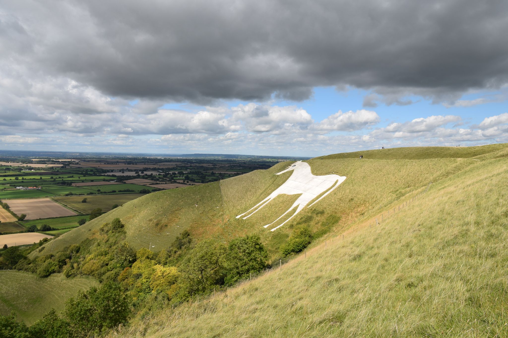
The Bulford Kiwi is a large depiction of a kiwi, carved in the chalk on Beacon Hill above the military town of Bulford on Salisbury Plain in Wiltshire, England. It was created in 1919 by soldiers of the New Zealand Expeditionary Force who were awaiting repatriation following the end of the First World War. It is one of the few hill figures in Wiltshire to be neither a white horse nor a military badge.
0
0

Can someone please be happy/laughing with me that Google Translate turns Amy's "henge and timber monument" into "Denkmal für Hühner 🐔" in German? - Great 😂😂😂
0
0

Location signage, that is, how to locate the cuckoo stone, is non-existent! Once you pass through the gate next to Woodhenge you’ll see the National Trust sign. The stone lies way off to your right at about 3 o’clock direction from the sign. If the grass is long it won’t be visible!
2
0


Like the larger megaliths that make up the outer ring of Stonehenge, the Cuckoo Stone is a sarsen stone and was once a standing stone. It has since fallen but is still a familiar landmark and is part of the wider Stonehenge Landscape. It's believed that the Cuckoo Stone was the ceremonial centrepiece for several burials around 2000 BC.
3
0

Frequently Asked Questions
How many easy hiking trails are available around Bulford?
Bulford offers a wide selection of easy hiking trails. There are over 65 easy routes specifically designed for a relaxed outdoor experience in the area.
What kind of terrain can I expect on easy hikes around Bulford?
Easy hikes around Bulford primarily feature rolling chalk downs and river valleys. The area is situated on the edge of Salisbury Plain, offering open vistas and pleasant walks along the Salisbury Avon and Nine Mile River. The chalk geology creates unique topographical features, making for varied yet gentle paths.
Are there any historical landmarks or points of interest along easy hiking trails in Bulford?
Yes, Bulford's easy trails often pass by or are close to significant historical sites. You can explore routes near ancient landscapes with round barrows, or visit notable attractions like Woodhenge and the Cuckoo Stone. The distinctive Bulford Kiwi, a large chalk carving, is also a local landmark.
Are the easy hiking trails in Bulford suitable for families with children?
Many easy trails in Bulford are ideal for families. Routes like the Playground by the River – Queensberry Bridge loop from Amesbury offer views along the river and are generally flat, making them suitable for all ages. The St. Leonard's Church, Bulford loop from Bulford is another local village walk that is easy and accessible.
Can I bring my dog on the easy hiking trails in Bulford?
Most easy hiking trails around Bulford are dog-friendly, allowing you to enjoy the scenic chalk downs and riverside paths with your canine companion. Always ensure your dog is under control, especially near livestock, and check for any specific local signage regarding dog access.
What do other hikers say about the easy trails in Bulford?
The easy hiking trails in Bulford are highly regarded by the komoot community, with an average rating of 4.4 stars from over 390 reviews. Hikers often praise the accessible nature of the paths, the pleasant riverside sections, and the opportunity to experience the region's unique historical and natural landscapes.
Are there circular easy hiking routes available in Bulford?
Yes, many easy hiking routes in Bulford are circular, allowing you to start and end your walk in the same location. Examples include the popular Playground by the River – Queensberry Bridge loop from Amesbury and the St. Leonard's Church, Bulford loop from Bulford.
Where can I find parking for easy hikes around Bulford?
Parking availability varies by trailhead. Many routes starting from villages like Bulford or Amesbury will have public parking options. It's advisable to check specific route details on komoot for parking recommendations near your chosen starting point.
Are there pubs or cafes near the easy hiking trails in Bulford?
Yes, you can find places to refresh yourself after a walk. For example, The Bridge Inn is a pub located near some of the trails, offering a convenient stop for hikers.
What is the best time of year to enjoy easy hikes in Bulford?
Bulford's easy hikes can be enjoyed year-round. Spring brings wildflowers to the downs, summer offers warm, open vistas, and autumn provides beautiful colours. Even in winter, the rolling chalk landscape can be quite atmospheric, though paths may be muddier. Always check local weather conditions before heading out.
Can I access easy hiking trails in Bulford using public transport?
Bulford is a village with local bus services that connect to nearby towns like Amesbury and Salisbury. Some trailheads may be accessible via public transport, particularly those starting directly from the villages. It's recommended to check local bus schedules and route maps to plan your journey.
What is the typical duration for an easy hike in Bulford?
Easy hikes in Bulford vary in length and duration. Many can be completed in under two hours, such as the Hovis Bakery – Reeve the Baker loop from Amesbury, which takes about 43 minutes. Longer options like the Playground by the River – Queensberry Bridge loop from Amesbury can take around 1 hour 35 minutes.
Most popular routes around Bulford
Most popular attractions around Bulford

Get inspired with the komoot mobile app


Explore more
Browse the best Hikes in other regions.
