Easy hikes and walks around South Brent
4.4
(1398)
8,515
hikers
48
hikes
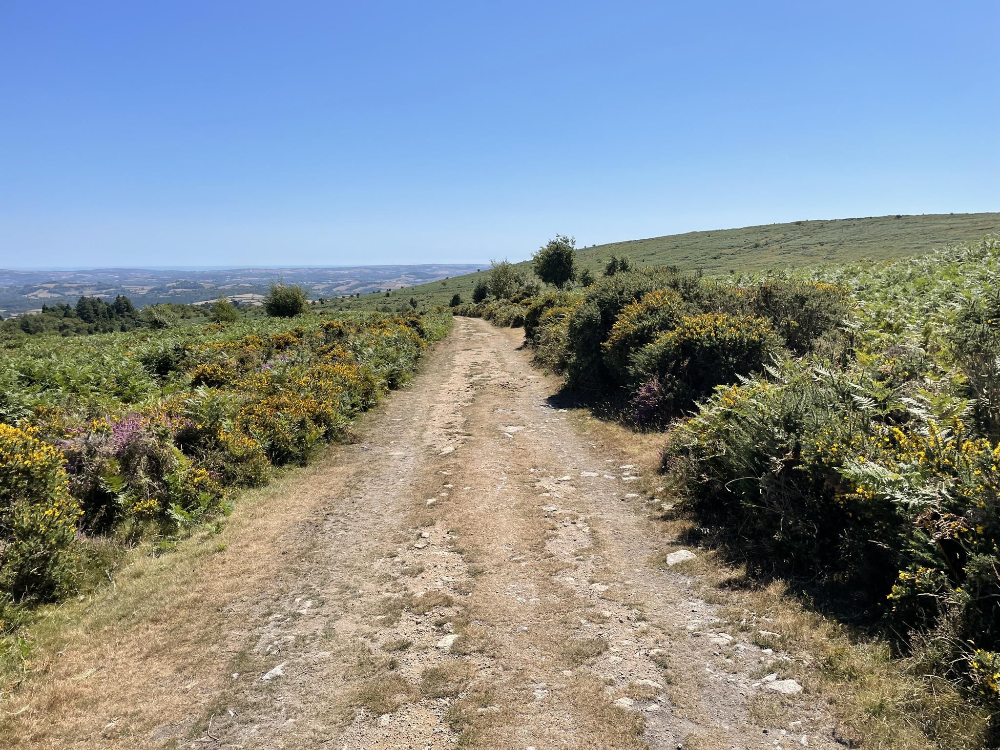
Easy hiking trails around South Brent offer access to the diverse landscapes bordering Dartmoor National Park and the South Devon coast. The region is characterized by open moorland, granite hills (tors), and river valleys, providing varied terrain for outdoor activities. Hikers can explore ancient sites, reservoirs, and woodlands, with paths ranging from gentle riverside strolls to routes across the South Moor. This area serves as a gateway to Dartmoor's natural features, including the River Avon and its boulder-filled valley.
Best easy hiking trails around South Brent
- The most popular easy hiking route is Shipley Bridge to Avon Dam, a 3.7 miles (6.0 km) trail that takes 1 hour 39 minutes to complete. This route follows a tarmac road alongside the River Avon to the Avon Dam Reservoir.
- Another top favourite among local hikers is Shipley Bridge to Avon Dam – Dartmoor Miles Without Stiles, an easy 3.6 miles (5.8 km) path. This trail offers an accessible route through the scenic River Avon valley to the reservoir.
- Local hikers also love the Waterfall at Lydia Bridge – Lydia Bridge Waterfall loop from South Brent, a 2.7 miles (4.3 km) trail leading through the countryside to a picturesque waterfall, often completed in about 1 hour 10 minutes.
- Hiking around South Brent is defined by moorland, river valleys, and ancient sites, offering a blend of natural and historical exploration. The network of routes provides options for various ability levels, with a focus on easy trails in this guide.
- The routes in South Brent are highly rated by the komoot community with an average score of 4.6 stars from over 300 reviews. More than 2,700 hikers have used komoot to explore South Brent's varied terrain.
Last updated: October 10, 2026
4.5
(24)
327
hikers
5.91km
01:39
120m
120m
Start at Shipley Bridge for an easy hike to Avon Dam, covering 3.7 miles (5.9 km) with a gentle elevation gain of 388 feet (118 metres). This route takes about 1 hour and 39 minutes to complete. You will follow the River Avon through a valley, where moss-covered trees create a serene atmosphere. The path eventually opens up, offering wide views of the moorland. Keep an eye out for Dartmoor ponies and sheep grazing in the open spaces. The journey culminates at the impressive Avon Dam, providing a rewarding vista across the reservoir.
Accessing the trailhead is straightforward from the Shipley Bridge car park. This car park offers convenient facilities, including toilets, and sometimes a coffee van is present. However, the trail can become quite popular, especially during peak times, so arriving early is a good idea to secure parking. While much of the initial path is accessible, be aware that some sections can be muddy after rain. You might also encounter potholes on the paved parts of the route. Planning your visit for a dry day will enhance your experience.
This route is nestled within Dartmoor National Park, a region renowned for its unique natural environment. As you hike, you are immersed in the distinct ecosystem of the moorland, characterized by its open spaces and the River Avon winding through it. The presence of Dartmoor ponies and sheep adds to the authentic feel of the landscape. The Avon Dam itself is a notable feature, an impressive structure that holds back the reservoir, offering a striking contrast to the natural surroundings.
4.4
(25)
330
hikers
5.79km
01:35
90m
90m
Easy hike. Great for any fitness level. Easily-accessible paths. Suitable for all skill levels.

4.0
(2)
18
hikers
4.31km
01:10
60m
50m
Easy hike. Great for any fitness level. Easily-accessible paths. Suitable for all skill levels.
5.0
(1)
13
hikers
5.14km
01:22
60m
60m
Easy hike. Great for any fitness level. Easily-accessible paths. Suitable for all skill levels.
8
hikers
Easy hike. Great for any fitness level. Easily-accessible paths. Suitable for all skill levels.
Get access to more routes and recommendations from other explorers.
Already have an account?
Our route recommendations are based on thousands of hikes, rides, and runs completed by other people on komoot.
Start today with a free account
Your next adventure awaits.

Tips from the Community

Lovely little hump back bridge on 'road unsuitable for motors.' Ok for bikes though.
0
0


At the end of the paved road up from Shipley Bridge you get a fantastic view of Avon Dam. You have to cross the River Avon just before you get to the dam, but it's all paved and easy going. The dam was constructed in 1957 to supply drinking water to the growing population housed in the towns in South Devon. It's best to visit after lots of rainfall to see the overflow in all its splendour!
1
0
Look out for the Clipper Tea van here on more popular, good weather days!
0
0

The Avon Dam was built in 1957 to supply water to the coastal towns of South Devon. You can ride up the access road to the base of the dam but will have to leave your bike or push up to see the reservoir.
0
0

Road bridge over River Avon. C17 or C18 packhorse bridge with hump back and widened on upstream side. Stone rubble. single round arch. Large stone slabs forming string with parapets above with large granite coping stones. In 1669 Lydia Bridge was in decay and the existing bridge appears to be either the restored earlier bridge or an entire rebuilding of late C17 or C18 https://britishlistedbuildings.co.uk/101307206-lydia-bridge-south-brent#.Y_SY0SaZO3A
1
0

Shipley Bridge is a major access point to Dartmoor's southern moors. There is a parking lot, toilets and information boards. A paved trail winds its way up through the Avon Dam Reservoir Valley to Avon Dam Reservoir. Initially this runs next to the river. Along the path you will meet stray pigs.
9
0
Frequently Asked Questions
How many easy hiking trails are available around South Brent?
South Brent offers a good selection of easy hiking trails, with 16 routes specifically categorized as easy. In total, there are 48 hiking routes of varying difficulties in the area, providing plenty of options for exploration.
What natural features or landmarks can I expect to see on easy hikes near South Brent?
Easy hikes around South Brent often lead you through diverse landscapes. You can explore the tranquil River Avon valley, discover the impressive Avon Dam Reservoir, or encounter ancient sites on Dartmoor's South Moor. Other notable features include Dartmeet, where two rivers converge, and the scenic Cadover Bridge.
Are there any easy trails that lead to waterfalls?
Yes, you can enjoy an easy walk to a picturesque waterfall. The Waterfall at Lydia Bridge – Lydia Bridge Waterfall loop from South Brent is a 2.7-mile (4.3 km) trail that takes you through the countryside to the beautiful Lydia Bridge Waterfall.
Are the easy trails around South Brent suitable for families with children?
Many easy trails in the South Brent area are ideal for families. Routes like Shipley Bridge to Avon Dam – Dartmoor Miles Without Stiles are part of Dartmoor's 'Miles Without Stiles' network, designed to be accessible for all abilities, including those with pushchairs. These paths often follow gentle gradients along rivers or reservoirs.
Can I bring my dog on the easy hikes in South Brent?
Yes, the South Brent area, being on the edge of Dartmoor National Park, is generally very dog-friendly. Many easy trails, particularly those along the River Avon and to the Avon Dam, are suitable for dogs. However, always keep dogs under close control, especially near livestock or ground-nesting birds, and follow the Countryside Code.
Are there any easy circular hiking routes available?
Absolutely. The Waterfall at Lydia Bridge – Lydia Bridge Waterfall loop from South Brent is a popular easy circular route. Another option is the Lady's Wood Footpath Sign – Glaze Brook Stone Bridge loop from South Brent, which offers a pleasant 2.7-mile (4.3 km) loop through the local countryside.
Where can I find parking for these easy trails?
A common starting point with ample parking for many easy trails is the Shipley Bridge car park. From here, you can access routes leading to the Avon Dam Reservoir and along the River Avon. Other trails may have smaller, local parking areas or be accessible from South Brent village itself.
What is the best time of year to enjoy easy hikes around South Brent?
The South Brent area is beautiful year-round. Spring brings wildflowers and new growth, while summer offers longer daylight hours for leisurely strolls. Autumn showcases stunning foliage, and even winter can be magical with crisp air and clear views, though some paths might be muddier. Always check local weather conditions before heading out.
What do other hikers enjoy the most about hiking in South Brent?
The komoot community highly rates the hiking experience around South Brent, with an average score of 4.6 stars from over 300 reviews. Hikers often praise the area's diverse scenery, from the open moorland to the peaceful river valleys, and appreciate the well-maintained paths that make for enjoyable and accessible walks.
Are there any trails suitable for wheelchairs or pushchairs?
Yes, the Shipley Bridge to Avon Dam – Dartmoor Miles Without Stiles route is specifically designed to be accessible. It follows a tarmac road alongside the River Avon, making it suitable for wheelchairs, pushchairs, and those with limited mobility, offering a scenic journey to the reservoir.
How long do easy hikes typically take around South Brent?
Easy hikes in the South Brent area vary in length and duration. For example, the popular Shipley Bridge to Avon Dam trail is about 3.7 miles (6.0 km) and takes approximately 1 hour 39 minutes. Shorter loops, like the Waterfall at Lydia Bridge loop, can be completed in about 1 hour 10 minutes.
Can I reach any of the easy trailheads using public transport?
South Brent village itself has some public transport links. From the village, you can access local paths that connect to the wider network of easy trails. For routes further into Dartmoor, such as those starting at Shipley Bridge, public transport options might be limited, so checking local bus schedules is advisable.
Most popular routes around South Brent
Most popular attractions around South Brent

Get inspired with the komoot mobile app


Explore more
Browse the best Hikes in other regions.
