Easy hikes and walks around Filderstadt
4.4
(734)
3,739
hikers
195
hikes
Easy hiking trails around Filderstadt traverse a diverse landscape, situated on the edge of the Schönbuch forest and the Filder Plateau. The region features extensive woodlands, picturesque valleys like the Siebenmühlental, and open agricultural plains. This varied terrain offers a mix of shaded forest paths, rolling hills, and elevated viewpoints, providing a range of experiences for hikers.
Best easy hiking trails around Filderstadt
- The most popular easy hiking route is Bärensee (Filderstadt) – Bärensee, Filderstadt loop from Stetten, a 4.0 miles (6.5 km) trail that takes 1 hour 45 minutes to complete. This pleasant loop is suitable for various fitness levels and family outings.
- Another top favourite among local hikers is Grünes Brett Information Board – Uhlberg Tower loop from Bonlanden, an easy 1.9 miles (3.0 km) path. This route leads to the Uhlberg Tower, offering panoramic views over the Filder plateau.
- Local hikers also love the Tree With Carved Face – Uhlberg Tower loop from Plattenhardt, a 3.3 miles (5.2 km) trail leading through woodlands and to the Uhlberg Tower, often completed in about 1 hour 25 minutes.
- Hiking around Filderstadt is defined by the extensive Schönbuch Forest, the rolling Filder Plateau, and the tranquil Siebenmühlental. The network offers options for different ability levels, with a strong focus on easy hiking trails.
- The routes in Filderstadt are highly rated by the komoot community with an average score of 4.5 stars from over 600 reviews. More than 3,700 hikers have used komoot to explore Filderstadt's varied terrain.
Last updated: October 17, 2026
4.4
(50)
242
hikers
6.51km
01:45
90m
90m
Easy hike. Great for any fitness level. Easily-accessible paths. Suitable for all skill levels.
4.7
(17)
155
hikers
Easy hike. Great for any fitness level. Easily-accessible paths. Suitable for all skill levels.

4.5
(46)
250
hikers
5.25km
01:25
70m
70m
Easy hike. Great for any fitness level. Easily-accessible paths. Suitable for all skill levels.
4.7
(22)
97
hikers
Easy hike. Great for any fitness level. Easily-accessible paths. Suitable for all skill levels.
4.4
(7)
39
hikers
6.68km
01:53
140m
140m
Easy hike. Great for any fitness level. Easily-accessible paths. Suitable for all skill levels.
Get access to more routes and recommendations from other explorers.
Already have an account?
Our route recommendations are based on thousands of hikes, rides, and runs completed by other people on komoot.
Start today with a free account
Your next adventure awaits.


Tips from the Community

The monument, also known as Herdfelderstein, is located in the Uhlberg forest area. Jakob Herdfelder was a day laborer and woodcutter from Plattenhardt. According to local church records, he met with a fatal "accident while felling trees" at this spot.
1
0
Directly on the meadow at the foot of the Uhlbergturm is a viewing platform built in 2017. A large photo board is mounted there, which serves as an orientation aid. It shows the panorama of the Swabian Jura and describes which mountains and peaks (like the Hohenzollern or the three Kaiserberge) are visible in the distance.
1
0
The stone is located below the well-known Uhlbergturm near a garden area on the Mittlerer Wengerterweg. It measures 92 cm in height, 26 cm in width, and 47 cm in depth, and bears the engraved year "1580" as a distinctive inscription.
5
0
The "Kelter" hikers' lodge of the Bonlanden local group of the Swabian Alb Association is located on the edge of the Uhlberghalde (approx. 3 km outside Filderstadt-Bonlanden) and is an ideal starting or intermediate point for hikes around the Uhlberg. The historic, former wine press is now run on a voluntary basis.
4
0
In Neuenhaus, the hiking trail begins near the Uhlberg restaurant and leads uphill to the Uhlbergturm. On both the right and left sides of the path, you can discover diverse grimaces. Lovingly incorporated into trees and tree stumps, the forest has a fairytale-like and legendary quality. The nature artist of the Fratzenweg, Adalbert Bachofer, displays his art not only along the trail but also in his studio at the beginning of the route.
4
0
The Gutenhalde in Filderstadt-Bonlanden is a striking historical manor farm that was built in the 1940s by the Stuttgart food manufacturer Willy Bürkle as a generous country estate and recreational area. What is special about the architecture is that the imposing, now listed farm was built according to the architectural model of Low German hall houses, which is untypical for the Swabian region.
5
0
The Filderstadt orchard educational trail (also known by the name of its mascot OLAF – ObstLehrpfad Filderstadt) is an approximately 2.5-kilometer circular route in Filderstadt-Bonlanden. It was jointly established by local orchard guides and the city to playfully and informatively convey the valuable cultural and living space of the native orchards.
5
0

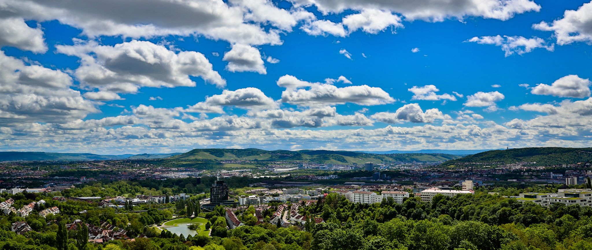
From this viewpoint, with good visibility, you can make out the Swabian Jura with the distinctive points from Hohenneuffen over Jusi, Floriansberg and Wackerstein to Reutlinger Georgenberg.
8
0
Frequently Asked Questions
How many easy hiking trails are available around Filderstadt?
Filderstadt offers a wide selection of easy hiking trails, with nearly 150 routes specifically categorized as easy. These trails are perfect for relaxed strolls through the diverse landscapes of the Schönbuch forest, the Filder Plateau, and the picturesque Siebenmühlental.
Are there family-friendly easy hikes in Filderstadt?
Yes, many easy trails around Filderstadt are ideal for families. The region features paths suitable for all ages, including themed trails designed with children in mind. A great option is the Bärensee (Filderstadt) – Bärensee, Filderstadt loop from Stetten, which is a pleasant loop suitable for various fitness levels and family outings.
Can I bring my dog on the easy hiking trails?
Absolutely! Filderstadt's hiking routes are generally dog-friendly, allowing your companions to join you in exploring the diverse landscapes. You'll find many paths through forests and open fields that are suitable for walks with your dog.
What kind of natural features can I expect to see on easy hikes around Filderstadt?
The easy hikes around Filderstadt offer a rich variety of natural features. You can explore the extensive woodlands of the Schönbuch Forest, enjoy panoramic views from the rolling Filder Plateau, or discover the tranquil beauty of the Siebenmühlental with its meandering stream and old mills. You might also encounter lakes like Schlüsselsee or Sulzbach Reservoir.
Are there any viewpoints or landmarks along the easy trails?
Yes, several easy trails lead to prominent landmarks and offer scenic views. The Grünes Brett Information Board – Uhlberg Tower loop from Bonlanden and the Tree With Carved Face – Uhlberg Tower loop from Plattenhardt both lead to the Uhlberg Tower, which provides panoramic views over the Filder plateau. You can also find educational trails like the Filderstadt Orchard Educational Trail.
What is the best time of year for easy hiking in Filderstadt?
Filderstadt is beautiful for easy hiking in various seasons. Spring is lovely when fruit trees blossom, and autumn offers a spectacular display of colorful foliage. The mixed terrain of forests and open fields provides pleasant conditions throughout these seasons.
Are most easy hiking trails in Filderstadt circular routes?
Yes, many of the easy hiking routes in Filderstadt are designed as circular paths for convenience. This allows hikers to start and end their journey at the same point without needing to retrace their steps, making for a more enjoyable and straightforward experience.
What do other hikers enjoy most about the easy trails in Filderstadt?
The easy trails in Filderstadt are highly rated by the komoot community, with an average score of 4.5 stars. Reviewers often praise the region's diverse landscapes, the well-maintained paths, and the accessibility of routes that cater to all fitness levels, especially the tranquil forest sections and scenic viewpoints.
Are there easy hikes accessible by public transport in Filderstadt?
Filderstadt has good public transport connections, and many trailheads are accessible via bus or train. It's advisable to check local transport schedules for specific routes to plan your journey to the starting points of the easy hikes.
Can I find easy hikes with waterfalls near Filderstadt?
While Filderstadt itself is known for its forests and valleys, the broader region includes natural attractions like the Heslacher Waterfalls. These are a notable natural monument that can be explored as part of a wider outing in the area.
Are there any places to stop for refreshments along the easy hiking trails?
Yes, some easy hiking routes in the Filderstadt area offer opportunities for refreshment stops. You might find local restaurants or cafes in the villages along the way, or even a beer garden like Biergarten Waldmeister, perfect for a break during your walk.
What is the typical length and duration of easy hikes in Filderstadt?
Easy hikes in Filderstadt vary in length, but many are designed for shorter, more relaxed outings. For example, the popular Bärensee (Filderstadt) – Bärensee, Filderstadt loop from Stetten is about 6.5 km (4 miles) and takes around 1 hour 45 minutes, while the Grünes Brett Information Board – Uhlberg Tower loop from Bonlanden is only 3 km (1.9 miles) and can be completed in under an hour.
Most popular routes around Filderstadt
Most popular attractions around Filderstadt

Get inspired with the komoot mobile app


Explore more
Browse the best Hikes in other regions.
