Easy hikes and walks around Donzdorf
4.6
(19392)
80,385
hikers
155
hikes
Easy hiking trails around Donzdorf are situated in the Lauter Valley, at the base of the Rehgebirge mountains, and on the edge of the Swabian Alb. The region features a diverse landscape with gentle hills, dense forests, and the steep escarpment of the Albtrauf, offering panoramic views. The Lauter river flows through the valley, and the Simonsbach Reservoir provides a tranquil natural feature.
Best easy hiking trails around Donzdorf
- The most popular easy hiking route is Messelstein Viewpoint – Messelberg…
Last updated: June 30, 2026
4.5
(26)
112
hikers
Easy hike. Great for any fitness level. Easily-accessible paths. Suitable for all skill levels.
4.9
(20)
81
hikers
4.15km
01:10
80m
80m
Easy hike. Great for any fitness level. Easily-accessible paths. Suitable for all skill levels.

Sign up for free
4.6
(11)
73
hikers
5.91km
01:36
80m
80m
Easy hike. Great for any fitness level. Easily-accessible paths. Suitable for all skill levels.
4.6
(7)
51
hikers
5.77km
01:36
100m
100m
Easy hike. Great for any fitness level. Easily-accessible paths. Suitable for all skill levels.
5.0
(17)
31
hikers
Easy hike. Great for any fitness level. Easily-accessible paths. Suitable for all skill levels.
Get access to more routes and recommendations from other explorers.
Sign up for free
Already have an account?
Our route recommendations are based on thousands of hikes, rides, and runs completed by other people on komoot.
Start today with a free account
Your next adventure awaits.
Login or Signup


Tips from the Community

..a completely normal curve, which is just not well visible...nothing particularly dangerous!! Whoever pays attention doesn't need such unnecessary signs..
0
0

The Simonsbachtal flood retention basin (also Simonsbachspeicher, Simonsbach-Stausee) is located near Donzdorf and Unterweckerstell. The Simonsbach is dammed, and flows further downstream in Donzdorf into the Lauter. The small reservoir is a nature paradise where many birds live.
0
0
The Kuchalb/Messelberg barbecue area in Donzdorf is an idyllic spot for nature and barbecue enthusiasts. It is located in a quiet area, surrounded by trees and meadows, and offers a cozy atmosphere. The fire pit is well-defined and surrounded by sturdy stone benches, ensuring safe grilling. A covered area with a wooden table and benches ensures that visitors can find comfortable seating even in changeable weather. The well-kept green space also offers ample room for groups, families, and children to play or relax. Due to its secluded yet easily accessible location, the barbecue area is perfect for social evenings or relaxed afternoons in nature. An ideal place for a successful barbecue with friends or family. https://www.tourenplaner.lkgp.de/de/poi/freizeitaktivitaet/grillstelle-kuchalb-messelberg/806655972/
1
0

Great tour - pleasant paths
0
0

Many beautiful bronze figures are scattered throughout the park and around the small pond.
0
0

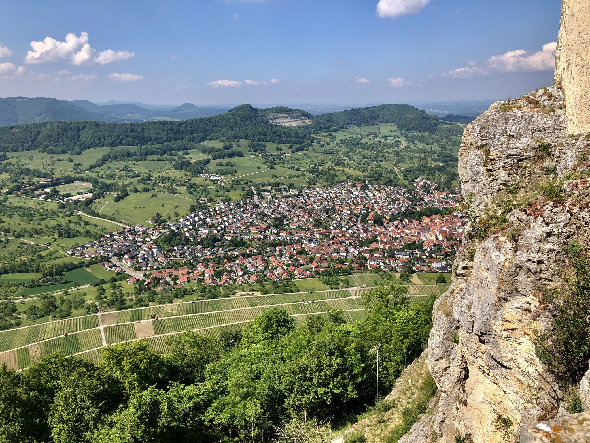
The Messelberg is a soaring mountain. A rocky cliff at 743 m above sea level, it protrudes from the Messelberg. From here, on a clear day, you can see as far as the Black Forest, about 130 km away. The Swabian Alb North Rim Trail, which runs along the edge of the Alb trauf, offers particularly beautiful views far down into the Fils Valley at the Rötelstein and Messelstein viewpoints near Donzdorf. One of the Lion Trails also leads along the Messelberg, a bare rock that protrudes from the green Messelberg. The Messelberg is also home to the Donzdorf Flying Group's gliding airfield. Not far from there, next to the Rötelstein, is the launch pad of the Staufen Hang Gliding and Paragliding Club.
0
0

There is a beautiful view from the benches in front of the castle.
0
0

Flow trail up and down
0
0
Frequently Asked Questions
How many easy hiking trails are there in Donzdorf?
Donzdorf offers a wide selection of easy hiking trails, with over 70 routes available. These trails are perfect for those looking for a relaxed outdoor experience in the scenic Lauter Valley and on the edge of the Swabian Alb.
What makes the easy hiking trails around Donzdorf unique?
The easy hiking trails in Donzdorf are unique due to their diverse landscape, blending gentle hills, dense forests, and the dramatic Albtrauf escarpment of the Swabian Alb. You'll find picturesque scattered orchards, heathland, and the tranquil Simonsbach Reservoir, all contributing to a varied and engaging hiking experience.
Are there easy circular walks in Donzdorf?
Yes, many of the easy trails in Donzdorf are circular, allowing you to start and end at the same point. For example, the View from Messelberg – Messelstein Viewpoint loop from Donzdorf is an easy 4.2 km circular path connecting two prominent viewpoints. Another option is the Planet Trail Donzdorf – Simonsbach Reservoir loop from Donzdorf, which is a 6.0 km circular route.
Are the easy hiking trails in Donzdorf suitable for families with children?
Absolutely! Donzdorf is known for its family-friendly options, including a dedicated Children's Adventure Trail with interactive stations. The easy routes, such as the Planet Trail Donzdorf – Simonsbach Reservoir loop from Donzdorf, are generally well-maintained and offer engaging points of interest for younger explorers.
Can I bring my dog on the easy hiking trails around Donzdorf?
Yes, most easy hiking trails in Donzdorf are dog-friendly. The diverse landscapes, from forests to open meadows, provide plenty of opportunities for you and your canine companion to enjoy the outdoors. Always remember to keep your dog on a leash where required and clean up after them.
Are there easy hikes with scenic viewpoints in Donzdorf?
Donzdorf is renowned for its panoramic views, especially along the Albtrauf. The Messelstein Viewpoint – Messelberg Airfield loop from Flugplatz Donzdorf-Messelberg offers impressive vistas from the Messelstein viewpoint. Another great option is the View from Messelberg – Messelstein Viewpoint loop from Donzdorf, which connects two key viewpoints.
Are there any easy hikes that pass by waterfalls or natural monuments?
Yes, the region around Donzdorf features several natural attractions. While hiking, you might encounter highlights like the Autal Waterfall or the unique Moss-Covered Tufa Rocks and Springs. The Planet Trail Donzdorf – Simonsbach Reservoir loop from Donzdorf also passes by the tranquil Simonsbach Reservoir, a significant natural feature.
Where can I find easy hikes with historical or educational points of interest?
For an educational experience, the Planet Trail Donzdorf – Simonsbach Reservoir loop from Donzdorf follows the unique Astronomical Lehrpfad, starting from the castle garden. You can also explore routes that pass by the Renaissance castle in Donzdorf's town center or the Hohenstaufen Castle Ruins and Viewpoint.
Are there parking facilities available for easy hikes in Donzdorf?
Yes, many popular starting points for easy hikes in Donzdorf, such as the Flugplatz Donzdorf-Messelberg or areas near the town center, offer convenient parking facilities. It's always a good idea to check the specific route details for parking information before you head out.
What is the typical duration of an easy hike in Donzdorf?
Easy hikes in Donzdorf typically range from 1 to 2 hours. For instance, the View from Messelberg – Messelstein Viewpoint loop from Donzdorf can be completed in about 1 hour 10 minutes, while the Messelstein Viewpoint – Messelberg Airfield loop from Flugplatz Donzdorf-Messelberg takes approximately 1 hour 53 minutes.
What do other hikers enjoy most about the easy trails in Donzdorf?
The easy trails in Donzdorf are highly rated by the komoot community, with an average score of 4.5 stars from over 2,100 reviews. Hikers often praise the well-marked paths, the breathtaking panoramic views from the Albtrauf, and the tranquil natural settings like the Simonsbach Reservoir.
Beyond the main viewpoints, are there other interesting places to explore on easy hikes?
Absolutely. Beyond the well-known viewpoints, you can discover charming areas like the forests on the Messelberg, which offer a blend of wooded and open spaces. The Lauter river valley itself provides serene paths, and the scattered orchards and heathland offer a different kind of natural beauty to explore on an easy walk.
Most popular routes around Donzdorf
Most popular attractions around Donzdorf

Get inspired with the komoot mobile app


Explore more
Browse the best Hikes in other regions.
