Easy hikes and walks around Pernitz
4.6
(4529)
24,786
hikers
55
hikes
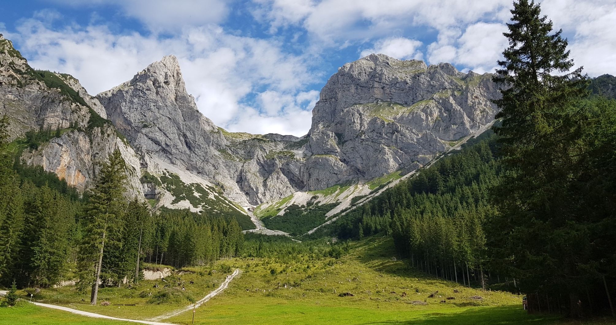
Easy hiking trails around Pernitz are situated within the Gutenstein Alps, characterized by green hills, mountains, and dense forests. The region features varied terrain with streams and ponds, providing a natural environment for exploration. Notable features include the Myra Falls, a natural monument with cascading water, and views towards the Schneeberg, Lower Austria's highest peak. The landscape offers diverse paths suitable for various skill levels.
Best easy hiking trails around Pernitz
- The most popular easy hiking route is Muggendorf Forest…
Last updated: October 17, 2026
5.0
(1)
16
hikers
Easy hike. Great for any fitness level. Easily-accessible paths. Suitable for all skill levels.
4.7
(3)
9
hikers
5.11km
01:29
130m
130m
Easy hike. Great for any fitness level. Easily-accessible paths. Suitable for all skill levels.

3.8
(4)
14
hikers
4.78km
01:27
160m
160m
Easy hike. Great for any fitness level. Easily-accessible paths. Suitable for all skill levels.
5.0
(1)
5
hikers
4.77km
01:22
110m
110m
Easy hike. Great for any fitness level. Easily-accessible paths. Suitable for all skill levels.
8
hikers
6.52km
01:57
200m
200m
Easy hike. Great for any fitness level. Easily-accessible paths. Suitable for all skill levels.
Get access to more routes and recommendations from other explorers.
Already have an account?
Our route recommendations are based on thousands of hikes, rides, and runs completed by other people on komoot.
Start today with a free account
Your next adventure awaits.


Tips from the Community

The forest path along the Myrabach leads through shady mixed forest and accompanies the crystal-clear water on its way through the valley. The quiet splashing of the stream and the calm atmosphere make this section particularly pleasant. A natural path where the beauty of the Myrabach can be experienced particularly well. 🌲💧
4
0
The Muggendorf Forest Educational Trail combines nature experience with exciting information about the forest and its inhabitants. Along the way, several stations impart knowledge about trees, animals, and the local plant world. A varied route that invites conscious exploration of nature – not just for families. 🌲🌿🐦
4
0
From here, there is a beautiful view of Muggendorf and the distinctive Hausstein, which rises above the valley. The combination of the idyllic village, the wooded slopes, and the striking rock formations makes this viewpoint particularly charming. A place where the landscape of the Piestingtal shows itself from its most beautiful side. 🌄🌿
1
0
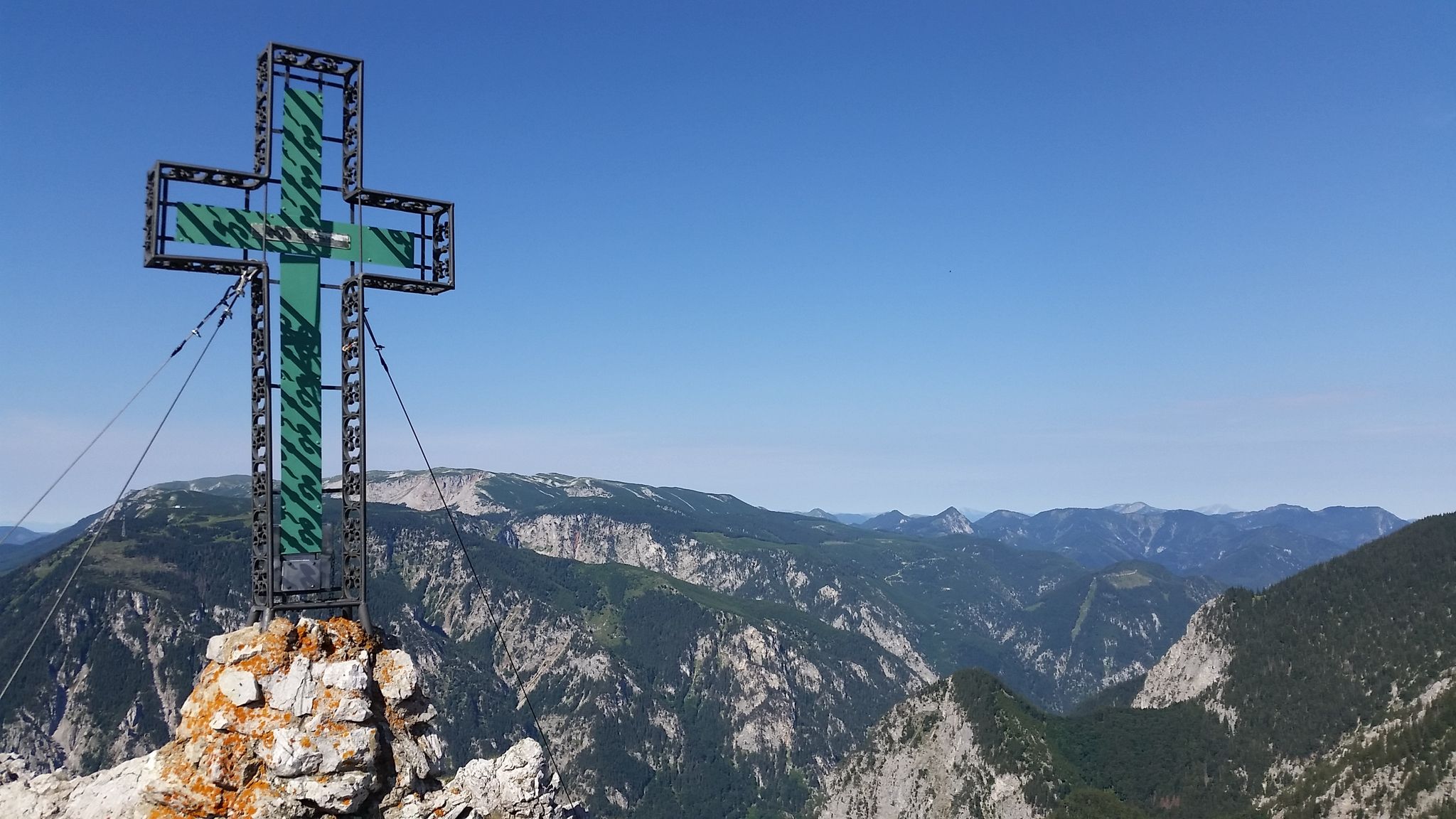
The rest stop at the Eichkreuz is a beautiful place to catch your breath after the climb. A place to sit and the simple wooden cross create a quiet atmosphere in the middle of the forest. A pleasant spot for a break before the path continues through the Gutensteiner Alps. 🌲🪑🌿
3
0
The wayside cross at Fuchsriegel stands quietly at the edge of the forest and accompanies hikers on their way across the ridge. Simply designed, it blends harmoniously into the surrounding landscape and invites a brief moment of peace. A small landmark with special charm in the middle of nature. 🌲✝️
3
1
The footbridge over the Myrabach connects the two banks of the clear mountain stream in the middle of Pernitz. The gently flowing water and the well-maintained bank design give this small crossing a special charm. A beautiful spot that shows how closely the town is connected to the Myrabach. 🌊🌿
4
0
The Biedermeier Erlebnisweg is much more than an ordinary hiking trail. Between Pernitz and Waidmannsfeld, varied paths lead through forests, across meadows, and past historical stations that bring Biedermeier-era life to life. A beautiful tour for everyone who wants to enjoy nature and discover a piece of regional history along the way. 🌿🚶
4
0
A simple wooden hunting stand directly on the path, a few meters above the ground.
1
0
Frequently Asked Questions
How many easy hiking trails are there around Pernitz?
Pernitz offers a good selection of easy hiking trails, with over 25 routes specifically categorized as easy. In total, there are more than 50 hiking routes in the area, catering to various skill levels.
What is the best time of year for easy hikes in Pernitz?
The most pleasant seasons for easy hiking in Pernitz are spring and autumn. During these times, temperatures are mild, and the natural scenery is particularly vibrant, with blooming flora in spring and colorful foliage in autumn.
Are there any short, easy hikes suitable for a quick outing?
Yes, many easy trails in Pernitz are relatively short. For example, the Muggendorf Forest Nature Trail loop from Pernitz is just 3.0 miles (4.8 km) and typically takes around 1 hour 19 minutes, offering a gentle walk through the local forest.
Can I find easy trails that feature waterfalls?
Yes, the Pernitz region is home to the beautiful Myra Falls, a natural monument where the Myrabach stream cascades over rocks. While some routes around the falls can be more challenging, there are often easier loops that allow you to experience this impressive natural feature.
What natural attractions can I explore on easy hikes around Pernitz?
Beyond the Myra Falls, easy hikes around Pernitz can lead you to various natural attractions. You might encounter impressive summits like the Hausstein Summit, offering views of the Piestingtal valley, or the Unterberg Summit, which provides expansive views of the Gutenstein Alps on clear days.
Are there family-friendly easy hiking options in Pernitz?
Absolutely. Many easy trails in Pernitz are suitable for families. The Biedermeier Adventure Trail loop from Pernitz is a great option, offering an engaging experience for all ages with its gentle terrain and points of interest.
Are dogs allowed on the easy hiking trails in Pernitz?
Generally, dogs are welcome on hiking trails in the Pernitz region. However, it's always recommended to keep them on a leash, especially in nature park areas or near livestock, and to be mindful of local regulations. Always carry water for your dog and clean up after them.
Are there easy circular hiking routes available?
Yes, Pernitz offers several easy circular hiking routes. The Luckerter Stein loop from Pernitz Wipfelhofstraße is a popular easy circular path featuring a moderate ascent and views of the wooded landscape. Another option is the Waxeneck Hut (765 m) – Wooden Cross loop from Hals, which takes you through forested areas.
Is public transport an option to reach easy hiking trails in Pernitz?
Pernitz is accessible by public transport, which can help you reach various starting points for hikes. Check local bus and train schedules to plan your journey to the trailheads. Some routes, like those starting directly from Pernitz, are easily reachable without a car.
Where can I find parking for easy trails in Pernitz?
Parking is generally available at common trailheads and in the town of Pernitz itself. For popular spots like the Myra Falls, dedicated parking areas are usually provided. It's advisable to check specific route descriptions for parking information relevant to your chosen trail.
What do other hikers say about the easy trails in Pernitz?
The easy trails in Pernitz are highly regarded by the komoot community, with an average rating of 4.7 stars from over 160 reviews. Hikers often praise the well-maintained paths, the peaceful forest environments, and the scenic views of the Gutenstein Alps.
How long do easy hikes in Pernitz typically take?
The duration of easy hikes in Pernitz can vary, but many are designed for shorter outings. For instance, the Waxeneck Hut (765 m) – Waxeneck Summit loop from Hals is about 3.0 miles (4.7 km) and can be completed in approximately 1 hour 20 minutes, making it ideal for a leisurely walk.
Most popular routes around Pernitz
Most popular attractions around Pernitz

Get inspired with the komoot mobile app


Explore more
Browse the best Hikes in other regions.
