Easy hikes and walks in Baie Du Mont Saint Michel
4.6
(8023)
60,246
hikers
134
hikes
Easy hiking trails in Baie Du Mont Saint Michel traverse a diverse landscape shaped by one of Europe's highest tides. The region features vast tidal flats, salt marshes, and fertile polders, alongside sandy beaches and rocky shores. The iconic Mont Saint-Michel, a UNESCO World Heritage site, serves as a prominent landmark, visible from many routes. Rivers like the Couesnon, Sée, and Sélune also contribute to the area's varied ecosystems.
Best easy hiking trails in Baie Du Mont Saint Michel
- The…
Last updated: October 10, 2026
4.7
(86)
424
hikers
6.71km
01:51
110m
110m
Easy hike. Great for any fitness level. Easily-accessible paths. Suitable for all skill levels.
4.6
(36)
527
hikers
Easy hike. Great for any fitness level. Easily-accessible paths. Suitable for all skill levels.

4.6
(23)
77
hikers
Easy hike. Great for any fitness level. Easily-accessible paths. Suitable for all skill levels.
4.6
(16)
140
hikers
6.58km
01:49
110m
120m
Easy hike. Great for any fitness level. Easily-accessible paths. Suitable for all skill levels.
4.3
(18)
83
hikers
Easy hike. Great for any fitness level. Easily-accessible paths. Suitable for all skill levels.
Get access to more routes and recommendations from other explorers.
Already have an account?
Our route recommendations are based on thousands of hikes, rides, and runs completed by other people on komoot.
Start today with a free account
Your next adventure awaits.
Other adventures in Baie Du Mont Saint Michel


Tips from the Community

This walk, with sea views from the top of the cliffs, is simply magnificent. The cliff-edge path is quite steep in places. The loop also goes through the woods, along the stream.
1
0

Heavily trodden and driven road embankment leading to Mont-Saint-Michel along the salt marshes. A little caution with heavy traffic and you will arrive at the Mont with good impressions.
4
0
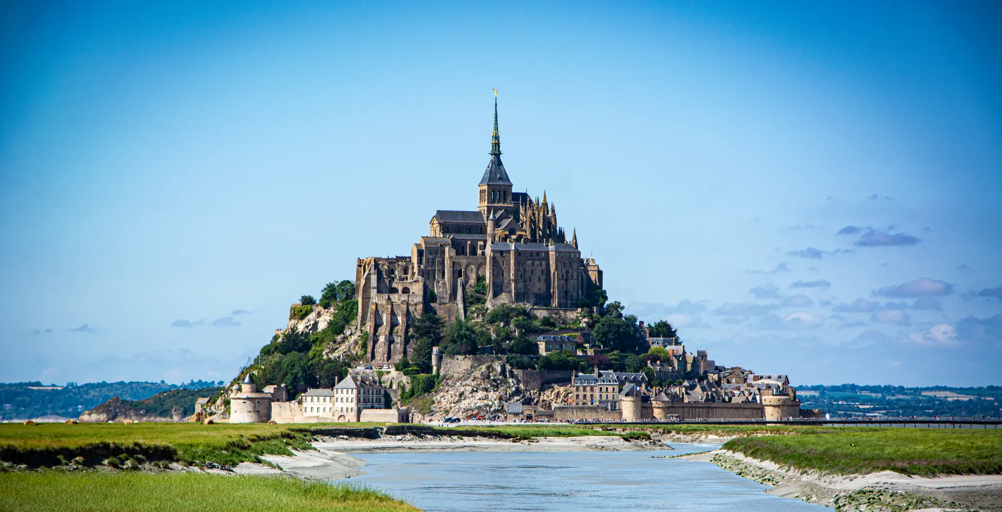
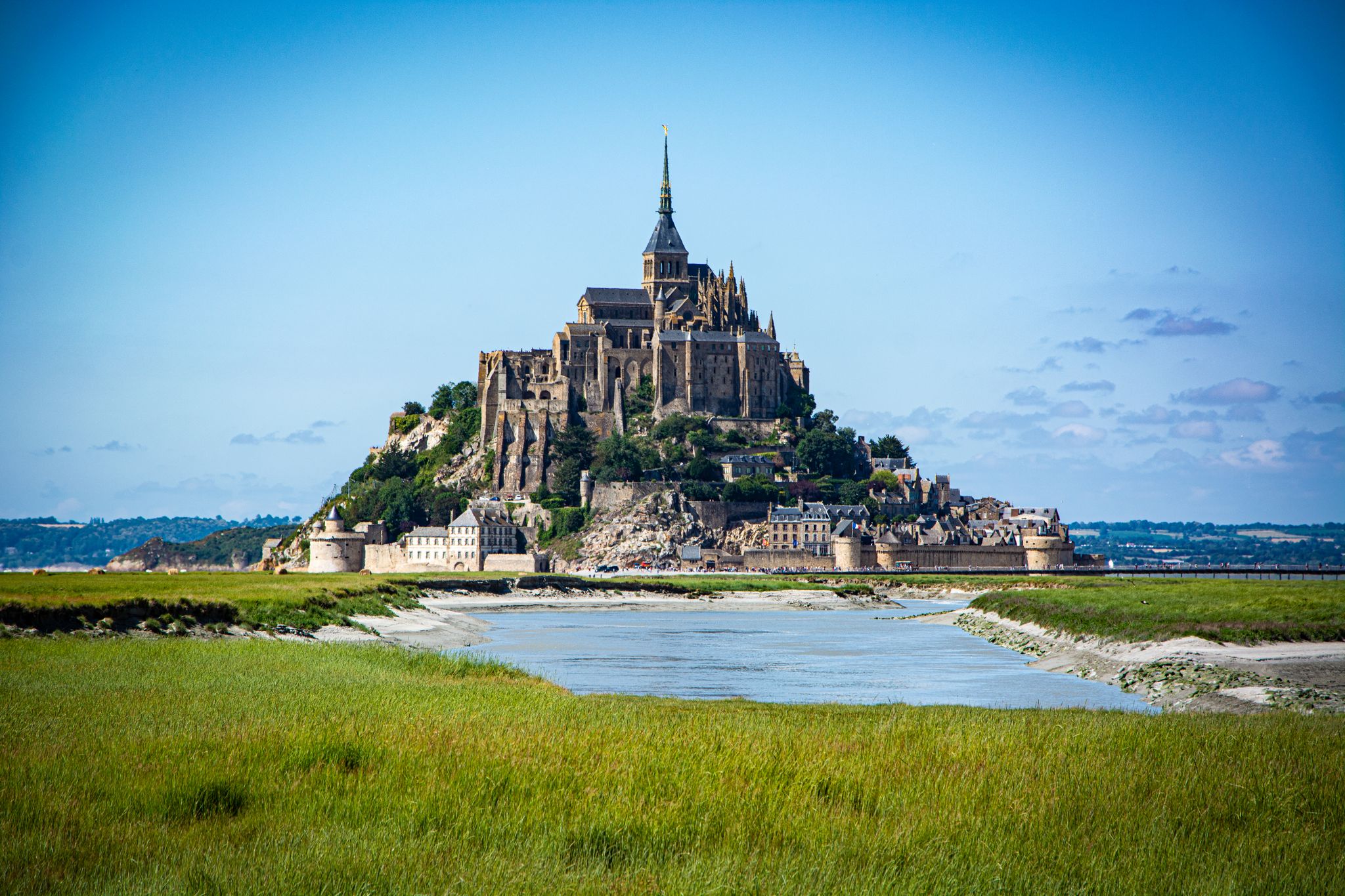
Mont-Saint-Michel is a world-famous rocky island and commune on the border between Normandy and Brittany in France. Crowned by a monumental, medieval Benedictine abbey, this architectural marvel has been a UNESCO World Heritage site since 1979. The bay of the mount is also known for Europe's strongest tides, with a tidal range of up to 14 meters.
2
0

The access bridge to Mont-Saint-Michel was opened in 2014, replacing the former road causeway that had impaired the natural movement of water and sediment in the bay. Built on stilts, the bridge allows for better exchange of tidal currents and helps to preserve the character of Mont-Saint-Michel as a tidal island. On the way to the island, there are wide views over the bay and an impressive sight of the abbey.
10
0
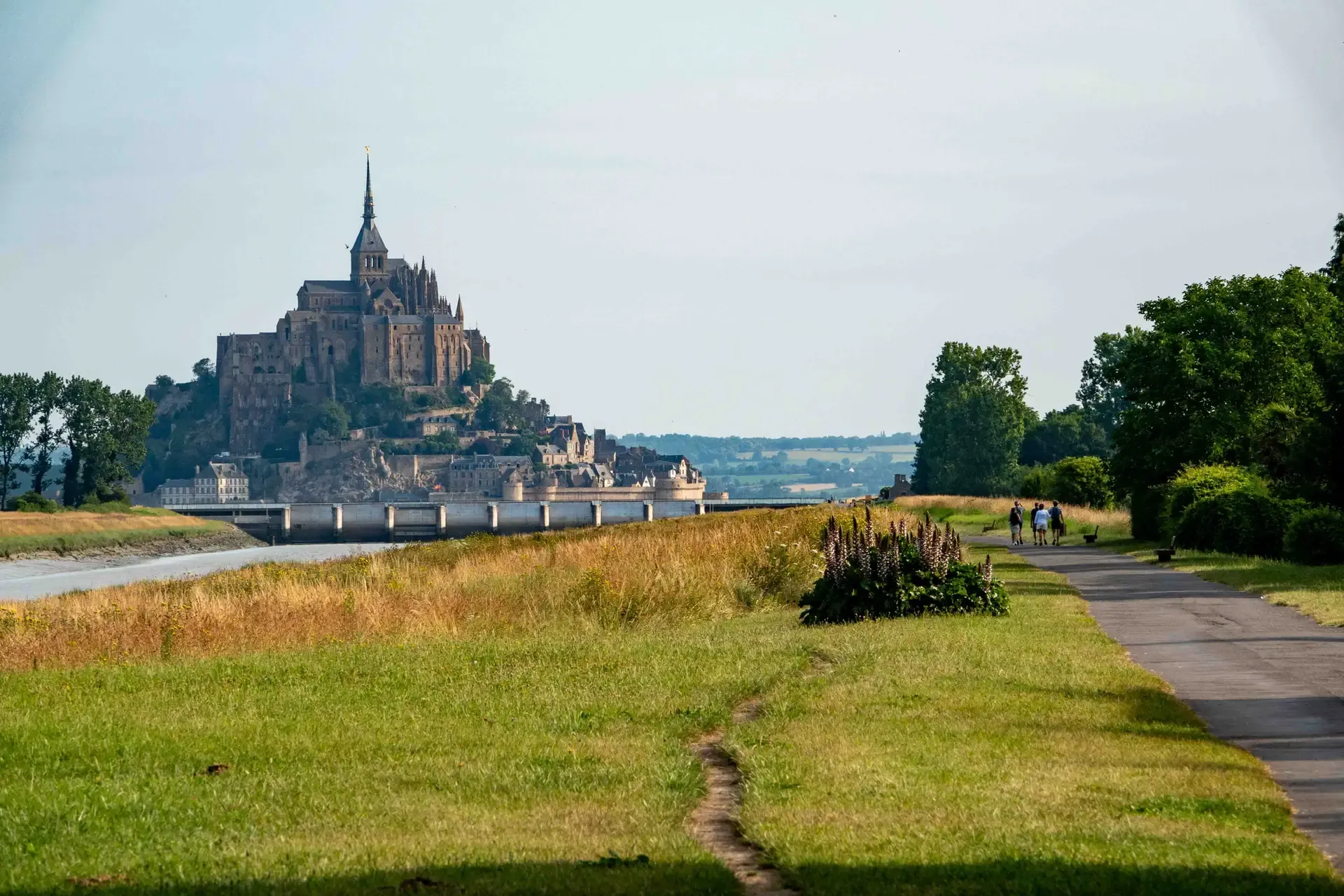
The footpath along the Couesnon to the dam already offers an impressive view of Mont-Saint-Michel. From here, the path with an unobstructed view leads across the salt marshes and the bay, with the landmark of Normandy impressively rising against the wide landscape. Especially in calm weather and with changing light, atmospheric views emerge of Mont-Saint-Michel, the course of the Couesnon river, and the tide-shaped surroundings.
13
0
The Couesnon dam (Barrage du Couesnon) was completed in 2009 and is part of the measures to preserve the bay of Mont-Saint-Michel. The facility regulates the water flow of the Couesnon and supports the natural removal of sediments by the tides. This is intended to counteract the increasing silting up of the bay and preserve the special character of Mont-Saint-Michel as a tidal island. The dam also offers a popular viewpoint with a view of Mont-Saint-Michel and the surrounding salt marshes.
3
0
The Vallée du Lude near Carolles is a protected coastal valley. A small stream winds its way through the green valley, eventually flowing into the English Channel at an idyllic pebble bay. The hiking trail leads through a varied landscape with steep cliffs, dense vegetation, and beautiful views of the coast – a peaceful natural spot that can be ideally combined with the Zöllnerpfad along the cliffs.
29
0
The weir on the river **Couesnon** in front of Mont-Saint-Michel is part of a major project to restore its original island character. It regulates the flow of the Couesnon and helps transport sediment deposited in the bay back out to sea. At the same time, the structure is a popular promenade and viewpoint with an impressive view of Mont-Saint-Michel and the tide-shaped landscape.
37
0
Frequently Asked Questions
How many easy hiking trails are available in Baie Du Mont Saint Michel?
There are 84 easy hiking trails in Baie Du Mont Saint Michel. In total, the region offers 136 routes for various skill levels, with the majority being suitable for easy walks.
What kind of terrain can I expect on easy hikes in Baie Du Mont Saint Michel?
Easy hikes in Baie Du Mont Saint Michel traverse a diverse landscape shaped by some of Europe's highest tides. You'll find vast tidal flats, extensive salt marshes (prés salés), fertile polders, sandy beaches, and rocky shores. The terrain is generally flat or gently undulating, making it accessible for most hikers.
Are there any specific natural features to look out for on these trails?
Yes, the region is rich in natural features. You can observe the dramatic tidal changes, diverse ecosystems supporting 130 bird species, and grazing sheep on the salt meadows. Rivers like the Couesnon, Sée, and Sélune traverse the bay, adding to its ecological diversity. The striking granite rock of Grouin du Sud also offers commanding views.
What historical landmarks or points of interest can I see on easy hikes?
Many easy trails offer views of the iconic Mont Saint-Michel. You might also encounter historical sites like the well-preserved Cabane Vauban, which once housed sentries, or parts of the ancient pilgrimage routes. The View of Mont Saint-Michel – Chemin du Douanier loop from Ecomusée de la Baie du Mont-Saint-Michel follows part of the historic Customs Officer's Path.
Are there family-friendly easy hikes in Baie Du Mont Saint Michel?
Many easy trails in the Baie Du Mont Saint Michel are suitable for families. Routes often feature flat paths and scenic views without significant elevation changes. For example, the The Couesnon at Beauvoir – Couesnon dike loop from Barrage du Mont Saint-Michel is a gentle 5.5 km walk along the river dike, perfect for a family outing.
Can I find circular easy hikes in the area?
Yes, there are several excellent circular easy hikes. The Lude Valley and Vauban Hut Loop from Carolles is a popular 6.7 km option, and the Chemin du Douanier – Grouin du Sud loop from Ecomusée de la Baie du Mont-Saint-Michel offers a 5 km circular route with coastal views.
What do other hikers say about the easy trails in Baie Du Mont Saint Michel?
The easy trails in Baie Du Mont Saint Michel are highly rated by the komoot community, with an average score of 4.6 stars from over 400 reviews. Hikers frequently praise the stunning views of Mont Saint-Michel, the well-maintained paths, and the unique coastal landscapes.
Are there any easy hikes that offer great viewpoints of Mont Saint-Michel?
Absolutely. The View of Mont Saint-Michel – Chemin du Douanier loop from Ecomusée de la Baie du Mont-Saint-Michel is specifically designed to offer panoramic views of the Mont. Many coastal paths along the bay also provide excellent perspectives, especially during low tide.
Is it possible to access easy hiking trails using public transport?
While specific public transport connections to every trailhead might vary, the area around Mont Saint-Michel is generally accessible. You can often reach key starting points for easy hikes, such as the Ecomusée de la Baie du Mont-Saint-Michel or areas near Carolles, via local bus services. It's advisable to check local transport schedules for the most up-to-date information.
What is the best time of year for easy hikes in Baie Du Mont Saint Michel?
The best time for easy hikes is generally from spring to early autumn (April to October) when the weather is milder and daylight hours are longer. Summer offers warm temperatures, but spring and autumn provide pleasant conditions with fewer crowds and beautiful seasonal colors. Always check tide times, as they significantly impact the landscape and accessibility of certain areas.
Are there any unique hiking experiences in the Baie Du Mont Saint Michel?
Yes, a unique and highly recommended activity is guided bay crossings. These allow you to walk barefoot across the expansive sands and mudflats at low tide, experiencing the dramatic tidal changes. It's crucial to undertake these with a certified guide due to quicksands and fast-rising tides.
Are dogs allowed on easy hiking trails in Baie Du Mont Saint Michel?
Many easy trails in the Baie Du Mont Saint Michel are dog-friendly, especially those on coastal paths and polders. However, specific restrictions may apply in nature reserves or protected areas, particularly during bird nesting seasons. Always keep your dog on a leash and be mindful of grazing sheep in the salt meadows. Check local signage for any specific rules.
Most popular routes in Baie Du Mont Saint Michel
Most popular attractions in Baie Du Mont Saint Michel

Get inspired with the komoot mobile app


Explore more
Browse the best Hikes in other regions.
