Easy hikes and walks in Frydalen Landskapsvernområde
4.6
(978)
4,261
hikers
130
hikes
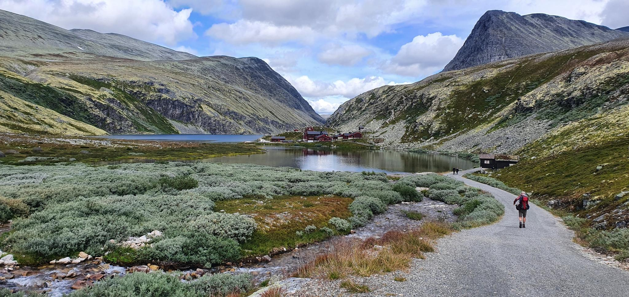
Easy hiking trails in Frydalen Landskapsvernområde traverse a landscape shaped by the last Ice Age, featuring varied topography with lichen-covered plateaus, rounded hills, and U-shaped valleys. The region includes barren and rocky mountain terrain, with several peaks exceeding 2000 meters. Hikers can explore ancient geological formations and encounter natural features such as waterfalls and gorges.
Best easy hiking trails in Frydalen Landskapsvernområde
- The most popular easy hiking route is Stolfossur Waterfall – Storulfossen Waterfall loop from Ulvangen, a 3.6…
Last updated: June 30, 2026
4.8
(61)
184
hikers
5.82km
01:36
90m
90m
Easy hike. Great for any fitness level. Easily-accessible paths. Suitable for all skill levels.
5.0
(7)
49
hikers
3.33km
00:56
60m
60m
Easy hike. Great for any fitness level. Easily-accessible paths. Suitable for all skill levels.

Sign up for free
4.9
(11)
49
hikers
5.03km
01:21
60m
60m
Easy hike. Great for any fitness level. Easily-accessible paths. Suitable for all skill levels.
4.8
(4)
6
hikers
5.83km
01:39
120m
120m
Easy hike. Great for any fitness level. Easily-accessible paths. Suitable for all skill levels.
5
hikers
4.92km
01:20
70m
80m
Easy hike. Great for any fitness level. Easily-accessible paths. Suitable for all skill levels.
Get access to more routes and recommendations from other explorers.
Sign up for free
Already have an account?
Our route recommendations are based on thousands of hikes, rides, and runs completed by other people on komoot.
Start today with a free account
Your next adventure awaits.
Login or Signup
Popular around Frydalen Landskapsvernområde
Other adventures in Frydalen Landskapsvernområde


Tips from the Community


The double waterfalls of Storulfossen is a real highlight of any run along the Storula river. The cascades can be reached from the Spranget car park, while to the northwest is the Rondvassbu DNT cabin and Rondane's impressive mountains.
0
0
Another lovely cascade on the Storula, not far from the even more impressive Storulfossen. A riverside run here is a glorious way to spend and hour or two.
0
0

A good starting point for a tour in or through Rondane National Park. The bus from Otta runs several times a day in summer and is very inexpensive. The Rondvassbu Hut is about 6-7 kilometers away.
2
1

Here you can cross the river with dry feet.
1
0
Very impressive waterfalls. The way down is worth it (don't forget your rain jacket).
2
0
It's easy to park here after paying NOK 30 to drive through. Here you can rent a bike via an app. Here you can strengthen yourself before or after the hike with a wonderful panorama.
1
1
Definitely dare the way down. When you arrive at the bottom, the spray is blowing around your nose.
2
0
Frequently Asked Questions
How many easy hiking trails are available in Frydalen Landskapsvernområde?
Frydalen Landskapsvernområde offers a wide selection of hiking opportunities, with over 30 easy trails specifically curated for a relaxed experience. In total, the region features more than 130 hiking routes across various difficulty levels.
What kind of landscapes can I expect on easy hikes in Frydalen Landskapsvernområde?
Easy hikes in Frydalen Landskapsvernområde showcase a diverse landscape shaped by the last Ice Age. You'll encounter vast, lichen-covered plateaus, rounded hills, and striking U-shaped valleys. The terrain often features barren and rocky mountain environments, with ancient geological formations like sandstone layers visible on the peaks.
Are there any waterfalls accessible on easy hiking trails?
Yes, several easy trails lead to impressive waterfalls. For instance, the Stolfossur Waterfall – Storulfossen Waterfall loop from Ulvangen allows you to experience both Ulafossen and Storulfossen. Another option is the Storulfossen – Storulfossen Waterfall loop from Indretjønne, which offers views of Storulfossen Waterfall within a shorter distance.
Are the easy hiking trails in Frydalen Landskapsvernområde suitable for families?
Absolutely. The region is well-suited for family-friendly hikes, offering many accessible paths. The dry climate and firm terrain make for comfortable walking conditions, and trails like the Spranget Trailhead – Stolfossur Waterfall loop from Ulvangen are popular choices for families looking to explore the varied landscape.
What interesting natural features or landmarks can I see along the easy trails?
Along the easy trails, you can discover several interesting features. You might encounter streams and sheep, cross a suspension bridge across the Svartåa, or walk on a trail and boardwalk between the trees. For panoramic views, consider routes that offer a view from Nørdre Geitberget.
Are there any circular routes among the easy hikes?
Yes, many of the easy hikes in Frydalen Landskapsvernområde are designed as circular routes, allowing you to start and end at the same point. Examples include the Stolfossur Waterfall – Storulfossen Waterfall loop from Ulvangen and the Storulfossen – Storulfossen Waterfall loop from Indretjønne, both offering scenic loops.
What do other hikers enjoy most about easy trails in Frydalen Landskapsvernområde?
The easy trails in Frydalen Landskapsvernområde are highly rated by the komoot community, with an average score of 4.7 stars from nearly 700 reviews. Hikers often praise the region's stunning high-mountain environment, the beauty of its waterfalls, and the well-marked paths that make exploration enjoyable for all ability levels.
Is there parking available near the easy hiking trailheads?
Yes, parking is generally available near popular trailheads. A notable starting point with parking facilities is the Spranget Trailhead, which serves as a gateway to several easy routes, including the Spranget Trailhead – Stolfossur Waterfall loop from Ulvangen.
What is the best time of year for easy hiking in Frydalen Landskapsvernområde?
The dry climate and firm terrain of Frydalen Landskapsvernområde make it suitable for mountain hiking throughout the warmer months. Late spring, summer, and early autumn typically offer the most favorable conditions, with accessible trails and pleasant weather for easy walks.
Can I see any wildlife on the easy hiking trails?
Frydalen Landskapsvernområde, being part of the broader Rondane National Park region, is home to a unique ecosystem. While sightings are never guaranteed, you might have the chance to spot wild reindeer, wolverines, or golden eagles, especially in the more remote areas or during quieter times of day.
Are there any cultural heritage sites along the easy hiking routes?
Yes, the region is rich in cultural heritage. Hikers can encounter historical elements such as ancient wild reindeer trapping sites, old farm villages like Høvringen and Grimsdalen, and other cultural monuments including stone huts and burial mounds. The Norwegian Scenic Route Rondane, which borders the massif, also offers glimpses of a well-preserved cultural landscape. For more information, you can visit Visit Norway.
What is the typical length and duration of easy hikes in the area?
Easy hikes in Frydalen Landskapsvernområde vary in length but are generally manageable. For example, the Stolfossur Waterfall – Storulfossen Waterfall loop from Ulvangen is about 5.8 km (3.6 miles) and takes approximately 1 hour 36 minutes. Shorter options like the Storulfossen – Storulfossen Waterfall loop from Indretjønne are around 3.3 km (2.1 miles).
Most popular routes in Frydalen Landskapsvernområde
Most popular attractions in Frydalen Landskapsvernområde

Get inspired with the komoot mobile app


Explore more
Browse the best Hikes in other regions.
