The best road cycling routes around Etang Du Couvent
57
riders
4
rides
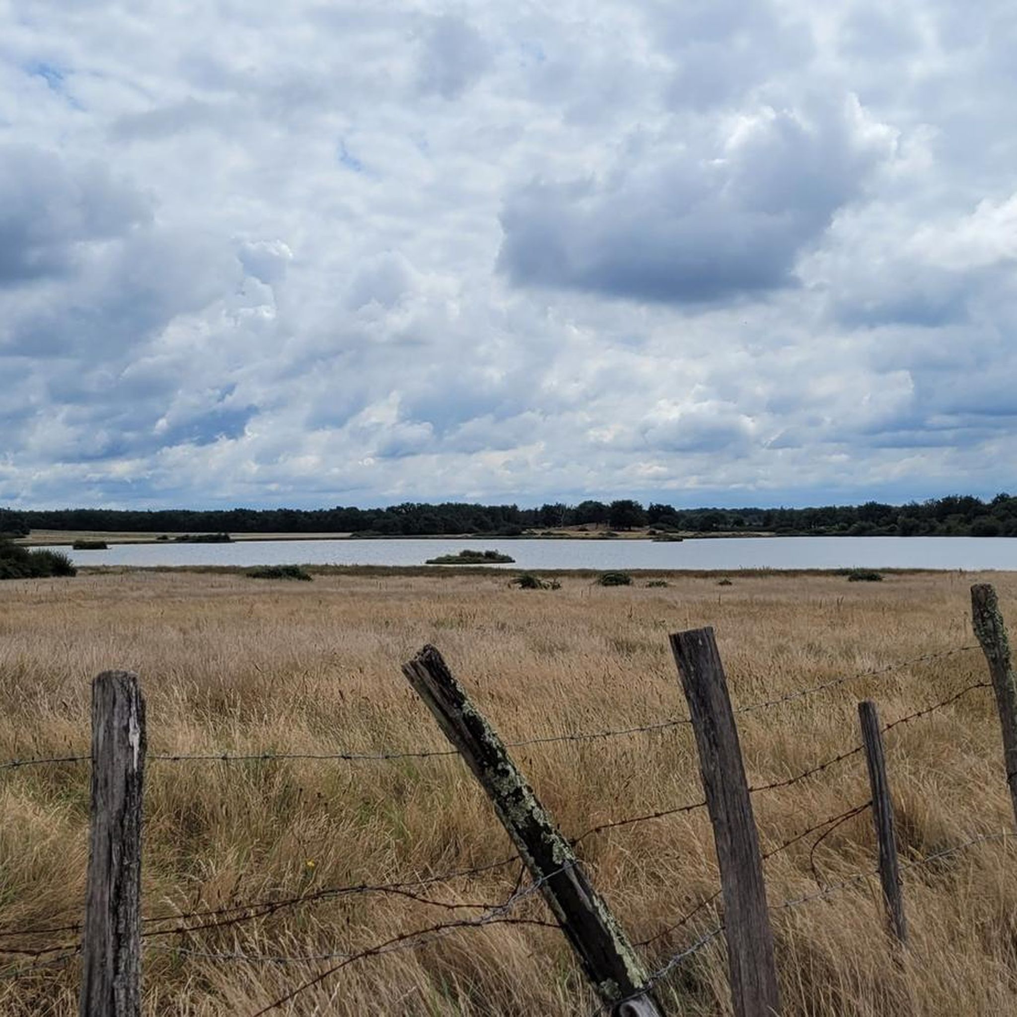
Road cycling routes around Etang Du Couvent are characterized by a generally flat to gently rolling landscape, typical of the Brenne Regional Natural Park. The terrain features numerous lakes and ponds (étangs), interspersed with agricultural fields and small woodlands. Elevation gains are modest, making the area suitable for various fitness levels. The region offers a network of quiet country roads connecting villages and natural areas.
Best road cycling routes around Etang Du Couvent
- The most popular road cycling route is…
Last updated: July 5, 2026
3
riders
14.2km
00:37
50m
50m
Easy road ride. Great for any fitness level. Mostly well-paved surfaces and easy to ride.
2
riders
44.2km
01:54
210m
210m
Easy road ride. Great for any fitness level. Mostly well-paved surfaces and easy to ride.

Sign up for free
12
riders
27.0km
01:10
100m
100m
Easy road ride. Great for any fitness level. Mostly well-paved surfaces and easy to ride.
7
riders
Moderate road ride. Good fitness required. Some segments of this route may be unpaved and difficult to ride.
2
riders
63.7km
02:35
360m
360m
Moderate road ride. Good fitness required. Mostly well-paved surfaces and easy to ride.
Our route recommendations are based on thousands of hikes, rides, and runs completed by other people on komoot.
Start today with a free account
Your next adventure awaits.
Login or Signup


Tips from the Community

Hike up to the old Château-Naillac with its twin 12th-century donjons—towers without buttresses—standing just above the Creuse River. Inside, you'll find remnants of prisoners' graffiti, a hall with a magnificent Romanesque fireplace, and a model showing what the castle once looked like.
2
0

Located in the heart of the Brenne regional natural park, the Azay-le-Ferron castle, rich in architecture stretching from the 15th to the 18th century, will transport you through styles and eras. Throughout the visit, you will discover living rooms, bedrooms, dining room, kitchen, library. Approximately fifteen sumptuously furnished rooms in which the Hersent-Luzarche family lived, owners since 1852. The last descendant of this family, Marthe Hersent-Luzarch, bequeathed the estate to the city of Tours in 1951, giving it the mission of open the doors of this exceptional place to the public. This exceptional ensemble is located in a remarkable 26-hectare green setting redeveloped by Denis and Eugène Bülher, a famous 19th century landscaper. They imagined a landscaped park decorated with numerous groves where a multitude of tree species, boxwood beds and topiaries coexist, the collection of which is renowned among the most beautiful in France. The walk continues into the flower gardens where the collection rose dominates. A conservatory orchard based on old varieties of apples and pears completes the plant diversity of the site. Lively tours in period costumes will allow you to discover the castle from a new perspective. They will notably be an opportunity to see rooms usually closed to the public, while having the opportunity to meet with guides and actors around a tasting of local products.
1
0

An exceptionally bucolic castle located in the middle of 55 hectares of greenery. Average duration of individual visit: 45 minutes. Average duration of the group visit: 1 hour. Animals are accepted. Languages available: French, English, German, Chinese, Spanish, Italian, Dutch, Russian
0
0

Pretty pass on the river, with the bell tower of Saint-Pierre abbey. The commune of Preuilly-sur-Claise has several archaeological sites. The archaeological site of Picardy is an open-air site, discovered in the 1980s, located on the left bank of the Claise, on a plateau.
0
0
This park is known for its 3,000 ponds, 267 species of birds, 100,000 pond turtles, 1,600 plant species including wild orchids and thousands of insects and animals. The Brenne Regional Natural Park attracts thousands of visitors each year in search of a calm, natural and authentic setting.
0
0

This 12th century Romanesque building housed a lamp that shone in honor of the dead buried in the nearby cemetery. Previously, lamps were placed in the center of cemeteries.
3
0
Château Naillac is a heterogeneous castle which has known several uses over the centuries. From the 12th century it was a fortress but much later, in the 18th century, it became a prison. It then became a school and now houses the Brenne Ecomuseum.
3
0
The church of Saint-Cyran, built in the 11th century, is now used as an exhibition space.
4
0
Frequently Asked Questions
What is the general terrain like for road cycling around Etang Du Couvent?
The region around Etang Du Couvent, part of the Brenne Regional Natural Park, is characterized by a generally flat to gently rolling landscape. You'll find numerous lakes and ponds (étangs), agricultural fields, and small woodlands. Elevation gains are modest, making it suitable for various fitness levels on quiet country roads.
Are there many easy road cycling routes in the Etang Du Couvent area?
Yes, the area is well-suited for easy road cycling. Out of the routes listed, 3 are classified as easy. An example is the Étang du Sablon loop from Saint-Michel-en-Brenne, which is about 9.1 miles (14.6 km) long.
Are there any challenging road bike climbs around Etang Du Couvent?
The Etang Du Couvent area is known for its generally modest elevation gains, typical of the Brenne Regional Natural Park. While there aren't significant mountain climbs, some routes offer more sustained rolling hills, such as the Roadbike loop from Rosnay, which has an elevation gain of approximately 335 meters over 35.1 miles (56.5 km).
What is the best time of year for road biking in Etang Du Couvent?
The spring and autumn months generally offer the most pleasant conditions for road cycling around Etang Du Couvent, with milder temperatures and beautiful scenery. Summer can also be enjoyable, but it's advisable to start earlier in the day to avoid the midday heat, especially on longer routes.
Are there any family-friendly road cycling routes in the region?
Given the generally flat to gently rolling terrain and quiet country roads, many routes around Etang Du Couvent are suitable for families. Shorter, easy loops like the Étang du Sablon loop from Saint-Michel-en-Brenne are excellent choices for a family outing.
What kind of distances can I expect from road cycling routes here?
Routes vary in length to suit different preferences. You can find shorter options like the Étang du Sablon loop from Saint-Michel-en-Brenne at 9.1 miles (14.6 km), or longer rides such as the Lantern of the Dead loop from Stationnement des Étangs de Foucault, which covers about 39.6 miles (63.7 km).
Are there circular road cycling routes available?
Yes, many of the road cycling routes in the Etang Du Couvent area are designed as loops, allowing you to start and finish at the same point. Examples include the Château d'Azay-le-Ferron loop from Saint-Michel-en-Brenne and the Étang de Montiacre – Étang de la Planche Maillet loop from Château du Bouchet.
What attractions or points of interest can I see along the road cycling routes?
The routes often pass through scenic natural areas and charming villages. For instance, the Château d'Azay-le-Ferron loop from Saint-Michel-en-Brenne takes you past the historic Château d'Azay-le-Ferron, offering a cultural highlight amidst your ride.
Where can I find parking for road biking trails in Etang Du Couvent?
Many routes start from villages or designated parking areas near key attractions. For example, the Lantern of the Dead loop begins from Stationnement des Étangs de Foucault, indicating available parking at that location. It's common to find parking in the centers of towns like Saint-Michel-en-Brenne or Rosnay, which serve as starting points for several routes.
Are there cafes or places to stop for refreshments along the routes?
The road cycling routes often connect various small villages within the Brenne Regional Natural Park. These villages typically offer local cafes, bakeries, or small shops where you can stop for refreshments and experience local hospitality. Planning your route to pass through these villages can enhance your cycling experience.
What do other road cyclists enjoy about the Etang Du Couvent area?
Road cyclists frequently praise the tranquil atmosphere, the network of quiet country roads, and the beautiful natural scenery, particularly the numerous étangs (ponds and lakes). The modest elevation changes also make it an accessible region for various skill levels, allowing for enjoyable, scenic rides.
How many road cycling routes are featured in this guide for Etang Du Couvent?
This guide features 5 distinct road cycling routes around Etang Du Couvent, offering a variety of distances and experiences within the region.
Most popular routes around Etang Du Couvent

Get inspired with the komoot mobile app


Explore more
Browse the best Road cycling routes in other regions.
