The best running trails around Grimaucourt-Près-Sampigny
4.7
(12)
299
runners
45
runs
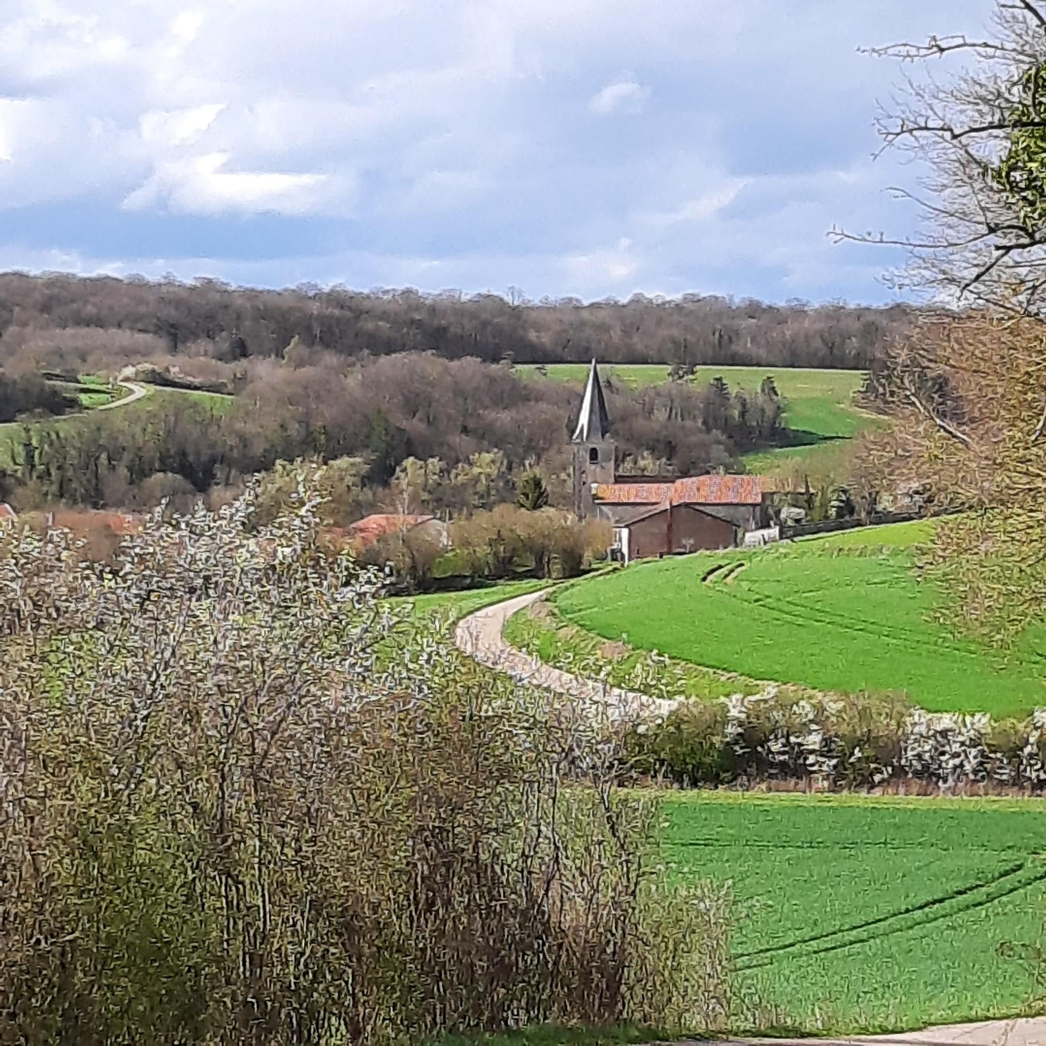
Jogging around Grimaucourt-Près-Sampigny offers diverse terrain, with elevations ranging from 236 to 368 meters, providing both flatter sections and challenging inclines. The region is characterized by extensive forest cover, with over 54% of the commune being wooded areas, offering shaded paths and natural surfaces. Waterways like the Girouet stream contribute to picturesque routes, and the area is part of the larger Parc Naturel Régional de Lorraine, known for its varied trail networks. This landscape provides a tranquil environment for running, combining physical activity with natural exploration.
Best jogging routes around Grimaucourt-Près-Sampigny
- The most popular jogging route is Aux grands bois – Château de Sampigny loop from Sampigny, a 7.1 miles (11.5 km) trail that takes 1 hour 19 minutes to complete. This moderate route features forest paths and views of historical elements.
- Another top favourite among local runners is The big batard loop from Sampigny, a moderate 4.4 miles (7.1 km) path. This route offers a relatively flat profile, suitable for a quicker run through open and wooded areas.
- Local runners also love the Running loop from Kœur-la-Petite, an 8.0 miles (12.9 km) trail leading through rural landscapes, often completed in about 1 hour 20 minutes.
- Jogging around Grimaucourt-Près-Sampigny is defined by varied topography, extensive forest cover, and tranquil waterways. The network offers options for different ability levels, from easy paths to more challenging routes.
- The routes in Grimaucourt-Près-Sampigny are highly rated by the komoot community with an average score of 4.8 stars from over 10 reviews. More than 200 runners have used komoot to explore Grimaucourt-Près-Sampigny's varied terrain.
Last updated: July 5, 2026
8
runners
13.8km
01:30
50m
50m
Moderate run. Good fitness required. Mostly paved surfaces. Suitable for all skill levels.
5
runners
11.5km
01:19
130m
130m
Moderate run. Good fitness required. Mostly paved surfaces. Suitable for all skill levels.

Sign up for free
4.5
(4)
5
runners
7.14km
00:50
10m
10m
Moderate run. Good fitness required. Mostly paved surfaces. Suitable for all skill levels.
4
runners
12.9km
01:21
70m
70m
Moderate run. Good fitness required. Mostly paved surfaces. Suitable for all skill levels.
4.5
(4)
4
runners
6.44km
00:45
10m
10m
Moderate run. Good fitness required. Mostly paved surfaces. Suitable for all skill levels.
Get access to more routes and recommendations from other explorers.
Sign up for free
Already have an account?
Our route recommendations are based on thousands of hikes, rides, and runs completed by other people on komoot.
Start today with a free account
Your next adventure awaits.
Login or Signup




Tips from the Community

The Meuse Canal is not perfectly straight like many French canals from the 19th century.
0
0

The picturesque landscape invites you to relax and escape the stress of everyday life.
2
0
Unfortunately, there are always garbage bags and plastic flash grill rights. I think it's a shame, there's already a place for them. Sad 😢.
3
0
Beautiful and relaxing places, ideal for cooling down after a hard tour.
4
0

The Marne-Rhine canal, also called the Meuse canal, is very pretty on the outskirts of the town of Commercy.
1
0

A very nice path along the canal, which is great fun for cyclists.
4
0
Frequently Asked Questions
What kind of terrain can I expect on the running routes around Grimaucourt-Près-Sampigny?
The region offers a diverse running experience with varied topography. You'll find both flatter sections and more challenging inclines, as elevations range from 236 to 368 meters. A significant portion of the area, over 54%, is covered by forests, providing shaded paths and natural surfaces ideal for trail running. You might also encounter picturesque routes alongside waterways like the Girouet stream.
How many running routes are available in Grimaucourt-Près-Sampigny?
There are over 45 running routes available around Grimaucourt-Près-Sampigny, catering to various preferences and fitness levels. The komoot community has explored these trails extensively, with over 200 runners using komoot to discover the area's diverse terrain.
Are there options for both shorter, quicker runs and longer, more challenging routes?
Yes, the area provides a good mix. For a quicker run, consider The big batard loop from Sampigny, a moderate 4.4-mile (7.1 km) path with a relatively flat profile. If you're looking for a longer challenge, the Running loop from Grimaucourt-près-Sampigny covers 8.0 miles (12.9 km) with more elevation.
What are the difficulty levels of the running routes?
The running routes around Grimaucourt-Près-Sampigny primarily feature moderate difficulty, with 40 such routes available. There are also a few easier options (2 routes) and some more difficult trails (3 routes) for those seeking a greater challenge.
What historical sites or natural features can I see while jogging?
While running, you can encounter several interesting points. The Aux grands bois – Château de Sampigny loop from Sampigny, for instance, offers views of historical elements. Other notable features in the wider area include the Trench of Thirst and Ailly Wood, and The Roman Camp, which provide a unique blend of physical activity and local history.
Are there many circular running routes available?
Yes, many of the running paths in the region are designed as loops, offering convenient circular routes. Examples include the popular Aux grands bois – Château de Sampigny loop from Sampigny and the Running loop from Kœur-la-Petite, allowing you to start and finish at the same point.
What do other runners say about the trails in Grimaucourt-Près-Sampigny?
The running routes in Grimaucourt-Près-Sampigny are highly rated by the komoot community, with an impressive average score of 4.8 stars from over 10 reviews. Runners often praise the varied topography, extensive forest cover, and tranquil waterways that define the experience, making it a rewarding destination for outdoor enthusiasts.
What is the best time of year for running in Grimaucourt-Près-Sampigny?
The extensive forest cover in Grimaucourt-Près-Sampigny provides shaded paths, making it pleasant for running even during warmer months. Spring and autumn offer particularly comfortable temperatures and beautiful scenery. While specific seasonal considerations aren't detailed, the varied terrain and natural environment are generally enjoyable throughout much of the year.
Are the running routes suitable for families?
While specific 'family-friendly' routes are not explicitly detailed, the region's diverse terrain includes easier paths that could be suitable for families. The extensive forest cover and natural environment offer a peaceful setting for outdoor activity. For specific family needs, consider routes with lower elevation gains, such as Running loop from Mécrin, which has minimal elevation changes.
Can I bring my dog on the jogging trails?
The region around Grimaucourt-Près-Sampigny, being part of the Grand Est region and near the Parc Naturel Régional de Lorraine, generally welcomes dogs on trails, especially in rural and forested areas. However, it's always advisable to keep dogs on a leash and respect local signage, particularly near agricultural land or protected wildlife zones. No specific restrictions for dogs on these routes are noted.
Are there any running routes that offer particularly scenic viewpoints?
The varied topography of Grimaucourt-Près-Sampigny, with elevations reaching up to 368 meters, suggests that some routes will offer scenic views of the surrounding rural landscapes and extensive forests. While specific viewpoints are not highlighted for individual routes, the natural beauty of the Meuse department and its position within a regional natural park ensure picturesque backdrops for your runs.
Is public transport available to access the running areas?
Grimaucourt-Près-Sampigny is a rural commune, so direct public transport access to specific trailheads might be limited. However, the broader Meuse department has well-equipped trail networks. For routes starting in nearby towns like Sampigny or Kœur-la-Petite, local bus services might connect to larger transport hubs, but planning ahead is recommended. Check local transport schedules for the most up-to-date information.
Where can I find parking for the running trails?
As many routes start from villages or towns, parking is generally available in or near these starting points. For example, routes like Aux grands bois – Château de Sampigny loop from Sampigny and The big batard loop from Sampigny would likely have parking options in Sampigny. It's advisable to check the specific route details on komoot for recommended parking locations.
Most popular routes around Grimaucourt-Près-Sampigny
Most popular attractions around Grimaucourt-Près-Sampigny

Get inspired with the komoot mobile app


Explore more
Browse the best Running Trails & Routes in other regions.
