The best gravel rides around Puxe
26
riders
5
rides
Gravel biking around Puxe offers access to the diverse landscapes of France's Grand Est region, particularly within the Meurthe-et-Moselle department and the Lorraine Regional Nature Park. The terrain features a mix of agricultural plateaus, dense forests, and winding valleys, providing varied riding experiences. Routes often traverse rural tracks, wooded trails, and small roads, with elevations ranging from lower river valleys to higher plateaus. This area is characterized by its natural beauty, including humid forests and numerous ponds.
Best gravel bike…
Last updated: July 4, 2026
4
riders
60.7km
03:54
570m
570m
Hard gravel ride. Very good fitness required. Mostly paved surfaces. Suitable for all skill levels.
10
riders
30.2km
01:59
150m
150m
Easy gravel ride. Great for any fitness level. Mostly paved surfaces. Suitable for all skill levels.

Sign up for free
4
riders
Hard gravel ride. Very good fitness required. Mostly paved surfaces. Suitable for all skill levels.
4
riders
Moderate gravel ride. Good fitness required. Mostly paved surfaces. Suitable for all skill levels.
2
riders
33.7km
02:24
300m
300m
Moderate gravel ride. Good fitness required. Mostly paved surfaces. Suitable for all skill levels.
Our route recommendations are based on thousands of hikes, rides, and runs completed by other people on komoot.
Start today with a free account
Your next adventure awaits.
Login or Signup




Tips from the Community

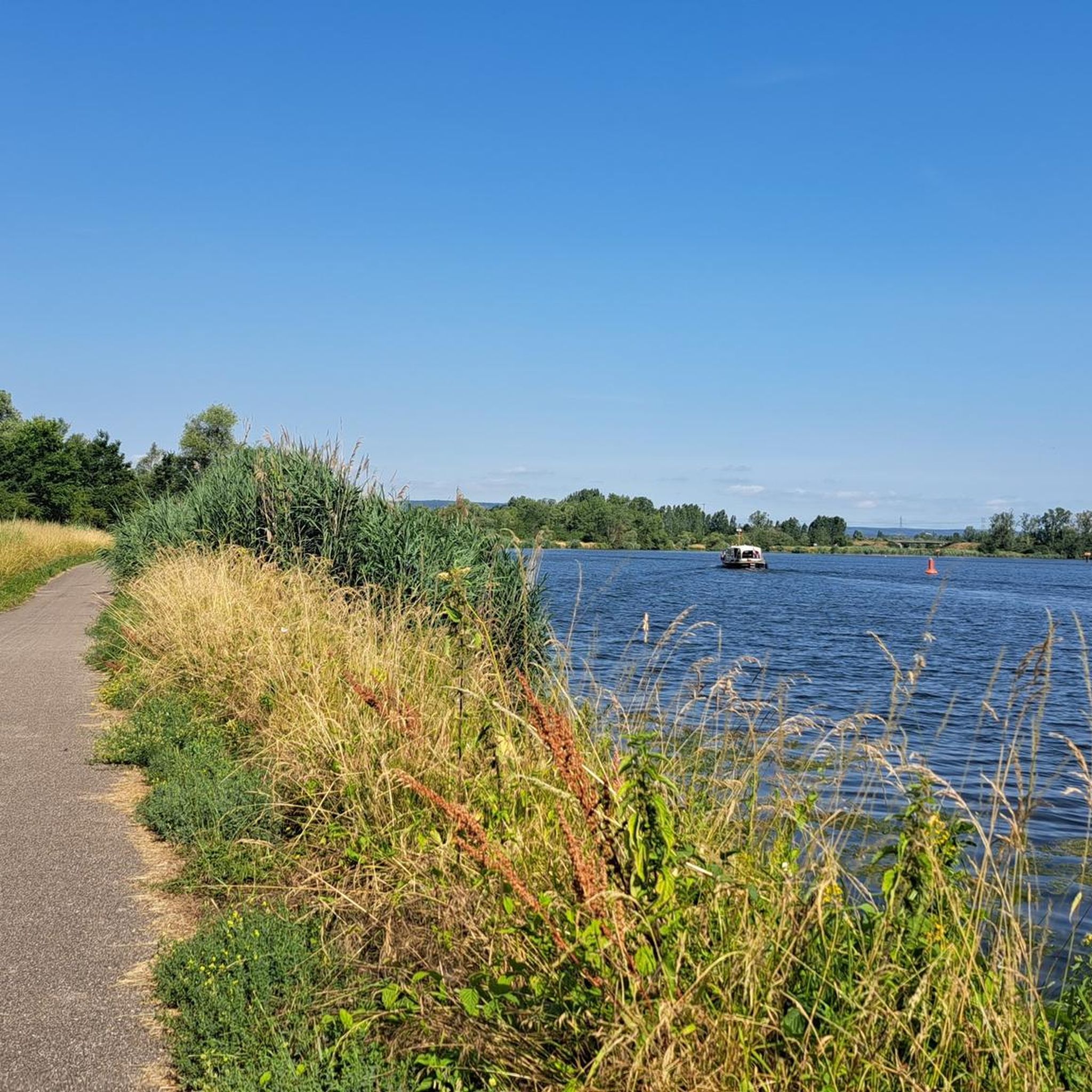
The Orne is a beautiful river
0
0

with family
0
0

The monument was created in 1930 by the sculptor Duilio Donzelli, originally from Lacroix-sur-Meuse. Like many French villages after the Great War, Bonzée erected this monument to pay tribute to the local soldiers who gave their lives for France. The names of the fallen are listed on the monument, often with inscriptions such as "Mort pour la France" or "Tué à l'ennemi". What makes it extra special is that Bonzée is located in an area that was badly affected during the war, near the infamous ridge of Les Éparges. The monument is therefore not only a symbol of mourning, but also of the deep scars that the conflict has left in this region.
6
0
The Saint-Laurent church in Bonzée, originally from the 18th century, destroyed in 1914, rebuilt in 1927.
7
0
This serene military cemetery was founded in 1915 and is the home of 2,960 French soldiers who fell during the bloody battles around the Crête des Éparges. Among them was Robert Porchon, friend of the writer Maurice Genevoix. The necropolis is located in the Hadimel ravine, at the foot of the ridge, and contains an ossuary with 852 unknown soldiers. A silent witness to the hell of trench warfare.
6
0

This village was an important Benedictine center in the Middle Ages, at the origin of an important reform of the Benedictine order (see https://fr.wikipedia.org/wiki/Abbaye_de_Gorze).
0
0

Transjarnysian route test
0
0
Frequently Asked Questions
What kind of terrain can I expect on gravel bike trails around Puxe?
The gravel bike trails around Puxe offer a diverse landscape, characteristic of the Lorraine Regional Nature Park. You'll encounter a mix of agricultural plateaus, dense forests, winding valleys, and wetlands. Routes often alternate between rural tracks, wooded trails, and small roads that pass through charming villages, providing varied riding experiences.
Are there any easy gravel bike routes suitable for beginners or families near Puxe?
Yes, there are options for easier rides. For a gentle introduction to the region's gravel paths, consider the Gravel loop from Hatrize. This 14.8-mile (23.8 km) path offers a pleasant ride through the local countryside, winding through varied terrain without significant elevation challenges.
What are some longer or more challenging gravel biking options in the Puxe area?
For those seeking a longer and more challenging ride, the La Tour Veloffel – La grange des toiles. loop from Conflans - Jarny is a great choice. This 38.1-mile (61.3 km) trail leads through varied terrain with notable ascents, often completed in about 3 hours 55 minutes. Another challenging option is the Locomotive CC-14161 (Krokodil) – Viewpoint loop from Conflans - Jarny, which covers 70 km with significant elevation gain.
Can I find circular gravel bike routes around Puxe?
Many of the gravel routes in the Puxe area are designed as loops, allowing you to start and finish at the same point. An example is the Quite a strange gateway – Orne River loop from Hatrize, which explores the varied landscapes along the Orne River over 31.4 miles (50.6 km).
What natural attractions or scenic views can I expect to see while gravel biking near Puxe?
The region is rich in natural beauty. You'll ride through expansive agricultural plateaus and serene forest valleys, such as the humid forests of Romersberg and Reine. The area is also known for its numerous ponds and wetlands, including the Petite Woëvre ponds and Lindre pond, which are significant for their rich flora and fauna. Lake Madine, within the Lorraine Regional Nature Park, offers beautiful views and opportunities for birdwatching.
Are there historical sites or landmarks along the gravel bike trails?
Yes, the Lorraine region has profound historical significance, particularly from World War I. Many cycling routes pass through areas with battlefields, trenches, and memorials, offering a poignant and educational dimension to your ride. The Montsec American Memorial, for instance, provides panoramic views of former battlefields.
What is the best time of year for gravel biking around Puxe?
The diverse landscapes of Lorraine, with its forests and agricultural plateaus, are enjoyable across multiple seasons. Spring and autumn offer pleasant temperatures and beautiful scenery with changing foliage. Summer is also suitable, though it can be warmer. Winter riding is possible, but conditions may vary, especially on unpaved sections.
How accessible are the gravel trails by public transport or car parking?
While specific public transport links directly to trailheads might vary, the region benefits from its proximity to towns like Conflans - Jarny and Hatrize, which serve as common starting points for many routes. These towns typically offer parking facilities. For example, the Transjarnysienne Route loop from Conflans - Jarny starts from a well-known location, making it convenient for those arriving by car.
What do other gravel bikers say about the trails in Puxe?
The gravel biking routes around Puxe are highly rated by the komoot community, with an average score of 4.75 stars from over 4 reviews. More than 50 gravel bikers have used komoot to explore the varied terrain, often praising the mix of rural tracks, wooded trails, and the natural beauty of the Lorraine Regional Nature Park.
Are there any specific regional cycling routes that connect to the Puxe area?
Yes, the Puxe area is well-situated to access broader regional cycling networks. The Lorraine Regional Nature Park itself boasts over 1,600 kilometers specifically suitable for gravel riding. Additionally, the Moselle Loop, an 85-kilometer circuit, combines urban and rural landscapes along the Moselle river, passing through historical sites. The Voie Bleue (Blue Way) also follows the Moselle river and canal, offering a popular and mostly paved option for exploring the picturesque scenery and connecting with other European cycle routes.
What is the overall elevation range for gravel biking in the Puxe region?
The region offers a varied elevation profile, with routes traversing from lower river valleys to higher plateaus. Elevations typically range between 166 and 412 meters, providing a mix of flatter sections and more challenging ascents, depending on the specific trail you choose.

Get inspired with the komoot mobile app


Explore more
Browse the best Gravel rides in other regions.
