The best walks and hikes around Springdale
5.0
(5)
172
hikers
31
hikes
Hiking around Springdale, Utah, offers access to diverse landscapes defined by towering red and white sandstone cliffs and deep canyons. The Virgin River has carved intricate networks of trails at various elevations, contributing to the region's ecology. Beyond the immediate canyon areas, high-desert environments provide varied terrain and scenery. The entire area is characterized by dramatic red rock formations, offering panoramic views.
Best hiking trails around Springdale
- The most popular hiking route is Lake Fayetteville Loop, a 5.6 miles…
Last updated: August 18, 2026
5.0
(3)
44
hikers
8.95km
02:19
50m
50m
The Lake Fayetteville Loop offers a delightful escape into nature, encircling the tranquil 194-acre Lake Fayetteville with diverse scenery. You can choose between a smooth, paved multi-use path or a…
1
hikers
12.2km
03:08
50m
40m
Explore the Razorback Greenway to Lake Springdale, a moderate hiking route that stretches 7.6 miles (12.2 km) with a gentle elevation gain of 180 feet (55 metres). You can expect…

Sign up for free
7
hikers
11.2km
03:01
150m
150m
Hike the moderate 6.9-mile Best Trail Ever, Butterfield, Fitzgerald, and Coyote Cave Loop at Fitzgerald Mountain, featuring diverse terrain
3
hikers
5.24km
01:23
40m
40m
Hike the easy 3.3-mile J.B. Hunt Park Loop in Springdale, Arkansas, enjoying Lake Springdale views and diverse park scenery.
12
hikers
7.78km
02:01
50m
50m
Moderate hike. Good fitness required. Easily-accessible paths. Suitable for all skill levels.
Get access to more routes and recommendations from other explorers.
Sign up for free
Already have an account?
Our route recommendations are based on thousands of hikes, rides, and runs completed by other people on komoot.
Start today with a free account
Your next adventure awaits.
Login or Signup

Tips from the Community

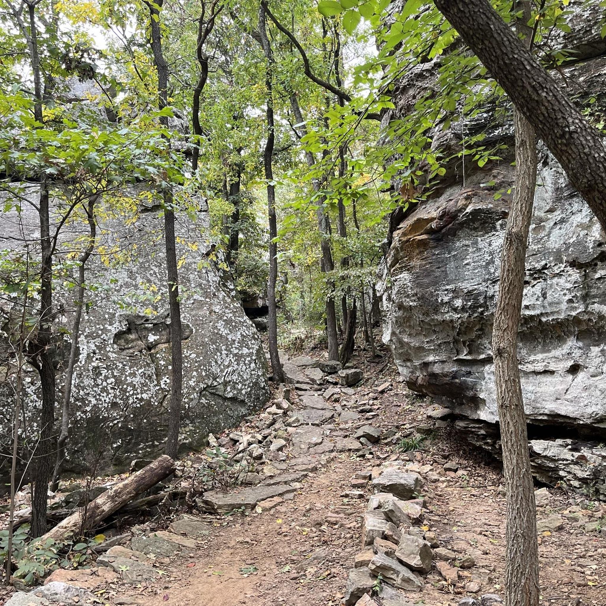
Coyote Cave Trail brings hikers past a cave system and is open to hikers and mountain bikers. This trail can get fairly rocky and runs through a well-shaded, wooded area. These trails were funded by the Walton Family Foundation and spans 130 acres of land.
0
0
Bayyari Park sits on 7.4 acres of natural beauty. The park features a hiking trail, a nature area, open green space, a paved multi-use trail, a picnic area, and a playground. Acquired in 1995, this scenic park is perfect for outdoor activities and family outings.
0
0
Razorback Regional Greenway spans over 40 miles in total, and is popular with bikers and hikers. This fully paved section meets up with other paths at Lake Springdale, a scenic reservoir in JB Hunt Park.
0
0
Rabbit Foot Lodge is one of Arkansas's best examples of Adirondack-style architecture. Built in 1908 and home to J. William Fulbright from 1936 to 1941, the 3,200-square-foot chinked-log structure features pyramidal roofs, wrap-around porches, stained ceiling beams, wooden shutters, and a natural stone fireplace. This charming lodge is on the National Register of Historic Places and part of J. B. Hunt Park.
0
0

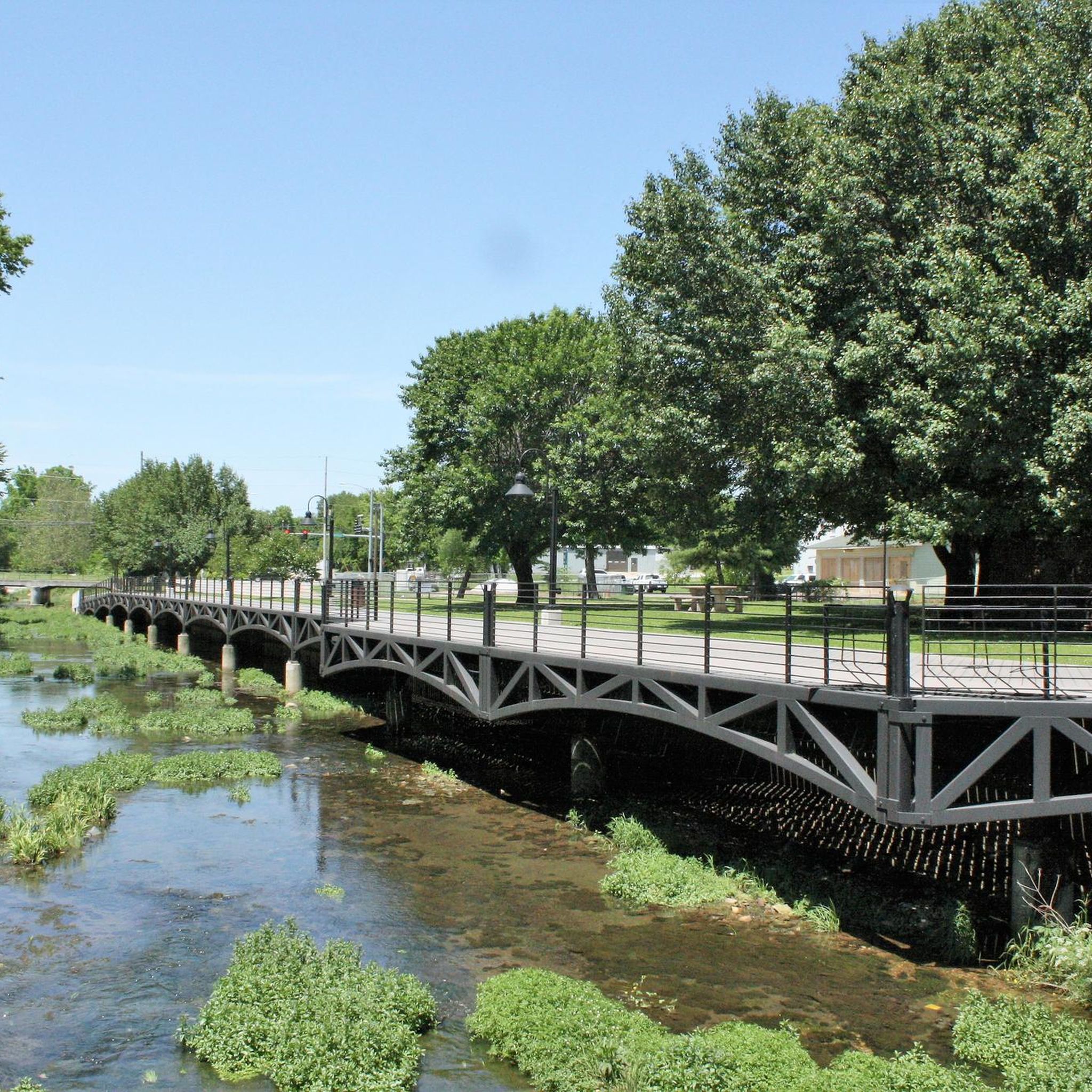
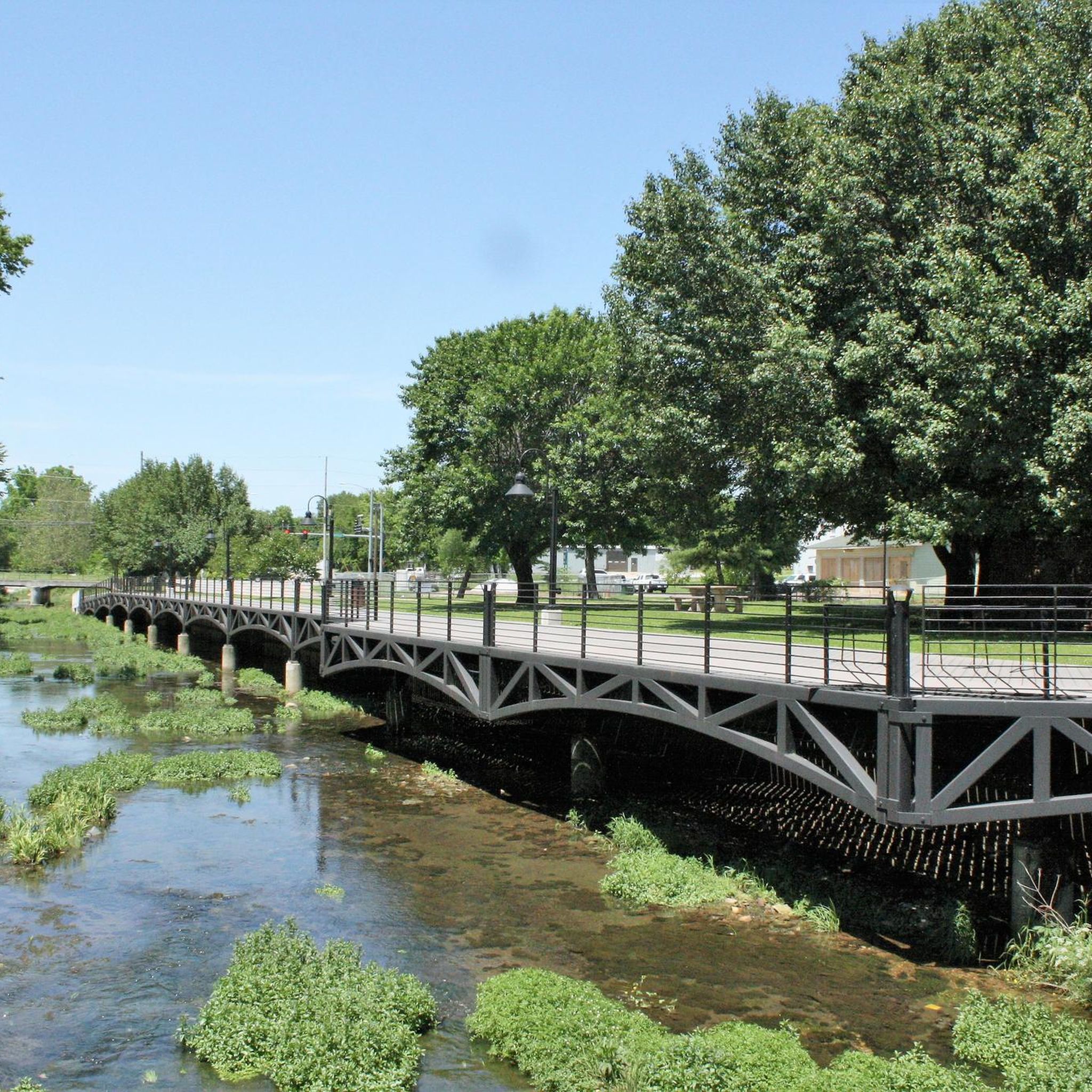
The Razorback Regional Greenway runs along a beautiful boardwalk through downtown Springdale. The path follows Spring Creek and there are also picnic tables at the side of the boardwalk. So if you need a rest, this is an ideal spot.
4
0
Make a stop on the Clear Creek bridge and admire the beauty of the rocky streambed. By the way, the multi-use trail Razorback Regional Greenway is also called Clear Creek Trail from here on and follows the course of the creek for a few miles.
2
0
This beautiful multi-use path lead is part of the Northwest Arkansas Razorback Regional Greenway that is altogether almost 38 miles long and takes you to spectacular places like the Lake Fayetteville.
4
0
Frequently Asked Questions
How many hiking trails are available around Springdale?
There are over 25 hiking routes around Springdale, offering diverse experiences from easy strolls to more challenging climbs. The komoot community has explored over 180 of these routes, rating them highly for their scenic beauty and varied terrain.
Are there any family-friendly hiking trails in Springdale?
Yes, Springdale offers several excellent options for families. Within Zion National Park, the Pa'rus Trail is an easy, paved multi-use path along the Virgin River. The Riverside Walk also provides a wide, easy path through cottonwood trees. For a slightly different experience, the J.B. Hunt Park Loop is an easy 3.3-mile trail suitable for a family outing.
What are some less crowded hiking options near Springdale?
While many trails within Zion National Park can be busy, consider exploring routes outside the immediate park entrance for more solitude. The Chinle Trail, for example, offers a longer journey through the park's lower desert. For a local experience, the Razorback Greenway to Lake Springdale provides a moderate 7.6-mile path with minimal elevation gain, often less frequented than the main park trails.
Can I find circular hiking routes in the Springdale area?
Yes, there are several circular routes available. A popular option is the Lake Fayetteville Loop, a moderate 5.6-mile trail with gentle elevation changes. Another local favorite is the Best Trail Ever, Butterfield, Fitzgerald, and Coyote Cave Loop, which covers 6.9 miles through varied terrain.
Are there any dog-friendly trails around Springdale?
Within Zion National Park, the Pa'rus Trail is the only trail where leashed dogs are permitted. Outside the park, many trails in the surrounding Springdale area are dog-friendly, but it's always best to check specific trail regulations before heading out. Remember to keep your dog on a leash and pack out all waste.
What kind of natural features and landmarks can I expect to see on hikes near Springdale?
Springdale's landscape is defined by towering red and white sandstone cliffs, deep canyons carved by the Virgin River, and dramatic red rock formations. You'll encounter stunning panoramic views, lush greenery along river paths, and high-desert environments. Notable landmarks include the iconic Watchman spire visible from the Watchman Trail, and the unique slot canyon experience of The Narrows. You can also explore local points of interest like Coyote Cave Trail.
What is the best time of year to hike in Springdale?
Spring and fall generally offer the most pleasant hiking conditions in Springdale, with mild temperatures and beautiful scenery. Summer can be very hot, especially in the canyons, making early morning or late afternoon hikes preferable. Winter hiking is possible, but some trails may be icy or closed due to snow, and the Virgin River's water levels for The Narrows can be very cold and high.
Are there any accessible trails for those with mobility challenges?
Yes, the Pa'rus Trail within Zion National Park is a paved, multi-use trail that is wheelchair and stroller accessible, offering beautiful views along the Virgin River. The Riverside Walk is also a wide, paved path suitable for most mobility levels.
What are the parking and public transport options for hikers in Springdale?
Springdale offers various parking options, including paid lots in town and at the Zion National Park Visitor Center. During peak seasons, a free shuttle system operates within Springdale and connects directly to popular destinations inside Zion National Park, significantly reducing the need for personal vehicles and easing parking congestion.
What do other hikers enjoy most about hiking in Springdale?
The hiking experiences around Springdale are highly rated by the komoot community, with an average score of 5.0 stars from over 7 reviews. Hikers frequently praise the region's breathtaking red rock vistas, the diverse terrain ranging from river walks to challenging canyon trails, and the overall accessibility to world-renowned natural beauty.
Are there any trails with waterfalls near Springdale?
Yes, the Emerald Pools Trail within Zion National Park is known for its lush greenery and seasonal waterfalls, particularly vibrant after rainfall or during spring snowmelt. The Weeping Rock Trail, though short, also offers a unique experience with water seeping from the canyon walls, creating a 'weeping' effect.
Most popular routes around Springdale
Most popular attractions around Springdale

Get inspired with the komoot mobile app


Explore more
Browse the best Hikes in other regions.
