The best walks and hikes around Villiers-Sur-Tholon
4.4
(10)
60
hikers
21
hikes
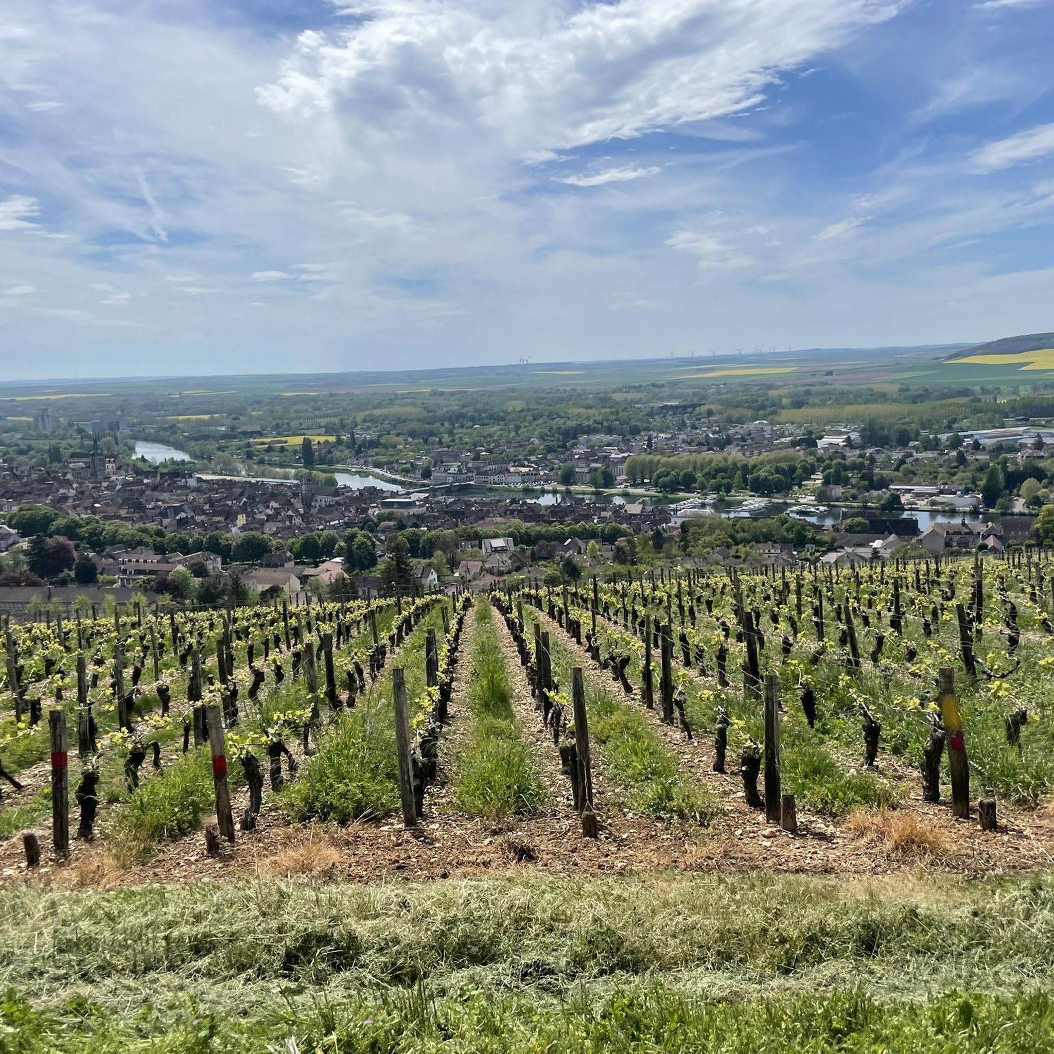
Hiking around Villiers-Sur-Tholon, located in the Yonne department of Burgundy-Franche-Comté, offers access to a network of trails. The landscape is characterized by rural charm, featuring a mix of fields and woodlands. Elevations range from 104 to 236 meters, providing varied terrain suitable for both gentle walks and routes with moderate ascents over hills.
Best hiking trails around Villiers-Sur-Tholon
- The most popular hiking route is Menhirs de la Pierre-Fitte loop from Aillant-sur-Tholon, a 5.8 miles (9.3 km) trail that takes…
Last updated: June 28, 2026
3
hikers
9.32km
02:28
90m
90m
Moderate hike. Good fitness required. Easily-accessible paths. Suitable for all skill levels.
3
hikers
9.77km
02:40
150m
150m
Moderate hike. Good fitness required. Easily-accessible paths. Suitable for all skill levels.

Sign up for free
5
hikers
9.49km
02:31
100m
100m
Moderate hike. Good fitness required. Easily-accessible paths. Suitable for all skill levels.
4
hikers
12.3km
03:17
140m
140m
Moderate hike. Good fitness required. Easily-accessible paths. Suitable for all skill levels.
4.5
(2)
4
hikers
9.27km
02:28
100m
100m
Moderate hike. Good fitness required. Easily-accessible paths. Suitable for all skill levels.
Get access to more routes and recommendations from other explorers.
Sign up for free
Already have an account?
Our route recommendations are based on thousands of hikes, rides, and runs completed by other people on komoot.
Start today with a free account
Your next adventure awaits.
Login or Signup



Tips from the Community

In the 5th century, the lands of Guerchy had been bequeathed to the Abbey of Auxerre by Saint Germain who had inherited them from his parents. In 1440, Jehan Régnier, bailiff of Auxerre, acquired the lands. Then he received from Charles the Bold the lordship of Guerchy, which remained in the Régnier family until his last descendant, who died unmarried in 1852. Adrien de Régnier had built, at the beginning of the 17th century, a castle that is known to have been sumptuous. His granddaughter Claude, "La Belle de Guerchy", lady of Bazarnes and maid of honor to Anne of Austria, received the Grand Condé there, exiled after the Fronde. He participated in the embellishments of the church.
0
0
Frequently Asked Questions
How many hiking trails are available around Villiers-sur-Tholon?
There are over 20 hiking routes in the Villiers-sur-Tholon area, catering to various preferences. You'll find 5 easy trails and 16 moderate routes, offering a good range of options for different fitness levels.
What kind of terrain can I expect on hikes near Villiers-sur-Tholon?
The hiking trails around Villiers-sur-Tholon are characterized by a charming rural landscape. You can expect to traverse a mix of open fields and dense woodlands. The elevation ranges from 104 to 236 meters, providing varied terrain with both gentle walks and routes featuring moderate ascents over rolling hills.
Are there any circular walks available in the Villiers-sur-Tholon area?
Yes, many of the trails around Villiers-sur-Tholon are circular, allowing you to start and end at the same point. For example, you could try the Menhirs de la Pierre-Fitte loop from Aillant-sur-Tholon, which is a moderate 9.3 km route, or the La Montagne loop from Fleury-la-Vallée, covering 9.5 km through rural landscapes.
What are some interesting landmarks or attractions to see while hiking?
While hiking, you can discover local points of interest. For instance, the Menhirs de la Pierre-Fitte loop from Aillant-sur-Tholon passes by the ancient Menhirs de la Pierre-Fitte. Additionally, the region is close to historic towns like Joigny, where you can find sights such as the Saint-Thibault de Joigny - Catholic Church and scenic views of Joigny. The Bennechiens pond is another natural spot to explore.
What do other hikers say about the trails in Villiers-sur-Tholon?
The trails in Villiers-sur-Tholon are highly regarded by the komoot community, holding an average rating of 4.5 stars from over 9 reviews. Hikers often praise the varied scenery, from quiet woodlands to open fields, and the well-maintained paths that make for an enjoyable outdoor experience.
Are there any easy hiking routes suitable for beginners or families?
Yes, there are 5 easy routes available around Villiers-sur-Tholon, perfect for beginners or families looking for a more relaxed walk. These trails typically feature gentler terrain and shorter distances, allowing everyone to enjoy the natural beauty of the area.
What is the best time of year to go hiking in Villiers-sur-Tholon?
The region's rural charm and varied landscapes make it suitable for hiking across multiple seasons. Spring and autumn offer pleasant temperatures and beautiful scenery with blooming flowers or vibrant foliage. Summer is also enjoyable, especially in the wooded areas, while winter hikes can provide a unique, tranquil experience, though some paths might be muddy.
Are there any longer, more challenging routes for experienced hikers?
While there are no routes classified as 'difficult' in the immediate vicinity, the 16 moderate trails offer good distances and some elevation changes. For a longer moderate hike, consider the Montaigu loop from Marnay, which covers over 12 km through varied terrain.
Can I find trails that go through forests or wooded areas?
Absolutely. The Villiers-sur-Tholon area is known for its mix of fields and woodlands. Many routes, such as the Bois loop from Saint-Martin-sur-Ocre, specifically lead through wooded areas, offering shade and a different kind of natural beauty.
What other activities or places can I visit near Villiers-sur-Tholon after a hike?
Beyond hiking, Villiers-sur-Tholon's location in the Yonne department provides access to several cultural and historical sites. The historic town of Joigny is just 11 km away, known for its traditional architecture. Auxerre, 20 km distant, boasts a cathedral and a historic center. You could also visit the Cistercian Abbey of Pontigny or the famous wine region of Chablis. For a unique experience, the medieval castle reconstruction project at Guédelon is also within reach.
Are there any trails that offer views of the surrounding countryside?
Yes, many trails provide expansive views of the rural countryside. The varied elevation, ranging up to 236 meters, means that certain points along the routes offer rewarding panoramas of fields, woodlands, and distant villages. The La Montagne loop from Fleury-la-Vallée, for example, leads through rural landscapes and past local hills, likely offering scenic vistas.
Most popular routes around Villiers-Sur-Tholon
Most popular attractions around Villiers-Sur-Tholon

Get inspired with the komoot mobile app


Explore more
Browse the best Hikes in other regions.
