The best mountain hikes around Parco Naturale della Val Troncea
4.8
(5)
69
hikers
4
hikes
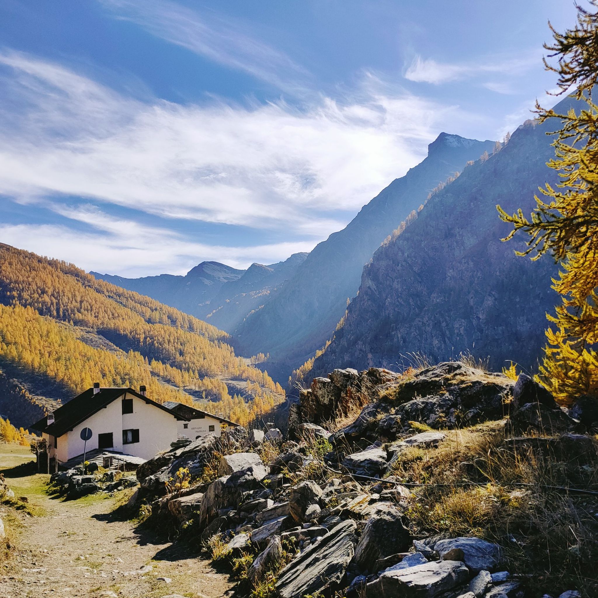
Mountaineering routes around Parco Naturale della Val Troncea are situated in the Cottian Alps, characterized by a significant elevation range from 1,670 meters to 3,280 meters. The landscape features a dramatic contrast between gently sloping, grass-covered areas and rugged rock walls descending into glacial valleys. This U-shaped valley, carved by ancient glaciers, is home to the Chisone stream and several high-altitude glacial lakes. The park encompasses 21 named mountains, many exceeding 3,000 meters, offering diverse terrain for challenging ascents.
Best…
Last updated: July 1, 2026
5.0
(1)
12
hikers
14.6km
07:21
1,180m
1,180m
Hard mountaineering route. Very good fitness required. Sure-footedness, sturdy shoes and alpine experience required.
4
hikers
12.9km
05:01
720m
720m
Hard mountaineering route. Very good fitness required. Sure-footedness, sturdy shoes and alpine experience required.

Sign up for free
4
hikers
8.96km
03:22
610m
610m
Moderate mountaineering route. Good fitness required. Easily-accessible paths. Suitable for all skill levels.
2
hikers
6.55km
02:33
260m
250m
Moderate mountaineering route. Good fitness required. Mostly accessible paths. Sure-footedness required.
2
hikers
5.47km
02:15
250m
250m
Moderate mountaineering route. Good fitness required. Mostly accessible paths. Sure-footedness required.
Our route recommendations are based on thousands of hikes, rides, and runs completed by other people on komoot.
Start today with a free account
Your next adventure awaits.
Login or Signup
Popular around Parco Naturale della Val Troncea
Hiking around Parco Naturale della Val Troncea
Road Cycling Routes around Parco Naturale della Val Troncea
Running Trails around Parco Naturale della Val Troncea
Cycling around Parco Naturale della Val Troncea

Gravel biking around Parco Naturale della Val Troncea
MTB Trails around Parco Naturale della Val Troncea
Tips from the Community

view of the 13 lakes basin
1
0

Sportinia is always beautiful. Reached by a hike starting from the experimental center and passing through Pian della Rocca, on August 31st we found the Rocce Nere refuge open, where we enjoyed a platter and a beer.
0
0

excellent trip with the possibility of loops
0
0

A summit offering a stunning 360-degree view! Highly recommended for a beautiful sunset!
0
0

A beautiful circular hike. Beware, however, of the misleading two-hour indication! Messner might be able to manage it. If you're a regular hiker, no less than three hours or more... WARNING: Once you reach Lake Cannoni or Ramella, if you suffer from vertigo, do not follow the signs for trail A on the right. There are exposed sections, and one section is equipped with a damaged rope. Turn left and you will rejoin the outward route at the level of the early 1900s forts.
1
0

Comfortable footwear for mostly soft terrain
0
0

Lago Verde Piccolo is one of the jewels of the Vallone dei Tredici Laghi, a suggestive and uncontaminated corner of the Cottian Alps. This small lake enchants with its deep green waters, enclosed by dark rocks and alpine meadows.
1
0

Frequently Asked Questions
How many mountaineering routes are available in Parco Naturale della Val Troncea?
Parco Naturale della Val Troncea offers a variety of mountaineering routes. Our guide features 6 distinct routes, ranging from moderate to difficult, providing options for different skill levels to explore the high alpine terrain.
What is the best time of year for mountaineering in Val Troncea?
The summer months are generally ideal for mountaineering in Val Troncea, offering cooler temperatures suitable for high-altitude activities. While the park is open year-round, specific routes and conditions vary, with winter offering opportunities for cross-country skiing and snowshoeing.
Are there any permits or special regulations for mountaineering in the park?
Generally, no specific permits are required for mountaineering in Parco Naturale della Val Troncea. However, it's always advisable to check local regulations, especially concerning eagle nesting areas or potential avalanche hazards, which might restrict access to certain technical routes like the 'Cascatone del Rouit'.
What kind of wildlife can I expect to see while mountaineering?
Val Troncea is rich in alpine wildlife. Keep an eye out for chamois, ibex, roe deer, red deer, and wild boar. Birdwatchers might spot golden eagles and peregrine falcons soaring above the peaks, adding to the natural beauty of your mountaineering experience.
Are there any challenging routes for experienced mountaineers?
Yes, the park offers several challenging routes. For instance, the ascent of Punta Rognosa di Sestriere (3,280 m), the highest peak, is a classic demanding mountaineering route. Other difficult options include Punta Cerisira loop from Prali, which features significant elevation gain over 18 km.
Are there any easier or moderate mountaineering options suitable for beginners?
While many routes are challenging, there are moderate options available. For example, the Rifugio Ciao Pais loop from Sauze d'Oulx is a moderate 9 km route that offers a less strenuous introduction to the park's beauty, with a manageable elevation gain.
Can I find circular mountaineering routes in Val Troncea?
Yes, many of the mountaineering routes in Val Troncea are designed as loops, allowing you to start and end at the same point. Examples include the Laghetto del Chiosonetto – Chisonetto Springs loop from Sestriere and the Monte Albergian Summit loop from Pragelato.
Where can I park when accessing mountaineering trails in Val Troncea?
Parking is typically available at the trailheads of popular routes, often near villages like Sestriere or Pragelato, which serve as common starting points for excursions into the park. Specific parking details may vary by route, so it's recommended to check the individual tour descriptions.
What are some notable peaks to ascend in the Val Troncea Natural Park?
Beyond Punta Rognosa di Sestriere, other significant peaks include Bric Ghinivert Summit and Monte Barifreddo. These offer incredible views and can often be accessed from mountain refuges within the park.
Are there any mountain huts or places to stay along the routes?
Yes, the park features mountain huts that provide essential support for longer excursions. Notable options include Troncea Hut and Rifugio Mulino di Laval, which can serve as bases or rest stops during your mountaineering adventures.
What are some interesting natural features or landmarks to look out for?
The park is known for its dramatic glacial valleys, the Chisone stream, and high-altitude glacial lakes like the Beth Lakes. You can also explore ancient hamlets such as Laval, Seytes, and Troncea, which offer a glimpse into the valley's history. Don't miss the 'valley of flowers' with its abundant alpine flora.
What do other mountaineers say about their experience in Parco Naturale della Val Troncea?
The mountaineering routes in Parco Naturale della Val Troncea are highly rated by the komoot community, with an average score of 4.4 stars. Reviewers often praise the challenging ascents, the stunning high alpine scenery, and the sense of wilderness found within the park.
Are there opportunities for winter mountaineering or ice climbing?
Yes, Val Troncea offers possibilities for winter mountaineering and is recognized for ice climbing, particularly at the 'Cascatone del Rouit'. Ski mountaineering is also an option, though some routes may involve long approaches. Always be aware of potential avalanche hazards and restrictions in eagle nesting areas during winter.
Are there any family-friendly mountaineering options?
While many routes are challenging, some areas of the park offer more accessible paths suitable for families looking for a less strenuous mountain experience. It's best to check individual route descriptions for difficulty levels and suitability for children.
Where can I find food or refreshments near the mountaineering routes?
Villages bordering the park, such as Pragelato and Sestriere, offer various options for restaurants and cafes. Additionally, mountain huts like Rifugio Mulino di Laval and Troncea Hut often provide refreshments and meals, especially useful for longer excursions.
Most popular routes around Parco Naturale della Val Troncea
Most popular attractions around Parco Naturale della Val Troncea

Get inspired with the komoot mobile app


Explore more
Browse the best Mountain Hikes & Routes in other regions.
