The best walks and hikes around Elyria
5.0
(10)
63
hikers
11
hikes
Hikes around Elyria Ohio are characterized by the landscape carved by the east and west branches of the Black River. The area's parklands, including the Black River Reservation and Cascade Park, feature a mix of paved multi-use paths and natural surface trails. These routes follow the river through sandstone gorges and woodlands, offering generally flat terrain suitable for a variety of activities.
Best hiking trails around Elyria
- The most popular hiking route is Bridgeway Trail — Black River State Reservation, a 7.1 mile (11.4 km) trail that takes about 2 hours 56 minutes to complete. This route features a 1,000-foot bridge offering treetop views over the river.
- Another top favourite among local hiking enthusiasts is The North Coast Inland Trail — Elyria, Ohio, a moderate 10.9 mile (17.5 km) path. This is a long-distance, paved trail that connects multiple communities in the region.
- Local hiking enthusiasts also love the Sandy Ridge Reservation loop — North Ridgeville, Ohio, a 2.2 mile (3.6 km) trail leading through wetlands, often completed in about 54 minutes.
- Hiking around Elyria is defined by riverside paths, sandstone gorges, and extensive paved trails. The network of routes provides options for both short, easy walks and longer-distance hikes.
- The routes in Elyria are highly rated by the komoot community with an average score of 5.0 stars from a number of reviews. More than 40 hikers have used komoot to explore Elyria's varied terrain.
Last updated: June 24, 2026
5.0
(1)
8
hikers
7.71km
01:57
10m
20m
The Bridgeway and Waterfall Trail offers a delightful escape into nature, winding through natural wetlands, open meadows, and peaceful forest groves. This easy 4.8-mile (7.7 km) hike, with a minimal 47 feet (14 metres) of elevation gain, is typically completed in just under two hours, making it perfect for a relaxed outing. Keep an eye out for the impressive 1,000-foot Bridgeway Trail Pedestrian Bridge, which provides panoramic views as it crosses the Black River twice.
Planning your visit is straightforward, as the trail provides ample amenities including parking, pavilions, and water fountains. While the route is mostly paved and considered easy, there is a steep hill near the trailhead that requires a bit of caution, particularly when descending. This trail is a fantastic option for families or anyone seeking a scenic, accessible walk.
Beyond the main path, you can explore mulched side trails, including one that leads to a year-round waterfall. The trail also connects to the Cottonwood Trail, where you can marvel at some of Lorain County's largest and oldest trees. This route is a great choice for those interested in Bridgeway and Waterfall Trail hiking with diverse scenery and notable landmarks.
5.0
(1)
2
hikers
6.67km
01:42
20m
30m
The Steel Mill Trail offers a distinctive journey through Lorain County, Ohio, where the raw, almost "Mad Max" vibe of the U.S. Steel Mill's slag fields dramatically contrasts with the serene natural beauty of the Black River. This easy 4.1-mile (6.7 km) route, with a minimal 78 feet (24 metres) of elevation gain, is primarily an asphalt path, making it a smooth experience for hikers, cyclists, and even rollerbladers. You'll cross both the Black River and French Creek, enjoying varied scenery from industrial remnants to riparian ecosystems.
Located within the popular Black River Reservation, the trail is highly accessible, though arriving early might be wise given the park's high visitor numbers. The route is well-suited for most fitness levels, taking approximately 1 hour and 42 minutes to complete. Remember that some areas have limited shade, so bring water and sun protection, especially on warmer days.
What truly sets the Steel Mill Trail apart is its unique blend of industrial history and natural landscapes, offering a compelling narrative of the region. It's part of a larger paved trail system, connecting to the Bridgeway Trail for those looking to extend their adventure. This trail provides a fascinating perspective on how nature reclaims and coexists with human industry, making it a notable point of interest in the area.

Sign up for free
1
hikers
937m
00:14
0m
0m
The Black River Short Loop offers a delightful, brief immersion into nature, winding through the kind of mixed forests often found along Black River trails. You'll experience a tranquil path that could showcase anything from jack pine and oak to cedar trees, providing a refreshing visual break. It's a genuinely easy 0.6-mile (0.9 km) hike with only 4 feet (1 metres) of elevation gain, making it a perfect 14-minute escape for those seeking a quick, accessible outdoor experience.
Planning your visit to this easy loop is straightforward. It's suitable for all seasons, though spring and autumn provide the most pleasant weather and vibrant natural colors. As a short and gentle route, it's an excellent option for a spontaneous outing or a quick leg-stretcher, especially if you're exploring other attractions in the Lorain County area. Always ensure you have appropriate footwear, even for such a short and easy trail.
This trail is a prime example of the family-friendly hiking options available in the Black River area, offering a chance to observe local wildlife like swans or turtles in a peaceful setting. While it might not feature dramatic elevation changes, its accessibility and natural beauty make it a notable choice for beginners or anyone looking for a low-impact way to enjoy the outdoors. It's a great way to experience the local ecosystem without a significant time commitment.
3.76km
00:58
20m
20m
Embark on an easy hike along the Meadow Loop Trail, a serene path designed for a relaxing outdoor experience. This route guides you through expansive open meadow landscapes, offering wide and clear paths perfect for a leisurely stroll. You can expect to complete the 2.3-mile (3.8 km) loop, with its gentle 57 feet (17 metres) of elevation gain, in about 58 minutes. Keep an eye out for local wildlife and various bird species that frequent the area, adding to the peaceful atmosphere as you explore.
Planning your visit to the Meadow Loop Trail is straightforward, as it is generally accessible and suitable for most hikers. You will find convenient parking available directly at the trailhead, making your start easy. There are no permits or fees required to enjoy this route, and you won't encounter any specific warnings regarding snow conditions or road closures. This makes it an ideal choice for a spontaneous outing, offering a hassle-free experience whenever you decide to go.
Located within the Carlisle Reservation, the Meadow Loop Trail stands out as a prime spot for nature observation and a quiet escape. Its focus on open meadows provides a distinct natural environment, making it a notable destination for those seeking a tranquil outdoor experience. The trail's easy difficulty ensures it is welcoming to a wide range of visitors, offering a simple yet rewarding connection with nature.
5.0
(4)
23
hikers
3.59km
00:54
0m
0m
The Marsh Loop Trail offers an easy hike through diverse habitats, perfect for a quick outdoor escape. You will find yourself on boardwalks that provide excellent views of the marshland and the Pond in Sandy Ridge Reservation. This route covers 2.2 miles (3.6 km) with a minimal elevation gain of just 15 feet (4 metres), making it accessible for nearly everyone. Expect to complete the loop in about 54 minutes at a steady pace. It's a gentle journey where you can truly immerse yourself in the natural surroundings.
Planning your visit to the Marsh Loop Trail is straightforward. The trailhead is easily accessible within Sandy Ridge Reservation. You will find ample parking available directly at the reservation, which makes starting your hike very convenient. This easy trail is suitable for most hikers, including families with children, so you can bring everyone along. It’s a great option for a morning stroll or an afternoon outing when you want to enjoy nature without a strenuous effort.
This area is particularly known for its rich wildlife, especially various bird species. As you hike, keep an eye out for different birds that frequent the marshland ecosystem. The trail's design, featuring boardwalks, allows you to get close to the unique marsh environment without disturbing it. It offers a wonderful opportunity to observe local flora and fauna in their natural setting, making it a notable spot for nature enthusiasts.
Get access to more routes and recommendations from other explorers.
Sign up for free
Already have an account?
Our route recommendations are based on thousands of hikes, rides, and runs completed by other people on komoot.
Start today with a free account
Your next adventure awaits.
Login or Signup
Popular around Elyria


Tips from the Community

Sandy Ridge Reservation is a 526-acre wetland and wildlife preserve. There are several trails that cut through the park and take you through a mixture of wetland and forest.
0
0
Nice view of one of the ponds in Sandy Ridge Reservation. There is a flat dirt track that runs around the edge of the water, so you can get close to the pond.
1
0
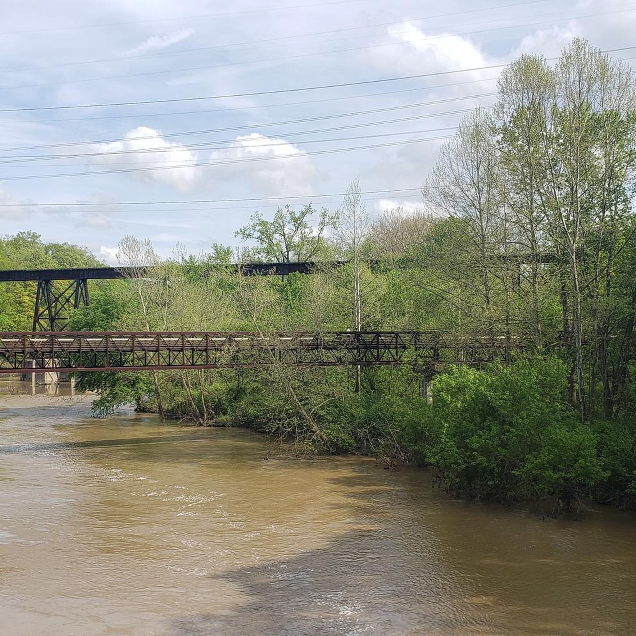
Nice pedestrian bridge that is part of the Bridgeway Trail. It is a great place to have a quick break to take in the wonderful views of the River.
0
0

Frequently Asked Questions
Are there any waterfall hikes in Elyria?
Yes, Elyria is known for its waterfalls, especially within Cascade Park. The park is home to both the East and West Falls, formed where the two branches of the Black River meet. The West Falls is particularly impressive and features a 50-foot deep cave behind it, offering a unique viewing perspective. Trails within the park provide scenic overlooks of these natural features.
What are the best options for an easy, family-friendly walk?
For a short and easy outing with the family, the Lakeview Park loop — Lorain is a great choice. It's a gentle walk of about 1.5 km. Additionally, Cascade Park is a local favorite for families, offering two inclusive playgrounds and a nature center alongside its trails.
Can I bring my dog on the hiking trails?
Yes, many trails in the Elyria area are dog-friendly, provided your dog is kept on a leash. The extensive paved paths within the Black River Reservation are particularly suitable for walking with dogs. Always check the specific regulations for the park you are visiting before you go.
Are there any long-distance hiking trails in the area?
The region offers excellent options for longer hikes. The Oberlin to Kipton via North Coast Inland Trail — Lorain County is a paved route stretching over 15 km, connecting several communities and offering a substantial trek for those looking to cover more ground.
What kind of terrain should I expect on Elyria's trails?
The trails around Elyria are quite varied. You'll find many fully accessible, paved asphalt trails like those in the Black River Reservation, which are perfect for walking and biking. In contrast, Cascade Park offers more primitive, natural surface trails that wind through rugged rock formations and sandstone gorges, sometimes featuring wooden bridges.
Where can I find good spots for birdwatching?
The Sandy Ridge Reservation loop — North Ridgeville, Ohio is an excellent destination for birdwatchers. The trail leads through wetlands, which provide a rich habitat for a wide variety of bird species throughout the year.
Where can I park to access the trails?
Most parks have designated parking areas. For the Black River Reservation, popular access points with parking include High Meadows on Ford Road and the Bur Oak area. Cascade Park also has its own parking facilities near the main entrances and playgrounds. It's best to check the Lorain County Metro Parks website for specific trailhead locations.
Are the trails accessible by public transport?
Accessing trailheads directly via public transport can be challenging. Most parks, like the Black River Reservation and Cascade Park, are best reached by car. It is recommended to check local bus routes with Lorain County Transit for the nearest stops, but you may still need to walk a considerable distance to reach a trailhead.
What do other hikers think of the trails around Elyria?
The trails in this area are highly rated by the komoot community, with an average score of 5.0 stars. Hikers often praise the well-maintained paved paths along the Black River and the dramatic scenery of the sandstone gorges and waterfalls found in Cascade Park.
Are there opportunities for kayaking or canoeing?
Yes, the Black River is a key feature of the region and offers opportunities for paddling. The Vermilion-Lorain Water Trail is a designated route for kayakers and canoeists. For detailed information on access points and trail conditions, you can consult the official guide from the Ohio Department of Natural Resources: Black River Water Trail Guide.
What is the best time of year to hike in Elyria?
Hiking in Elyria is enjoyable year-round. Spring brings blooming wildflowers, while summer offers full, green canopy for shade. Autumn is particularly beautiful with vibrant fall foliage along the river gorges. Winter hikes can be magical, especially when the waterfalls freeze, but be sure to wear appropriate footwear for potentially icy or snowy conditions.
Most popular attractions around Elyria

Get inspired with the komoot mobile app


Explore more
Browse the best Hikes in other regions.
