The best gravel rides around Villa Park
5.0
(1)
47
riders
8
rides
Gravel bike trails around Villa Park, Illinois, offer a diverse landscape for outdoor enthusiasts. The region features a network of multi-use trails, many of which are former rail-to-trail conversions with significant stretches of crushed limestone or gravel. These paths traverse varied scenery, including tree-lined sections, suburban areas, and natural forest preserves. The terrain is generally flat to gently rolling, providing accessible gravel biking experiences.
Best gravel bike trails around Villa Park
- The most popular gravel bike trail is Black Star…
Last updated: October 14, 2026
5.0
(1)
12
riders
64.8km
04:22
510m
510m
Hard gravel ride. Very good fitness required. Mostly paved surfaces. Suitable for all skill levels.
13
riders
51.5km
04:09
1,030m
1,030m
Hard gravel ride. Very good fitness required. Mostly paved surfaces. Suitable for all skill levels.

5
riders
55.7km
04:29
1,060m
1,060m
Hard gravel ride. Very good fitness required. Mostly paved surfaces. Suitable for all skill levels.
8
riders
Moderate gravel ride. Good fitness required. Mostly paved surfaces. Suitable for all skill levels.
1
riders
Moderate gravel ride. Good fitness required. Mostly paved surfaces. Suitable for all skill levels.
Get access to more routes and recommendations from other explorers.
Already have an account?
Our route recommendations are based on thousands of hikes, rides, and runs completed by other people on komoot.
Start today with a free account
Your next adventure awaits.

Tips from the Community

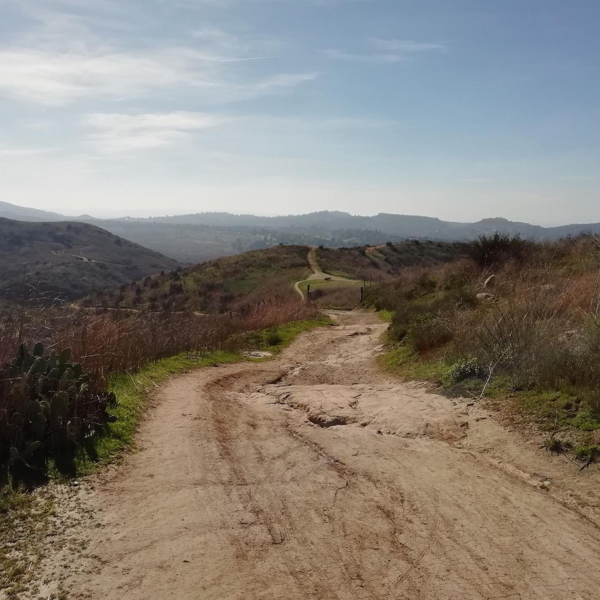
Lots of walkers/hikers/dogs in Peters Canyon, so be prepared for a slow cruise enjoying the scenery. There are some very steep hills if you want them but they can be avoided if you'd like.
0
0

This is the intersection of five trails: Raptor Ridge Trail, North Ridge Trail, Bovinian Delight Trail or Telegraph Canyon Road. There are also some boards with information about the trails and a restroom.
0
0

Bring plenty of water. There only are water fountains midway in Anaheim.
0
0

This view of Sierra Peak showcases one of the highest and most easily identifiable peaks in northern Orange County. It stands at 3,045 feet above sea level.
1
0

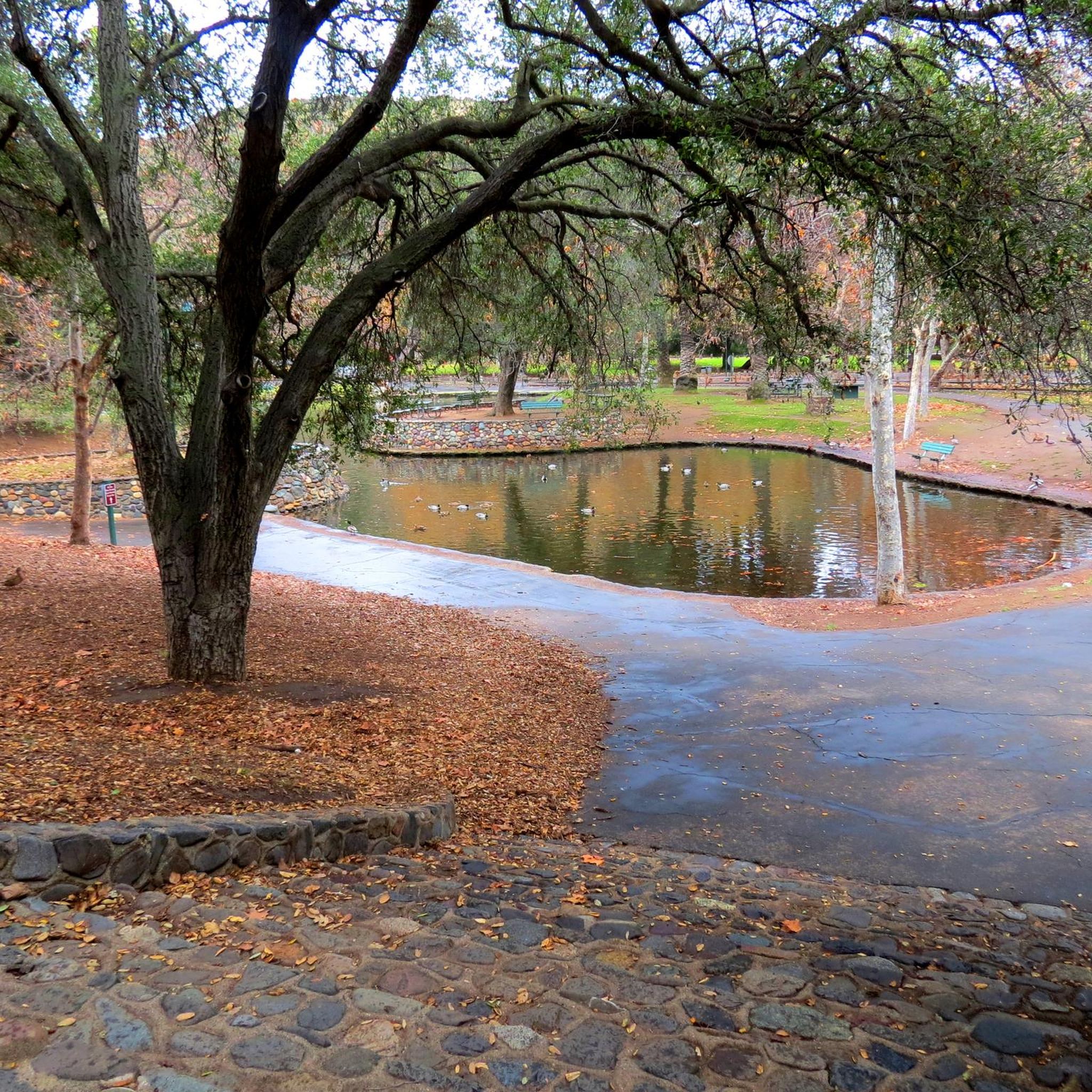
Carbon Canyon Regional Park is a great local park with a small lake and some nature trails featuring Redwoods and the Carbon Canyon Creek. It connects to the Chino Hills State Park and is a great spot for some quick day hiking, fishing, sports, or just sitting and enjoying some nature.
0
0
Irvine Park is a popular park outside Orange, CA. It is a family friendly park, with a lot of activities for kids, as well as restrooms and parking.
0
0
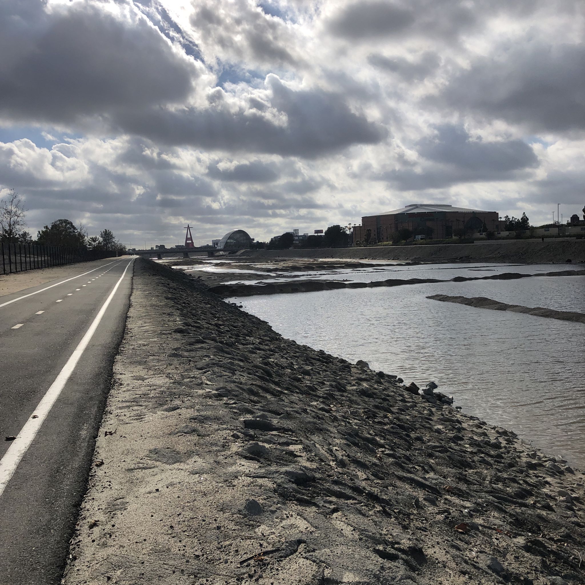
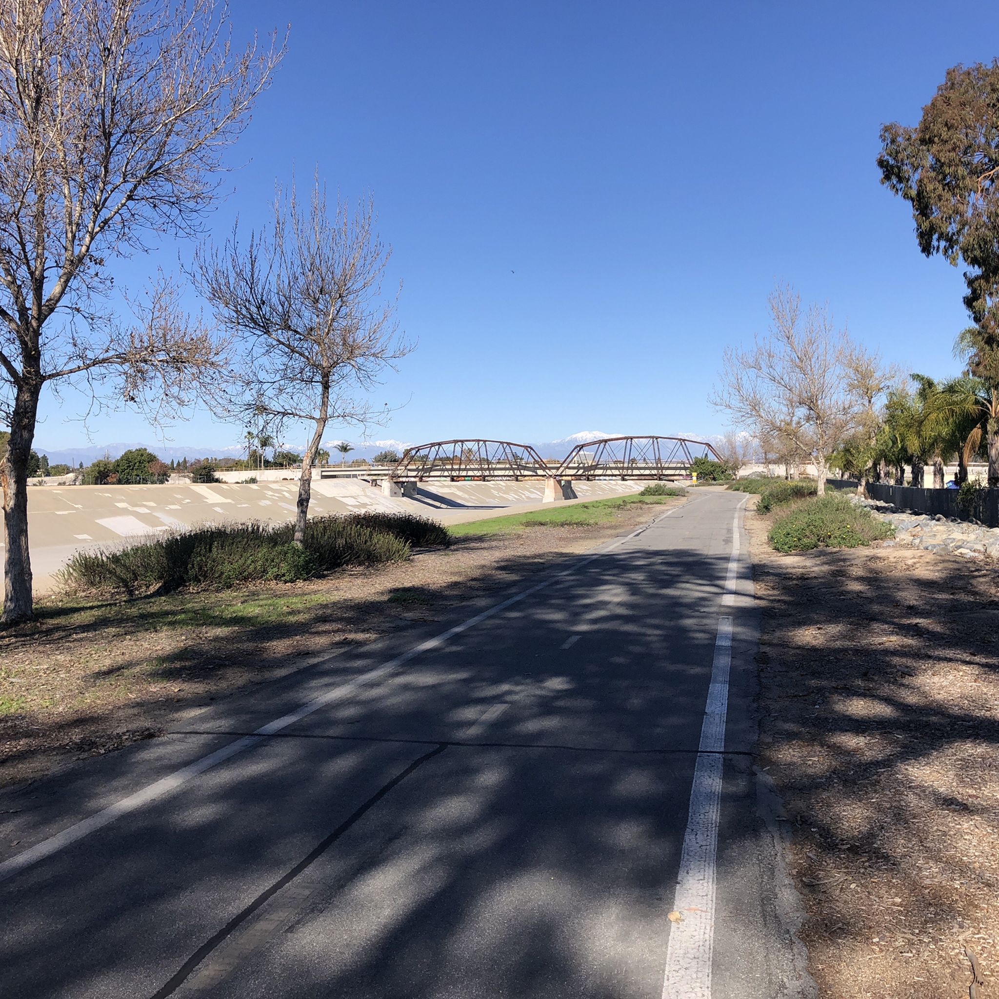
Nice wooden bridge along the Santa Ana River Trail. It takes you over the river and gives you a good view of the water.
1
0

Set along the edge of the Santa Ana Canyon this park offers visitors a variety of amenities such as sports fields, picnic & BBQ areas, fishing, playgrounds, and more. The Santa Ana Trail runs along the edge of the park and allows you to access other nearby areas as well.
0
0
Frequently Asked Questions
What kind of terrain can I expect on gravel bike trails around Villa Park?
The gravel bike trails in and around Villa Park feature a diverse landscape, primarily consisting of multi-use paths that are often former rail-to-trail conversions. You'll find significant stretches of hard-packed crushed limestone or gravel, alongside some paved sections. The terrain is generally flat to gently rolling, traversing tree-lined paths, suburban areas, and natural forest preserves.
Are there any beginner-friendly gravel biking routes in the Villa Park area?
While many routes in the immediate Villa Park area are rated moderate to difficult, the region's extensive network of multi-use trails, like sections of the Illinois Prairie Path, offers generally flat and accessible gravel surfaces suitable for beginners. These trails provide a great way to get started with gravel biking, though specific beginner-rated komoot tours might be found slightly further afield.
What are some challenging gravel bike routes for experienced riders near Villa Park?
For experienced gravel bikers seeking a challenge, routes like the Black Star Falls – Native American Village loop from Santiago Canyon College offer significant elevation gain over 33.2 miles. Another demanding option is the Sierra Peak Summit – View of Sierra Peak loop from A, a 33.9-mile path with challenging climbs and expansive views. These routes are rated difficult and provide a rigorous experience.
Are there any circular gravel bike routes around Villa Park?
Yes, there are several circular gravel bike routes available. For instance, the View of Sierra Peak – Barham Ridge Trail viewpoint loop from Santiago Canyon College is a 43.2-mile circular trail that leads through varied terrain with substantial elevation. Another option is the Santiago Creek Trail – Roadrunner Loop trailhead loop from Orange Park Acres, a moderate 21.7-mile loop.
What natural features or attractions can I see along the gravel trails?
The trails around Villa Park offer diverse scenery. The Illinois Prairie Path features tree-lined paths and segments of original prairies. The Salt Creek Trail winds through forest preserves and natural areas, offering shaded canopies, open prairies, and opportunities for wildlife viewing. Nearby, Waterfall Glen Forest Preserve boasts diverse ecosystems, including woodlands and prairies, and features the Rocky Glen waterfall and Sawmill Creek bluff overlook. You might also encounter highlights like the Santa Ana River Trail or the Santa Ana River Trail at Yorba Regional Park.
Are there any routes that pass by lakes or water features?
Yes, some routes and nearby areas feature lakes and water. The Salt Creek Trail runs along Salt Creek, offering views of the water. Additionally, nearby Twin Lakes Park offers fishing opportunities, and Hidden Lake Forest Preserve provides opportunities for picnicking and water activities. You can also find highlights like Upper Peters Canyon Reservoir or the Lake View Trail in the vicinity.
What is the best time of year for gravel biking in Villa Park?
Gravel biking in Villa Park is enjoyable across multiple seasons. Spring and fall offer pleasant temperatures and vibrant scenery, with changing foliage in autumn. Summer can be warm, but many trails are tree-lined, providing shade. Winter conditions can vary, so it's advisable to check local weather and trail conditions for ice or snow, especially on unpaved sections.
Are there any long-distance gravel trails accessible from Villa Park?
Yes, Villa Park provides excellent access to long-distance gravel trails. The Illinois Prairie Path spans over 60 miles, with substantial crushed limestone sections, and connects to the Fox River Trail for even longer rides. The Great Western Trail, primarily a crushed stone path, also offers extended riding options, especially its western section which runs for 18 miles through rural townships and prairies.
What do other gravel bikers say about the trails in Villa Park?
The gravel biking routes in Villa Park are highly regarded by the komoot community, with an average score of 5.0 stars. Over 55 gravel bikers have used komoot to explore the varied terrain, often praising the diverse landscapes, from tree-lined paths to natural forest preserves, and the well-maintained crushed limestone surfaces.
Are there options for parking near the gravel bike trails?
Yes, many of the major trailheads and forest preserves in and around Villa Park offer designated parking areas. For instance, access points along the Illinois Prairie Path, Salt Creek Trail, and Great Western Trail, as well as places like Waterfall Glen Forest Preserve, typically have parking facilities available for visitors.
Can I access gravel trails in Villa Park using public transport?
Villa Park's location within the broader Chicago metropolitan area means that some trails, particularly the Illinois Prairie Path, may be accessible via public transport connections, especially Metra train lines that run through or near towns along the trail. It's recommended to check specific public transport routes and their proximity to trail access points for the most accurate information.
Most popular attractions around Villa Park

Get inspired with the komoot mobile app


Explore more
Browse the best Gravel rides in other regions.
