The best running trails around Area H (Canim Lake/Forest Grove)
5.0
(1)
37
runners
3
runs
Jogging around Area H (Canim Lake/Forest Grove) offers diverse landscapes for outdoor activity. The region is characterized by its abundant lakes, such as Canim Lake, extensive forest environments, and notable waterfalls like Helmcken Falls. Jogging routes here often feature serene lake shorelines, dense Douglas-fir forests, and trails that follow the Canim River. The area provides a variety of running experiences, from gentle paths to more challenging routes with elevation changes.
Best jogging routes around Area H (Canim Lake/Forest Grove)
- The…
Last updated: July 10, 2026
5.0
(1)
21
runners
7.94km
00:59
70m
70m
Moderate run. Good fitness required. Mostly paved surfaces. Suitable for all skill levels.
6
runners
14.9km
02:16
360m
360m
Hard run. Very good fitness required. Sure-footedness, sturdy shoes and alpine experience required.

Sign up for free
4
runners
9.94km
01:11
40m
40m
Moderate run. Good fitness required. Mostly paved surfaces. Suitable for all skill levels.
4
runners
11.3km
01:20
50m
50m
Moderate run. Good fitness required. Mostly paved surfaces. Suitable for all skill levels.
2
runners
6.61km
00:45
60m
60m
Moderate run. Good fitness required. Mostly paved surfaces. Suitable for all skill levels.
Our route recommendations are based on thousands of hikes, rides, and runs completed by other people on komoot.
Start today with a free account
Your next adventure awaits.
Login or Signup
Popular around Area H (Canim Lake/Forest Grove)
Tips from the Community

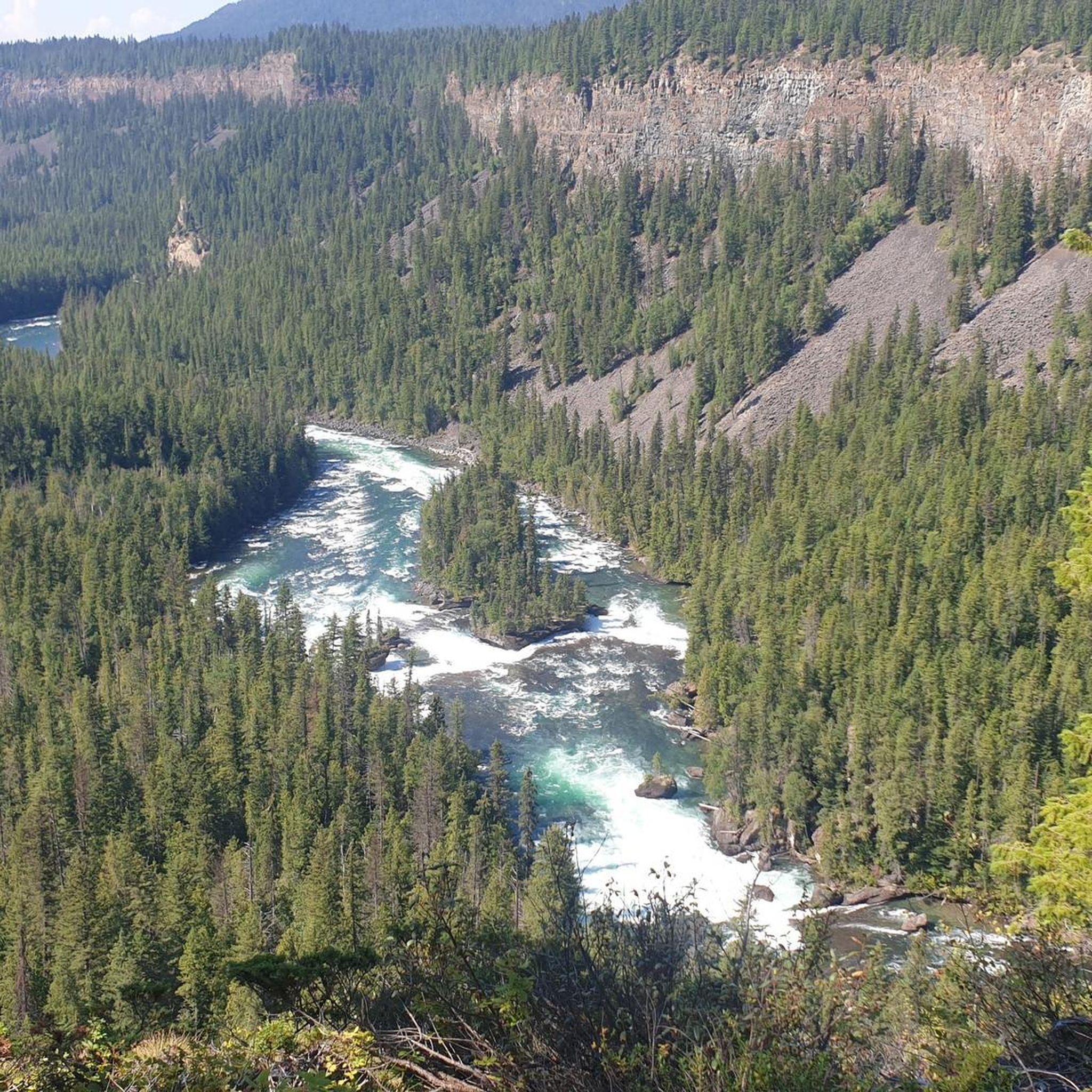
The Murtle River has to be one of the most scenic rivers in all of Canada. Getting its start at the foot of a glacier in the Cariboo Mountains the Murtle River is the largest tributary of the Clearwater River. Along its short 36-kilometre run the Murtle River has seven named waterfalls, including the iconic Helmcken Falls in Wells Gray Provincial Park. Thankfully there are trails tracing along the course of the river by much of its route so you can get out and enjoy this short, but stunning, river.
0
0
At over 140 metres tall, it's easy to see why Helmcken Falls was one of the main reasons for the formation of Wells Gray Provincial Park. While the spectacular waterfall is a main draw during the busy summer season, the area is also popular with ice climbers during winter and the falls are known as the "Yosemite of ice climbing".
1
0

The hike to Helmcken Falls starts from its own parking lot, located directly on the 30-mile bend.
0
0

The rather steep climb is rewarded with a sensational view over seemingly endless forests.
1
0

A beautiful waterfall, easily reachable on a trail. Quite lonely!
1
0
Frequently Asked Questions
How many running routes are available in Area H (Canim Lake/Forest Grove)?
Area H (Canim Lake/Forest Grove) offers a variety of running experiences, with 3 routes detailed in this guide. These routes cater to different preferences, from moderate loops to more challenging trails.
Are there running routes for all skill levels in Area H?
Yes, the running routes in Area H (Canim Lake/Forest Grove) cater to various skill levels. You'll find 2 moderate routes and 1 difficult route, ensuring options for both casual joggers and those seeking a more challenging run.
What natural features or landmarks can I see while running in Area H?
The region is rich in natural beauty. Many running routes offer views of stunning lakes like Canim Lake, and you can also encounter impressive waterfalls. For example, the Helmcken Falls loop from Rim Trail provides views of Helmcken Falls. Other notable waterfalls in the broader area include Mahood Falls and Hendrix Creek Falls, often dramatic during spring runoff.
Are there any circular running trails in Area H (Canim Lake/Forest Grove)?
Yes, several routes in the area are circular, allowing you to start and end at the same point. Examples include the Helmcken Falls loop from Rim Trail, the Osprey Lookout loop from Clearwater River, and the Sepa Lake – 108 Mile Lake loop from 108 Heritage Site.
What is the best time of year for running in Area H?
The region is beautiful year-round, but spring and summer are particularly popular for running due to pleasant weather and lush scenery. Spring runoff makes waterfalls especially impressive. However, many trails, including logging roads, can be accessed in winter, offering a different, serene experience.
Are there any family-friendly running trails in the Canim Lake/Forest Grove area?
While specific family-friendly routes aren't detailed in this guide, the region offers diverse terrain. Ruth Lake Lodge Resort, for instance, features groomed trails that are generally easy and accessible, making them suitable for families. The easy Canim Falls Trail in Wells Gray Provincial Park is another option for a less strenuous outing.
Can I bring my dog on the running trails in Area H?
Many outdoor areas in British Columbia are dog-friendly, especially on trails outside of highly protected zones. Logging roads and less formal trails are often suitable for dogs. However, it's always best to check specific park regulations, such as those for provincial parks like Canim Beach or Wells Gray, regarding pets on trails.
Are there running routes that offer views of lakes?
Absolutely. Canim Lake is a central feature of the area, and many routes offer serene views along its shoreline. Other nearby lakes like Ruth Lake and Greenlee Lake also contribute to the tranquil waterscapes, providing picturesque backdrops for your run.
What do other runners enjoy most about jogging in Area H (Canim Lake/Forest Grove)?
The area is highly rated by the komoot community, with an average score of 5.0 stars. Runners often praise the diverse landscapes, from serene lake shorelines to dense Douglas-fir forests, and the opportunity to encounter impressive natural features like waterfalls.
Are there any longer, more challenging running routes in the area?
Yes, for those seeking a more challenging run, the Osprey Lookout loop from Clearwater River is a difficult 9.3 miles (14.9 km) path with significant elevation changes, providing scenic vistas over the river and surrounding natural features.
Where can I find parking for running trails near Forest Grove?
Parking availability varies by trail. For routes like the Sepa Lake – 108 Mile Lake loop, you can often find parking near the 108 Heritage Site. For trails within provincial parks or near specific attractions like Canim Falls, designated parking areas are usually available. It's advisable to check specific route details for precise parking information.
Are there any running routes that pass through unique forest environments?
Yes, the region is known for its diverse forest environments. Many routes, especially around Canim Lake, take you through beautiful Douglas-fir forests typical of the Cariboo Basin. The extensive network of trails and logging roads also allows for deep immersion into the wilderness.
Most popular routes around Area H (Canim Lake/Forest Grove)
Most popular attractions around Area H (Canim Lake/Forest Grove)

Get inspired with the komoot mobile app


Explore more
Browse the best Running Trails & Routes in other regions.
