The best walks and hikes around Saint-Sernin-Sur-Rance
4.4
(48)
126
hikers
15
hikes
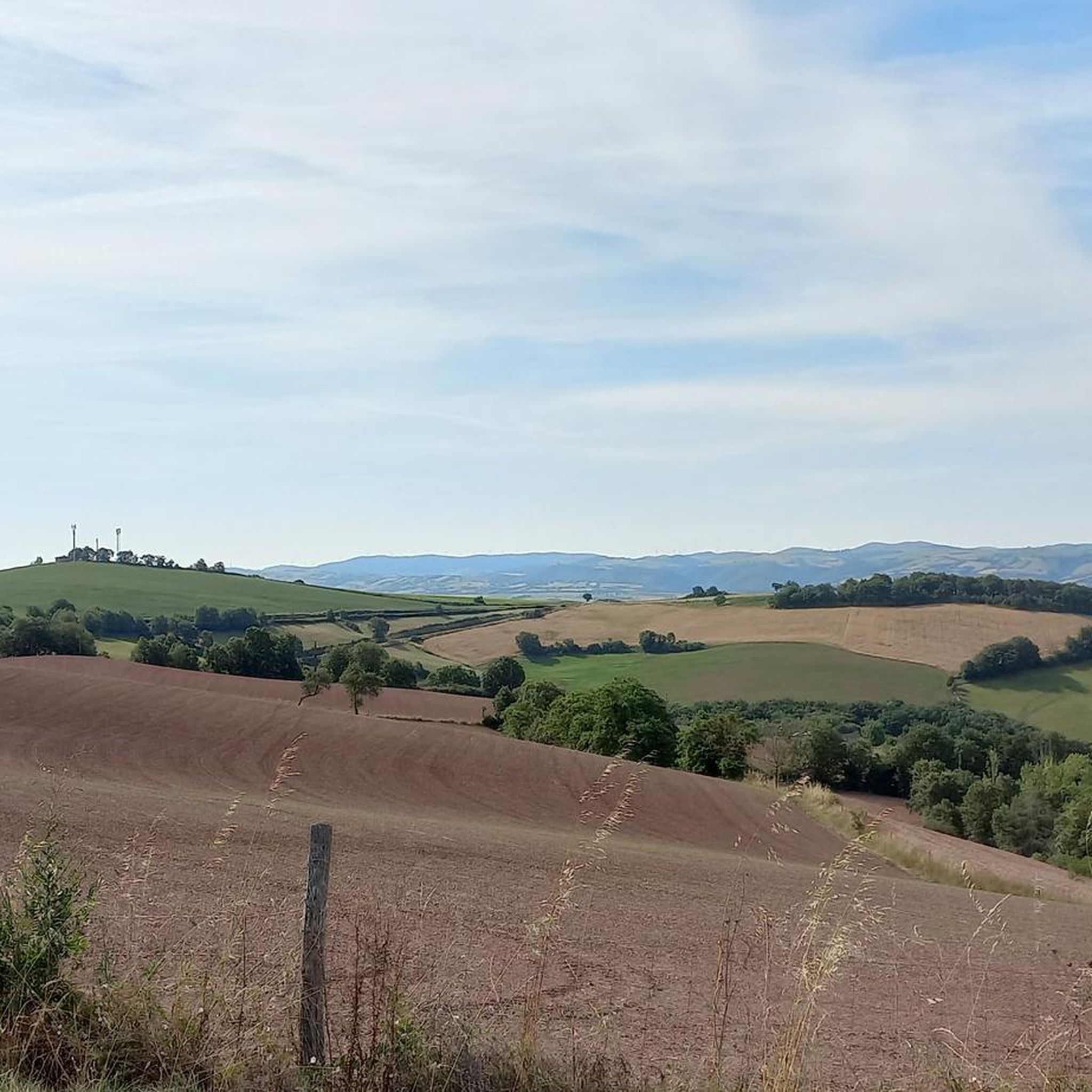
Hiking around Saint-Sernin-Sur-Rance offers exploration within the Regional Natural Park of the Grands Causses in Aveyron. The area features a diverse terrain of valleys, plateaus, and forests, including extensive chestnut groves. Rivers like the Rance and Merdanson shape the landscape, with paths often following their banks. The region also includes distinctive red earth landscapes in the Rougier de Camarès.
Best hiking trails around Saint-Sernin-Sur-Rance
- The most popular hiking route is Combret Medieval Village loop from Pousthomy, a 9.0 miles (14.5 km) moderate trail that takes 4 hours 20 minutes to complete. This route passes through charming villages and offers views of the Rance valley.
- Another top favourite among local hikers is Combret Medieval Village loop from Combret, a moderate 10.4 miles (16.7 km) path. This trail explores diverse landscapes around the medieval village of Combret.
- Local hikers also love the Hiking loop from La Bastide-Solages, a 4.0 miles (6.4 km) trail leading through varied terrain, often completed in about 1 hour 55 minutes.
- Hiking around Saint-Sernin-Sur-Rance is defined by river valleys, plateaus, and dense forests, with historical elements like ancient statues and medieval architecture. The network offers options for different ability levels, from easy walks to moderate hikes with elevation changes.
- The routes in Saint-Sernin-Sur-Rance are highly rated by the komoot community with an average score of 4.5 stars from more than 40 reviews. More than 100 hikers have used komoot to explore Saint-Sernin-Sur-Rance's varied terrain.
Last updated: July 10, 2026
5.0
(3)
10
hikers
14.5km
04:20
460m
460m
Moderate hike. Good fitness required. Easily-accessible paths. Suitable for all skill levels.
5.0
(3)
12
hikers
16.7km
04:58
500m
500m
Moderate hike. Good fitness required. Easily-accessible paths. Suitable for all skill levels.

Sign up for free
1.5
(2)
4
hikers
6.51km
01:57
210m
210m
Easy hike. Great for any fitness level. Easily-accessible paths. Suitable for all skill levels.
4.5
(2)
8
hikers
8.14km
02:26
240m
230m
Moderate hike. Good fitness required. Easily-accessible paths. Suitable for all skill levels.
7
hikers
8.88km
02:42
310m
310m
Moderate hike. Good fitness required. Easily-accessible paths. Suitable for all skill levels.
Get access to more routes and recommendations from other explorers.
Sign up for free
Already have an account?
Our route recommendations are based on thousands of hikes, rides, and runs completed by other people on komoot.
Start today with a free account
Your next adventure awaits.
Login or Signup



Tips from the Community

Here you can sit comfortably and enjoy the panoramic view.
0
0

Saint-Sernin-sur-Rance is a small village with a rich architectural heritage with four listed buildings: the collegiate church, the town hall and two houses. The Saint-Martin hill offers a lovely view of the village.
1
0

Small city of character built on a particularly narrow rocky outcrop on a meander of the Rance. Pretty red sandstone houses and steep little streets.
1
0

Medieval village which is still quite preserved. For the moment...
0
0
Frequently Asked Questions
How many hiking trails are available around Saint-Sernin-Sur-Rance?
The area offers over 15 hiking routes, ranging from easy walks to more challenging moderate trails. These paths explore the diverse landscapes of the Regional Natural Park of the Grands Causses.
Are there easy or family-friendly hiking options in Saint-Sernin-Sur-Rance?
Yes, Saint-Sernin-Sur-Rance has several easy trails suitable for families. A notable option is the Sentier du Salès, a very easy walk that explores the historic heart and riverside areas of Saint-Sernin-sur-Rance, showcasing historical elements like old bridges and dry stone walls. Another easy route is the Hiking loop from La Bastide-Solages.
What kind of landscapes can I expect to see while hiking here?
Hikers can explore a diverse terrain featuring valleys, plateaus, and forests, including abundant chestnut groves. The region is crisscrossed by rivers like the Rance and Merdanson, with paths often winding along their banks. You'll also encounter distinctive red earth landscapes in the Rougier de Camarès and the striking Oulas Gorges.
Are there any circular hiking routes available?
Yes, many of the trails in the region are circular. For example, you can explore the immediate surroundings of the village on the Saint-Sernin-sur-Rance loop from Saint-Sernin-sur-Rance, or enjoy scenic vistas on the View of the Miolles Valley loop from Miolles.
What historical or cultural sights can I discover on the trails?
The trails often incorporate rich historical and cultural elements. You can encounter medieval heritage in villages with narrow streets and half-timbered houses, such as Saint-Sernin-sur-Rance itself. The region is also known for its mysterious menhir statues, like the 'Dame de Saint-Sernin' (a copy is visible on the Sentier du Salès). The Sentier du Patrimoine specifically explores the village's history, botany, and heritage.
Are there any specific viewpoints or scenic spots along the hikes?
Yes, several trails offer panoramic views. The View of the Miolles Valley loop provides scenic vistas. Additionally, the site of Roquecezière, one of the highest points in Aveyron, offers expansive views, where on a clear day, the Pyrenees can be seen.
What do other hikers enjoy most about hiking in Saint-Sernin-Sur-Rance?
The area is highly rated by the komoot community, with an average score of 4.5 stars from over 40 reviews. Hikers often praise the diverse terrain, the tranquility of the natural environment, and the blend of natural beauty with historical discoveries along the paths.
Are there any specific attractions or villages to visit near the hiking routes?
Beyond the trails, you can explore the medieval character of Saint-Sernin-sur-Rance itself, with its 15th-century town hall and collegiate church. The Combret Medieval Village is another charming destination, and the nearby Coupiac castle is also worth a visit.
Is the area suitable for hiking with dogs?
While specific regulations for dogs on trails can vary, the natural environment of Saint-Sernin-Sur-Rance, with its extensive forests and riverbanks, generally offers good opportunities for hiking with dogs. It's always advisable to keep dogs on a leash, especially in areas with livestock or protected wildlife, and to check local signage for any specific restrictions.
What is the best time of year to go hiking in Saint-Sernin-Sur-Rance?
The region offers pleasant hiking conditions for much of the year. Spring and autumn provide mild temperatures and beautiful scenery, with spring bringing lush greenery and autumn showcasing vibrant fall colors. Summer is also popular, though it can be warmer, making early morning or late afternoon hikes ideal. Winter hikes are possible, but some paths might be muddy or require appropriate gear depending on conditions.
Are there any trails that feature waterfalls?
Yes, the region's diverse landscape includes areas with waterfalls. The 'Corniches du Tarn' in Fraissines, for instance, features 'balcony paths' that wind along steep slopes overlooking the Tarn and Aveyron valleys, known for their diverse vegetation, springs, and waterfalls.
Most popular routes around Saint-Sernin-Sur-Rance
Most popular attractions around Saint-Sernin-Sur-Rance

Get inspired with the komoot mobile app


Explore more
Browse the best Hikes in other regions.
