The best mountain hikes around La Roche-Sur-Le-Buis
5.0
(3)
26
hikers
2
hikes
Mountaineering routes around La Roche-Sur-Le-Buis offer access to the iconic Mont Ventoux region, characterized by its distinctive barren limestone summit and the surrounding forested slopes of the Baronnies Provençales Regional Natural Park. The terrain transitions from dense woodlands at lower elevations to more exposed, rocky landscapes closer to the peak. This area provides varied ascents and panoramic views across Provence.
Best mountaineering routes around La Roche-Sur-Le-Buis
- The most popular mountaineering route is Pass of Storms – Grand panorama loop from Mont Ventoux, an 8.6 miles (13.8 km) trail that takes 4 hours 27 minutes to complete, offering expansive views from the upper slopes.
- Another top favourite among local mountaineers is Summit of Mont Ventoux loop from Mont Ventoux, a moderate 5.9 miles (9.5 km) path. This route provides a direct experience of the summit's unique lunar-like landscape.
- Local mountaineers also love the Pass of Storms – Grand panorama loop from Chalet Reynard, a 9.7 miles (15.5 km) trail leading through forested sections and open, rocky terrain, often completed in about 5 hours 9 minutes.
- Mountaineering around La Roche-Sur-Le-Buis is defined by limestone peaks, forested slopes, and panoramic vistas. The network offers options for different ability levels, from moderate ascents to more challenging routes for experienced hikers.
- The routes in La Roche-Sur-Le-Buis are highly rated by the komoot community with an average score of 4.8 stars from more than 7 reviews. More than 35 mountaineers have used komoot to explore La Roche-Sur-Le-Buis's varied terrain.
Last updated: September 1, 2026
5.0
(1)
11
hikers
14.3km
04:37
620m
620m
Moderate mountaineering route. Good fitness required. Easily-accessible paths. Suitable for all skill levels.
5.0
(1)
10
hikers
15.6km
05:11
750m
750m
Hard mountaineering route. Very good fitness required. Easily-accessible paths. Suitable for all skill levels.

Sign up for free
5.0
(1)
5
hikers
9.22km
03:09
490m
490m
Moderate mountaineering route. Good fitness required. Easily-accessible paths. Suitable for all skill levels.
Our route recommendations are based on thousands of hikes, rides, and runs completed by other people on komoot.
Start today with a free account
Your next adventure awaits.
Login or Signup

Tips from the Community

From the summit of Ventoux, numerous viewpoints allow you to admire the natural parks of the Baronnies, Ventoux, or the Luberon. Here, you are facing the Écrins massif which literally unfolds before your eyes.
0
0

Spectacular view from this point.
8
0
The view from the top is sublime.
4
0
Finish line , if you see it, you've made it.
7
1

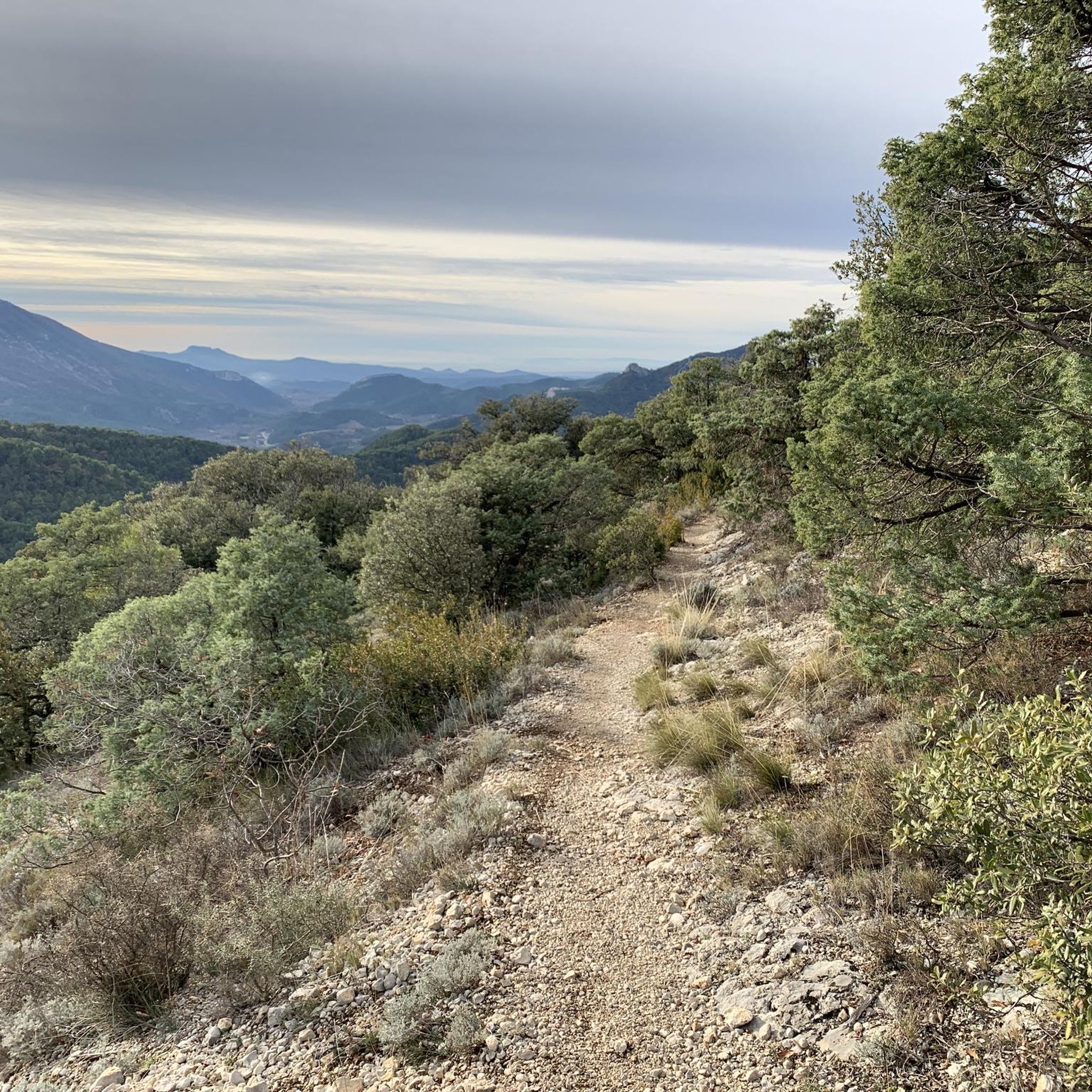
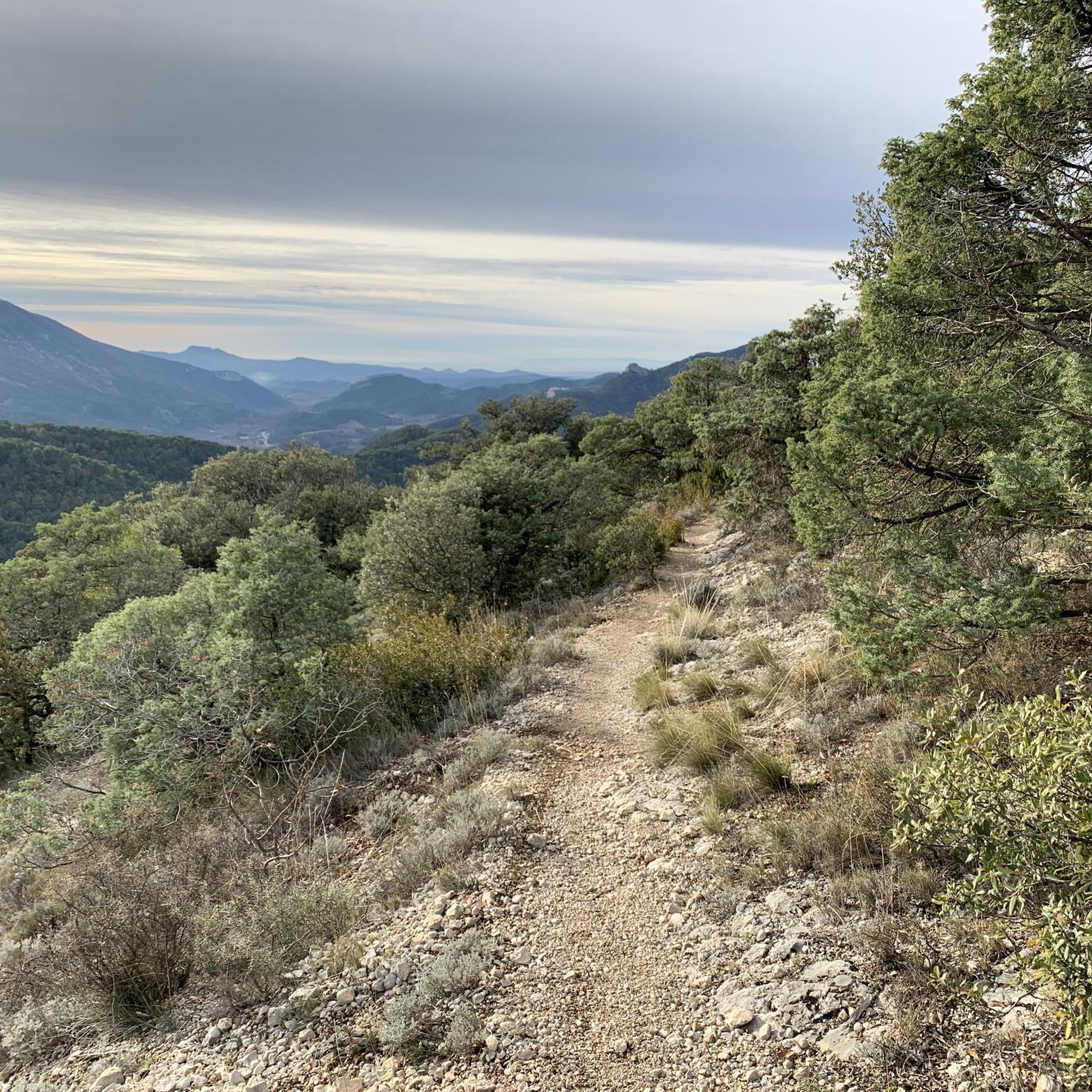
An iconic passage along the ridge, between scree and clearings. Here, you can breathe in the altitude and enjoy a first wide panorama towards the Baronnies and the Lure mountain.
0
0

Beautiful trails, I recommend it, but you need to be in good physical condition 😆🤪💪💪
0
0

Small Chapel with a panoramic view to the magnificent cross
1
0

The wind can be strong
0
0
Frequently Asked Questions
How many mountaineering routes are available around La Roche-Sur-Le-Buis?
There are currently 4 mountaineering routes listed around La Roche-Sur-Le-Buis, offering diverse experiences in the Mont Ventoux region. These routes cater to various skill levels, from moderate ascents to more challenging trails.
Are there any easy mountaineering routes for beginners in La Roche-Sur-Le-Buis?
While all listed routes are rated moderate to difficult, the Summit of Mont Ventoux loop from Mont Ventoux is a moderate 5.9 miles (9.5 km) path. It's a good option for those with some hiking experience looking to tackle Mont Ventoux and experience its unique lunar-like landscape.
Which mountaineering routes are most challenging for experienced hikers?
For experienced hikers seeking a challenge, the Pass of Storms – Grand panorama loop from Chalet Reynard is rated difficult. This 9.7 miles (15.5 km) trail involves significant elevation gain and takes around 5 hours 9 minutes to complete, offering a robust experience through forested sections and open, rocky terrain.
Are there any circular mountaineering trails in the area?
Yes, all the mountaineering routes listed for La Roche-Sur-Le-Buis are circular trails. For example, the Pass of Storms – Grand panorama loop from Mont Ventoux is an 8.6-mile (13.8 km) loop offering expansive views from the upper slopes.
What is the best time of year for mountaineering around La Roche-Sur-Le-Buis?
The best time for mountaineering in this region is typically from late spring to early autumn (May to October). During these months, the weather is generally more stable, and the trails are clear of snow. However, be prepared for strong winds and rapid weather changes, especially closer to the summit of Mont Ventoux.
What kind of natural attractions can I see along the mountaineering routes?
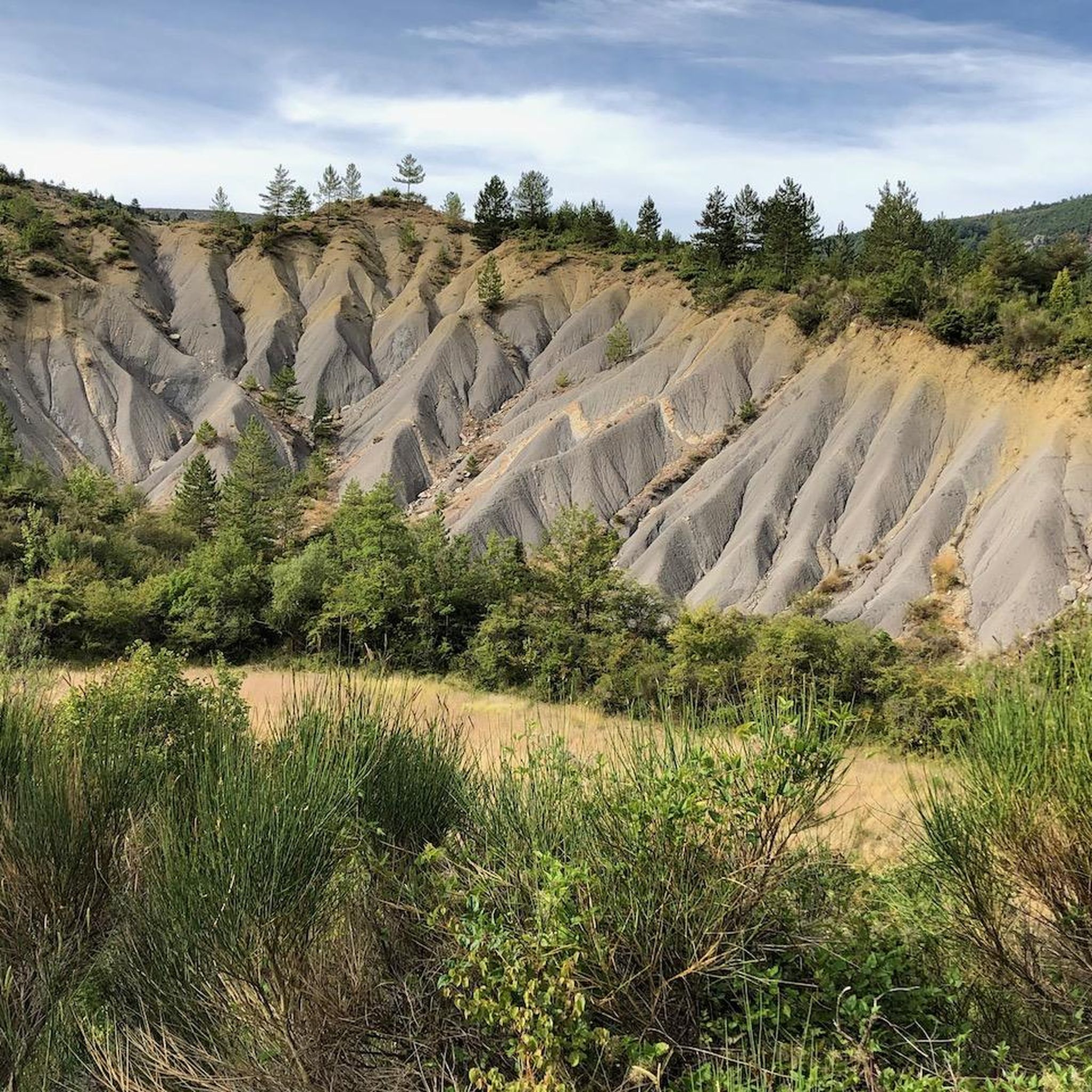
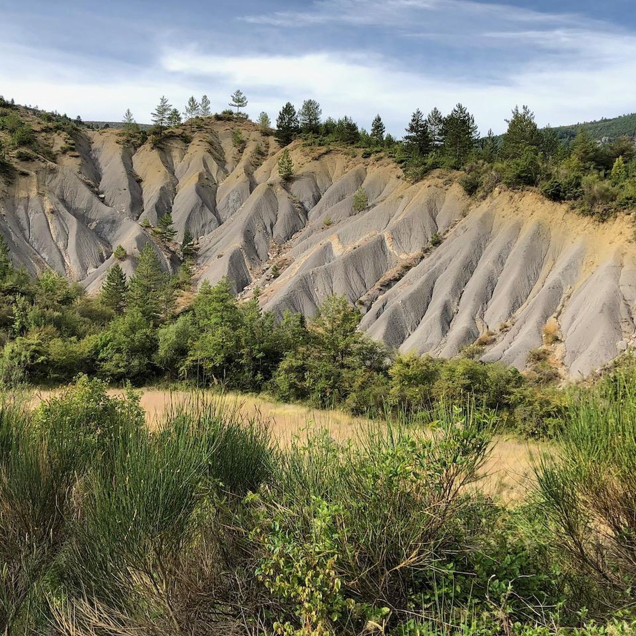
The routes offer access to stunning natural features. You can reach the iconic Mont Ventoux summit, explore the Entrance to the Toulourenc Gorges, or discover the Baume des Eyguiers Grotto. The region is rich in limestone formations and diverse landscapes.
Are there any specific landmarks or points of interest near the trails?
Beyond the natural beauty, you can encounter notable points like the Fontaube Pass, which offers scenic vistas. The Final 6 km to the summit of Mont Ventoux is also a significant landmark in itself, known for its challenging ascent and unique environment.
What do other mountaineers enjoy most about mountaineering in La Roche-Sur-Le-Buis?
The area is highly rated by the komoot community, with an average score of 4.8 stars from more than 7 reviews. Reviewers often praise the panoramic views from Mont Ventoux, the diverse terrain transitioning from forested slopes to rocky landscapes, and the overall sense of accomplishment from tackling these iconic ascents.
Are there any shorter mountaineering routes, perhaps around 3 hours?
The shortest listed mountaineering route is the Mountaineering loop from Mont Ventoux, which is 5.7 miles (9.2 km) long and typically takes around 3 hours 9 minutes to complete. This route offers a good option for a substantial half-day hike.
What are the typical conditions for winter mountaineering on Mont Ventoux?
Winter mountaineering on Mont Ventoux can be challenging. The summit is often covered in snow and ice, and strong winds are common. Conditions can change rapidly, requiring appropriate gear, experience, and careful monitoring of weather forecasts. Some roads to the summit may also be closed during winter.
Is there parking available at the trailheads for these routes?
Yes, the listed routes typically start from well-known access points like Mont Ventoux itself or Chalet Reynard, where parking facilities are generally available. It's advisable to arrive early during peak season to secure a spot.
Most popular routes around La Roche-Sur-Le-Buis
Most popular attractions around La Roche-Sur-Le-Buis

Get inspired with the komoot mobile app


Explore more
Browse the best Mountain Hikes & Routes in other regions.
