The best waterfall hikes and walks around Réserve naturelle des Aiguilles rouges
4.6
(8156)
106,828
hikers
55
hikes
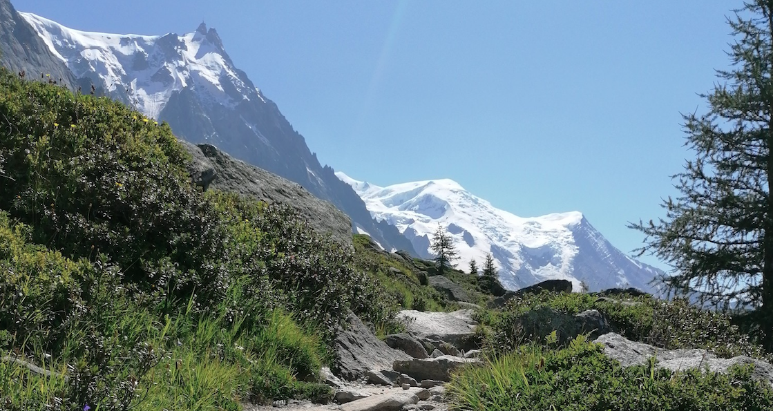
Waterfall hiking trails around Réserve naturelle des Aiguilles rouges traverse a dramatic alpine landscape characterized by siliceous and crystalline rock formations, offering views of the Mont Blanc massif. The region features a significant altitudinal stratification, transitioning from spruce and larch forests to rhododendron heaths, alpine meadows, and high-altitude mineral environments. Hikers can explore numerous moraine screes, around 17 lakes, and glaciers, with altitudes ranging from 1,200 m to 2,965 m. This diverse terrain provides a variety of hiking experiences amidst…
Last updated: July 9, 2026
4.8
(41)
714
hikers
19.8km
08:07
1,730m
1,730m
Hard hike. Very good fitness required. Mostly accessible paths. Sure-footedness required.
4.8
(4)
93
hikers
23.5km
11:59
1,970m
1,970m
Hike the difficult Mont Buet and Le Cheval Blanc Loop for 14.6 miles (23.5 km) with 6466 feet (1971 metres) of elevation gain and panoramic

Sign up for free
4.7
(15)
126
hikers
3.91km
01:23
190m
190m
Moderate hike. Great for any fitness level. Mostly accessible paths. Sure-footedness required.
5.0
(6)
34
hikers
10.6km
03:05
270m
270m
Moderate hike. Good fitness required. Mostly accessible paths. Sure-footedness required.
4.3
(3)
25
hikers
4.89km
01:24
120m
120m
Easy hike. Great for any fitness level. Easily-accessible paths. Suitable for all skill levels.
Get access to more routes and recommendations from other explorers.
Sign up for free
Already have an account?
Our route recommendations are based on thousands of hikes, rides, and runs completed by other people on komoot.
Start today with a free account
Your next adventure awaits.
Login or Signup
Popular around Réserve naturelle des Aiguilles rouges


Other adventures around Réserve naturelle des Aiguilles rouges


Tips from the Community

Located on the edge of a nature reserve, you can only bivouac near the refuge; it is forbidden above. Ask the warden. Dogs and drones are also forbidden in nature reserves.
1
0

idyllic campsite where tenting without caravans is the dominant activity
0
0

a very beautiful via ferrata for everyone, without vertigo
0
0

magnificent place near the Aiguilles Rouges reserve
0
0
Ideal place to recharge your batteries
0
0

Between the impressive waterfall, if you go to the end of the footbridge, you're guaranteed a shower. The Farinet cave, a historic site in the valley, where he made counterfeit money for the poorest, he was nicknamed the Robin Hood.
0
0

Beautiful scenery, must be especially nice in spring with all the melt water!
0
0
Frequently Asked Questions
How many waterfall hiking trails are available in Réserve naturelle des Aiguilles rouges?
There are over 60 waterfall hiking trails around Réserve naturelle des Aiguilles rouges. These routes traverse a dramatic alpine landscape, offering diverse experiences from moderate valley walks to demanding alpine ascents.
What makes waterfall hikes in Réserve naturelle des Aiguilles rouges unique?
The waterfall hikes in this region are unique due to the stunning alpine landscapes, characterized by siliceous and crystalline rock formations that appear red from iron oxidation. You'll find privileged views of the Mont Blanc massif and its glaciers, alongside a rich altitudinal stratification from spruce forests to rhododendron heaths and high-altitude mineral environments.
Are there easy waterfall hikes suitable for beginners or families?
Yes, there are several easier options. For instance, the La Poya – Sur-le-Rocher loop from Vallorcine is a moderate 2.4-mile (3.9 km) trail that offers a pleasant experience. The region features 2 easy and 27 moderate trails, providing choices for various fitness levels, including families looking for a less strenuous walk.
What kind of terrain can I expect on waterfall hikes in this region?
You can expect varied terrain, ranging from forested valleys and rhododendron heaths at lower elevations to more mineral environments higher up, featuring moraine scree and rocky paths. The trails often involve ascents through alpine meadows and can lead to high mountain passes, offering a true alpine hiking experience.
Are there any circular waterfall routes in Réserve naturelle des Aiguilles rouges?
Yes, several circular routes allow you to return to your starting point. A popular option is the La Poya – Bérard Waterfall loop from Le Buet, a 4.2-mile (6.8 km) trail that takes you through forested valleys to the Bérard Waterfall. Another is the Bérard Waterfall – Along the Eau de Bérard loop from Le Buet, a moderate 6.9-mile (11.1 km) route.
What other natural attractions can I see near the waterfall trails?
Beyond the waterfalls, the region is rich in natural beauty. You can explore around 17 high-altitude lakes, such as Lac Blanc and Lacs des Chéserys. There are also numerous mountain passes like Brévent Pass and Montets Pass, offering stunning panoramic views of the Mont Blanc massif.
What wildlife might I encounter on a waterfall hike?
The diverse habitats support a rich array of wildlife. Hikers often spot marmots, chamois, and ibex (bouquetins). In the skies, you might see golden eagles and nutcrackers, while ptarmigans inhabit higher areas. The spruce forests are home to woodpeckers and owls, adding to the natural experience.
What do other hikers say about the waterfall trails in Réserve naturelle des Aiguilles rouges?
The trails in Réserve naturelle des Aiguilles rouges are highly rated by the komoot community, with an average score of 4.5 stars from over 1,800 reviews. Hikers often praise the dramatic alpine scenery, the rewarding views of Mont Blanc, and the variety of trails available for different skill levels.
Can I bring my dog on the waterfall trails?
While many trails in the Réserve naturelle des Aiguilles Rouges are accessible, it's generally recommended to keep dogs on a leash, especially in a nature reserve, to protect wildlife and ensure a pleasant experience for all hikers. Always check specific trail regulations before heading out.
Is parking available near the trailheads for waterfall hikes?
Yes, parking is generally available near popular trailheads, such as at Col des Montets or Le Buet, which serve as common starting points for many hikes, including those leading to waterfalls. It's advisable to arrive early during peak season to secure a spot.
What is the best time of year to experience the waterfall trails?
The best time to experience the waterfall trails is typically from late spring to early autumn (June to September). During this period, the snow has usually melted at lower and mid-altitudes, trails are more accessible, and the weather is generally favorable. Spring offers the most powerful waterfalls due to snowmelt, while autumn provides vibrant foliage.
Are there specific viewpoints or landmarks to look out for?
Absolutely. Many trails offer unparalleled panoramic views, particularly of the Mont Blanc massif and its glaciers. Notable viewpoints include those from the various mountain passes like Montets Pass, and the stunning vistas from high-altitude lakes such as Lac Blanc.
Most popular routes around Réserve naturelle des Aiguilles rouges
Most popular attractions around Réserve naturelle des Aiguilles rouges

Get inspired with the komoot mobile app


Explore more
Browse the best Hikes in other regions.
