The best mountain hikes in Lauvitel
6
hikers
3
hikes
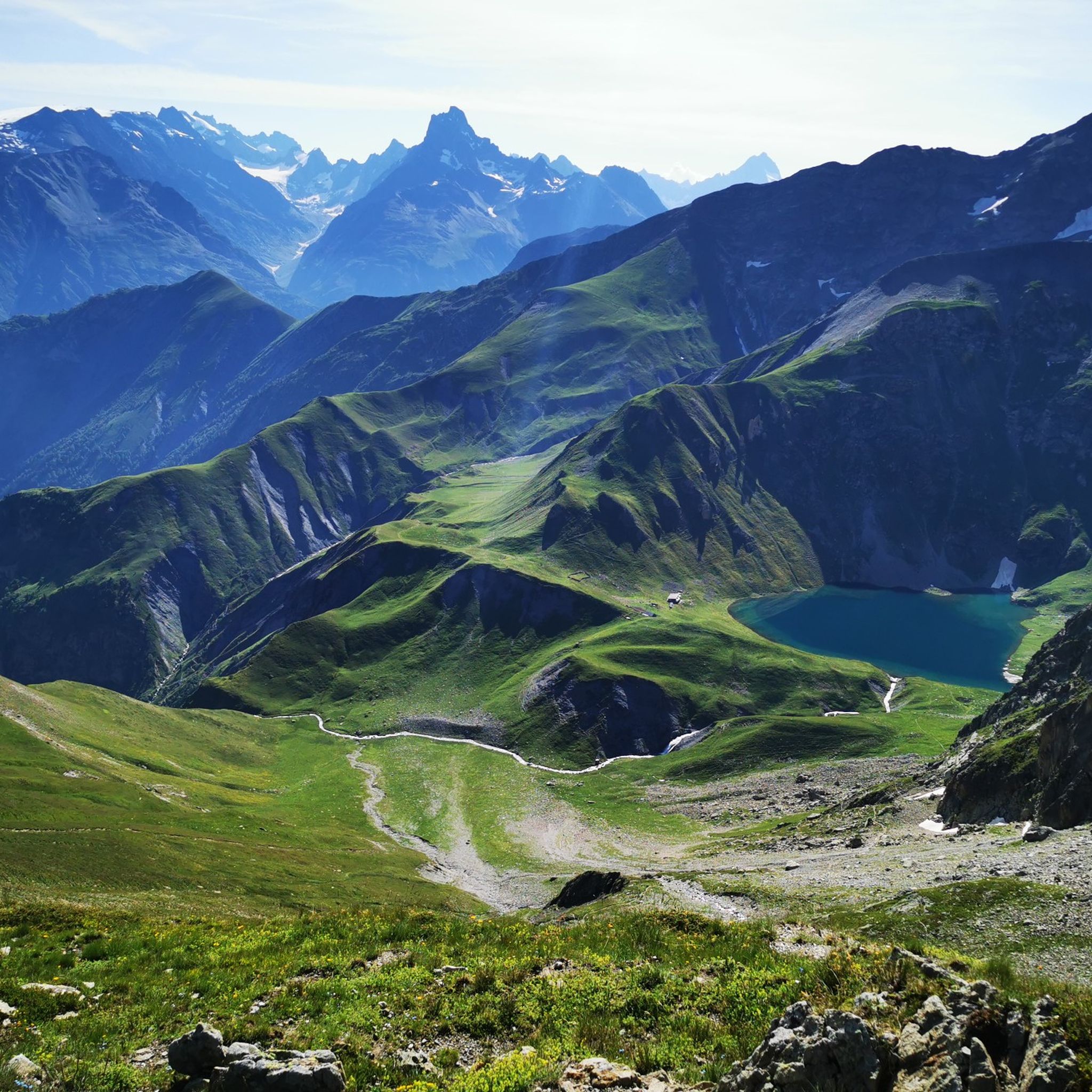
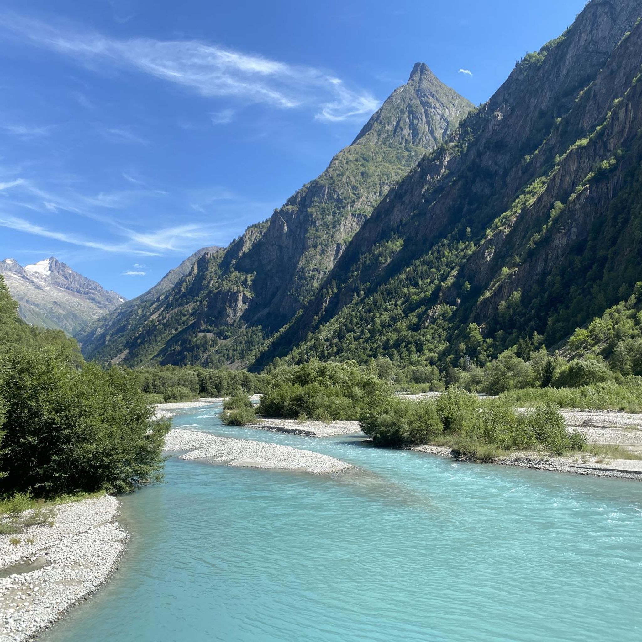
Mountaineering in Lauvitel offers access to the dramatic alpine landscapes of the Écrins National Park in the French Alps. The region is characterized by steep rocky slopes and towering peaks, many exceeding 3000 meters, including Rochail and Tête de la Muraillette. At its heart lies Lac du Lauvitel, the largest and deepest lake in the Écrins massif, surrounded by dense forests and the Vénéon valley, providing a diverse environment for alpine pursuits.
Best mountaineering routes in Lauvitel
- The most popular…
Last updated: July 4, 2026
2
hikers
4.75km
03:37
500m
490m
Hard mountaineering route. Good fitness required. Sure-footedness, sturdy shoes and alpine experience required.
3
hikers
10.0km
03:29
450m
450m
Moderate mountaineering route. Good fitness required. Mostly accessible paths. Sure-footedness required.

Sign up for free
1
hikers
10.1km
04:05
590m
590m
Moderate mountaineering route. Good fitness required. Mostly accessible paths. Sure-footedness required.
Our route recommendations are based on thousands of hikes, rides, and runs completed by other people on komoot.
Start today with a free account
Your next adventure awaits.
Login or Signup
Tips from the Community

The climb up to the town is great but the place itself is a bit of an over-commercialised, purpose-built tourist trap. Enjoy the climb, grab a coffee then get out of there!
0
0

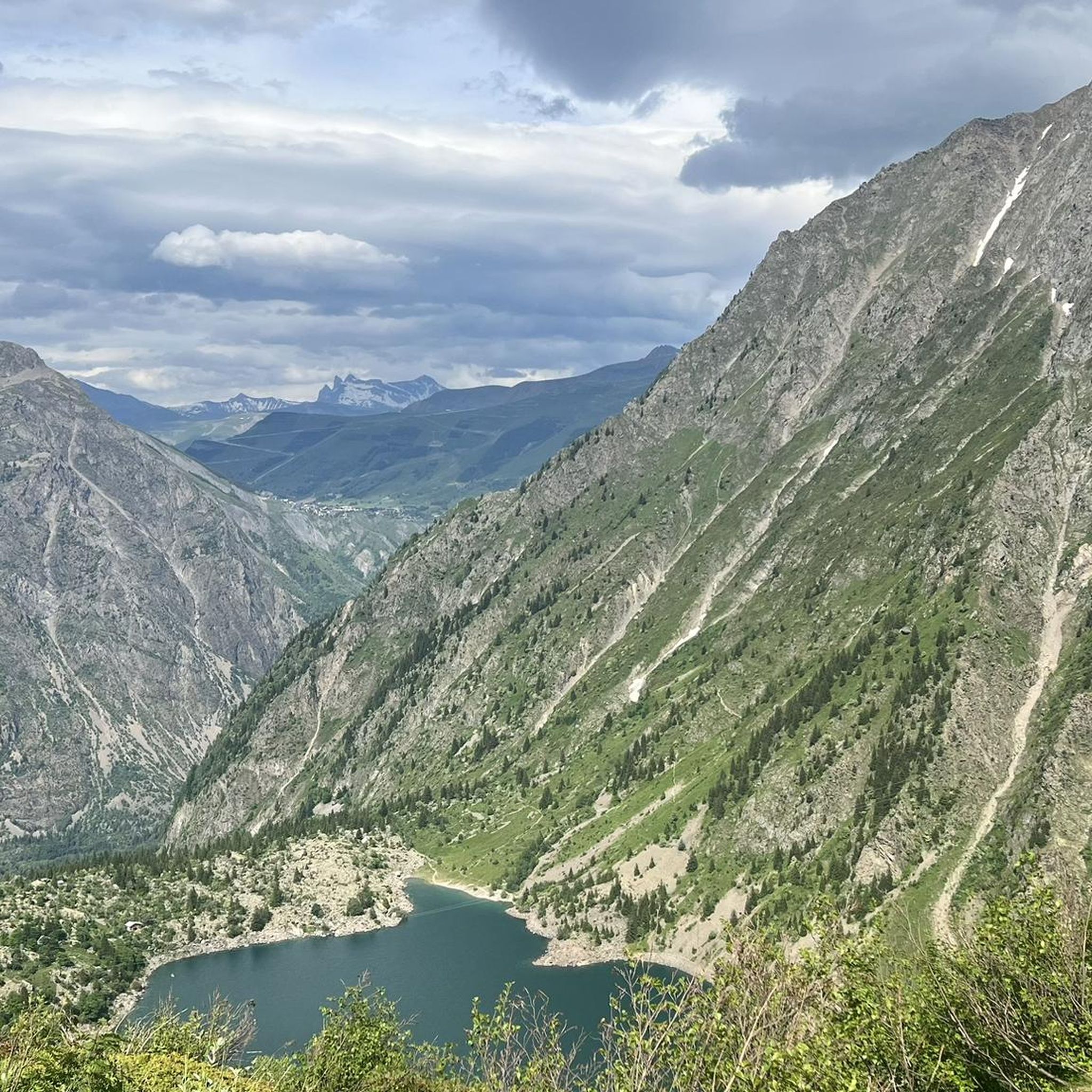
Not far from the Deux Alpes resort, the view of Lake Chambon is magnificent, with the peaks of the Arves massif in the background.
0
0

Location where one of the largest ski areas in all of France is located, Les Deux Alpes are famous in the cycling world due to a famous victory by Marco Pantani in the 1998 Tour. The Pirate attacked on the Galibier and arrived alone on the finish line of Les Deux Alpes, where he won the stage and wore the first yellow jersey of his career.
1
0
Frequently Asked Questions
What types of mountaineering routes can I find in Lauvitel?
Lauvitel offers a diverse range of mountaineering routes within the Écrins National Park, catering to various skill levels. You'll find everything from moderate ascents, such as the Lake Lauvitel loop from La Danchère, to challenging multi-hour expeditions like the Muzelle Refuge – Lake Lauvitel loop from Venosc. The landscape features steep rocky slopes, towering peaks, and alpine lakes, with paths often winding through forests and along the Vénéon valley.
Are there any beginner-friendly mountaineering routes in Lauvitel?
While mountaineering in Lauvitel generally involves significant elevation, there are moderate options suitable for those with some experience looking to progress. The Lake Lauvitel loop from La Danchère is a moderate 6.6 km route with about 549 meters of elevation gain, offering stunning views of Lac du Lauvitel without extreme technical difficulty. Another moderate option is the Les Perrons loop from Les Deux Alpes, which is shorter at 4.6 km with 248 meters of ascent.
What are some challenging mountaineering routes in the Lauvitel area?
For experienced mountaineers seeking a challenge, Lauvitel provides several demanding routes. The Muzelle Refuge – Lake Lauvitel loop from Venosc is a difficult 20.9 km path with over 1700 meters of elevation gain, traversing high alpine terrain. Another difficult option is the Waterfall – Muzelle Refuge loop from Champ du Moulin, covering 13.3 km with 1230 meters of ascent, often taking over 7 hours to complete.
Are there any circular mountaineering routes around Lauvitel?
Yes, many of the mountaineering routes in Lauvitel are designed as loops, allowing you to experience diverse scenery without retracing your steps. Popular circular options include the Lake Lauvitel loop from La Danchère, the challenging Muzelle Refuge – Lake Lauvitel loop from Venosc, and the scenic Waterfall – Muzelle Refuge loop from Champ du Moulin. These loops offer varied alpine landscapes, from lakeside paths to high mountain passes.
What natural features or landmarks can I expect to see on mountaineering routes in Lauvitel?
Mountaineering in Lauvitel offers breathtaking natural features. You'll encounter the expansive Lac du Lauvitel, the largest and deepest lake in the Écrins massif, often surrounded by dense forests. Routes frequently pass through the scenic Vénéon valley, known for its river walks, rocky outcrops, and sandy paths. The landscape is dominated by towering peaks like Rochail and Tête de la Muraillette, providing dramatic alpine backdrops. Keep an eye out for alpine flora such as martagon lilies and spotted orchids, and you might even spot marmots.
What is the best time of year for mountaineering in Lauvitel?
The best time for mountaineering in Lauvitel is typically during the warmer months, from late spring to early autumn (roughly June to September), when trails are generally free of snow and weather conditions are more stable. This period allows for access to higher alpine terrain and offers the most favorable conditions for enjoying the region's diverse flora and fauna. Always check local weather forecasts and trail conditions before heading out, as alpine weather can change rapidly.
What are the regulations for mountaineering in Écrins National Park, particularly regarding dogs?
As Lauvitel is nestled within the Écrins National Park, visitors must adhere to specific regulations to preserve its exceptional natural environment. This includes staying on marked paths, proper waste disposal, and refraining from picking flowers. Dogs are generally prohibited within the core zone of the national park, which includes many mountaineering areas around Lauvitel, to protect wildlife. Always check the latest park regulations before your visit.
Are there any places to explore near the mountaineering routes in Lauvitel?
Beyond the mountaineering routes themselves, the Lauvitel area offers charming spots to explore. The village of La Danchère, often a starting point for tours, features the picturesque Danchère Chapel. The Vénéon valley provides magical river walks through forests and past rocky outcrops. For those interested in the natural environment, the Lauvitel nature reserve, adjacent to the lake, is a protected area for scientific study of its untouched flora and fauna, though access might be restricted to marked paths.
What do other mountaineers say about their experience in Lauvitel?
The mountaineering routes in Lauvitel are highly rated by the komoot community, with an average score of 4.3 stars from over 9 reviews. Many of the 70+ mountaineers who have explored the area praise the dramatic alpine landscapes, the stunning views of Lac du Lauvitel, and the diverse terrain that ranges from dense forests to high mountain passes. The variety of routes, from moderate to difficult, is also frequently highlighted as a positive aspect.
How long do mountaineering routes in Lauvitel typically take?
The duration of mountaineering routes in Lauvitel varies significantly based on distance, elevation gain, and difficulty. For instance, a moderate route like the Lake Lauvitel loop from La Danchère typically takes around 3 hours and 25 minutes. More challenging routes, such as the Muzelle Refuge – Lake Lauvitel loop from Venosc, can take over 11 hours due to their length (20.9 km) and significant elevation gain (1737 m). Always check the estimated duration for your chosen route and factor in your own fitness level and breaks.
Is public transport available to access mountaineering trailheads in Lauvitel?
While specific public transport details for every trailhead are not always readily available, the Lauvitel region, being part of the Écrins National Park, often has limited public transport options directly to remote trailheads. Villages like Venosc and La Danchère, which serve as starting points for some routes, may be accessible by local bus services, especially during peak season. However, for ultimate flexibility and access to all trailheads, a car is often recommended. Always check local transport schedules in advance.
Are there any waterfalls to see on the mountaineering routes in Lauvitel?
Yes, the alpine environment of Lauvitel, with its steep terrain and glacial meltwater, features several impressive waterfalls. The Waterfall – Muzelle Refuge loop from Champ du Moulin explicitly highlights a waterfall as a key feature of the route, offering a scenic reward during your mountaineering adventure. You'll likely encounter other cascades and streams along various paths, especially during spring and early summer when snowmelt is abundant.

Get inspired with the komoot mobile app


Explore more
Browse the best Mountain Hikes & Routes in other regions.
