The best mountain hikes around Lac de Monteynard-Avignonet
4.8
(8)
36
hikers
3
hikes
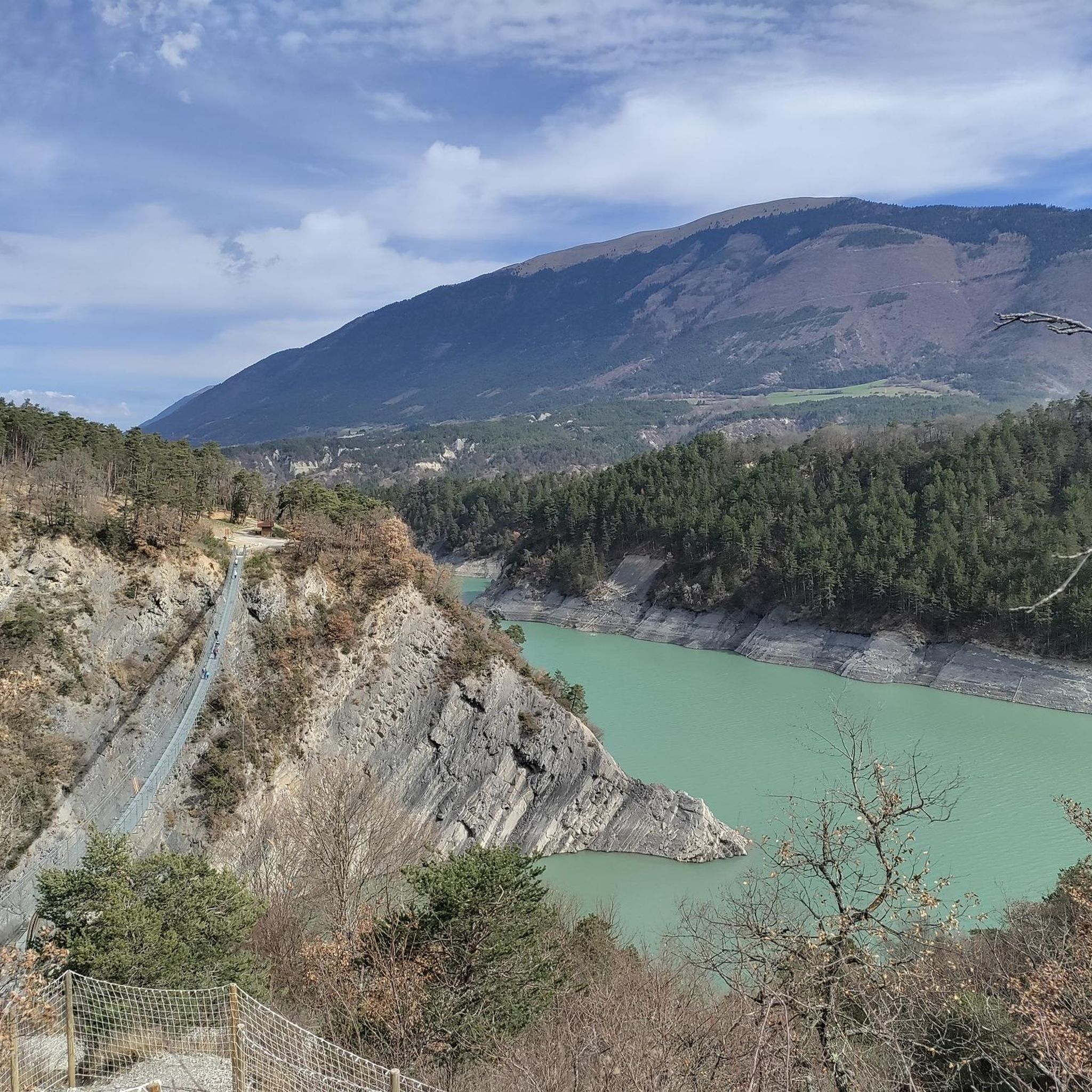
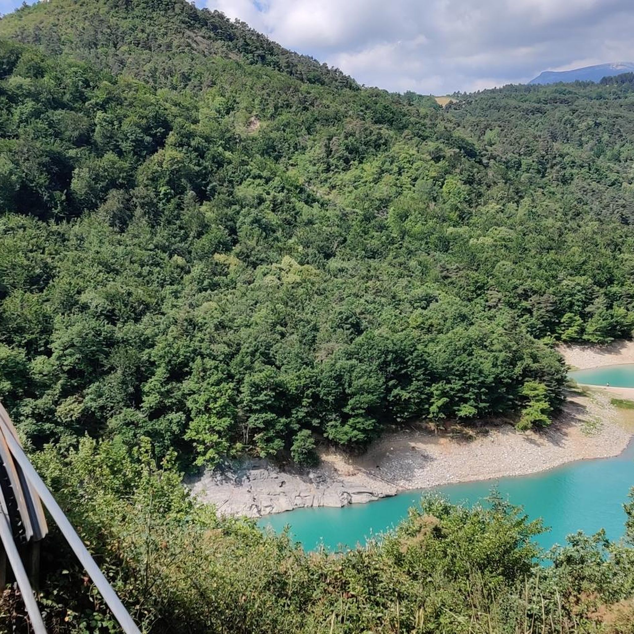
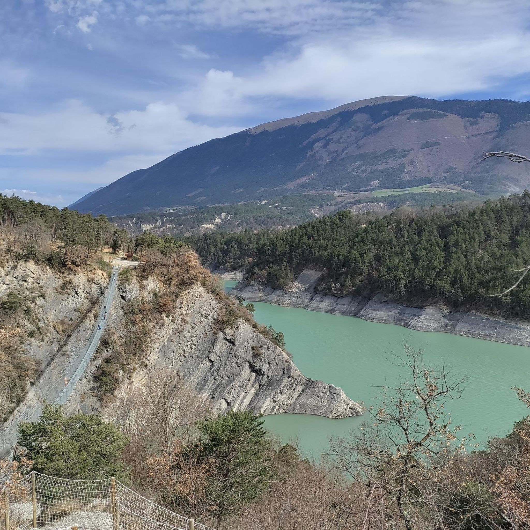
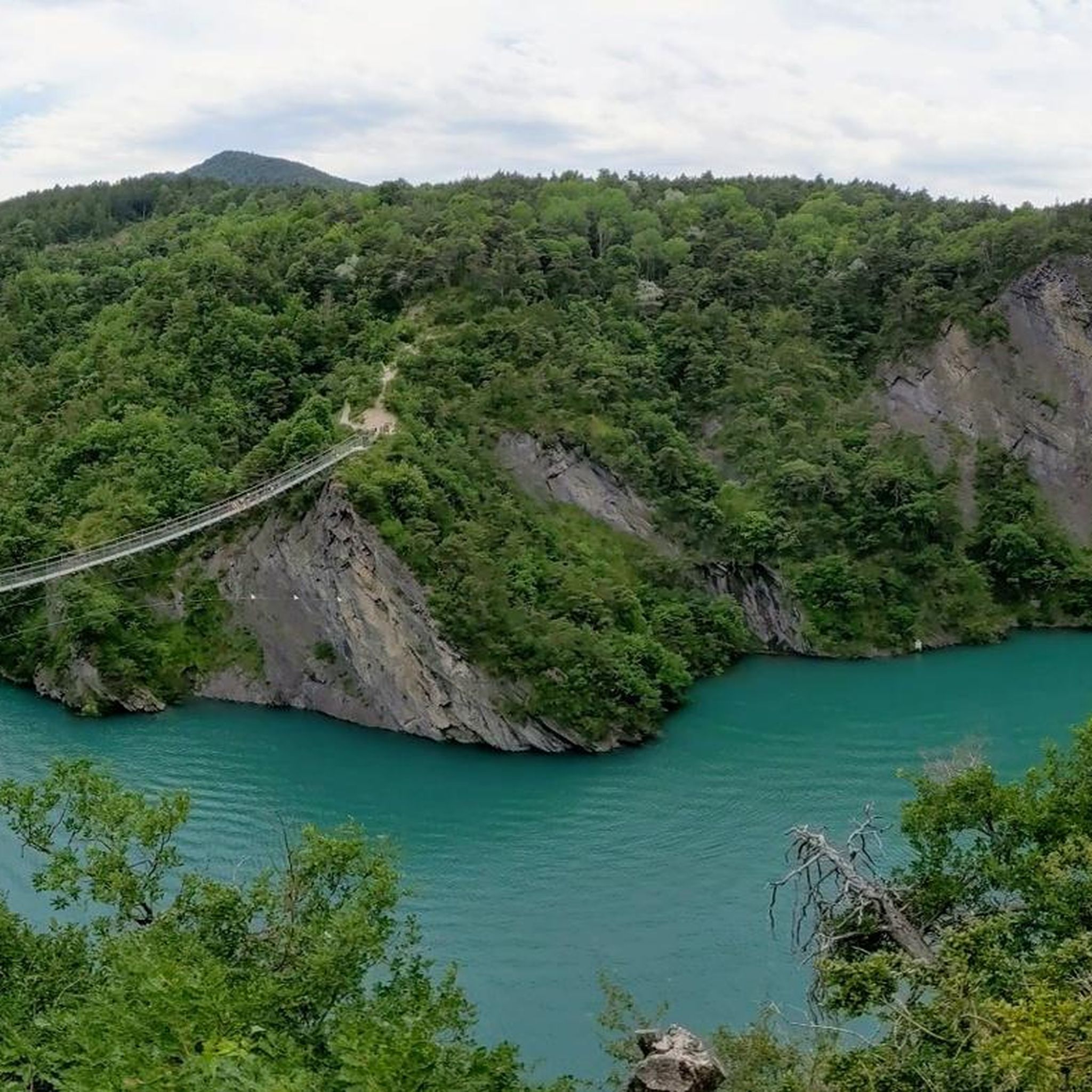
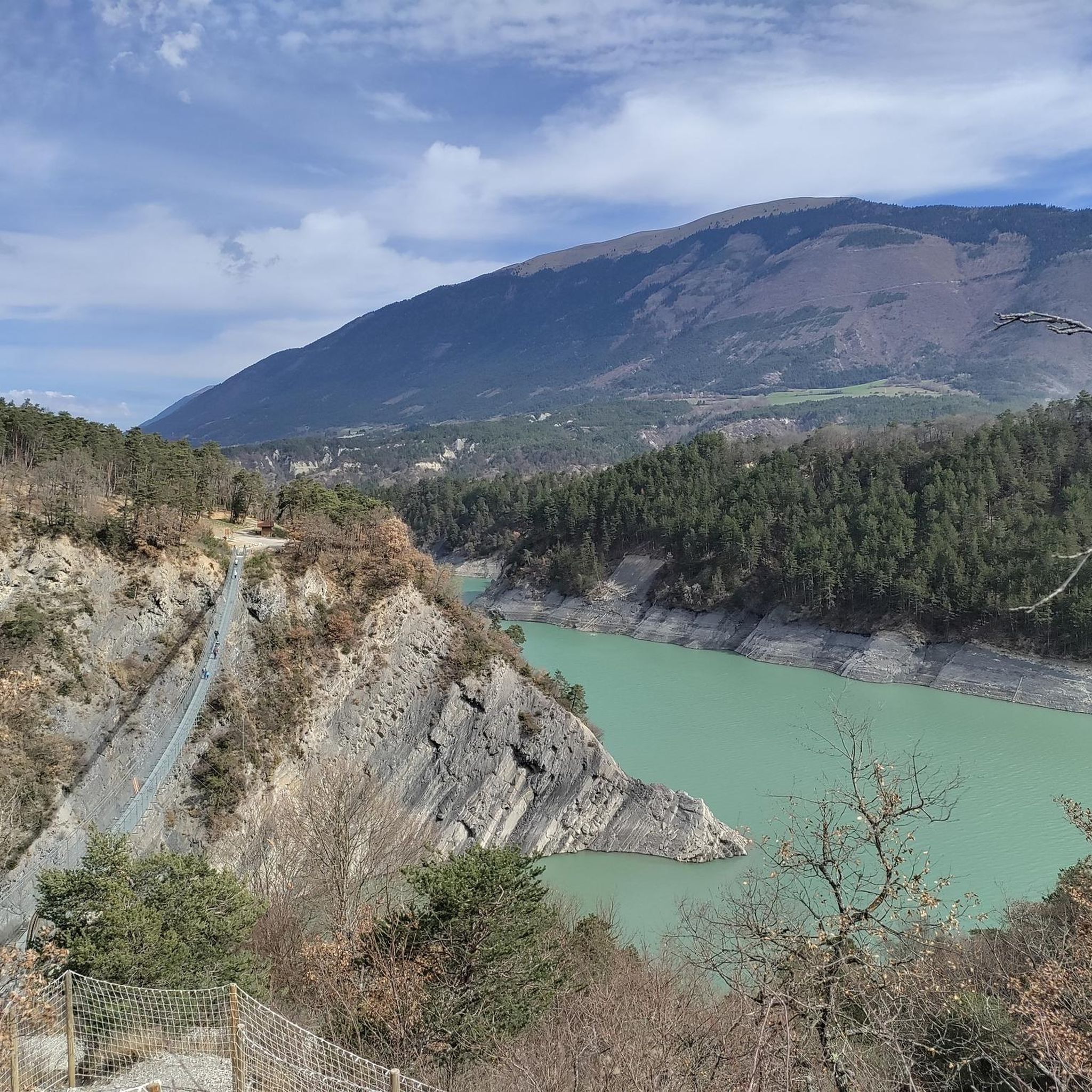
Mountaineering routes around Lac de Monteynard-Avignonet are set amidst the dramatic landscapes of the French Alps, characterized by the lake's turquoise waters and the surrounding Trièves and Matheysine mountains. The region features significant peaks like Mont Aiguille, offering diverse rock climbing opportunities on limestone cliffs and through forested areas. The terrain includes both challenging ascents and more accessible paths, often incorporating unique features such as deep gorges and high footbridges.
Best mountaineering routes around Lac de Monteynard-Avignonet
- The most popular…
Last updated: July 3, 2026
5.0
(1)
6
hikers
12.7km
04:05
470m
470m
Moderate mountaineering route. Good fitness required. Mostly accessible paths. Sure-footedness required.
4.0
(2)
4
hikers
Easy mountaineering route. Great for any fitness level. Easily-accessible paths. Suitable for all skill levels.

Sign up for free
5.0
(2)
7
hikers
15.4km
05:19
750m
750m
Hard mountaineering route. Very good fitness required. Mostly accessible paths. Sure-footedness required.
2
hikers
9.11km
03:41
600m
590m
Moderate mountaineering route. Good fitness required. Mostly accessible paths. Sure-footedness required.
5.0
(2)
5
hikers
15.9km
08:03
1,270m
1,270m
Hard mountaineering route. Very good fitness required. Sure-footedness, sturdy shoes and alpine experience required.
Our route recommendations are based on thousands of hikes, rides, and runs completed by other people on komoot.
Start today with a free account
Your next adventure awaits.
Login or Signup
Popular around Lac de Monteynard-Avignonet

Tips from the Community

Technical passage, stay focused and careful on the supports. Magnificent!
0
0

It's a small summit in the Trièves region, easily accessible from Chichiliane. From the top, there's a 360° view of the Vercors, the Dévoluy, the Taillefer...
0
0
fairly easy, very nice views, quiet roads.
0
0


great hike to do in good weather. very shaded
0
0

The Pont de Brion belvedere offers a breathtaking view of the charming stone bridge that spans the river below, with green hills as a backdrop. Along the trail, enjoy the tranquility of the place and the vibrant greenery that characterizes this picturesque spot.
0
0

Beautiful but unfortunately becoming a bit of a victim of its success. Done on the morning of November 2nd and there were a lot of people.
2
1
Frequently Asked Questions
What types of mountaineering routes can I find around Lac de Monteynard-Avignonet?
The region offers a diverse range of mountaineering experiences, from challenging multi-pitch climbs on limestone cliffs to more accessible paths through forested areas. You'll find routes incorporating unique features like deep gorges and impressive high footbridges. The area is particularly known for its iconic Himalayan footbridges and proximity to significant peaks like Mont Aiguille, which offers around 50 climbing routes.
Are there any easy or beginner-friendly mountaineering routes in the area?
Yes, there are options suitable for beginners. For instance, the Passerelle de L'Ébron loop from Communauté de communes du Trièves is an easy 3.6 km trail that takes about 1 hour 24 minutes to complete. The region also has climbing sites like those in Chichilianne with bouldering suitable for beginners, and Mont Aiguille offers a 'normal route' that can be tackled by beginners with a guide.
What are some notable landmarks or viewpoints I can expect to see on these routes?
The most iconic landmarks are the two spectacular Himalayan footbridges: the Drac Footbridge (220m long) and the Ebron Footbridge (180m long), suspended between 45 and 85 meters above the lake. These offer breathtaking panoramic views. You can also enjoy views of the Brion Bridge and the stunning turquoise waters of Lac de Monteynard-Avignonet itself, embraced by the Trièves and Matheysine mountains.
Are there any circular mountaineering routes available?
Yes, many routes are designed as loops. A popular and challenging option is the Drac Footbridge – Ebron Footbridge loop from Mayres-Savel, which is 15.6 km long and takes about 5 hours 21 minutes. For a moderate experience with expansive views, consider the Magnificent view – Drac Footbridge loop from Mayres-Savel, a 12.5 km path. The Passerelle de L'Ébron loop from Communauté de communes du Trièves is a shorter, easier circular option.
What is the best time of year for mountaineering around Lac de Monteynard-Avignonet?
The warmer months, typically from late spring to early autumn, are ideal for mountaineering and hiking around Lac de Monteynard-Avignonet. During this period, the weather is generally more stable, and trails are clear of snow, making for safer and more enjoyable conditions. The lake's consistent thermal winds also make it excellent for water sports during these months.
Are there any family-friendly mountaineering or climbing options?
While some mountaineering routes are challenging, there are family-friendly options. The easier hiking loops, such as the Passerelle de L'Ébron loop, are suitable for families. For climbing, the Trièves region offers bouldering sites in Chichilianne that are suitable for beginners, and many climbing walls for those new to the sport, particularly around Alpe du Grand Serre in Matheysine.
What about public transport access to the mountaineering routes?
While specific public transport details for each trailhead can vary, the region around Lac de Monteynard-Avignonet is generally more accessible by car. However, some areas might have limited bus services connecting to nearby towns. For the iconic footbridges, a scenic boat trip on 'La Mira' can be used to traverse the lake, connecting different parts of the hiking loop, which can reduce the need for a full circular hike back to a starting point.
Are there opportunities for advanced or technical climbing?
Absolutely. The region, particularly the Trièves and Matheysine mountains, offers significant opportunities for advanced climbing. Mont Aiguille is a major draw for experienced climbers, with approximately 50 climbing routes beyond its 'normal route'. There are also various climbing sites in areas like Gresse-en-Vercors, Trézanne, and Saint Guillaume, offering multi-pitch routes for the more experienced. For a blend of hiking and climbing, consider via corda and via ferrata routes, such as the Via Ferrata du Grand Frisson near the Sautet dam.
What do other mountaineers say about the routes in Lac de Monteynard-Avignonet?
The mountaineering routes in Lac de Monteynard-Avignonet are highly rated by the komoot community, with an average score of 4.8 stars from over 8 reviews. More than 40 mountaineers have used komoot to explore the varied terrain, often praising the dramatic landscapes, the thrilling experience of the footbridges, and the diverse options for different skill levels.
Are there any permits required for mountaineering or climbing in the area?
Generally, permits are not required for hiking on established trails around Lac de Monteynard-Avignonet. However, for specific technical climbing routes, especially on iconic peaks like Mont Aiguille, it's always advisable to check with local guides or mountaineering associations for any specific regulations or recommended practices, particularly regarding guided ascents or protected areas.
Can I find accommodation or places to eat near the mountaineering routes?
Yes, the area around Lac de Monteynard-Avignonet, being a popular tourist destination, offers various accommodation options ranging from campsites to guesthouses and hotels in nearby villages. You'll also find cafes and restaurants, especially in towns like Mayres-Savel or near the lake's main activity hubs, where you can refuel after your mountaineering adventures.
Are there any routes that are particularly challenging or require a high level of fitness?
Yes, for those seeking a significant challenge, the Highly technical passage loop from Château-Bernard is a difficult mountaineering route covering 15.8 km with over 1270 meters of elevation gain, taking approximately 7 hours 49 minutes. The Drac Footbridge – Ebron Footbridge loop from Mayres-Savel is also rated difficult, with substantial elevation gain over 15.6 km.
Most popular routes around Lac de Monteynard-Avignonet
Most popular attractions around Lac de Monteynard-Avignonet

Get inspired with the komoot mobile app


Explore more
Browse the best Mountain Hikes & Routes in other regions.
