The best gravel rides in Chino Hills State Park
4.7
(8)
77
riders
9
rides
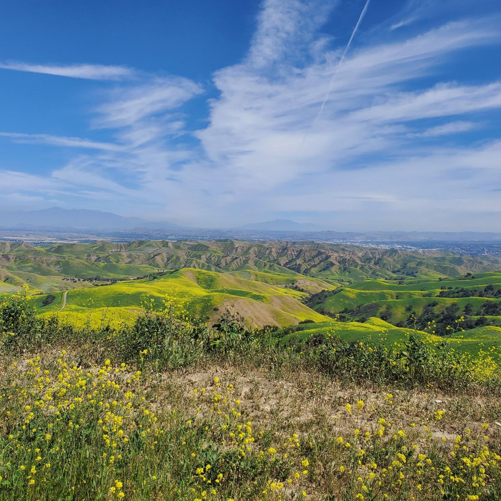
Gravel biking in Chino Hills State Park features an extensive trail system across more than 14,000 acres of rolling, grassy hills and valleys in Southern California. The park's terrain includes diverse ecosystems such as chaparral, grasslands, oak woodlands, and riparian habitats. Elevations range from 430 feet to 1,781 feet, providing varied landscapes for cycling. The park offers over 90 miles of multi-use trails, with sections ranging from smooth, wide paths to challenging, steep climbs.
Best gravel bike trails in Chino…
Last updated: July 12, 2026
4.8
(5)
26
riders
Hard gravel ride. Very good fitness required. Mostly paved surfaces. Suitable for all skill levels.
9
riders
47.6km
04:40
1,020m
1,020m
Hard gravel ride. Very good fitness required. Mostly paved surfaces. Suitable for all skill levels.

Sign up for free
4.0
(1)
6
riders
The Carbon Canyon Regional Park – Telegraph Canyon Road loop offers a delightful escape into Southern California's natural beauty, perfect for a relaxed gravel bike ride. You'll pedal through diverse…
5.0
(1)
10
riders
46.2km
04:26
980m
980m
Hard gravel ride. Very good fitness required. Mostly paved surfaces. Suitable for all skill levels.
5
riders
55.7km
04:29
1,060m
1,060m
The Sierra Peak Summit loop from Yorba Regional Park is a challenging gravel biking route that rewards your effort with truly expansive views. You'll navigate through rolling, chaparral-covered hills and…
Get access to more routes and recommendations from other explorers.
Sign up for free
Already have an account?
Our route recommendations are based on thousands of hikes, rides, and runs completed by other people on komoot.
Start today with a free account
Your next adventure awaits.
Login or Signup
Tips from the Community

This is the intersection of five trails: Raptor Ridge Trail, North Ridge Trail, Bovinian Delight Trail or Telegraph Canyon Road. There are also some boards with information about the trails and a restroom.
0
0

This view of Sierra Peak showcases one of the highest and most easily identifiable peaks in northern Orange County. It stands at 3,045 feet above sea level.
1
0
The Faultline Trail is a mix of dirt singletrack and fire road sections. There are some short, steep climbs and fast descents with loose gravel in places. It is a blue trail with a few sections that may challenge newer riders due to ruts, roots, and tight turns. This trail can get busy with runners and hikers on weekends as well.
1
0

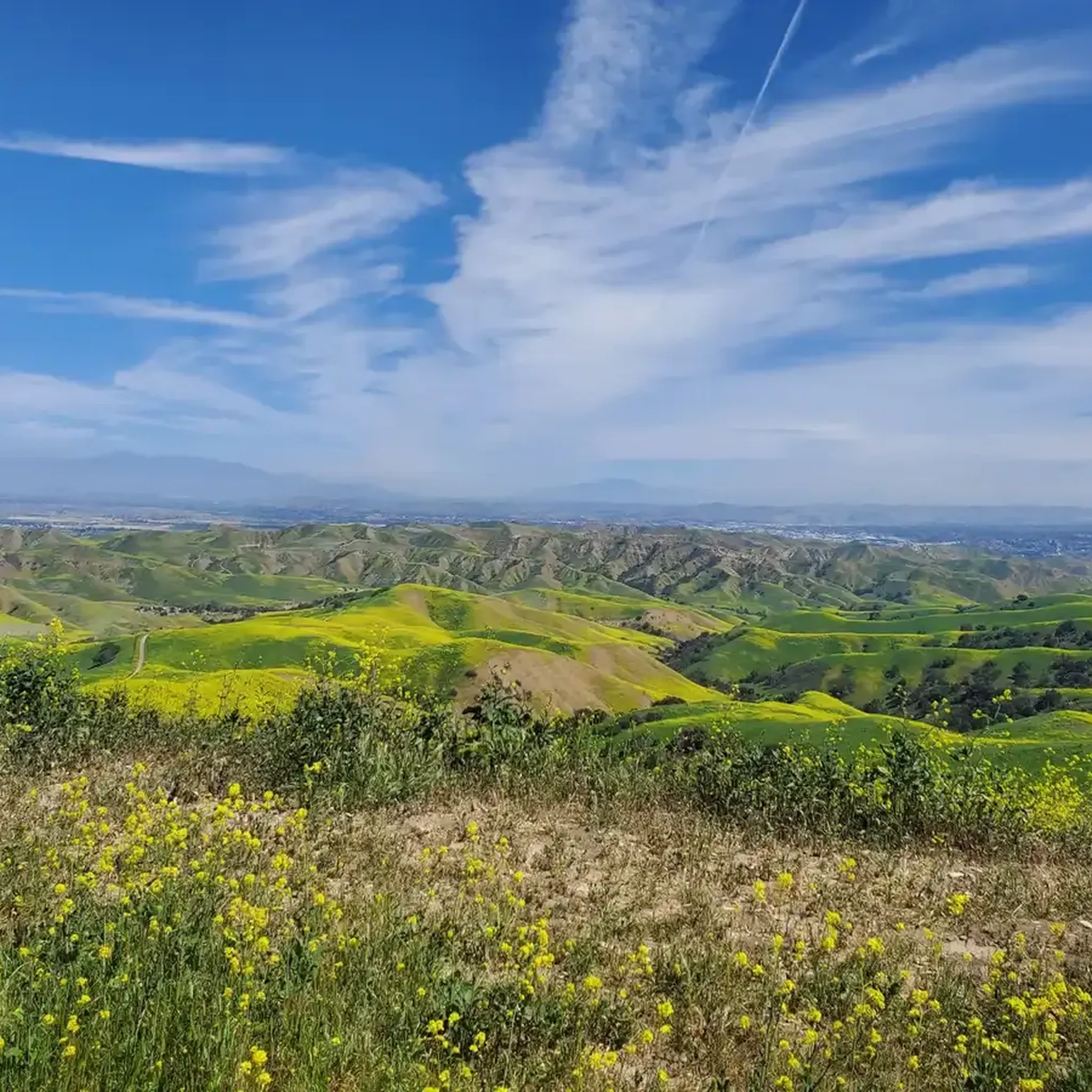
Situated up with the cell towers at 3,045 feet, Sierra Peak offers awesome views of Orange County and the surrounding mountains. Because it's such a long trek from car to summit, you'll likely have most of the route and the peak to yourself.
0
0

The trail is a wide dirt road through what feels like remote terrain, despite being quite close to Orange County. There is some loose rock that could make the descent mildly technical, but otherwise, this is a fairly steady route to Mini Moab and Sierra.
0
0
This area is designated as a wildlife sanctuary for rare and endangered wildlife. It has about 4,500 acres of wild space and open land.
0
0
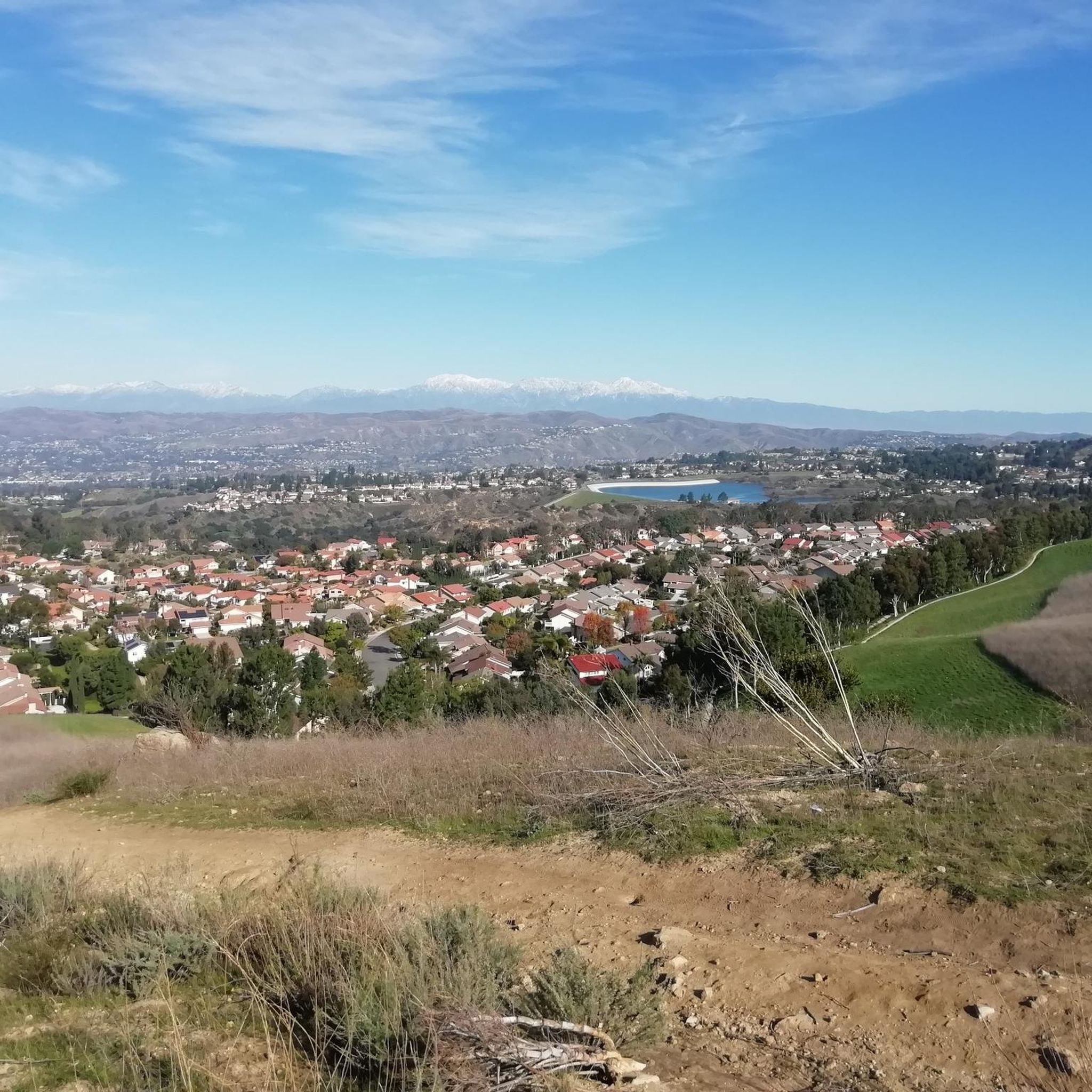
This is a cool, panoramic overlook with a placard off the side of the South Ridge Trail. The overlook is situated over the city and neighborhoods of Yorba Linda.
0
0
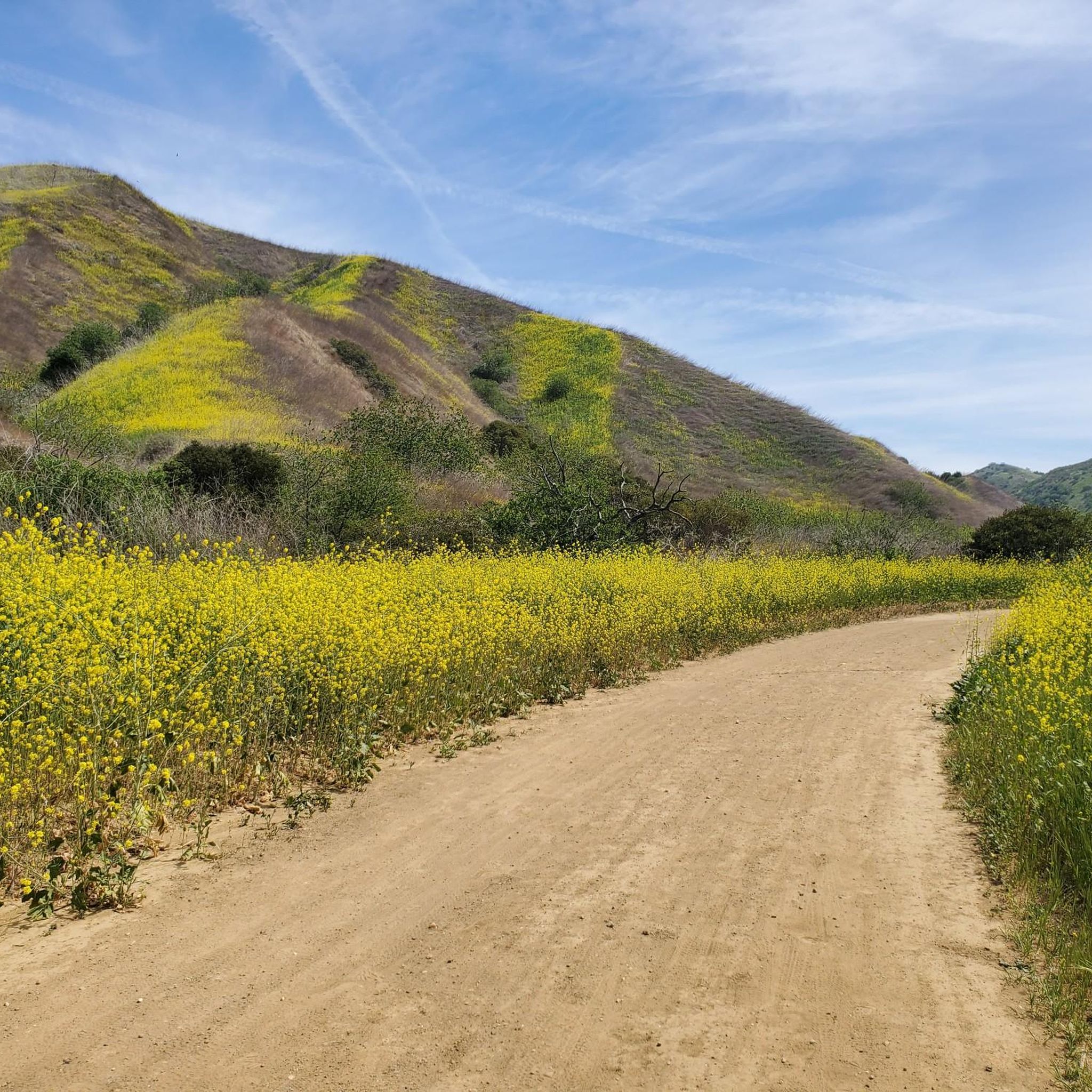
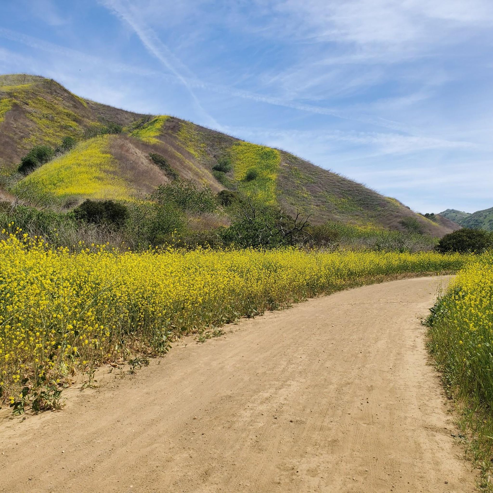
Telegraph Canyon Trail is one of the most popular paths in the entire park. It leaves the visitor's center as a wide, smooth road and eventually narrows a bit, but it's pretty smooth the entire way. As you approach Four Corners, the trail starts to become more hilly, but it's always considered a "green" trail in terms of difficulty.
0
0
Frequently Asked Questions
How many gravel bike trails are available in Chino Hills State Park?
Chino Hills State Park offers a network of over 90 miles of multi-use trails. On komoot, you'll find several curated gravel bike routes, ranging from easy to difficult, to help you explore the park's diverse landscapes.
What kind of terrain can I expect when gravel biking in Chino Hills State Park?
The park is characterized by rolling, grassy hills and valleys, with elevations ranging from 430 to 1,781 feet. You'll encounter diverse ecosystems including chaparral, grasslands, oak woodlands, and riparian habitats. Trails vary from smooth, wide paths to challenging, prolonged, and steep climbs, with some sections being unpaved and demanding good fitness.
Are there trails suitable for beginners or less experienced gravel bikers?
Yes, while many routes in Chino Hills State Park are considered difficult, there are options for less experienced riders. For an easier ride through valleys and woodlands, consider the Carbon Canyon Regional Park – Telegraph Canyon Road loop from Carbon Canyon Regional Park, which is about 7.9 miles long.
What are some challenging routes for experienced gravel bikers in the park?
Experienced gravel bikers will find plenty of challenging terrain. Routes like the Four Corners – Telegraph Canyon Trail loop from Country Hills, an 18.1-mile difficult route, or the even longer View of Yorba Linda – Four Corners loop from Carbon Canyon Regional Park (29.6 miles with significant elevation gain), offer demanding rides through varied landscapes.
When is the best time of year to go gravel biking in Chino Hills State Park?
Spring is particularly stunning, as wildflowers adorn the hillsides, creating breathtaking displays of color. However, it's important to note that the park may close during extreme fire danger or after significant rainfall for safety reasons. Always check park conditions before your visit.
What are some notable landmarks or viewpoints along the gravel bike trails?
The park offers several points of interest. You might pass through Four Corners, a popular junction, or ride along the scenic Telegraph Canyon Trail. For panoramic views, routes like the Picnic Rock Viewpoint – Sierra Peak Summit loop from Corona–West offer impressive vistas.
Are there any loop trails for gravel biking in the park?
Yes, many of the gravel biking routes in Chino Hills State Park are designed as loops, allowing you to start and end at the same point. Examples include the Four Corners – View of Yorba Linda loop from Chino Hills High School, which covers about 28.7 miles, and the shorter Carbon Canyon Regional Park – Telegraph Canyon Road loop.
What kind of wildlife can I expect to see while gravel biking?
Chino Hills State Park is home to diverse wildlife. You might spot coyotes, deer, bobcats, and over 200 species of birds and mammals. The park serves as a crucial biological link, supporting a rich variety of plant and animal species in its varied ecosystems.
Is there a bike repair station available in the park?
Yes, for your convenience, a bike repair station is located near the State Park entrance, which can be helpful for any minor adjustments or fixes you might need during your ride.
What do other gravel bikers enjoy the most about gravel biking in Chino Hills State Park?
The area is highly rated by the komoot community, with an average score of 4.7 stars from more than 7 reviews. Reviewers often praise the extensive trail system, the impressive views, and the opportunity to escape urban life into the tranquil natural landscapes.
Are there any facilities or visitor centers in the park?
Yes, the park features a Discovery Center, which serves as a visitor center and exhibit hall. It provides interactive exhibits and information on the park's flora, fauna, and human impact. Picnicking and camping at the Rolling M Ranch Campground are also available for those looking to extend their stay.
Most popular routes in Chino Hills State Park
Most popular attractions in Chino Hills State Park

Get inspired with the komoot mobile app


Explore more
Browse the best Gravel rides in other regions.
