The best gravel rides around Greene
33
riders
5
rides
Gravel bike trails around Greene are characterized by a mix of rural roads and managed natural areas, offering varied terrain for cycling. The region features rolling hills and forested sections, with routes often passing by local landmarks and waterways. This landscape provides a diverse setting for gravel biking, from moderate paths to more challenging ascents.
Best gravel bike trails around Greene
- The most popular gravel bike trail is Circle 'C' Campground – Greene loop from Coventry, a 20.5 miles (33.1 km) trail that takes 2 hours 11 minutes to complete. This moderate route features an elevation gain of 867 feet (264 meters).
- Another top favourite among local gravel bikers is Arcadia Management Area – Stepstone Falls loop from Wood River Barrens, a difficult 62.1 miles (100.0 km) path. This route includes significant climbing, with an elevation gain of 3,565 feet (1,087 meters).
- Local gravel bikers also love the Round Hill – Cucumber Hill loop from Coventry, a 40.5 miles (65.2 km) trail leading through hilly terrain, often completed in about 4 hours 47 minutes.
- Gravel biking around Greene is defined by rural back roads, managed natural areas, and rolling hills. The network offers options for different ability levels, from moderate loops to difficult, longer routes with substantial elevation gain.
- The routes in Greene are highly rated by the komoot community with an average score of 4.0 stars from over 1 review. More than 30 gravel bikers have used komoot to explore Greene's varied terrain.
Last updated: August 21, 2026
2
riders
99.0km
06:32
1,060m
1,060m
Hard gravel ride. Very good fitness required. Mostly paved surfaces. Suitable for all skill levels.
4
riders
33.0km
02:11
260m
260m
Moderate gravel ride. Good fitness required. Mostly paved surfaces. Suitable for all skill levels.

Sign up for free
8
riders
66.1km
04:05
660m
660m
Hard gravel ride. Very good fitness required. Mostly paved surfaces. Suitable for all skill levels.
1
riders
28.4km
01:48
240m
240m
Moderate gravel ride. Good fitness required. Mostly paved surfaces. Suitable for all skill levels.
3
riders
59.1km
03:45
530m
530m
Hard gravel ride. Very good fitness required. Mostly paved surfaces. Suitable for all skill levels.
Our route recommendations are based on thousands of hikes, rides, and runs completed by other people on komoot.
Start today with a free account
Your next adventure awaits.
Login or Signup


Tips from the Community

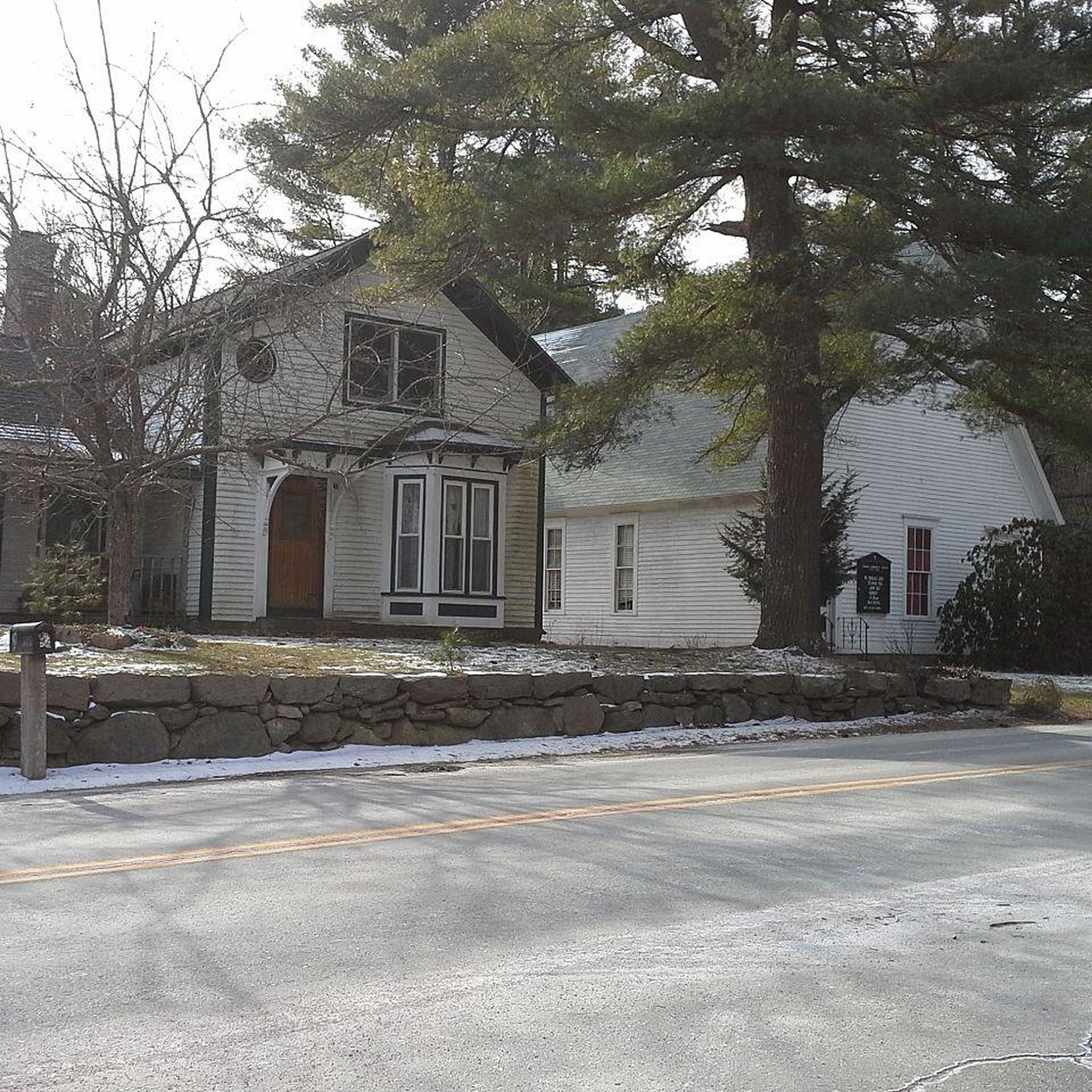
Circle 'C' Campground has both pine-shaded and grassy open campsites with water and electric hookups. Hikers can choose tent camping or rustic cabin rentals and have access to restrooms. The campground also offers a playground, a mini convenience store, and a recreation hall. There is also access to Bailey Pond, where visitors can launch or rent boats for bass fishing or take a swim in the smaller spring-fed pond. This campground is a mile detour off of the North-South Trail, but as dispersed camping is not allowed in the area, it's a great option for legal camping.
0
0
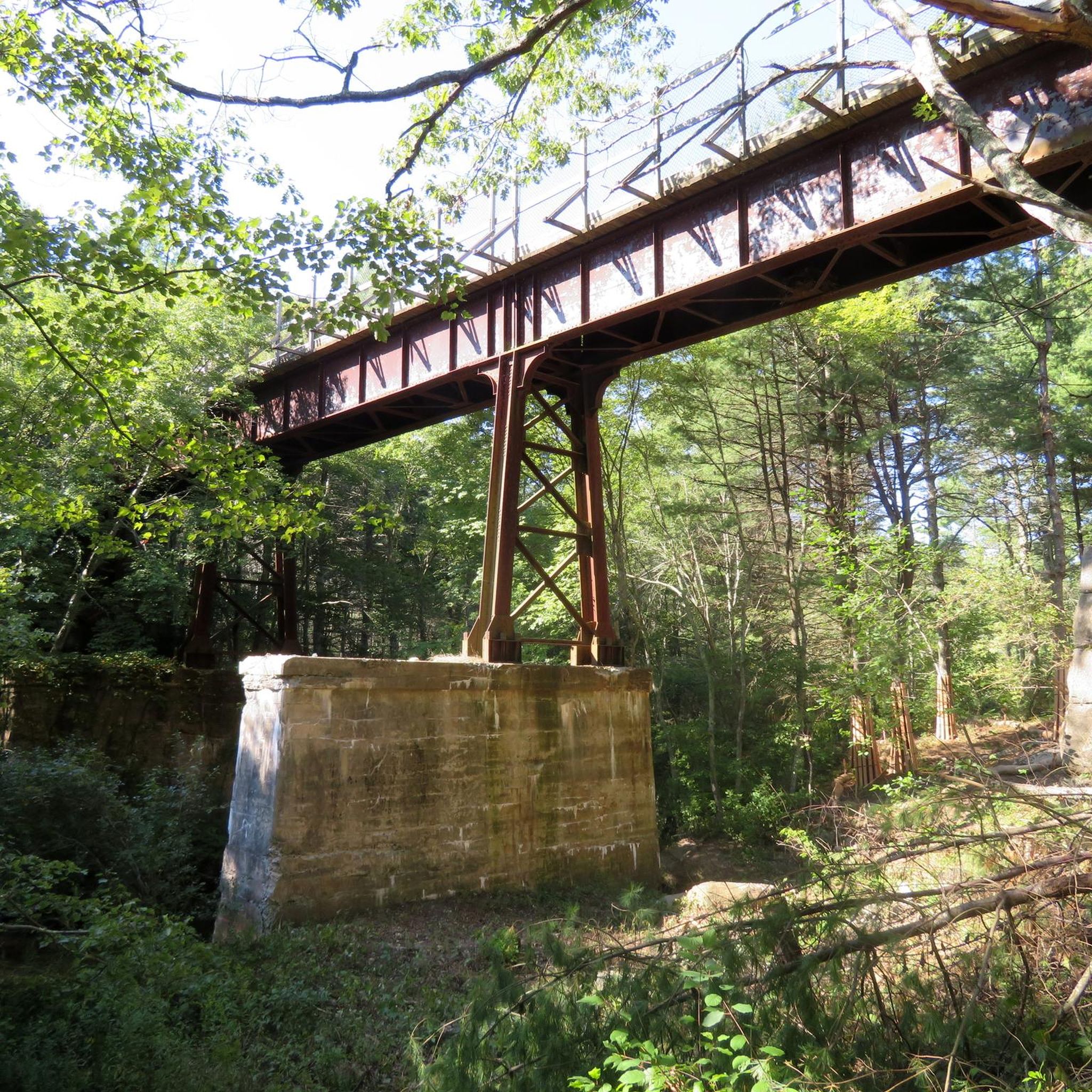
The Trestle Trail spans 5 miles and is paved and used by hikers, runners, cyclists, and ATVs.
0
0

The Kate Randall Road is a quiet gravel and dirt road that runs north-south from the Central Pike, just west of the Barden Reservoir. This is a great place for a quiet stroll around the lake.
0
0

Just off the road, you'll find an abandoned barn. Take a break from your bike ride and explore this spot.
0
0
You can catch a glimpse of the Dam and Ponaganset Falls from the road, overlooking the 220-acre Reservoir. It's a great place to take a break!
0
0
Ponagansett Road winds between two lakes, offering a wooded route, but be cautious of passing cars along its winding path. It's a great road for cycling.
0
0

Ponaganset Falls is a waterfall that is visible right from the side of the road. Ponaganset Falls is at the southeast end of the Barden Reservoir.
0
0

The Trestle Trail is best known for its 5-mile paved path that shares a route with the Coventry Greenway. This extra section west of the Moosup River leaves the pavement and becomes a rough double-track road. The path is utilized by hikers, runners, cyclists, and ATVs. It also offers access to the Carbuncle Pond area.
0
0
Frequently Asked Questions
How many gravel bike trails are available in Greene?
There are over 7 gravel bike trails around Greene, offering a variety of experiences for different skill levels. These routes are highly rated by the komoot community.
What kind of terrain can I expect on gravel bike trails around Greene?
Gravel bike trails around Greene are characterized by a mix of rural roads and managed natural areas. You'll encounter rolling hills and forested sections, with routes often passing by local landmarks and waterways. The landscape provides a diverse setting, from moderate paths to more challenging ascents.
Are there any challenging gravel bike routes for experienced riders in Greene?
Yes, Greene offers several challenging routes. For instance, the Arcadia Management Area – Stepstone Falls loop from Wood River Barrens is a difficult 62.1-mile path with a significant elevation gain of 3,565 feet. Another demanding option is the Round Hill – Cucumber Hill loop from Coventry, which covers 40.5 miles through hilly terrain.
What are some scenic attractions or natural features I can see along the gravel bike trails in Greene?
Many routes in Greene pass by beautiful natural features. You can find attractions like Stepstone Falls, Breakheart Pond, and Ponaganset Falls. The Trestle Trail also offers scenic views.
Are there any family-friendly or easy gravel bike trails in Greene?
While the guide highlights more moderate to difficult routes, the general terrain of rural roads and managed natural areas can offer sections suitable for families. For a moderate option, consider the Circle 'C' Campground – Greene loop from Coventry, which is 20.5 miles with a moderate elevation gain. Always check route details for specific difficulty and length to ensure it suits your family's needs.
What do other gravel bikers enjoy most about gravel biking in Greene?
The area is highly rated by the komoot community, with an average score of 4.0 stars from over 1 review. Reviewers often praise the varied terrain, from rural back roads to managed natural areas, and the options available for different ability levels.
Are there any loop routes for gravel biking in Greene?
Yes, many of the gravel bike routes in Greene are designed as loops. Examples include the Circle 'C' Campground – Greene loop from Coventry, the Arcadia Management Area – Stepstone Falls loop from Wood River Barrens, and the Round Hill – Cucumber Hill loop from Coventry.
What is the best time of year for gravel biking in Greene?
The best time for gravel biking in Greene generally aligns with milder weather seasons, such as spring, summer, and fall. These seasons offer pleasant temperatures and less chance of snow or ice, making the mixed-surface roads more enjoyable. Always check local weather conditions before heading out.
Are there any routes that pass by historic or notable landmarks?
While specific historic landmarks are not detailed for every route, the region's rural back roads and managed natural areas often feature picturesque elements. For example, the Swamp Meadow Covered Bridge – Barn on Old Plainfield Pike loop from George B. Parker Woodland Wildlife Refuge suggests routes that might pass by charming local structures like covered bridges.
Can I find long-distance gravel cycling routes in Greene?
Absolutely. Greene offers several longer routes for those seeking a more extensive ride. The Arcadia Management Area – Stepstone Falls loop from Wood River Barrens is a challenging 62.1-mile route, and the Round Hill – Cucumber Hill loop from Coventry covers 40.5 miles, providing ample distance for a full day's adventure.
What are the typical elevation gains on gravel bike trails in Greene?
Elevation gains vary significantly depending on the route's difficulty. Moderate trails like the Circle 'C' Campground – Greene loop from Coventry have an elevation gain of around 867 feet (264 meters). More difficult routes, such as the Arcadia Management Area – Stepstone Falls loop from Wood River Barrens, can feature substantial climbs, reaching up to 3,565 feet (1,087 meters) of elevation gain.
Are there any trails that feature water bodies like lakes or reservoirs?
Yes, several routes and nearby attractions in Greene feature water bodies. You can find Breakheart Pond and the Scituate Reservoir Protection Area, which offer scenic views and opportunities to ride alongside water. Tillinghast Pond is another notable lake in the vicinity.
Most popular attractions around Greene

Get inspired with the komoot mobile app


Explore more
Browse the best Gravel rides in other regions.
