The best gravel rides around Millers Falls
5.0
(2)
63
riders
8
rides
Gravel biking around Millers Falls features routes that navigate a landscape characterized by river valleys, covered bridges, and forested areas. The region includes various reservoirs and farm landscapes, offering a mix of terrain for gravel cyclists. Trails often follow historical routes and connect natural landmarks, providing diverse riding experiences.
Best gravel bike trails around Millers Falls
- The most popular gravel bike trail is Green River Covered Bridge – Green River Road, Colrain loop from Greenfield, a 57.2 miles (92.0…
Last updated: July 9, 2026
5.0
(2)
37
riders
92.0km
06:12
1,640m
1,640m
Hard gravel ride. Very good fitness required. Mostly paved surfaces. Suitable for all skill levels.
10
riders
100.0km
07:50
2,020m
2,020m
Hard gravel ride. Very good fitness required. Mostly paved surfaces. Suitable for all skill levels.

Sign up for free
6
riders
50.3km
03:19
650m
650m
Hard gravel ride. Very good fitness required. Mostly paved surfaces. Suitable for all skill levels.
7
riders
92.9km
06:06
1,510m
1,510m
Hard gravel ride. Very good fitness required. Mostly paved surfaces. Suitable for all skill levels.
3
riders
Hard gravel ride. Very good fitness required. Mostly paved surfaces. Suitable for all skill levels.
Get access to more routes and recommendations from other explorers.
Sign up for free
Already have an account?
Our route recommendations are based on thousands of hikes, rides, and runs completed by other people on komoot.
Start today with a free account
Your next adventure awaits.
Login or Signup


Tips from the Community

There is a small green space near bridge that is a great place to stop for a snack or lunch.
0
0

Settlers first established Heath in 1765 and named it after General Heath, who served as a commanding officer in the national army during the American Revolution. This location serves as a common area, housing the town hall and featuring a pleasant green space with benches for taking breaks.
1
0

Mill River is part of the Cushman Brook and flows through to the Cushman Brook Conservation Area and the Mill River Conservation Area. This river is in a thickly forested area in a ravine. Some of this protected area was donated and some was purchased. Visiting Mill River is a family-friendly get-away into nature open for the public to enjoy.
0
0

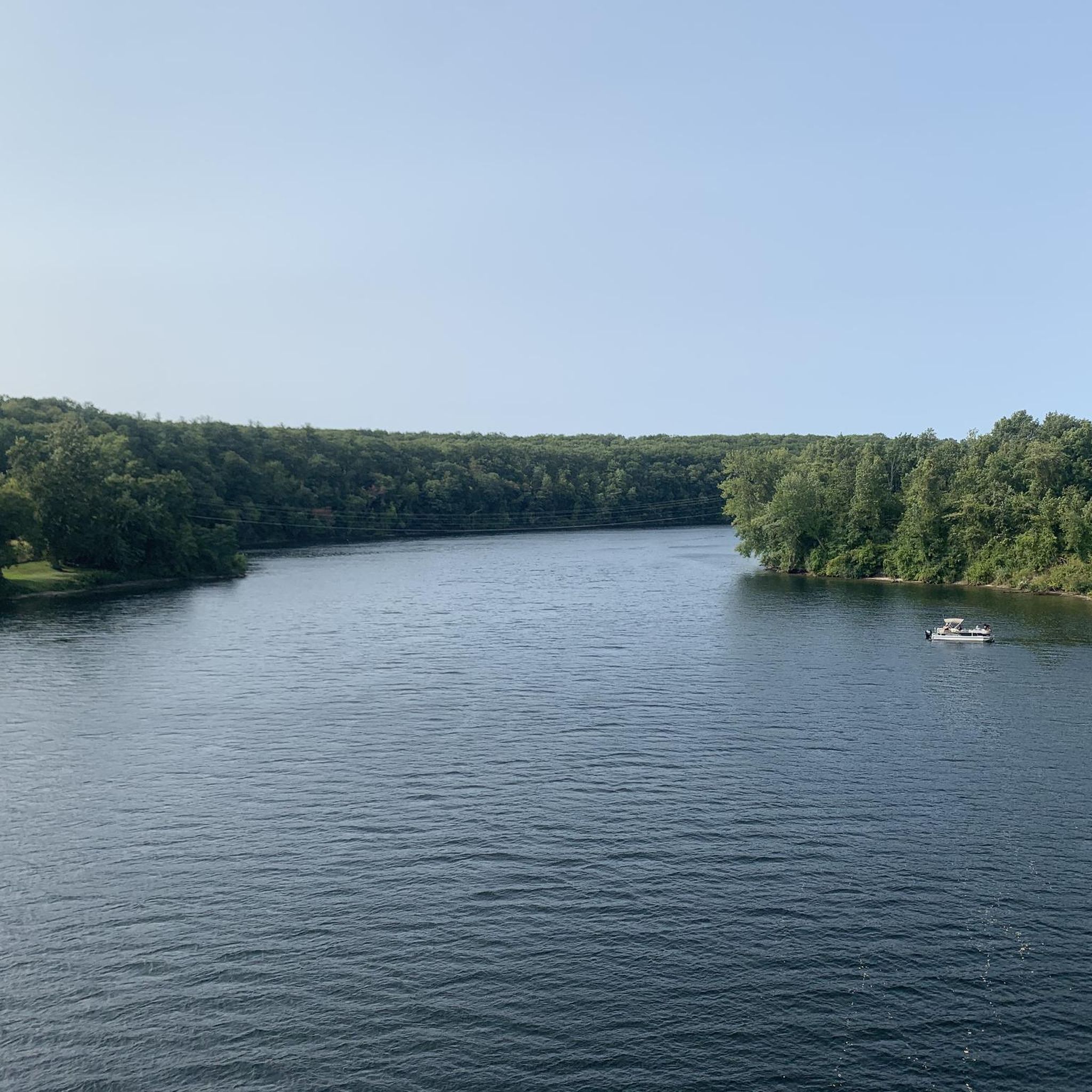
As you ride along the crystal-clear waters of the Green River, surrounded by the picturesque landscape of this stunning region, take a moment to immerse yourself in the natural beauty surrounding you. In the fall, the foliage of the trees adds to the already spectacular scenery of this wondrous place.
0
0

Historic covered bridges such as this one are traditional in the area, and it is great to see them maintained. The Bissel Covered Bridge was built in 1881. By the mid-20th century the bridge was due to be replaced by a modern steel and concrete structure. The local town opposed the new structure, and the original bridge was rebuilt and kept to the original specifications. The bridge still features a wooden structure and wooden floor.
0
0
Mill River is part of the Cushman Brook and flows through to the Cushman Brook Conservation Area and the Mill River Conservation Area. This river is in a thickly forested area in a ravine. Some of this protected area was donated and some was purchased. Visiting Mill River is a family-friendly get-away into nature open for the public to enjoy.
0
0

Puffers Pond is a popular 11-acre pond in Amherst. This freshwater pond is the largest body of water in the town and has sandy beaches for swimming and places where you can launch a canoe. There are trails that encircle it that you can hike, bird, and fish along. This is a nice place to stop as you ride around the area.
1
0

On this side of Depot Road, you can enjoy a good view of Leverett Pond from its boat launch point. The bottom of this pond is completely covered by submerged vegetation.
0
0
Frequently Asked Questions
How many gravel bike trails are available around Millers Falls?
There are 8 gravel bike trails documented around Millers Falls on komoot, offering a variety of experiences for different skill levels. Most routes are considered moderate to difficult, with significant distances and elevation.
Are there any easy gravel bike trails suitable for beginners or families?
While many routes around Millers Falls feature significant distances and elevation, there are options that can be adapted. For a less strenuous experience, consider exploring sections of trails rather than full loops. The region's trails are generally rated as moderate to difficult, so beginners should choose carefully and be prepared for varied terrain.
What are the typical lengths and durations of gravel bike routes in this area?
Gravel bike routes around Millers Falls vary in length, with many being quite substantial. For instance, the View of Leverett Pond – Atkins Reservoir loop from Sawmill River Access is about 31.2 miles (50.3 km) and typically takes around 3 hours 23 minutes. Other routes can be much longer, extending up to 58 miles (93.4 km) or more.
Are there any circular gravel bike routes around Millers Falls?
Yes, many of the gravel bike routes in the Millers Falls area are designed as loops, allowing you to start and finish at the same point. An example is the Mill Village Road Deerfield – View from Whatley library loop from Deerfield, which offers a substantial circular ride through varied landscapes.
What is the best season for gravel biking in Millers Falls?
The best seasons for gravel biking around Millers Falls are typically spring, summer, and fall. These seasons offer pleasant temperatures and generally drier trail conditions. Fall is particularly scenic with the changing foliage, while spring brings blooming landscapes. Always check local weather and trail conditions before heading out.
What kind of trail conditions can I expect on gravel bike routes here?
Gravel bike trails around Millers Falls navigate a mix of terrain, including river valleys, forested areas, and farm landscapes. You can expect a combination of gravel roads, dirt paths, and potentially some paved sections connecting different areas. Conditions can vary with weather, so be prepared for potential mud after rain or loose gravel in dry periods.
Are there any scenic gravel bike routes that highlight the region's natural beauty?
Absolutely. The region is known for its river corridors, historic covered bridges, and rolling forested hills. Routes like the Graves Farm Wildlife Sanctuary – Turner's Falls Bridge loop from Deerfield offer scenic views, passing through wildlife sanctuaries and alongside significant landmarks like the Turner's Falls Bridge.
What interesting sights or landmarks can I see along the gravel bike trails?
The gravel bike trails often connect natural and historical landmarks. You might encounter sights such as Mount Toby, the Turner's Falls Bridge, and sections of the Canalside Rail Trail. The region is also characterized by its numerous covered bridges and reservoir areas like Lake Wyola Dam.
What do other gravel bikers enjoy most about riding in Millers Falls?
The gravel biking experience in Millers Falls is highly rated by the komoot community, with an average score of 5.0 stars. Riders often praise the diverse terrain, the scenic beauty of river valleys and covered bridges, and the challenging yet rewarding nature of the routes. The sense of exploring historical routes and natural landmarks is also a common highlight.
Is parking available near the gravel bike trailheads in Millers Falls?
Parking availability varies by trailhead. Many routes start from towns or designated access points where public parking may be available. For specific routes, it's advisable to check the tour details on komoot, as they often include information about starting points and potential parking options.
Are there any cafes or places to eat near the gravel bike trails?
The Millers Falls region includes several small towns and communities. While specific cafes directly on every trailhead might be limited, you can often find dining options in nearby towns like Greenfield or Deerfield, which serve as common starting or passing points for many routes. Planning your route with stops in these towns can enhance your ride.
Can I bring my dog on the gravel bike trails?
Policies regarding dogs on trails can vary. Generally, dogs are permitted on many public trails if kept on a leash. However, it's always best to check specific regulations for any wildlife sanctuaries, state parks, or private lands that a route might pass through to ensure compliance and a safe experience for your pet and other trail users.
Most popular attractions around Millers Falls

Get inspired with the komoot mobile app


Explore more
Browse the best Gravel rides in other regions.
