The best gravel rides around Muir Beach
4.6
(13)
317
riders
22
rides
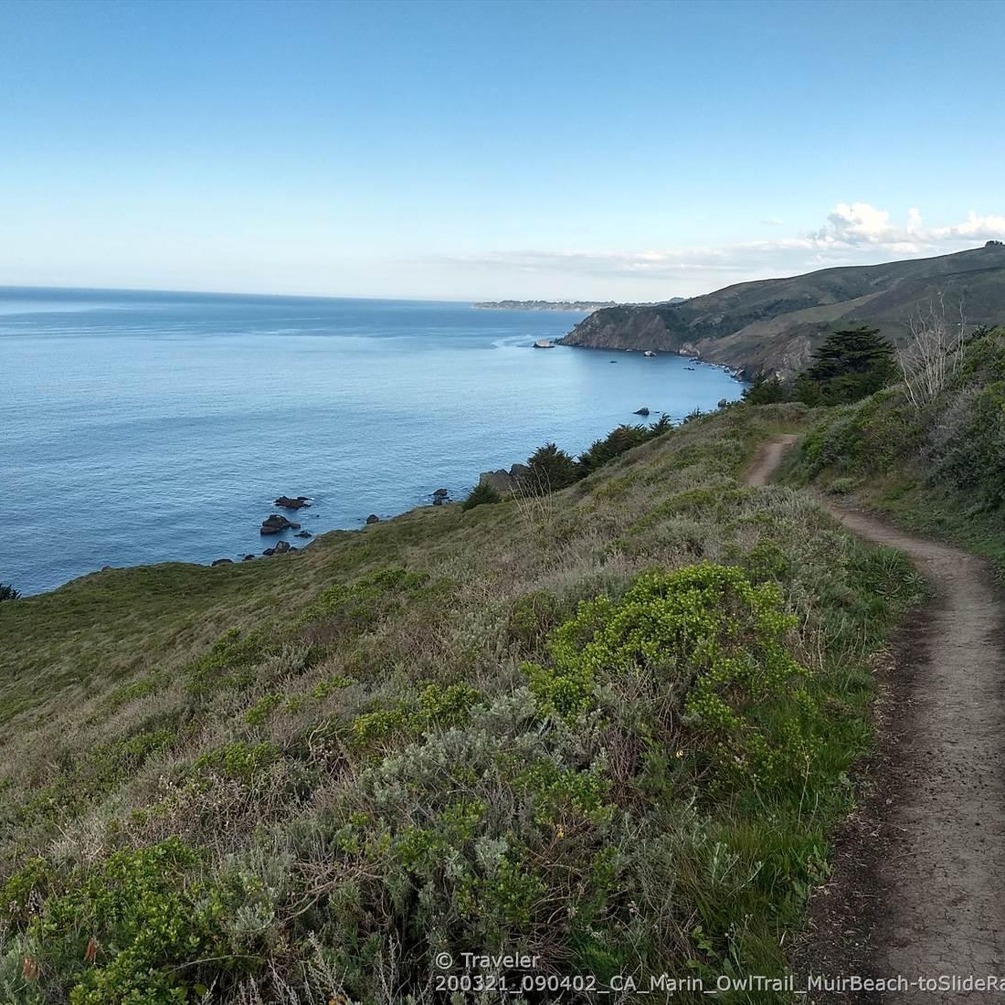
Gravel biking around Muir Beach offers a diverse landscape characterized by coastal bluffs, rolling hills, and the foothills of Mount Tamalpais. The region features a network of trails that combine both paved and unpaved surfaces, providing varied riding experiences. Riders can navigate through areas with panoramic ocean views, redwood forests, and open terrain. Elevation changes in the area range from gentle coastal paths to challenging climbs up Mount Tamalpais.
Best gravel bike trails around Muir Beach
- The most popular gravel bike trail is Fern Creek and spring – Pantoll Road loop from Mill Valley, a 23.4 miles (37.7 km) trail that takes 3 hours 7 minutes to complete. This route includes mostly paved sections and offers varying difficulty levels as it ascends Mount Tamalpais.
- Another top favourite among local gravel bikers is Old Mine Trail (lower) 🌲 loop from Mill Valley, a difficult 29.5 miles (47.4 km) path. This trail leads through varied terrain with coastal views.
- Local gravel bikers also love the Sausalito — Mill Valley Path – Marincello Trail loop from Marin City, a 29.2 miles (47.1 km) trail leading through diverse landscapes, often completed in about 4 hours 15 minutes.
- Gravel biking around Muir Beach is defined by coastal paths, climbs into the Mount Tamalpais foothills, and diverse mixed-surface terrain. The network offers options for different ability levels, from moderate to difficult.
- The routes in Muir Beach are highly rated by the komoot community with an average score of 4.5 stars from over 10 reviews. More than 380 gravel bikers have used komoot to explore Muir Beach's varied terrain.
Last updated: July 1, 2026
4.8
(6)
73
riders
47.4km
04:21
1,270m
1,270m
Hard gravel ride. Very good fitness required. Mostly paved surfaces. Suitable for all skill levels.
15
riders
45.7km
03:59
1,180m
1,180m
The Phoenix Lake – Fish Gulch trail junction loop from Mill Valley offers a demanding yet incredibly scenic gravel biking adventure. You'll wind through diverse landscapes, from the cool shade of redwood forests to sun-drenched oak woodlands and open grasslands, with the promise of sweeping views of the Pacific Ocean and Golden Gate Bridge from higher points near Mount Tamalpais. This route is a true test of endurance, featuring steep and loose sections that demand very good fitness and bike handling skills.
Planning your ride requires a bit of foresight; while much of the loop is prime for gravel biking, be aware that the immediate trails around Phoenix Lake itself may not allow bikes. Parking is generally available in Mill Valley, but it's always wise to arrive early, especially on weekends, to secure a spot. Given the route's length and elevation, pack ample water and snacks, and consider starting early to make the most of the daylight.
This loop is a standout in the Mill Valley area, celebrated by local gravel bikers for its challenging terrain and the opportunity to combine dirt climbs with rewarding road descents. It showcases the region's extensive trail network and significant elevation gains, making it a prime destination for those looking to push their limits and experience the natural beauty of Marin County.

Sign up for free
4.0
(2)
10
riders
19.6km
01:35
430m
430m
Moderate gravel ride. Good fitness required. Mostly paved surfaces. Suitable for all skill levels.
10
riders
51.6km
04:12
1,200m
1,200m
Hard gravel ride. Very good fitness required. Mostly paved surfaces. Suitable for all skill levels.
4.0
(1)
4
riders
The Tennessee Valley Trailhead – Panoramic Highway loop offers a dynamic gravel biking adventure through the Golden Gate National Recreation Area. This moderate 13.2-mile (21.2 km) route, which typically takes around 1 hour and 36 minutes, features a mix of dirt trails, gravel roads, and paved sections, with 1326 feet (404 metres) of elevation gain. You'll ride through verdant valleys, past coastal scrub, and enjoy panoramic views of the Pacific Ocean and Marin Headlands, often catching glimpses of the Golden Gate Bridge from higher points.
Planning your ride requires some foresight, as the Tennessee Valley Trailhead parking lot can fill up quickly during peak hours. Be ready for varied conditions; while some fire roads are smooth, sections like the initial climb on Old Springs Trail are steep and may require hike-a-biking. The climate can also shift dramatically, from warm in the valley to cold and foggy near Rodeo Beach, so dress in layers.
Beyond the natural beauty, this route is steeped in history, passing by World War II military fortifications like Battery Townsley. The area is also part of the Mount Tamalpais region, widely recognized as the birthplace of mountain biking, adding a unique historical layer to your ride. It's a fantastic option for experienced riders looking for a challenging and scenic outing.
Get access to more routes and recommendations from other explorers.
Sign up for free
Already have an account?
Our route recommendations are based on thousands of hikes, rides, and runs completed by other people on komoot.
Start today with a free account
Your next adventure awaits.
Login or Signup
Tips from the Community


Beginning of the wide gravel fire road following along the crest of Coyote Ridge from Miwok Trail down towards the beach.
0
0


This tidal sanctuary runs along the Mill Valley-Sausalito Pathway and the Charles F. McGlashan Pathway. More than 400 species of migratory birds rest here after their long flights, and if you pass through in the early morning or late evening, the sunrises and sunsets reflect beautifully on the surface of this 106-acre marsh.
0
0

There is a great view of the northern point of Alpine lake where a small channel feeds over to Bon Tempe Lake. This is a great place to drop a line, or just enjoy the aquatic views.
0
0

From easiest to hardest climbs out of phoenix lake from this junction: -Shaver Grade, easy grade, longer, shaded and pretty -Eldridge Grade, medium, good length and can connect you to mt tam east peak -Fish Grade fire road, very steep, we hiked the bikes
1
0
Frequently Asked Questions
How many gravel bike trails are available around Muir Beach?
There are over 25 gravel bike trails around Muir Beach, offering a diverse range of experiences. These routes are highly rated by the komoot community, with an average score of 4.5 stars from over 10 reviews.
What is the general difficulty level of gravel biking trails near Muir Beach?
The gravel biking trails around Muir Beach are predominantly moderate to difficult. You'll find a good selection of challenging routes, with 21 trails rated as difficult and 6 as moderate. These often involve significant elevation changes as you climb towards Mount Tamalpais or navigate coastal bluffs.
Are there any beginner-friendly gravel bike routes in the Muir Beach area?
While many routes in Muir Beach are rated moderate to difficult, some sections of trails like the Pantoll Road loop from Mill Valley include mostly paved surfaces, which can be more accessible for beginners. However, be prepared for varying difficulty levels and elevation changes even on these routes.
What kind of scenery can I expect on gravel bike trails around Muir Beach?
Gravel biking around Muir Beach offers a stunning variety of landscapes. You'll experience panoramic ocean views, coastal bluffs, and the rugged beauty of the Marin Headlands. Many routes also ascend Mount Tamalpais, providing rewarding climbs with spectacular vistas towards the foothills and Muir Woods, often winding through redwood forests and open terrain.
Are there any scenic viewpoints along the gravel bike trails?
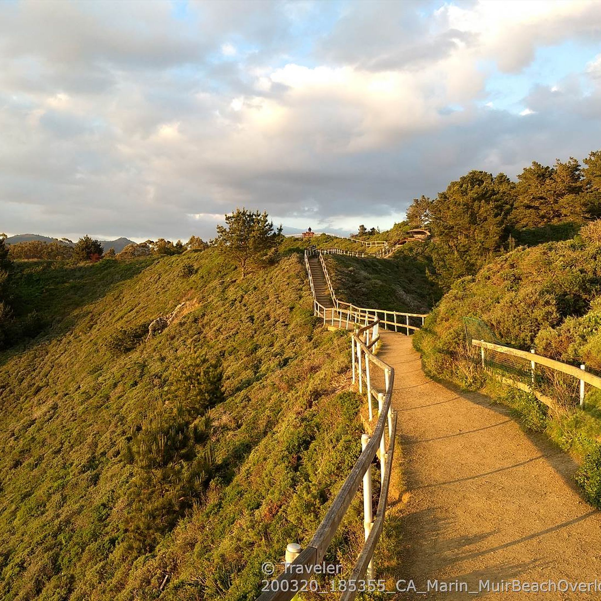
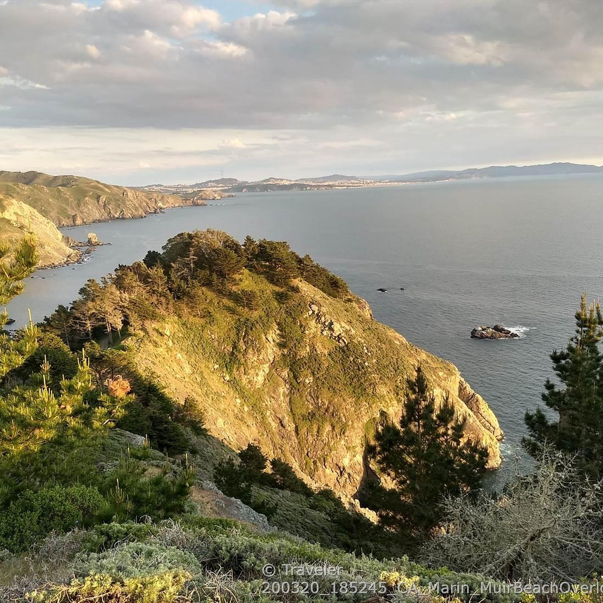
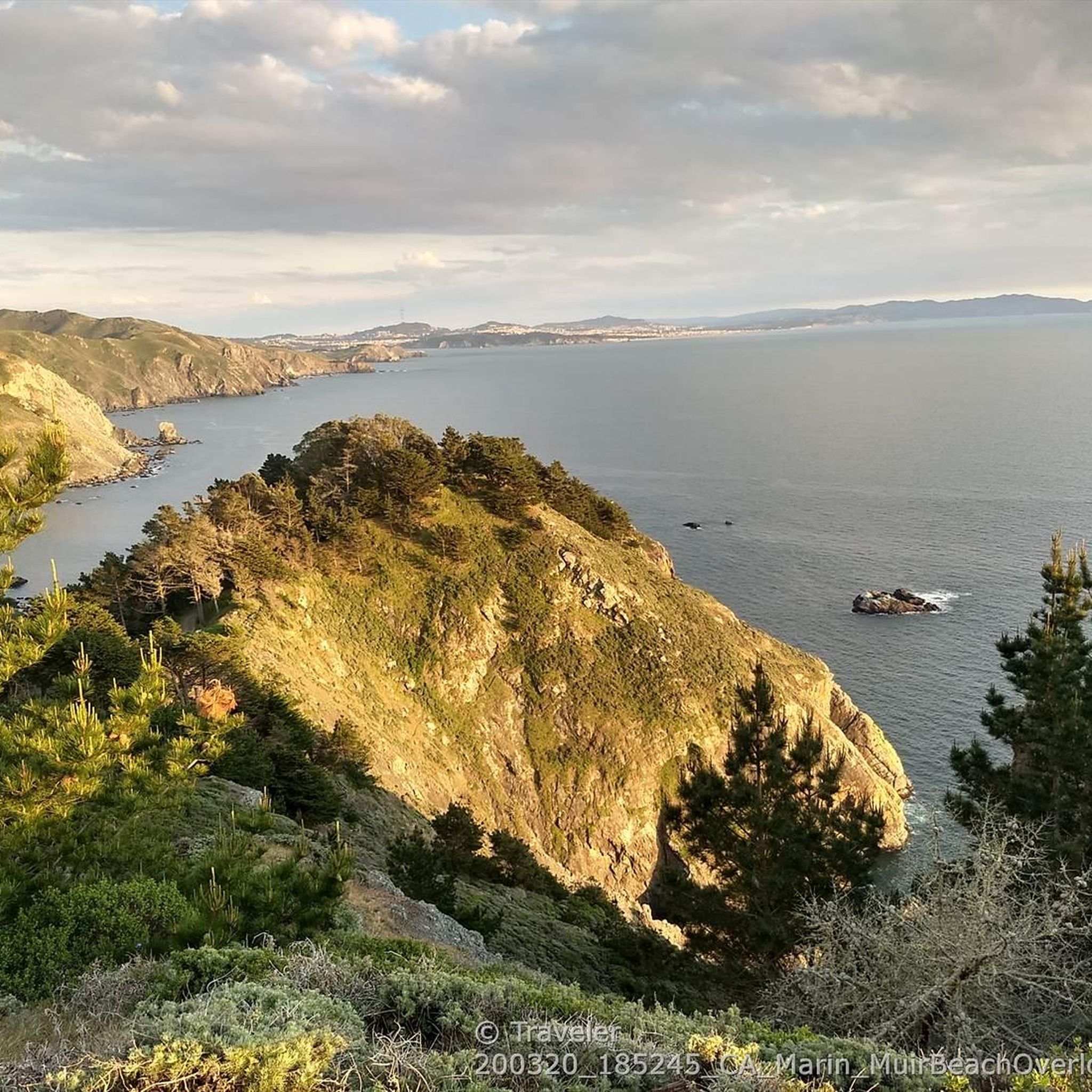
Yes, the area is rich with scenic viewpoints. The Railroad Grade Fire Road loop from Mill Valley, for instance, offers expansive vistas from the West Point of Mount Tamalpais. The Muir Beach Overlook is another rocky point providing sweeping views of the Pacific Coast, including the Point Reyes Peninsula and San Francisco. You can also find great views from highlights like Mount Tamalpais Summits.
What natural attractions or landmarks can I explore near the gravel bike routes?
Beyond the trails, you can explore several natural attractions. Muir Woods National Monument, just three miles from Muir Beach, is home to ancient old-growth redwoods. The Bothin Marsh Preserve and Phoenix Lake offer serene natural settings. You might also encounter wildlife, including monarch butterflies during migration season, and even spot whales from coastal vantage points.
Are there any loop routes for gravel biking near Muir Beach?
Yes, many gravel routes in the area are designed as loops. Examples include the Pantoll Road loop from Mill Valley, the Railroad Grade Fire Road loop from Mill Valley, and the Old Mine Trail (lower) 🌲 – Coast View Trail loop from Tamalpais-Homestead Valley. These loops allow you to experience diverse terrain without retracing your steps.
What is the best season for gravel biking around Muir Beach?
Muir Beach offers good gravel biking conditions year-round, but spring and fall are particularly pleasant with milder temperatures and less fog. Winter can be a good time for whale watching, while autumn brings monarch butterflies. Always check local weather and trail conditions before heading out, as coastal weather can change rapidly.
Is public transport available to access gravel trails near Muir Beach?
While Muir Beach is accessible by car, public transport options directly to trailheads can be limited. It's advisable to check local bus schedules for Marin County, as some routes might get you close to the general area, but direct access to specific gravel trail starting points often requires personal transport or a short ride from a bus stop.
Where can I find parking for gravel biking near Muir Beach?
Parking is available at Muir Beach itself, with a 450-foot pedestrian bridge connecting the parking lot to the beach and the Coastal Trail. For routes starting further inland, such as those near Mill Valley or Tamalpais-Homestead Valley, you'll find various parking areas, often near trailheads or in designated park lots. Always check local signage for parking regulations and fees.
Are there any cafes or pubs near the gravel biking trails in Muir Beach?
Muir Beach itself is a quieter area, but you can find amenities in nearby towns. Mill Valley, a common starting point for many routes like the Phoenix Lake – Fish Gulch trail junction loop, offers a selection of cafes, restaurants, and pubs where you can refuel after your ride. Stinson Beach, another coastal town, is also a short drive away.
What should I wear for gravel biking in Muir Beach?
Due to the coastal influence and varied terrain, it's best to dress in layers. The weather can change quickly from cool and foggy to warm and sunny. Essential gear includes a helmet, appropriate cycling attire, gloves, and sturdy shoes. Always carry water, snacks, and basic repair tools for your bike.
How does gravel biking in Muir Beach compare to Stinson Beach?
Both Muir Beach and Stinson Beach offer excellent coastal gravel biking. Muir Beach is known for its direct access to Mount Tamalpais climbs and the rugged Marin Headlands, providing more challenging, elevation-heavy routes. Stinson Beach, while also scenic, might offer slightly flatter coastal sections and is a popular starting point for rides along the Bolinas Ridge. Muir Beach generally provides a more diverse mix of challenging climbs and varied terrain.
Most popular attractions around Muir Beach

Get inspired with the komoot mobile app


Explore more
Browse the best Gravel rides in other regions.
