The best gravel rides around Surrey
4.6
(128)
794
riders
21
rides
Gravel biking around Surrey offers diverse terrain, from coastal paths to river dikes and urban forests. The region features a mix of flat, well-maintained gravel paths and some sections with gentle elevation changes. Natural features include expansive bay areas, river floodplains, and numerous regional parks. This landscape provides varied environments suitable for different gravel biking experiences.
Best gravel bike trails around Surrey
- The most popular gravel bike trail is Mud Bay Park – Boundary Bay Gravel Path loop from Watershed Park, a 32.3 miles (52.0 km) trail that takes 4 hours 24 minutes to complete. This route offers extensive views along the Boundary Bay Gravel Path.
- Another top favourite among local gravel bikers is Mud Bay Park – Boundary Bay Gravel Path loop from Joe Brown Park Equestrian Trailhead, a moderate 23.9 miles (38.6 km) path. This trail features scenic stretches along the bay and through parkland.
- Local gravel bikers also love the Pitt River Bridge – Pitt River Dike Trail loop from Walnut Grove, a 32.6 miles (52.5 km) trail leading through river dikes and along the Pitt River, often completed in about 4 hours 20 minutes.
- Gravel biking around Surrey is defined by extensive dike trails, regional park networks, and coastal routes. The network offers options for various ability levels, from easy loops to more moderate distances.
- The routes in Surrey are highly rated by the komoot community with an average score of 4.6 stars from over 140 reviews. More than 900 gravel bikers have used komoot to explore Surrey's varied terrain.
Last updated: October 20, 2026
5.0
(10)
145
riders
74.9km
04:41
980m
980m
Hard gravel ride. Very good fitness required. You may need to push your bike for some segments of this route.
4.3
(38)
126
riders
42.9km
02:09
110m
110m
Moderate gravel ride. Good fitness required. Mostly paved surfaces. Suitable for all skill levels.

4.9
(7)
67
riders
52.0km
02:37
140m
140m
Moderate gravel ride. Good fitness required. Mostly paved surfaces. Suitable for all skill levels.
4.9
(7)
38
riders
51.1km
02:28
90m
90m
Moderate gravel ride. Good fitness required. Mostly paved surfaces. Suitable for all skill levels.
4.3
(6)
30
riders
31.0km
01:30
60m
60m
Easy gravel ride. Great for any fitness level. Mostly paved surfaces. Suitable for all skill levels.
Get access to more routes and recommendations from other explorers.
Already have an account?
Our route recommendations are based on thousands of hikes, rides, and runs completed by other people on komoot.
Start today with a free account
Your next adventure awaits.
Tips from the Community

The Alouette River was formerly known as the Lillooet River, but the name was changed since there is a larger, more well known river that had the same name. The name Alouette was chosen for the simple reason that it sounds similar to Lillooet, but French speakers will recognize that it means lark.
0
0

The Hyde Creek Salmon Hatchery is a small powerhouse of local conservation, run entirely by volunteers who raise thousands of coho and chum salmon each year. Its story began in the 1980s with a homemade backyard hatchery, complete with an old bathtub! Drop by on a Saturday morning when volunteers are usually around, and you may get a glimpse behind the scenes before heading back out to watch for salmon in Hyde Creek itself.
1
0

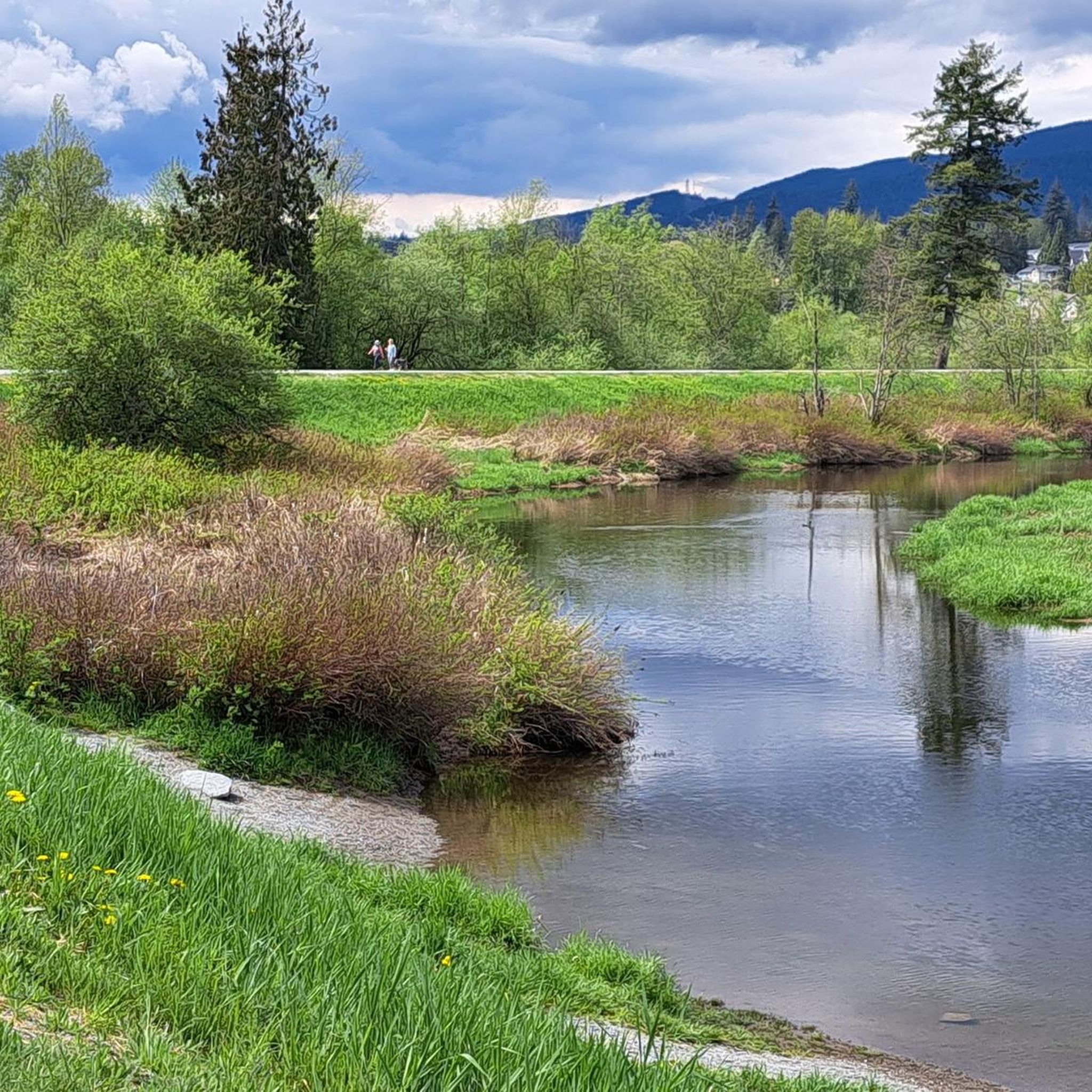
The view opens onto a slow, meandering river cutting through wide-open farmland — a mix of grassy fields, wetland patches, and hedgerows rather than dense forest crowding the banks.
0
0
This brigde was built through community fundraising efforts led by the Colony Farm Park Association, working in partnership with Metro Vancouver, to give walkers and cyclists a direct river crossing within the park's trail network. It serves as a key junction point: crossing it lets visitors extend a walk into a longer loop, linking the western side of the park near the Community Gardens to the eastern Wilson Farm area, rather than backtracking the way they came.
0
0

So need to use a gravel bike ? Would it be too challenge with road bike?
0
0

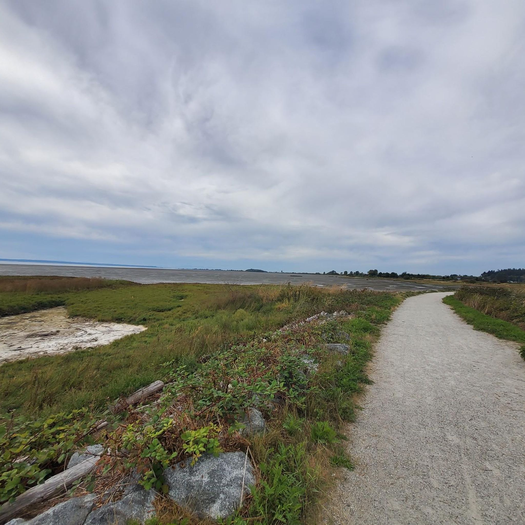
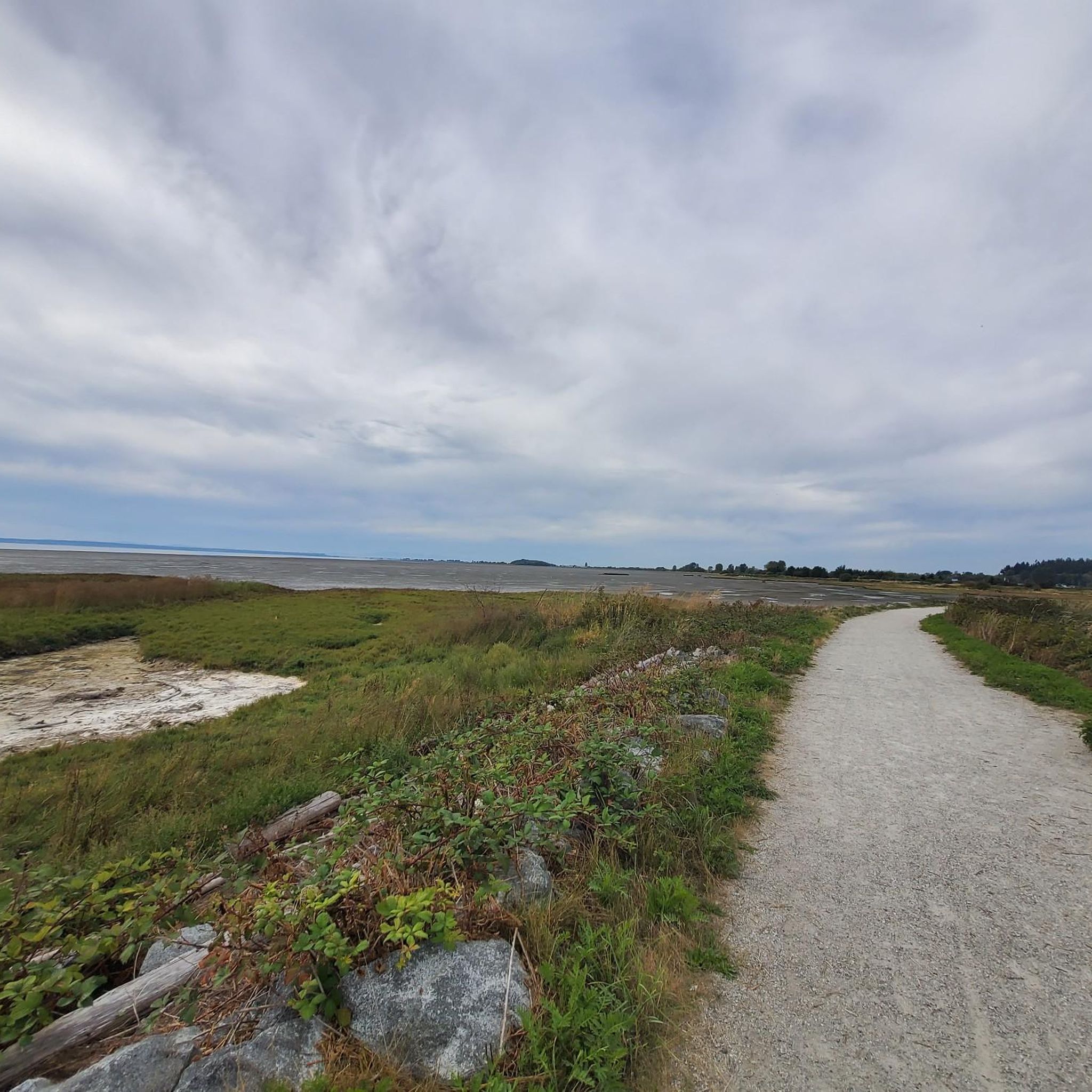
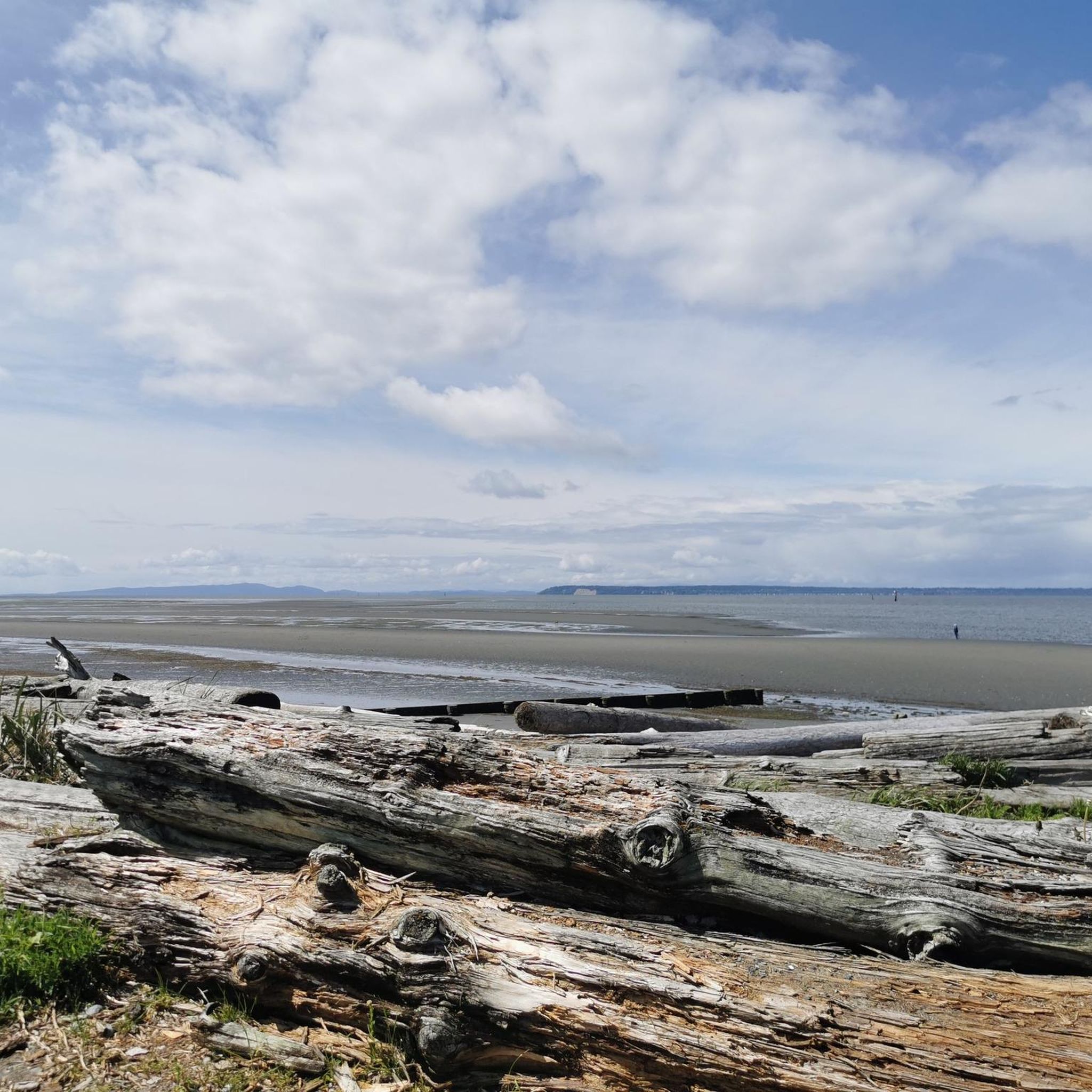
Boundary Bay Wildlife Management Area protects a vast stretch of intertidal mudflats, salt marsh, and eelgrass habitat along Boundary Bay. The area supports large numbers of migratory shorebirds and waterfowl, making it one of the most important bird habitats on Canada’s Pacific coast. Its accessible trails, consistent bird activity, and ever-changing tidal scenery make it an especially rewarding place to explore on foot or by bike.
0
0
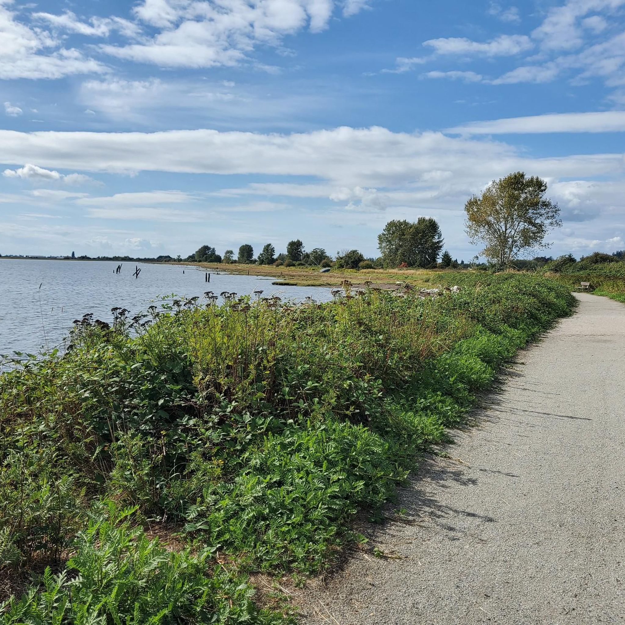
Boundary Bay Dyke Trail is a long, flat route along the shoreline, with uninterrupted views across mudflats and the open water. Its wide gravel surface is ideal for walking and cycling, with plenty of benches and access points along the way. Set along a major migratory route, the trail is especially known for birdlife and beautiful, expansive coastal scenery.
1
0
Pitt Meadows Regional Airport sits right along the Pitt River Regional Greenway and the Fraser River, serving general aviation, flight training, and small aircraft operations in the Lower Mainland. The low-lying airfield is surrounded by farmland and dike trails, making aircraft activity a constant backdrop for nearby walks and rides. As you pass by, you'll likely see planes taking off and landing at close range against the open valley setting.
0
0
Frequently Asked Questions
How many gravel bike trails are available in Surrey?
Surrey offers a wide selection of gravel biking routes, with over 35 trails to explore. These routes cater to various skill levels, including easy, moderate, and more challenging options.
What kind of terrain can I expect on Surrey's gravel bike trails?
The gravel bike trails in Surrey feature diverse terrain, ranging from smooth, well-maintained gravel paths to sections with gentle elevation changes. You'll encounter coastal paths, river dikes, and routes through urban forests, providing a varied and engaging riding experience.
Are there any easy gravel bike trails suitable for beginners in Surrey?
Yes, Surrey has 13 easy gravel biking routes perfect for beginners or those looking for a relaxed ride. These trails often feature flatter sections and well-maintained surfaces, making them accessible for all skill levels.
What are some popular gravel biking routes in Surrey?
Among the local favorites are the Mud Bay Park – Boundary Bay Gravel Path loop from Watershed Park, which offers extensive bay views, and the Pitt River Bridge – Pitt River Dike Trail loop from Walnut Grove, known for its scenic river dikes.
What do other gravel bikers enjoy most about riding in Surrey?
The gravel biking routes in Surrey are highly rated by the komoot community, with an average score of 4.6 stars from over 140 reviews. Riders often praise the extensive dike trails, regional park networks, and coastal routes that offer diverse scenery and options for various ability levels.
Are there any circular gravel bike routes in Surrey?
Many of Surrey's gravel bike trails are designed as loops, offering convenient circular routes. For example, the Fort-to-Fort Trail – Derby Reach Regional Park loop from Walnut Grove is an easy circular option that allows you to start and finish in the same location.
What are some natural features or landmarks I might see along the gravel trails?
Along Surrey's gravel trails, you can enjoy expansive bay areas, river floodplains, and numerous regional parks. You might also encounter highlights such as Burnaby Lake Wetlands or the scenic South Shore Trail.
Are there any attractions or points of interest near the gravel biking routes?
Yes, Surrey offers several interesting attractions nearby. You could visit the Tynehead Pedestrian Overpass, explore the historic Fort-to-Fort Trail, or see the iconic White Rock Pier and Waterfront.
How long do gravel bike rides in Surrey typically take?
The duration of gravel bike rides in Surrey varies depending on the route and your pace. For instance, the Mud Bay Park – Boundary Bay Gravel Path loop from Watershed Park typically takes around 4 hours and 24 minutes, while shorter routes can be completed in under two hours.
Can I find moderate or difficult gravel bike trails in Surrey?
Absolutely. Surrey provides 15 moderate and 8 difficult gravel biking routes for those seeking more of a challenge. These trails may feature longer distances, more varied terrain, or greater elevation changes to test your skills.
Are there any routes that offer coastal views?
Many of Surrey's gravel routes incorporate coastal paths, providing stunning views. The Mud Bay Park – Boundary Bay Gravel Path loop from Joe Brown Park Equestrian Trailhead is a great example, featuring scenic stretches along the bay.
Most popular routes around Surrey
Most popular attractions around Surrey

Get inspired with the komoot mobile app


Explore more
Browse the best Gravel rides in other regions.
