The best gravel rides around Villers-Franqueux
4.1
(10)
54
riders
16
rides
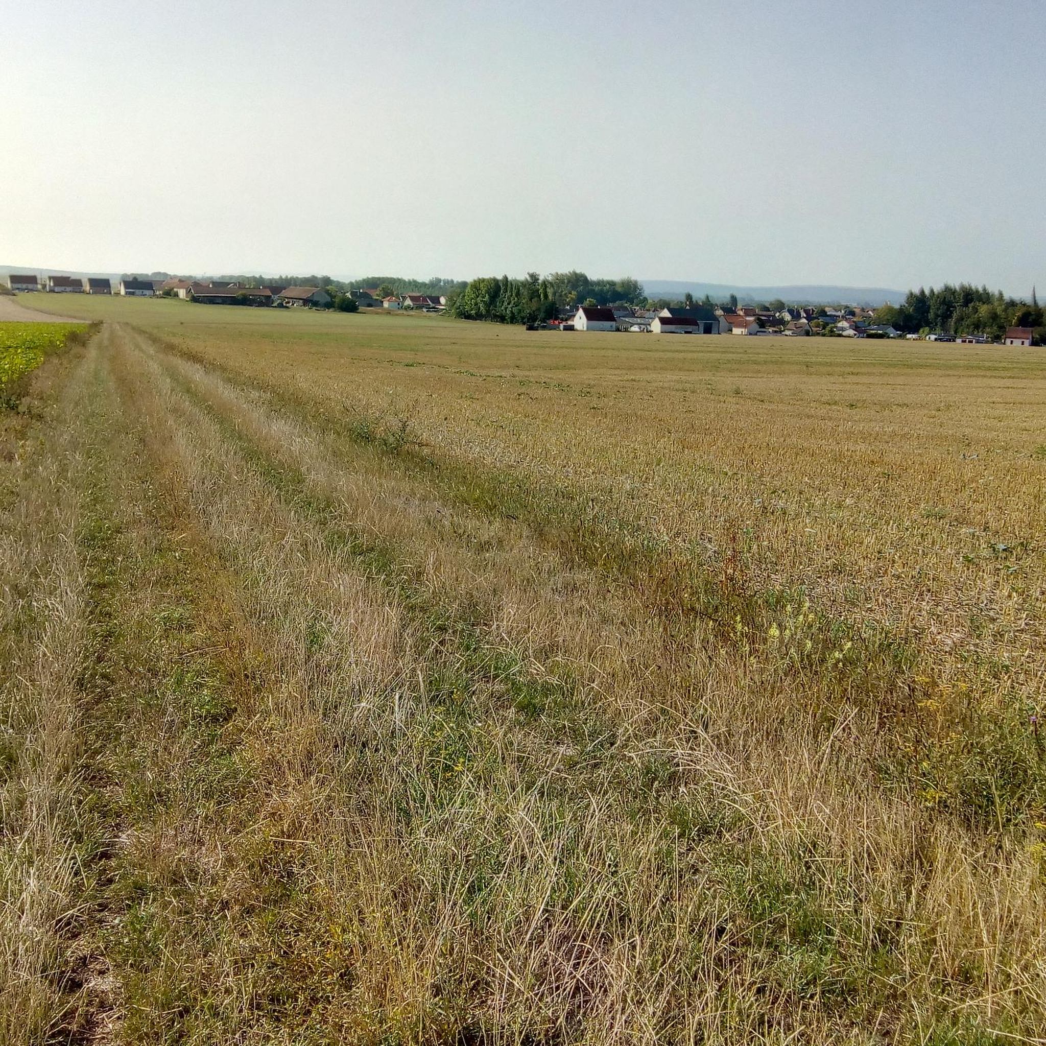
Gravel biking around Villers-Franqueux offers routes through diverse landscapes in the Marne department of north-eastern France. The region is characterized by extensive vineyards, cultivated fields, and significant forest areas within the Massif de Saint-Thierry. Terrain varies from mild slopes in agricultural zones to more undulating paths in wooded sections, providing a range of elevations suitable for gravel cycling. This area combines rural charm with access to the Champagne tourist route, featuring well-maintained gravel and dirt roads.
Best gravel bike trails…
Last updated: October 20, 2026
3.8
(4)
17
riders
56.1km
03:22
350m
350m
Moderate gravel ride. Good fitness required. Mostly paved surfaces. Suitable for all skill levels.
4.0
(1)
8
riders
82.6km
05:45
1,220m
1,220m
Hard gravel ride. Very good fitness required. Mostly paved surfaces. Suitable for all skill levels.

5.0
(1)
7
riders
35.8km
02:36
340m
340m
Moderate gravel ride. Good fitness required. Mostly paved surfaces. Suitable for all skill levels.
5.0
(2)
3
riders
46.7km
03:24
540m
540m
Hard gravel ride. Very good fitness required. Mostly paved surfaces. Suitable for all skill levels.
3
riders
23.8km
01:43
260m
260m
Moderate gravel ride. Good fitness required. Mostly paved surfaces. Suitable for all skill levels.
Get access to more routes and recommendations from other explorers.
Already have an account?
Our route recommendations are based on thousands of hikes, rides, and runs completed by other people on komoot.
Start today with a free account
Your next adventure awaits.

Tips from the Community

Sure, it's not really a mountain bike destination, but you should definitely take the time, it's worth it.
1
0

Under the central arch is a calendar depicting the activities and tasks of agriculture and viticulture: grape pressing, harvesting, etc. A calendar can be seen here through the carved reliefs. Under the eastern arch, we can see a she-wolf suckling Romulus and Remus. According to legend, it was Remus who founded Reims. Finally, under the western arch, we can see Leda being seduced by Jupiter.
1
0
This ancient monument is one of the longest in the Roman world: it is approximately 32 meters long and 12 meters high! The Mars Gate was built towards the end of the 2nd century and is the only one of the four monumental arches providing access to the city of Durocortorum that has survived. It consists of three arcades. The central arch carried the city's major north-south axis, intended for the passage of carriages. The two side arcades were used by pedestrians.
1
0

While staying on the asphalt, you can cover more than 24 km. From the St. Brice Courcelles side, you can go up to La Neuvillette, then to Courcy, it's an unpaved road (passable but not for road bikes). After Courcy, there's asphalt up to Berry au Ferry (this allows you to discover the Sapigneul Owl, about 150 m on dirt road). On the other side, after Sillery, you can continue to Beaumont (asphalt). Then, on a dirt road passable by mountain bike, you can go to the Billy Arch, where the canal passes through a tunnel.
0
0

The monument survived destruction because it was walled up inside the Archbishop's castle in the 13th century, which inadvertently preserved it for future generations.
3
1
The Porte de Mars is a 3rd-century Roman monument in Reims, France, representing the widest arch in the entire Roman world at 33 meters long and 13 meters high. Originally built as one of four monumental arches at the cardinal entrances to ancient Durocortorum, it's the only surviving example of these grand structures. The arch features three decorated archways with intricate relief carvings, including scenes of Romulus and Remus with the she-wolf, agricultural calendars showing Gallic harvesters, and mythological figures like Leda and Zeus.
3
1
From 1793 to 1802, the church was repurposed as a stable and military barracks during the French Revolutionary period. The church also showcases modern stained glass windows by renowned artists including Czech painter Joseph Sima and Portuguese artist Maria Elena Vieira Da Silva
5
2
From its inauguration, residents criticized the fountain's weak water flow of only 12 liters per second, and the nude naiads representing the rivers caused public controversy. During World War II, German occupiers removed the bronze statue, but remarkably the fountain remained intact despite 60% of Reims being destroyed during the war.
4
3
Frequently Asked Questions
How many gravel bike trails are available around Villers-Franqueux?
There are over 20 gravel bike trails around Villers-Franqueux, offering a variety of experiences. These routes are highly rated by the komoot community, with an average score of 4.4 stars from over 20 reviews.
What kind of terrain can I expect on the gravel bike routes in Villers-Franqueux?
The terrain around Villers-Franqueux is diverse, featuring picturesque vineyards, cultivated fields, and significant forest areas within the Massif de Saint-Thierry. You'll find a mix of well-maintained gravel and dirt roads, with mild slopes in agricultural zones and more undulating paths in wooded sections.
Are there gravel routes suitable for beginners or families?
Yes, the region offers routes for various ability levels. While many routes are moderate, there are also easier paths that are suitable for beginners or families looking for a less strenuous ride. The mild slopes in the vineyard areas are generally quite manageable.
What are some notable landmarks or natural features I might see along the trails?
The routes often pass through the scenic vineyards of the Champagne region and the tranquil forests of the Massif de Saint-Thierry. While cycling, you might encounter historical sites in nearby Reims such as the Place Royale, the Subé fountain, or the ancient Mars Gate.
Are there any circular gravel bike routes in the area?
Many of the gravel bike routes around Villers-Franqueux are designed as loops, allowing you to start and finish in the same location. For example, the Reims green corridor – View of the canal loop from Reims is a popular circular trail offering views along the canal and through the countryside.
Can I combine gravel biking with exploring the Champagne region's wineries?
Absolutely! Villers-Franqueux is traversed by the Champagne tourist route. You can easily combine your gravel biking adventure with visits to local wineries and tasting cellars, such as the local cooperative '6 coteaux' in the village.
What do other gravel bikers enjoy most about the routes in Villers-Franqueux?
The komoot community highly rates the gravel biking experience here, with an average of 4.4 stars. Riders often praise the diverse landscapes, the peaceful rural character, and the opportunity to cycle through vineyards and forests. The variety of terrain and well-maintained paths are also frequently highlighted.
Is it possible to reach Villers-Franqueux by public transport with a bike?
Villers-Franqueux is only 8 kilometers from Reims, a larger urban center. While direct public transport options to the village with bikes might be limited, you can likely reach Reims by train and then cycle the short distance to Villers-Franqueux. It's advisable to check local transport regulations regarding bikes.
Are there places to park my car when starting a gravel bike tour?
Given its rural character and proximity to Reims, you can generally find parking in or around Villers-Franqueux, especially in designated village parking areas. For routes starting closer to Reims, there are usually more established parking facilities.
Are there any routes that follow former railway lines?
Yes, Villers-Franqueux has preserved its old train station and quay from the former Reims suburban railway (CBR). These former railway lines are often repurposed into greenways or cycle paths, offering flat and direct routes that are ideal for gravel biking and exploring the local history.
What is a good route for experiencing both canal views and vineyard scenery?
The Canal de l'Aisne à la Marne – Verzenay Windmill loop from Reims is an excellent choice. This moderate 45 km path navigates along the canal and features beautiful vineyard scenery, offering a great blend of both landscapes.
Can I find routes that take me through cultivated fields and forest edges?
Certainly. The Reims green corridor – Hermonville loop from Reims is a popular 37.4 km trail that leads through cultivated fields and along forest edges, providing a varied and engaging ride.
Most popular routes around Villers-Franqueux
Most popular attractions around Villers-Franqueux

Get inspired with the komoot mobile app


Explore more
Browse the best Gravel rides in other regions.
