The best gravel rides around Bérigny
4.8
(12)
122
riders
15
rides
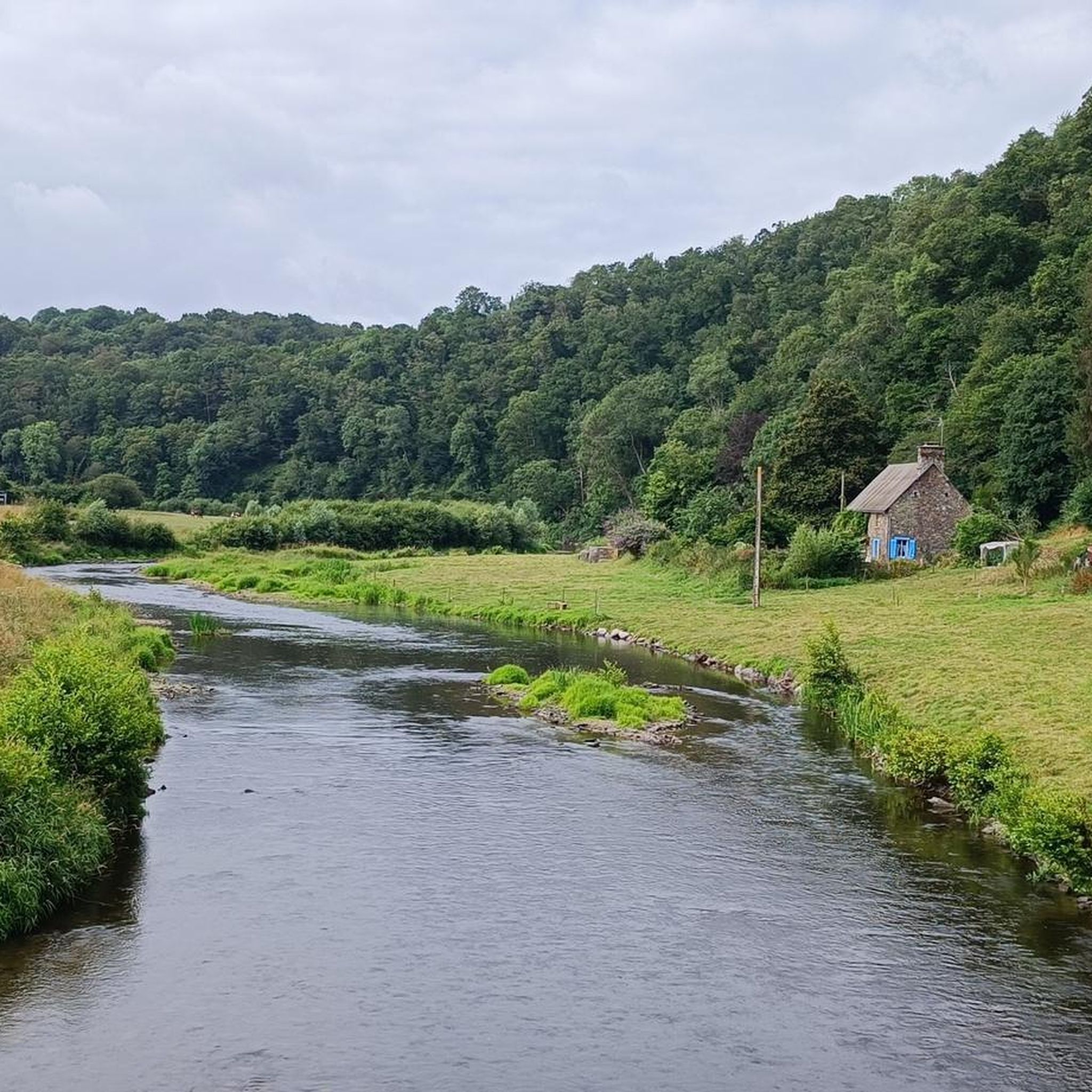
Gravel biking around Bérigny offers access to the diverse landscapes of the Manche department in Normandy, France. The region features a "bocage" countryside with rolling farmlands, sunken roads, and hedgerows, providing a mix of paved and unpaved surfaces. Bérigny itself has an elevation ranging from 73 to 159 meters, indicating varied terrain suitable for dynamic gravel biking experiences. The area is also characterized by river valleys, such as the Vire valley, which offer picturesque routes.
Best gravel bike trails around Bérigny
- The most popular gravel bike trail is Saint-Lô Véloroute – Towing Path loop from Saint-Lô, a 24.8 miles (39.9 km) trail that takes 2 hours 39 minutes to complete. This route follows the Vire River, offering a tranquil experience.
- Another top favourite among local gravel bikers is View of the Rochers de Ham – Moderate Vire Tour loop from Saint-Lô, a moderate 24.6 miles (39.6 km) path. This route provides views over the Vire valley and the prominent Roches de Ham.
- Local gravel bikers also love the Les Roches de Ham – View of the Rochers de Ham loop from Saint-Amand, a 33.5 miles (53.9 km) trail leading through the area around the Roches de Ham, often completed in about 3 hours 56 minutes.
- Gravel biking around Bérigny is defined by bocage countryside, river valleys, and quiet D-roads, offering a blend of natural beauty and varied surfaces. The network includes options for both moderate and difficult routes, catering to different ability levels.
- The routes in Bérigny are highly rated by the komoot community with an average score of 5.0 stars from several reviews. Nearly 100 gravel bikers have used komoot to explore Bérigny's varied terrain.
Last updated: July 3, 2026
24
riders
38.1km
01:59
190m
190m
Moderate gravel ride. Good fitness required. Mostly paved surfaces. Suitable for all skill levels.
5.0
(2)
25
riders
40.1km
02:02
160m
160m
Moderate gravel ride. Good fitness required. Mostly paved surfaces. Suitable for all skill levels.

Sign up for free
25
riders
39.9km
02:04
210m
210m
Moderate gravel ride. Good fitness required. Mostly paved surfaces. Suitable for all skill levels.
5.0
(4)
8
riders
54.3km
02:57
400m
400m
Moderate gravel ride. Good fitness required. Mostly paved surfaces. Suitable for all skill levels.
11
riders
83.8km
04:51
900m
900m
Hard gravel ride. Very good fitness required. Mostly paved surfaces. Suitable for all skill levels.
Get access to more routes and recommendations from other explorers.
Sign up for free
Already have an account?
Our route recommendations are based on thousands of hikes, rides, and runs completed by other people on komoot.
Start today with a free account
Your next adventure awaits.
Login or Signup



Tips from the Community

Water point, public restrooms, picnic tables. Quiet and bucolic location.
1
0

We received a very warm welcome during our visit. This profusion of objects from a not-so-distant past may well inspire some nostalgia.
0
0

mix of towpath and path
0
0

From the top, you have a beautiful view and are, of course, ideal for zipline fans like myself. Unfortunately, during my visit, the activities were only available to employees of a company that had rented the entire facility for the day. If you're planning a visit, it's worth checking in advance whether the park is open. The mini golf course and the summer toboggan run are definitely something for children or those with a fear of heights.
0
0
From up here, you have a beautiful view down into the valley and across the Vire River. If the weather's good, you can even go for a short hike.
0
0
It's quite impressive when you're standing at the bottom and someone whizzes past on the zipline. But if you want to do more than just watch, check beforehand whether the facility is actually open. When I was there at the end of September 2024, a company had rented it for a team event. Luckily, I was allowed up on the first platform to take a few photos. You can also easily cycle up through the forest with a loaded trekking bike.
0
0

Beautiful location for leisure activities
0
0

The Vire is a coastal river in Normandy, whose course, 128.4 km long, crosses the departments of Calvados and Manche, successively bathing the towns of Vire, Saint-Lô and Isigny-sur-Mer, ending up flow into the Channel, at the limit of the two departments, more precisely in the Bay of Veys.
2
0
Frequently Asked Questions
What kind of terrain can I expect on gravel bike trails around Bérigny?
The Bérigny area, situated in the Manche department of Normandy, is characterized by its 'bocage' countryside. This means you'll encounter a mix of rolling farmlands, quiet sunken roads, and high hedgerows. The terrain offers a blend of paved and unpaved surfaces, with elevations ranging from 73 to 159 meters, providing varied and dynamic gravel biking experiences. River valleys, such as the Vire valley, also feature prominently, offering picturesque routes.
Are there any family-friendly gravel bike routes near Bérigny?
While specific 'family-friendly' designations aren't provided, many of the routes in the region follow quiet D-roads, farm tracks, and greenways, which can be suitable for families. The Saint-Lô Véloroute – Towing Path loop from Saint-Lô, for example, follows the tranquil Vire River, which might offer a more relaxed experience. Always check the route details for distance and elevation to ensure it matches your family's capabilities.
What are some notable natural features or viewpoints along the gravel trails?
Many routes offer scenic views, particularly those around the Vire valley. The View of the Rochers de Ham – Moderate Vire Tour loop from Saint-Lô and Les Roches de Ham – View of the Rochers de Ham loop from Saint-Amand provide stunning vistas over the prominent Roches de Ham. The region's bocage landscape itself, with its hedgerows and farmlands, offers a unique natural backdrop for your rides.
What is the best time of year to go gravel biking in Bérigny?
The Manche department generally offers pleasant cycling conditions from spring through autumn. Spring brings blooming landscapes, while autumn showcases vibrant foliage. Summer is also popular, though it can be warmer. Winter conditions might include colder temperatures and potentially wet or muddy paths, especially on unpaved sections. For the most comfortable experience, consider late spring or early autumn.
Are there any circular gravel bike routes available?
Yes, several popular gravel routes around Bérigny are designed as loops. Examples include the Saint-Lô Véloroute – Towing Path loop from Saint-Lô, the View of the Rochers de Ham – Moderate Vire Tour loop from Saint-Lô, and the Les Roches de Ham – View of the Rochers de Ham loop from Saint-Amand. These circular routes allow you to start and finish at the same point, making logistics easier.
What kind of difficulty levels can I expect from the gravel trails?
The gravel biking routes around Bérigny cater to various skill levels. You'll find a good mix of moderate and difficult trails. For instance, the Moderate Vire Tour – Les Roches de Ham loop from Torigni-sur-Vire is classified as difficult due to its length and elevation gain, while others like the Forêt Domaniale de Cerisy loop from Balleroy-sur-Drôme are moderate. Always check the route details for specific difficulty ratings, distance, and elevation before you set out.
What are some interesting landmarks or attractions I can visit near the gravel bike routes?
Beyond the natural beauty, the region offers several points of interest. You can explore the historic Abbey of Cerisy-la-Forêt or the impressive Balleroy Castle. The Saint-Lô Véloroute and its Towing Path along the Vire River are also popular highlights for cyclists.
How many gravel bike trails are there in the Bérigny area?
There are over 15 gravel bike trails available around Bérigny, offering a diverse range of experiences. These routes vary in length and difficulty, ensuring options for different preferences and skill levels.
What do other gravel bikers enjoy most about gravel biking in Bérigny?
The area is highly rated by the komoot community, with an average score of 5.0 stars from numerous reviews. Reviewers often praise the varied terrain, the tranquil bocage countryside, and the picturesque river valleys, which offer a blend of natural beauty and engaging riding surfaces.
Is there public transport access to the gravel trails around Bérigny?
Bérigny is a rural commune, so direct public transport access to specific trailheads might be limited. However, larger towns in the Manche department, such as Saint-Lô, often have better public transport connections. From these hubs, you might need to cycle to reach the starting points of some routes. It's advisable to check local bus or train schedules if you plan to rely on public transport.
Where can I find parking for gravel biking trails near Bérigny?
Parking availability will vary depending on the specific trailhead. Many routes start from or pass through villages and towns where public parking might be available. For example, routes originating from Saint-Lô or Saint-Amand would likely have parking options. Always look for designated parking areas or consult local maps for suitable spots near your chosen starting point.
Are there opportunities for cafe stops or places to eat along the routes?
While Bérigny itself is a small commune, many gravel routes pass through or near other villages and towns in the Manche department. These locations often offer local cafes, bakeries, or small restaurants where you can refuel. Planning your route with potential stops in mind, especially in places like Saint-Lô or other larger settlements, is recommended.
Most popular attractions around Bérigny

Get inspired with the komoot mobile app


Explore more
Browse the best Gravel rides in other regions.
