The best gravel rides around Buxerolles
4.4
(51)
474
riders
118
rides
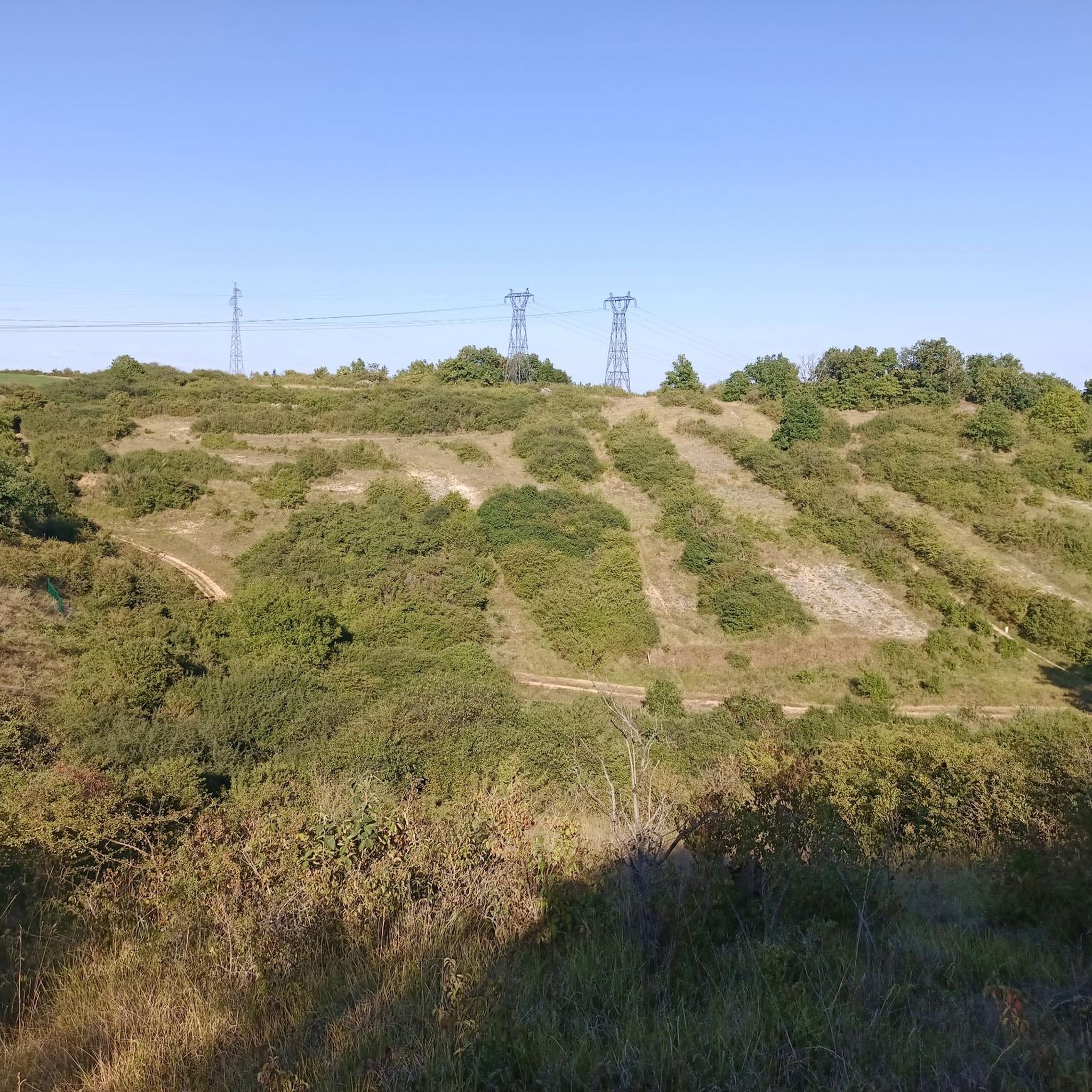
Gravel biking around Buxerolles offers diverse landscapes, including river valleys, unique "dry valleys," and accessible paths. The region is characterized by the Clain River and its banks, providing pleasant routes alongside geological formations like the "Vallées Sèches" which are rich in biodiversity. These areas feature varied terrain with moderate ascents, making them suitable for gravel bikes. Green spaces and parks further contribute to the network of paths available for exploration.
Best gravel bike trails around Buxerolles
- The most popular gravel…
Last updated: July 3, 2026
5.0
(2)
25
riders
34.4km
02:20
280m
280m
Moderate gravel ride. Good fitness required. Mostly paved surfaces. Suitable for all skill levels.
21
riders
79.0km
05:29
620m
620m
Hard gravel ride. Very good fitness required. Mostly paved surfaces. Suitable for all skill levels.

Sign up for free
4.0
(3)
13
riders
58.8km
04:12
470m
470m
Hard gravel ride. Very good fitness required. Mostly paved surfaces. Suitable for all skill levels.
4.0
(2)
18
riders
51.4km
03:17
370m
370m
Moderate gravel ride. Good fitness required. Mostly paved surfaces. Suitable for all skill levels.
4.5
(2)
9
riders
45.4km
03:21
330m
330m
Moderate gravel ride. Good fitness required. Mostly paved surfaces. Suitable for all skill levels.
Get access to more routes and recommendations from other explorers.
Sign up for free
Already have an account?
Our route recommendations are based on thousands of hikes, rides, and runs completed by other people on komoot.
Start today with a free account
Your next adventure awaits.
Login or Signup


Tips from the Community

Finally, I was able to do this walk I'd been dreaming about for so long. With these 25 to 30 meters of height, you have a beautiful view of the Auxance valley.
1
0

Walked today (25/07/25) and it is difficult to walk due to 30 fallen trees
1
0

Cliffs I knew well, about sixty years ago. It was an excellent climbing school; climbing walls didn't exist. Very good memories, with the APDA.
1
0

Caution! Between the Futuroscope station and the first few meters of safety, you must drive along a four-lane road (Avenue de Bordeaux). Not for children!
0
0


The Roman Road, good physical condition, elevation gain +200, pleasant path with not too much rutted terrain, magnificent scenery, and guaranteed tranquility. This path, also known as the Via Podiensis or Chemin du Puy, is one of the main pilgrimage routes to Santiago de Compostela in France: *Start and Finish**: From Tours to Le Puy-en-Velay, in central France, and ends in Saint-Jean-Pied-de-Port, near the Spanish border. From there, pilgrims can continue to Santiago de Compostela in Spain. *Historical**: This route partly follows the ancient Roman roads, hence its name. It is one of the four major French routes leading to Santiago de Compostela, along with the Via Turonensis, the Via Lemovicensis, and the Via Tolosana. *Heritage and Landscapes**: The route crosses varied landscapes, including valleys and plains. It passes several historical and cultural sites, such as churches, abbeys, and medieval villages. **Symbolism**: As with the other Camino de Santiago routes, the Via Podiensis is marked by scallop shells and yellow arrows that guide pilgrims. These symbols are important landmarks for travelers. **Spiritual and Cultural Experience**: For many pilgrims, walking this route is an enriching spiritual and cultural experience.
0
0

Frequently Asked Questions
How many gravel bike trails are available around Buxerolles?
There are over 120 gravel bike routes around Buxerolles, offering diverse landscapes and challenges. You'll find a good mix of easy, moderate, and difficult trails to explore the region.
What kind of terrain can I expect on gravel bike trails near Buxerolles?
The terrain around Buxerolles is varied, featuring river valleys along the Clain River, unique 'dry valleys' like the Vallée des Buis, and accessible paths through green spaces. You'll encounter a mix of surfaces suitable for gravel bikes, with some routes offering moderate ascents and others providing more challenging climbs.
Are there any family-friendly gravel bike routes in Buxerolles?
Yes, Buxerolles offers accessible paths and green spaces suitable for family outings. While specific 'family-friendly' routes aren't explicitly categorized, many of the easier paths through parks like Valvert Park or Parc de la Robla could be suitable for families looking for a relaxed ride.
What natural features or landmarks can I see along the gravel bike trails?
Many routes follow the scenic Clain River and its banks. You can also explore the unique 'Vallées Sèches' (dry valleys), which are rich in biodiversity. For specific landmarks, consider routes that pass by historical sites like Le Moulin de la Norée or even castles such as Château de Dissay.
Are there any circular gravel bike routes around Buxerolles?
Yes, many of the gravel routes around Buxerolles are designed as loops. For instance, you could try the Small arch – Le Moulin de la Norée loop from Poitiers, which is a moderate 42.2 km ride exploring the Clain River area.
What is the best time of year for gravel biking in Buxerolles?
The region's 'dry valleys' can occasionally flood after prolonged rain, reverting to their ancient riverine appearance. Therefore, spring and summer generally offer the most reliable conditions for gravel biking. Autumn can also be pleasant, but it's always wise to check local weather conditions, especially after heavy rainfall.
Are there any longer or more challenging gravel bike routes for experienced riders?
For those seeking a longer and more challenging ride, the Le Tison Urban Park – Poitiers loop from Poitiers is a difficult 89.7 km route with significant elevation gain, offering an extensive exploration of the wider area.
Where can I find parking for gravel biking near Buxerolles?
Buxerolles, being a suburb of Poitiers, offers various parking options. Many routes start from Poitiers itself, where public parking is available. For routes originating directly in Buxerolles, local parks like Valvert Park or Parc de la Robla may have designated parking areas, providing convenient access to the trails.
What do other gravel bikers enjoy most about the trails in Buxerolles?
The gravel biking routes in Buxerolles are highly rated by the komoot community, with an average score of 4.4 stars from over 50 reviews. Riders often praise the diverse landscapes, the mix of river valleys and unique dry valleys, and the variety of accessible paths that cater to different fitness levels.
Are there any routes that offer an extended exploration of the wider Poitiers area?
Absolutely. The Le Moulin de la Norée – Small arch loop from Poitiers is a moderate 56.6 km path that provides an extended journey through the diverse landscapes surrounding Poitiers, perfect for a longer day out.
Can I access gravel bike trails near Buxerolles using public transport?
Buxerolles is well-connected to Poitiers, which serves as a hub for public transport. Many gravel routes start from Poitiers, making it feasible to reach starting points via local bus services or by train to Poitiers station, then cycling to the trailheads. Check local transport schedules for specific connections.
Are there any routes that lead through green corridors and accessible paths?
Yes, the region is known for its green spaces and accessible paths. A great example is the Le Moulin de la Norée – Chemin des Près de la Fontaine loop from Poitiers, a 31.3 km trail that guides you through pleasant green corridors and well-maintained paths.
Most popular routes around Buxerolles
Most popular attractions around Buxerolles

Get inspired with the komoot mobile app


Explore more
Browse the best Gravel rides in other regions.
