The best gravel rides around Wolfzahnau
4.4
(815)
4,193
riders
221
rides
Gravel bike trails around Wolfzahnau are located within a 76-hectare landscape protection area in northern Augsburg, Germany, at the confluence of the Wertach and Lech rivers. The terrain features jungle-like riparian forests, open meadows, and diverse biotopes, offering varied surfaces suitable for gravel biking. This includes compacted earth, gravel paths, and some rougher sections, providing a mix of riding experiences. The landscape is maintained by conservation efforts and Scottish Highland cattle, contributing to its ecological balance.
Best gravel bike trails…
Last updated: July 2, 2026
4
riders
30.3km
01:39
150m
150m
Moderate gravel ride. Good fitness required. Mostly paved surfaces. Suitable for all skill levels.
4.5
(34)
166
riders
Moderate gravel ride. Good fitness required. Mostly paved surfaces. Suitable for all skill levels.

Sign up for free
4.2
(5)
43
riders
44.4km
02:34
470m
460m
Hard gravel ride. Very good fitness required. You may need to push your bike for some segments of this route.
4.6
(9)
67
riders
Moderate gravel ride. Good fitness required. Mostly paved surfaces. Suitable for all skill levels.
4.5
(2)
44
riders
15.9km
00:48
40m
40m
Easy gravel ride. Great for any fitness level. Mostly paved surfaces. Suitable for all skill levels.
Get access to more routes and recommendations from other explorers.
Sign up for free
Already have an account?
Our route recommendations are based on thousands of hikes, rides, and runs completed by other people on komoot.
Start today with a free account
Your next adventure awaits.
Login or Signup
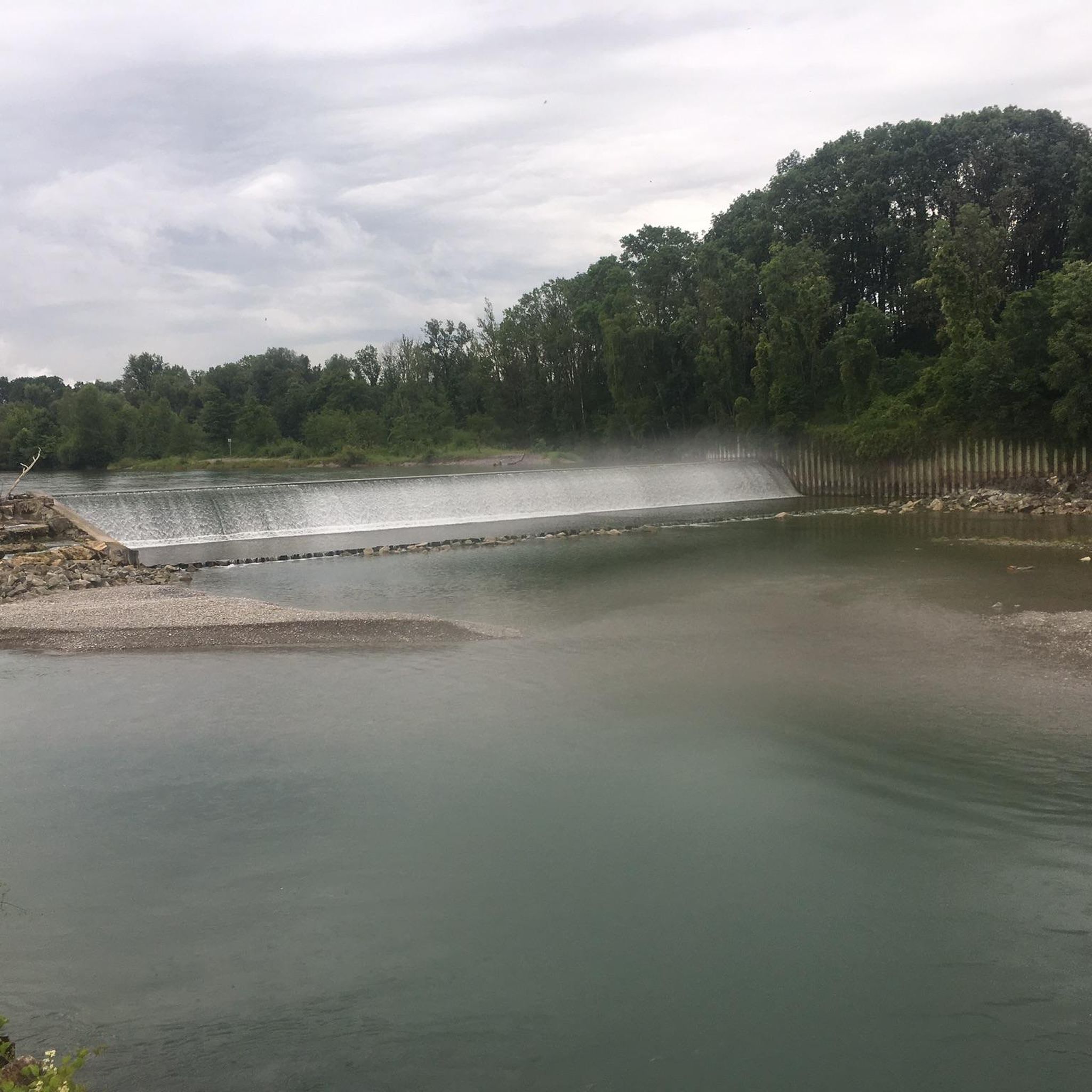
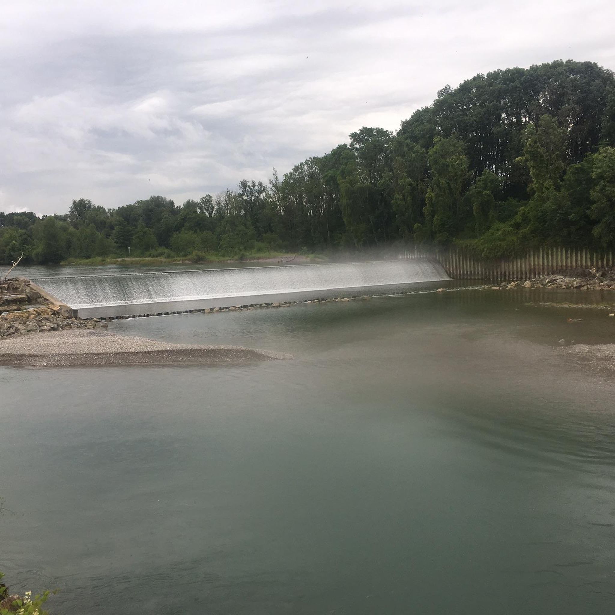
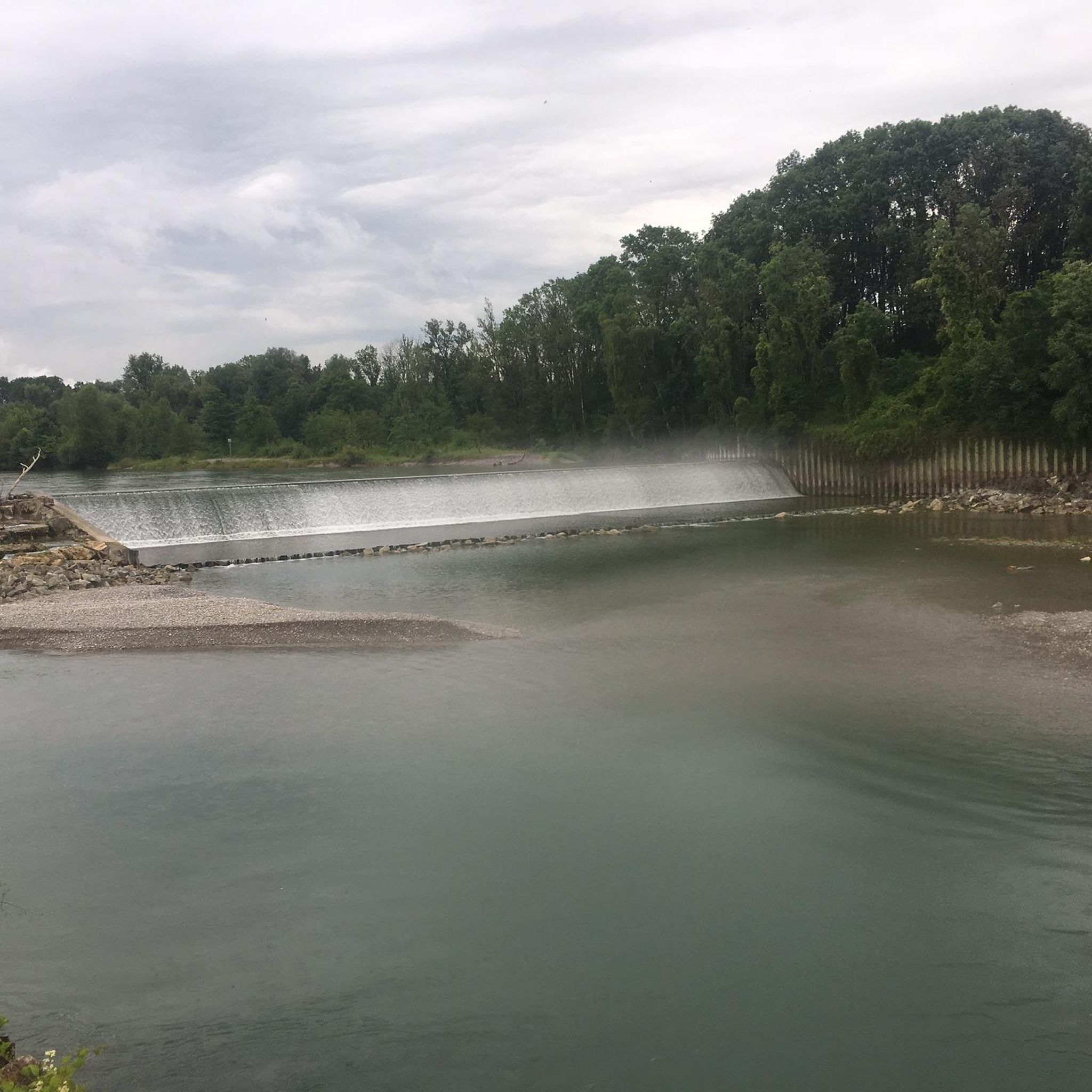
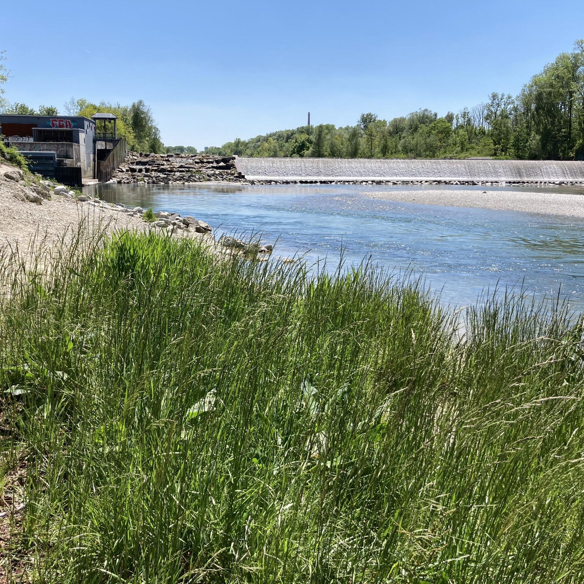
Tips from the Community

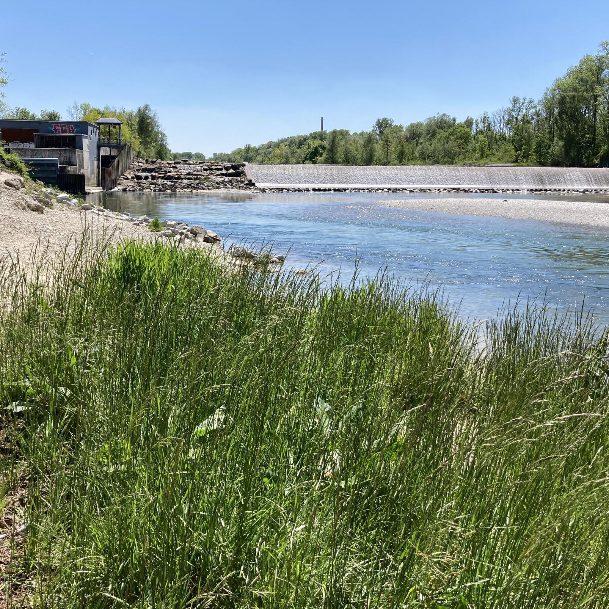
Depending on the water flow in the Lech, north of the weir in Gersthofen, the "river" is only fed by the water flowing through the fish ladder, with the water being primarily diverted into the Lech canal.😒
0
0

The pond is beautifully situated in the middle of the forest, where you can go on very long hikes.
0
0

… and always be prepared to drive a car: don’t take blind bends too fast (today, when the road through Gessertshausen was closed, many took the route through the forest 😟)
0
0

At the northern end of the Wolfzahnau, the Wertach River flows into the Lech River. The Lech and Wertach rivers converge in the Wolfzahnau – a landscape conservation area within the city of Augsburg, located on the western bank of the Lech River. The Lech carries greenish water, while the Wertach carries brownish water.
1
0

The Lech is a right tributary of the Danube. The 256 km long river originates in Vorarlberg in the Hochtannberg region at the confluence of the Spullerbach and Formarinbach streams in the Tannläger valley. It flows through Tyrol and southern Bavaria, where it empties into the Danube. Shortly before the Austrian-German border, it joins the Vils river, forms the artificial Lechfall near Füssen, and crosses Swabia and Upper Bavaria on its way. The largest cities on the Lech are Landsberg and Augsburg; in this city, it receives its largest tributary, the Wertach. The river empties into the Danube near Marxheim. Source: Wikipedia
1
0

The Lech is a right tributary of the Danube. The 256 km long river originates in Vorarlberg in the Hochtannberg region at the confluence of the Spullerbach and Formarinbach streams in the Tannläger valley. It flows through Tyrol and southern Bavaria, where it empties into the Danube. Shortly before the Austrian-German border, it joins the Vils river, forms the artificial Lechfall near Füssen, and crosses Swabia and Upper Bavaria on its way. The largest cities on the Lech are Landsberg and Augsburg; in this city, it receives its largest tributary, the Wertach. The river empties into the Danube near Marxheim. Source: Wikipedia
1
0
The Lech is a right tributary of the Danube. The 256 km long river originates in Vorarlberg in the Hochtannberg region at the confluence of the Spullerbach and Formarinbach streams in the Tannläger valley. It flows through Tyrol and southern Bavaria, where it empties into the Danube. Shortly before the Austrian-German border, it joins the Vils river, forms the artificial Lechfall near Füssen, and crosses Swabia and Upper Bavaria on its way. The largest cities on the Lech are Landsberg and Augsburg; in this city, it receives its largest tributary, the Wertach. The river empties into the Danube near Marxheim. Source: Wikipedia
1
0
Frequently Asked Questions
How many gravel bike trails are available in Wolfzahnau?
Wolfzahnau offers a wide selection of gravel bike trails, with over 330 routes available. These range from easy to difficult, ensuring options for all skill levels.
What kind of terrain can I expect on gravel bike trails in Wolfzahnau?
The terrain in Wolfzahnau is diverse, featuring a mix of compacted earth, gravel paths, and some rougher sections. You'll ride through jungle-like riparian forests, open meadows, and along the riverbanks, providing a varied and engaging experience for gravel bikers.
Are there easy gravel bike trails suitable for beginners in Wolfzahnau?
Yes, Wolfzahnau has over 70 easy gravel bike routes. A good option for a more relaxed ride is the Kuhsee – Hochablass Dam (Augsburg) loop from Augsburg, which is an easy 15.7 km (9.8 mi) trail.
Are there challenging gravel routes for experienced riders in Wolfzahnau?
Absolutely. For experienced riders seeking a challenge, there are over 70 difficult routes. Consider the Top to Grotte Trail – Anhauser Valley loop from Augsburg-Oberhausen, a demanding 44.5 km (27.6 mi) path that traverses varied terrain through the Anhauser Valley.
What natural features or landmarks can I see along the gravel bike trails in Wolfzahnau?
Many trails offer views of the impressive Confluence of the Wertach and the Lech rivers. You can also spot the historic Wolfzahnau Hydroelectric Power Plant, a UNESCO World Heritage site, and observe the Scottish Highland cattle that help maintain the open meadows.
Are the gravel bike trails in Wolfzahnau family-friendly?
Yes, many of the easier routes through the open meadows and along the riverbanks are suitable for families. The varied landscape allows for leisurely rides through nature, perfect for enjoying with children.
Can I bring my dog on the gravel bike trails in Wolfzahnau?
Wolfzahnau is a landscape protection area, and while cycling with dogs is generally permitted on designated paths, it's always best to keep your dog on a leash to protect the local wildlife and ensure a pleasant experience for all visitors. Please respect local signage regarding nature conservation.
Are there circular gravel routes available in Wolfzahnau?
Yes, many of the gravel routes in Wolfzahnau are designed as loops. For example, the Between the Lech and the Lech Canal – Thierhaupten Monastery loop from Augsburg-Oberhausen is a 52.3 km (32.5 mi) trail that takes you through riverine landscapes and past the Lech Canal.
What do other cyclists say about gravel biking in Wolfzahnau?
The area is highly rated by the komoot community, with an average score of 4.4 stars from over 850 reviews. Cyclists often praise the diverse terrain, the scenic river views, and the tranquility of the riparian forests.
Where can I park my car when visiting Wolfzahnau for gravel biking?
Parking is available at various access points around the Wolfzahnau area in Augsburg. Look for designated parking lots near the entrances to the nature reserve or along the main roads bordering the area. Specific parking information can often be found on local Augsburg city websites or mapping services.
How can I reach Wolfzahnau by public transport with my bike?
Augsburg's public transport system (AVV) offers options to reach areas near Wolfzahnau. Depending on the specific route, you might be able to take a tram or bus that allows bikes during off-peak hours. It's advisable to check the AVV website for current regulations and schedules regarding bike transport.
What is the best season for gravel biking in Wolfzahnau?
Gravel biking in Wolfzahnau is enjoyable throughout much of the year. Spring and autumn offer pleasant temperatures and beautiful scenery with changing foliage. Summer is also great, though it can be warmer. Winter riding is possible, but be mindful of potential icy or muddy conditions on unpaved sections.
Most popular routes around Wolfzahnau
Most popular attractions around Wolfzahnau

Get inspired with the komoot mobile app


Explore more
Browse the best Gravel rides in other regions.
