The best gravel rides around Steinbachtalsperre
5.0
(10)
118
riders
49
rides
Gravel biking around Steinbachtalsperre offers a diverse landscape characterized by rolling hills, river valleys, and historic castle grounds. The region features a mix of forested sections and open agricultural areas, providing varied terrain for gravel riders. Elevations are generally moderate, with some routes including sustained climbs and descents.
Best gravel bike trails around Steinbachtalsperre
- The most popular gravel bike trail is Satzvey Castle – Through the Eschweiler Valley loop from Unteres Steinbachtal, a 29.1 miles (46.8 km) difficult trail…
Last updated: July 3, 2026
8
riders
Hard gravel ride. Very good fitness required. Mostly paved surfaces. Suitable for all skill levels.
6
riders
Moderate gravel ride. Good fitness required. Mostly paved surfaces. Suitable for all skill levels.

Sign up for free
5.0
(1)
3
riders
Moderate gravel ride. Good fitness required. Mostly paved surfaces. Suitable for all skill levels.
5.0
(1)
10
riders
58.7km
04:26
1,020m
1,020m
Hard gravel ride. Very good fitness required. Mostly paved surfaces. Suitable for all skill levels.
1
riders
Moderate gravel ride. Good fitness required. Mostly paved surfaces. Suitable for all skill levels.
Get access to more routes and recommendations from other explorers.
Sign up for free
Already have an account?
Our route recommendations are based on thousands of hikes, rides, and runs completed by other people on komoot.
Start today with a free account
Your next adventure awaits.
Login or Signup
Tips from the Community


"...The restored town hall on Marktstraße was rededicated in December 1930. It is considered one of the most beautiful town halls in the Rhineland. Its red color and the design of its facade make it particularly striking. ..." CONTINUED and MORE INFORMATION: https://www.bad-muenstereifel.de/leben-in-bad-muenstereifel/neuigkeiten/details/news/wiedereinweihung-des-rathauses-1930
1
0

From here you have a magnificent view over the Eifel hills.
0
0
The Orchheim Gate is located in the south. It appears very imposing because the gate tower was shortened by one story. The gate has a Baroque archway facing the fields and a Gothic pointed arch facing the town. The interior spaces are used as apartments. Source: https://badmuenstereifelaktiv.de/stadttore/
1
0
John of Nepomuk lived from about 1350 to 1393. He died as punishment by being thrown from the Charles Bridge into the Vltava River and drowned. As a patron saint of bridges, his statue stands on many bridges in Europe.
1
0

The Gothic Town Hall in Bad Münstereifel, also known as the Red Town Hall, is a historic landmark on the market square. Originally mentioned in 1476 as the cloth merchants' hall, it later became the seat of the council and administration. It was expanded in 1550/51, suffered damage after the 2021 flood, but has been extensively renovated and now once again houses important municipal services.
6
0

Avoid the Erft Cycle Path in the Erftstadt area. A catastrophic condition.
1
0

Frequently Asked Questions
How varied are the gravel bike trails in terms of difficulty and length around Steinbachtalsperre?
The Steinbachtalsperre region offers a wide range of gravel bike trails. You'll find 4 easy routes, 37 moderate routes, and 38 difficult routes. Distances vary significantly, with many routes falling between 22 km and 50 km, ensuring options for all fitness levels.
Are there any family-friendly or beginner-level gravel bike routes available?
Yes, there are several options suitable for families and beginners. The region features 4 easy routes, which are generally shorter and have less elevation gain. These trails provide a great introduction to gravel biking in the area.
What options are there for experienced gravel bikers seeking a challenge?
Experienced gravel bikers will find plenty of challenging routes. There are 38 difficult trails, often featuring sustained climbs and descents. For example, the Satzvey Castle – Through the Eschweiler Valley loop from Unteres Steinbachtal is a difficult 46.8 km route with significant elevation changes.
When is the best time of year to go gravel biking, and what are winter conditions like?
The best time for gravel biking around Steinbachtalsperre is typically from spring through autumn, when the weather is milder and trails are dry. During winter, conditions can become challenging due to snow, ice, and muddy sections, especially in forested areas. Always check local weather and trail conditions before heading out in colder months.
Are most gravel bike routes around Steinbachtalsperre circular?
Many of the gravel bike routes in the Steinbachtalsperre area are designed as loops, allowing you to start and finish at the same point. Examples include the Hardtburg Castle – View of the Voreifel Landscape loop from Euskirchen-Kreuzweingarten and the Market Square, Bad Münstereifel – Werther Gate, Bad Münstereifel loop from Euskirchen-Stotzheim.
What kind of nature and wildlife can I expect to see along the trails?
The region is characterized by diverse landscapes, including rolling hills, river valleys, forested sections, and open agricultural areas. You can expect to see various local flora and fauna typical of Central European woodlands and fields. Keep an eye out for birds and smaller mammals, especially in quieter sections of the trails.
Are there places to eat or drink along the gravel bike routes?
Yes, you can find options for refreshments. For instance, the Waldgasthaus Steinbach Brewery & Beer Garden is a popular spot near the Steinbachtalsperre itself, offering a chance to refuel during or after your ride.
Can I find scenic viewpoints along the gravel bike trails?
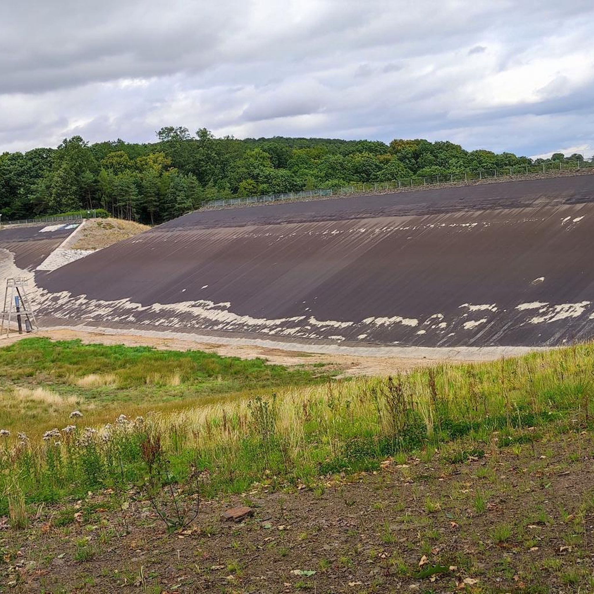
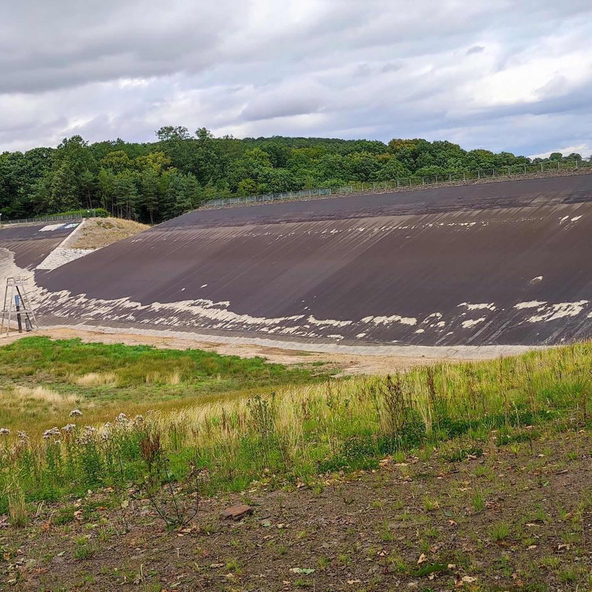
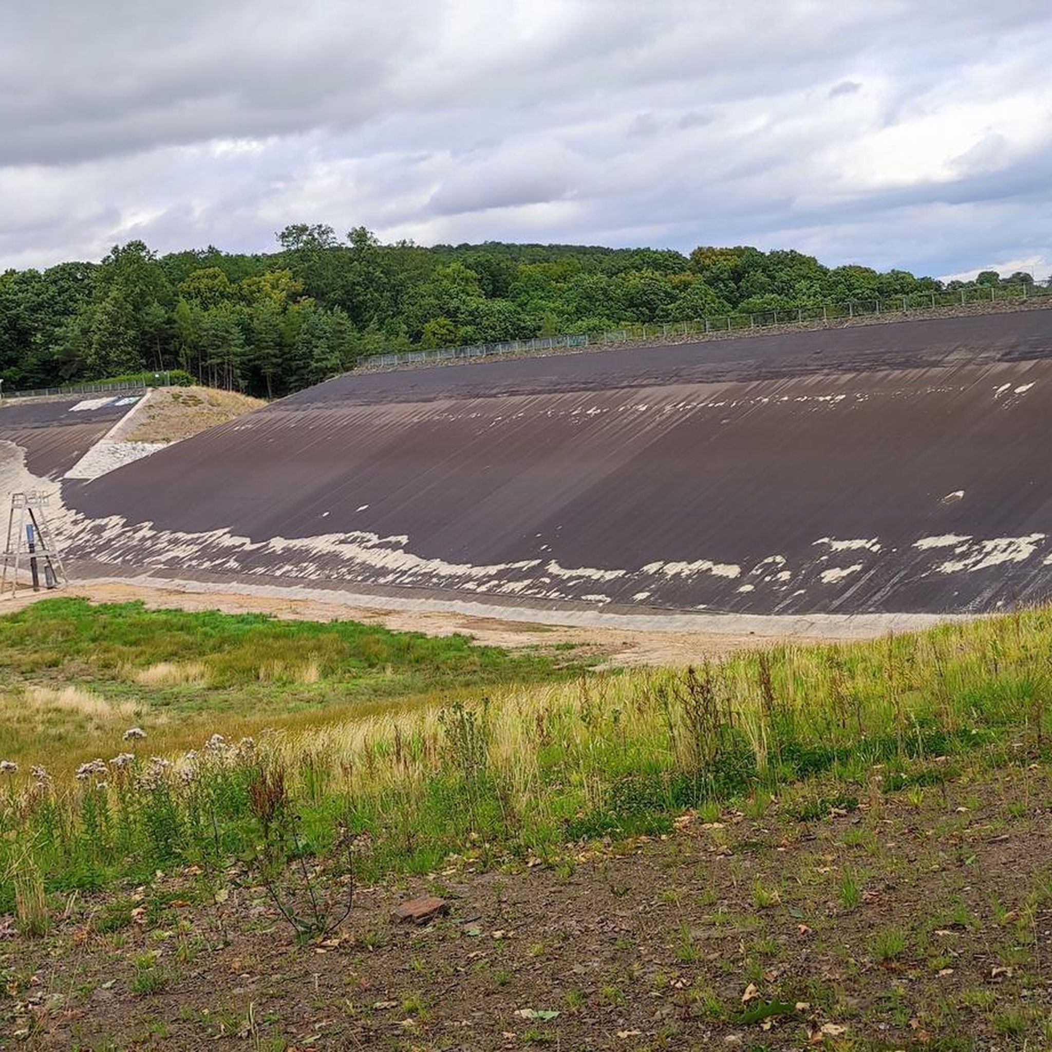
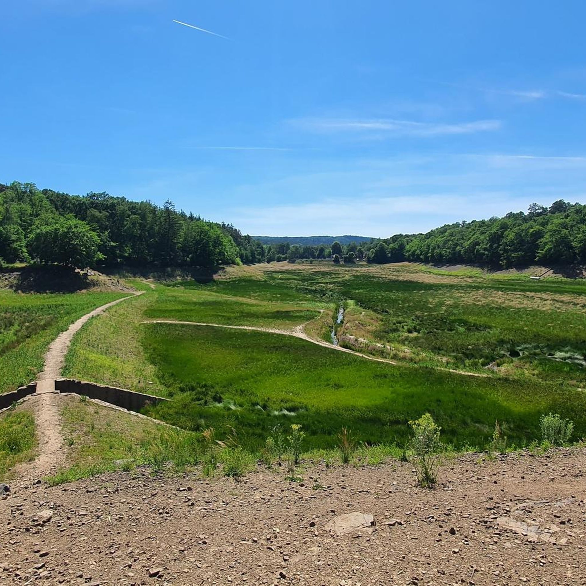
Absolutely. The region offers several scenic viewpoints, particularly those overlooking the Voreifel landscape or the Steinbachtalsperre. Highlights like a Quiet spot with a great view and a View of the empty Steinbach Reservoir are popular among visitors.
What historical sites or landmarks can I see along the gravel bike trails?
The area is rich in history, featuring several castles and historic towns. Routes often pass by impressive landmarks such as Satzvey Castle, Hardtburg Castle, and the historic town of Bad Münstereifel. The Swist River at Heimerzheim – Heimerzheim Castle loop from Euskirchen-Stotzheim also takes you past Heimerzheim Castle.
What do other gravel bikers enjoy the most about gravel biking in Steinbachtalsperre?
The area is highly rated by the komoot community, with an average score of 4.8 stars from over 30 reviews. Reviewers often praise the diverse landscape, which includes scenic river valleys, historic castles, and varied forest paths, offering a rewarding experience for all skill levels.
Are there any lakes or reservoirs to see while gravel biking?
Yes, the Steinbachtalsperre itself is a prominent feature of the region. You can find highlights like the Steinbach Reservoir, which is a central point for many routes and offers picturesque views.
Where can I park to access the gravel bike trails around Steinbachtalsperre?
Parking is generally available at various starting points for the routes. Many tours begin from towns like Unteres Steinbachtal, Euskirchen-Kreuzweingarten, or Euskirchen-Stotzheim, where you can typically find public parking facilities to access the trailheads.
Is it possible to reach the gravel bike trails around Steinbachtalsperre by public transport?
While some starting points like Euskirchen may have better public transport connections, direct access to all trailheads by public transport can be limited. It's advisable to check local bus or train schedules to see if they align with your chosen route's starting point.
Most popular routes around Steinbachtalsperre
Most popular attractions around Steinbachtalsperre

Get inspired with the komoot mobile app


Explore more
Browse the best Gravel rides in other regions.
