The best gravel rides around Beyenburger Stausee
4.4
(155)
676
riders
42
rides
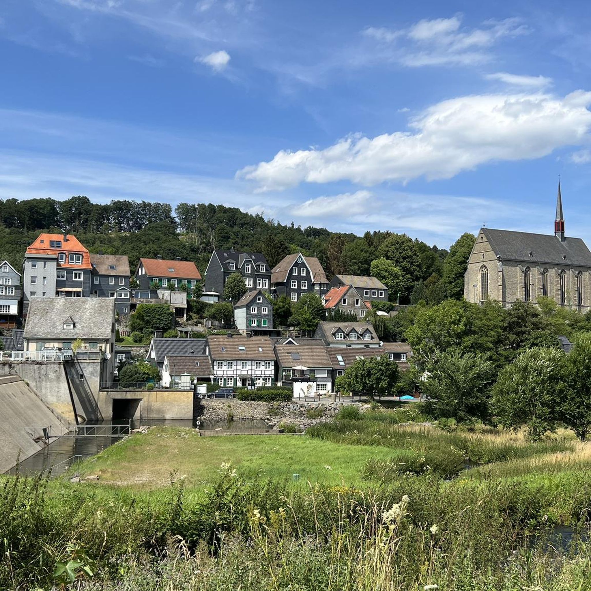
Gravel biking around Beyenburger Stausee offers varied terrain within the Bergisches Land region. The area features a mix of paved and gravel farm roads, alongside forest trails, suitable for gravel bikes. The landscape is characterized by forested hills, the Wupper River, and the tranquil Beyenburger Stausee reservoir. Cyclists can expect routes with diverse surfaces and scenic views of the reservoir, historic villages, and natural surroundings.
Best gravel bike trails around Beyenburger Stausee
- The most popular gravel bike trail is Schwelmer Forest – Forest Path by the Stream loop from Schwelm, a 10.5 miles (17.0 km) trail that takes 1 hour 20 minutes to complete. This moderate route navigates through the Schwelmer Forest, following a stream.
- Another top favourite among local gravel bikers is Schwelmer Forest – Rüggeberg Market Square loop from Schwelm, a difficult 32.1 miles (51.6 km) path. This route leads through the Schwelmer Forest and towards Rüggeberg Market Square.
- Local gravel bikers also love the Herbringhauser Reservoir – View of Herbringhauser Dam loop from Spreeler Bachtal, a 13.9 miles (22.4 km) trail leading through varied terrain, often completed in about 1 hour 44 minutes.
- Gravel biking around Beyenburger Stausee is defined by its reservoir paths, forest trails, and rolling hills. The network offers options for easy, moderate, and difficult routes, catering to various ability levels.
- The routes in Beyenburger Stausee are highly rated by the komoot community with an average score of 4.5 stars from over 80 reviews. More than 400 gravel bikers have used komoot to explore Beyenburger Stausee's varied terrain.
Last updated: October 18, 2026
5.0
(1)
7
riders
Hard gravel ride. Good fitness required. You may need to push your bike for some segments of this route.
4.0
(1)
5
riders
17.0km
01:20
280m
280m
Moderate gravel ride. Good fitness required. Mostly paved surfaces. Suitable for all skill levels.

3.7
(3)
10
riders
54.2km
03:51
980m
980m
Hard gravel ride. Very good fitness required. Mostly paved surfaces. Suitable for all skill levels.
5.0
(1)
7
riders
Hard gravel ride. Very good fitness required. Mostly paved surfaces. Suitable for all skill levels.
4.4
(28)
88
riders
46.2km
02:53
560m
560m
Hard gravel ride. Very good fitness required. You may need to push your bike for some segments of this route.
Get access to more routes and recommendations from other explorers.
Already have an account?
Our route recommendations are based on thousands of hikes, rides, and runs completed by other people on komoot.
Start today with a free account
Your next adventure awaits.

Other adventures around Beyenburger Stausee

Tips from the Community

Schwelm is a district town over 500 years old in the Ennepe-Ruhr district of North Rhine-Westphalia and, with an area of around 20.5 square kilometers, is considered the smallest political municipality in the state by area. The city is located in the southern Ruhr area at the transition to the Bergisch-Sauerland highlands and, due to its historical and geographical position, is also referred to as the "Gateway to Westphalia".
0
0

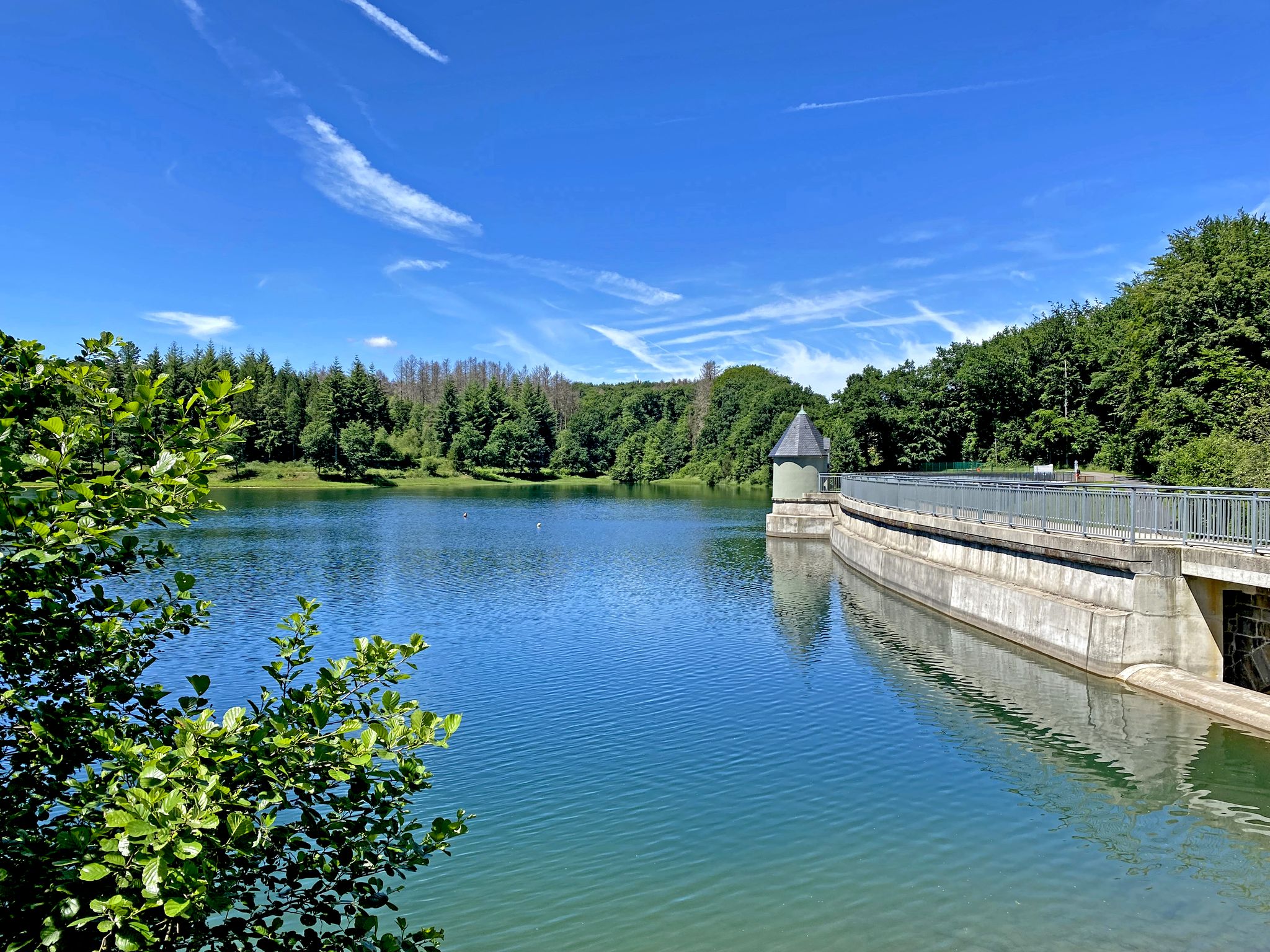
The Herbringhauser Dam was built between 1898 and 1901 by the city of Barmen (now Wuppertal-Barmen). The dam serves as the drinking water supply for the city of Wuppertal. Since 2016, the Wupperverband has owned the Herbringhauser Dam. A monumental structure & a recommended photo spot.
2
0
The Herbringhauser Dam was built from 1898 to 1901 by the city of Barmen (now Wuppertal-Barmen). The dam serves as the drinking water supply for the city of Wuppertal. Since 2016, the Wupperverband has owned the Herbringhauser Dam. A monumental structure & a recommended photo spot.
2
0


Unfortunately you can't get to the water, but you can take a look at the water through the fence.
1
0

The ascent from the north is somewhat steep, but scenic.
0
0

It's about 4 km uphill, but you have beautiful views 😍
0
0

🚴♂️ Old Railway Line Radevormwald – Peace & Nature on Rails The former railway line near Radevormwald is a real insider tip for anyone who wants to cycle in a relaxed way and breathe in history at the same time. Where trains once puffed through the Bergisches Land, a nearly level asphalt ribbon now winds through green forests, rolling hills, and quiet valleys. Under your tires, you feel time passing – past old signal boxes, hidden bridges, and moss-covered embankments that whisper of the past. Shady forest sections alternate with open stretches where sunbeams break through the canopy, making the greenery glow. 🌳☀️ The calm pace invites you to experience nature with all your senses: birdsong, the rustling of leaves, and the distant splashing of a stream accompany you along the entire route. Small villages and lovingly preserved half-timbered houses line the path, offering you glimpses into rural life here. Whether for a leisurely break or as part of a longer tour – this railway line perfectly combines nature, history, and recreation. Just hop on, roll along, and leave the everyday noise behind. 🌿🚴♀️ My tip: Stop at one of the old train stations, take a break, and imagine how travelers and goods used to move here – a real journey back in time!
1
0
Frequently Asked Questions
How many gravel bike trails are available around Beyenburger Stausee?
There are over 75 gravel bike trails around Beyenburger Stausee, offering a wide range of options for different skill levels and preferences. The komoot community has explored these routes over 1700 times.
What kind of terrain can I expect on gravel bike trails near Beyenburger Stausee?
The region offers a varied landscape, combining paved and gravel farm roads with forest trails. You'll encounter rolling hills, paths along the Wupper River, and scenic routes around the Beyenburger Stausee itself. The area is part of the broader Bergisches Land, known for its diverse cycling terrain.
Are there options for beginners or less experienced gravel bikers?
Yes, there are routes suitable for beginners. While many routes are moderate or difficult, there is at least one easy gravel bike trail available. For example, the Schwelmer Forest – Forest Path by the Stream loop from Schwelm is a moderate option that navigates through pleasant forest paths.
What about more challenging gravel routes around Beyenburger Stausee?
For experienced gravel bikers seeking a challenge, there are numerous difficult routes. Over 40 trails in the area are rated as difficult. A good example is the Krähwinkler Bridge – View of Bergisches Land loop from Radevormwald, which is nearly 40 km long and offers expansive views with varied terrain.
Are the gravel bike routes around Beyenburger Stausee typically loop trails?
Many of the gravel bike routes in the area are designed as loop trails, allowing you to start and end at the same point. This is convenient for exploring the diverse landscapes without needing to arrange transport back to your starting location.
What natural sights or landmarks can I see along the gravel bike routes?
You'll find plenty of natural beauty. The routes often pass by the tranquil Beyenburg Reservoir and the Wupper River. You can also enjoy panoramic views, such as the View of Beyenburg and St. Mary Magdalene Abbey from the Beyenburger Reservoir. Some trails, like the Blaubeertrail (Root Trail), offer technically good routes with great views of the Wupper below.
Are there any historic places to explore near the trails?
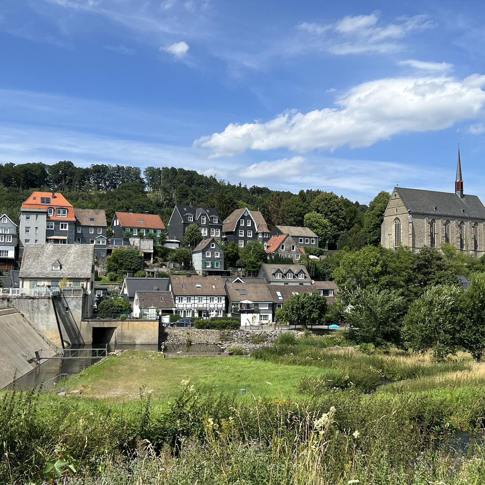
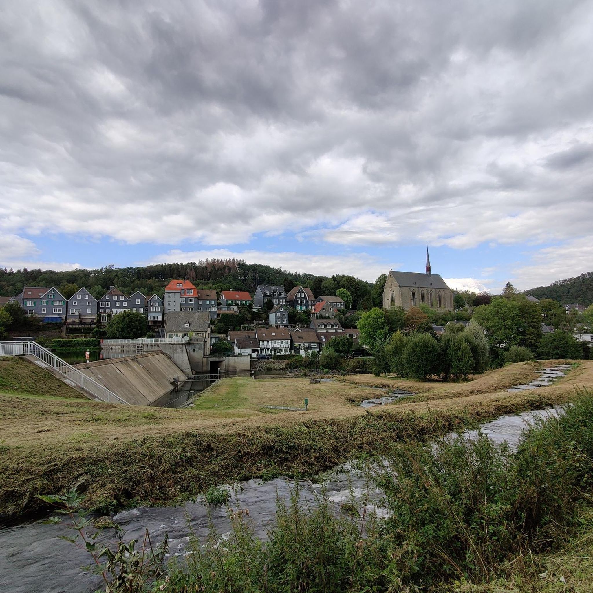
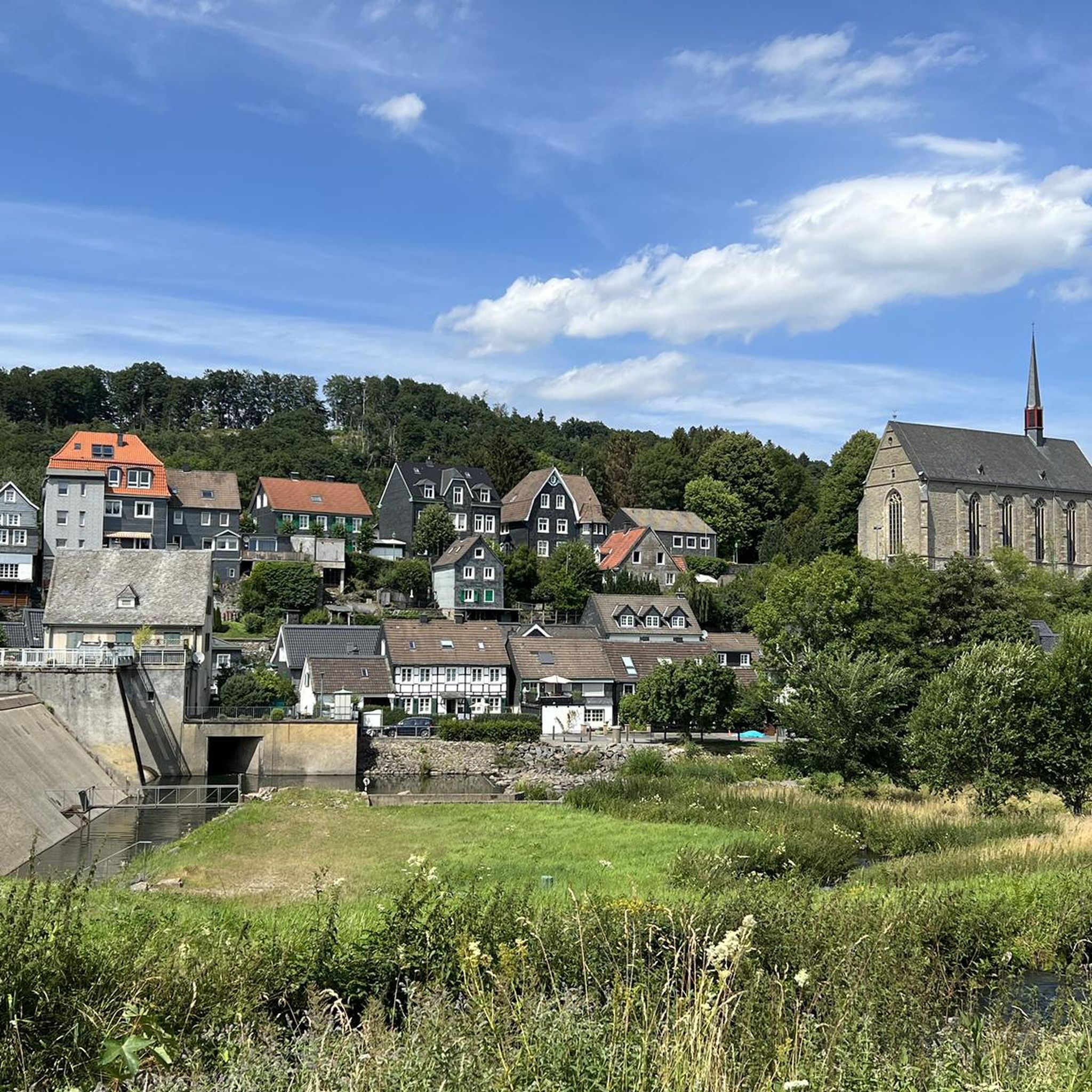
Absolutely. The small town of Beyenburg — Historic Village itself is rich in history, with winding roads and beautiful half-timbered houses. The imposing, late Gothic Church of St. Mary Magdalene, also known as 'Beyenburg Cathedral,' is a significant historical attraction dating back to the 14th century, located alongside an old monastery.
What do other gravel bikers enjoy the most about gravel biking in Beyenburger Stausee?
The area is highly rated by the komoot community, with an average score of 4.3 stars from over 300 reviews. Reviewers often praise the varied terrain, the scenic views of the reservoir and surrounding forests, and the mix of challenging and more relaxed paths that cater to different skill levels.
Is Beyenburger Stausee a good destination for family-friendly gravel biking?
While many routes are moderate to difficult, the presence of easier sections and the scenic, relatively quiet environment around the reservoir can make it suitable for families with some cycling experience. Look for routes with less elevation gain and smoother surfaces for a more family-friendly experience.
Where can I find parking for gravel biking around Beyenburger Stausee?
Parking is generally available in and around the Beyenburg village area, close to the reservoir. Specific starting points for tours often have designated parking. It's advisable to check the tour details on komoot for recommended parking spots near your chosen route's starting point.
What is the best season for gravel biking around Beyenburger Stausee?
The region is enjoyable for gravel biking throughout much of the year. Spring and autumn offer pleasant temperatures and beautiful foliage, while summer provides longer daylight hours. Even in winter, some trails can be ridden, though conditions may vary with snow or ice, so checking local weather is always recommended.
Are there any gravel bike-friendly cafes or places to stop for refreshments?
Beyenburg village, situated directly on the reservoir, offers options for refreshments. You'll find local establishments where you can take a break and enjoy a drink or a meal. Exploring the village itself can also be a pleasant stop during your ride.
Most popular routes around Beyenburger Stausee
Most popular attractions around Beyenburger Stausee

Get inspired with the komoot mobile app


Explore more
Browse the best Gravel rides in other regions.
