The best gravel rides in the Sapphire Mountains
5.0
(1)
96
riders
11
rides
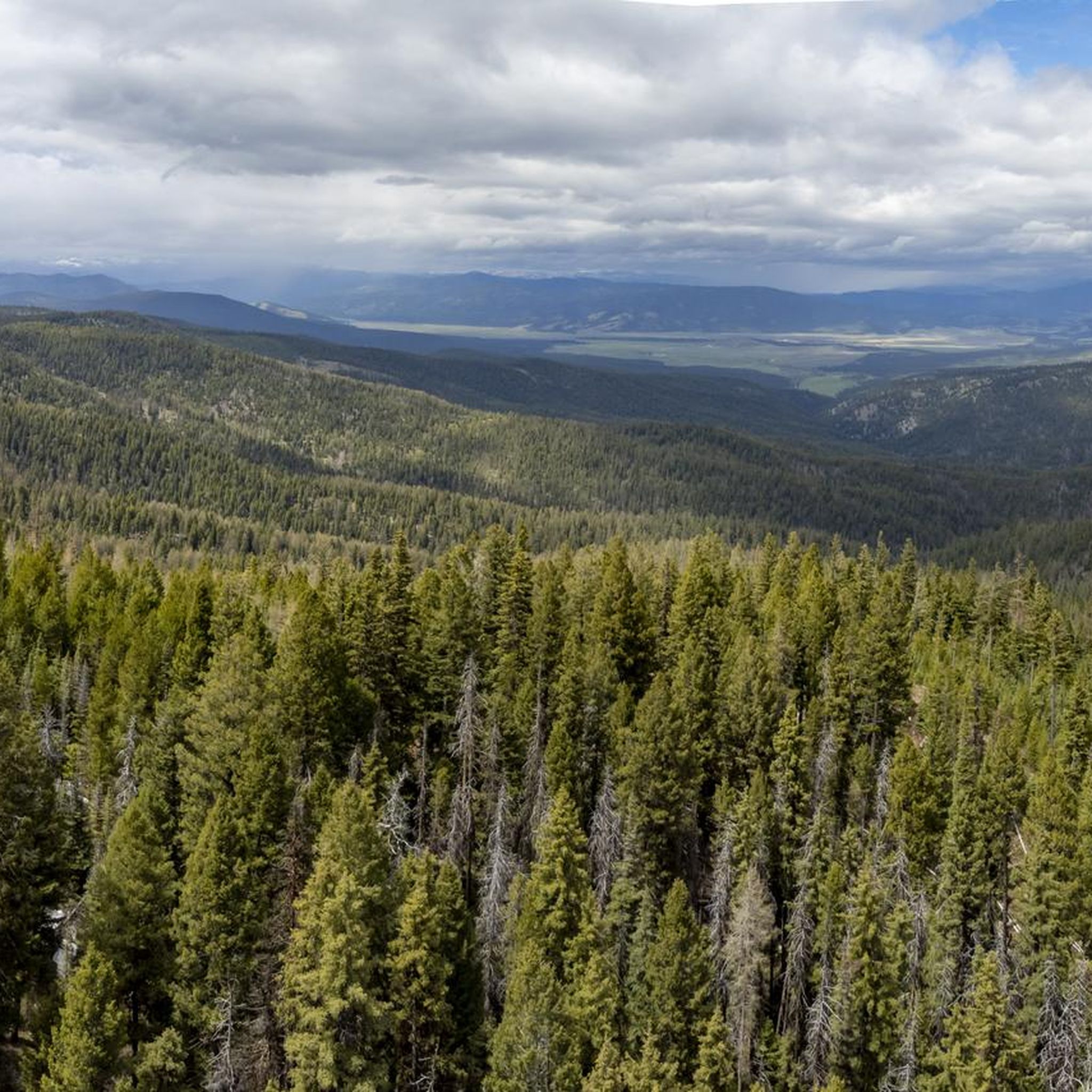
Gravel biking in the Sapphire Mountains offers an extensive network of routes, many utilizing old logging roads, ideal for exploration. The region is characterized by dense pine, fir, and spruce forests, alongside large grassy meadows and sagebrush areas. Riders can expect varied terrain, from steady climbs to fast downhills, with views of the Bitterroot Mountains. This landscape provides diverse gravel biking opportunities across public lands including parts of the Lolo National Forest.
Best gravel bike trails in the Sapphire Mountains
…Last updated: July 11, 2026
11
riders
27.7km
02:25
470m
470m
Hard gravel ride. Very good fitness required. Mostly paved surfaces. Suitable for all skill levels.
17
riders
29.7km
01:56
340m
340m
Moderate gravel ride. Good fitness required. Mostly paved surfaces. Suitable for all skill levels.

Sign up for free
16
riders
39.8km
02:55
630m
630m
Hard gravel ride. Very good fitness required. Mostly paved surfaces. Suitable for all skill levels.
5.0
(1)
7
riders
79.5km
05:53
1,270m
1,270m
Hard gravel ride. Very good fitness required. Mostly paved surfaces. Suitable for all skill levels.
15
riders
30.8km
01:57
230m
230m
Moderate gravel ride. Good fitness required. Mostly paved surfaces. Suitable for all skill levels.
Get access to more routes and recommendations from other explorers.
Sign up for free
Already have an account?
Our route recommendations are based on thousands of hikes, rides, and runs completed by other people on komoot.
Start today with a free account
Your next adventure awaits.
Login or Signup
Tips from the Community

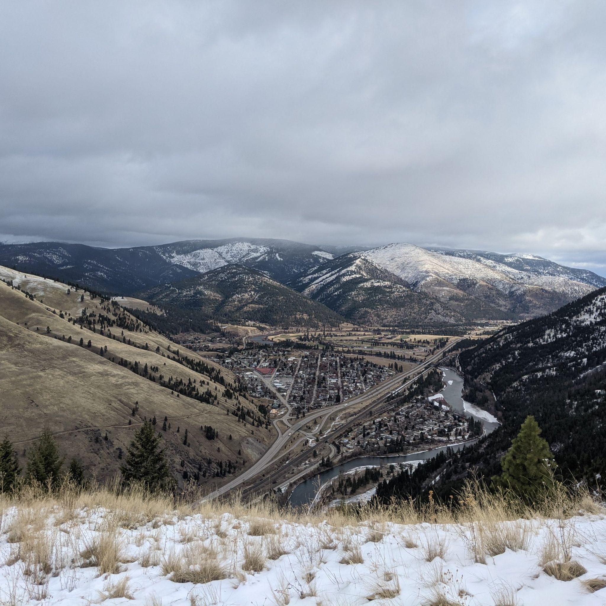
There is a great view here of Woody Mountain and the Mount Jumbo Wildlife Management Area. This double-track road is pretty smooth and most bikes can handle the terrain pretty easily.
0
0

The Beartracks Bridge is a four-lane bridge over the Clark Fork River in downtown Missoula. It was constructed in 1962 and recently renovated to improve pedestrian safety. The bridge now has dedicated bike lanes and widened sidewalks.
0
0

Jacob's Island is a dog park on the banks of Clark Fork River. The park is 6-acres and the river works as a beautiful natural barrier for the dogs. It also offers a series of paved and unpaved trails, benches, picnic tables and dog-waste bags.
0
0
Jacob's Island is a dog park on the banks of Clark Fork River. The park is 6 acres and the river works as a beautiful natural barrier for the dogs. It also offers a series of paved and unpaved trails, benches, picnic tables and dog-waste bags.
0
0

Nestled in the northern Rockies, the city is known as the "Garden City" for its lush surroundings as well as trout fishing. The city is home to the University of Montana, founded in 1893.
0
0
The Kim Williams Trail is a super popular trail in Missoula. It follows along the river the majority of the way, but it is often times tucked in the trees without a lot of views. The section of trail furthest west is a really smooth paved and dirt path. As you get further east, the trail narrows and becomes bumpier. Some choose to ride a bike with more suspension for this rougher section, but most touring bikes can handle the trail just fine from start to finish.
0
0
McCormic Park marks the western terminus of the Kim Williams Trail and the eastern terminus of the Milwaukee Trail. The park has some playing fields, open space, picnic areas, and is nestled up right next to the river.
0
0
Deer Creek Sneak is labeled as a "Green" mountain biking trail, but it is popular for gravel bikes and bike touring as well. The trail climbs steadily from Deer Creek Road to the intersection with the Pattee Canyon mountain biking trail system. This can be a fun, fast downhill trail to ride.
0
0
Frequently Asked Questions
How many gravel biking routes are available in the Sapphire Mountains?
The Sapphire Mountains offer over 10 gravel biking routes, ranging from moderate to difficult, providing a variety of options for exploration. These routes often utilize old logging roads and forest service roads, characteristic of the region's extensive network.
What kind of terrain can I expect on gravel bike trails in the Sapphire Mountains?
You can expect a diverse range of terrain, from extensive old logging roads and forest service roads to varied landscapes featuring dense pine, fir, and spruce forests, large grassy meadows, and sagebrush areas. Routes often include steady climbs and fast downhills, with many offering scenic views of the Bitterroot Mountains.
Are there gravel biking routes suitable for beginners in the Sapphire Mountains?
Yes, there are several moderate routes available. For example, the Kim Williams Trail – Jacob's Island loop from Hellgate High School is a moderate 17.0-mile path offering a mix of terrain along the Clark Fork River, which could be a good option for those newer to gravel biking.
What are some notable natural features or landmarks I might see while gravel biking in the Sapphire Mountains?
While riding, you can enjoy breathtaking vistas of the Bitterroot Mountains. The region is also known for its diverse ecosystems, including dense forests and meadows. Keep an eye out for wildlife, as the area is home to bear, moose, deer, and elk. Rivers like Rock Creek and Skalkaho Creek are also prominent features.
Are there any family-friendly gravel biking options in the Sapphire Mountains?
While many routes in the Sapphire Mountains are rated moderate to difficult, the Bitterroot Trail, which connects to some gravel routes, offers a more accessible experience. For specific family-friendly gravel sections, look for routes with less elevation gain and shorter distances, often found closer to towns like Missoula or Hamilton.
Can I bring my dog on gravel biking trails in the Sapphire Mountains?
Many public lands in the Sapphire Mountains, including parts of the Lolo National Forest and Beaverhead-Deerlodge National Forest, are generally dog-friendly, especially on forest service roads. However, it's always best to check specific regulations for any designated wilderness areas or specific trails you plan to ride, as rules can vary. Always keep your dog under control and pack out waste.
What is the best time of year for gravel biking in the Sapphire Mountains?
The best time for gravel biking in the Sapphire Mountains is typically from late spring through early fall. Early season rides, such as those along Miller Creek Road or Southside Road, are popular as snow melts. Summer offers wildflowers and warmer weather, while fall brings vibrant foliage. Always check current weather and road conditions, especially for higher elevations like Skalkaho Pass Road.
Are there any gravel biking routes that form a loop in the Sapphire Mountains?
Yes, several routes offer loop configurations. For instance, the Kim Williams Trail – Deer Creek Sneak Trail loop from Hellgate High School is a popular 21.0-mile loop. Another option is the longer James Lake loop from Ovando, which covers 62.2 miles through varied backcountry landscapes.
Where can I find parking for gravel biking trailheads in the Sapphire Mountains?
Parking is generally available at various access points for forest service roads and trailheads throughout the Sapphire Mountains. For routes starting near urban areas, like those from Hellgate High School in Missoula, designated parking facilities are often available. For more remote routes, look for pull-offs or designated parking areas at the start of forest roads.
What do other gravel bikers enjoy most about gravel biking in the Sapphire Mountains?
The Sapphire Mountains are highly rated by the komoot community, with an average score of 5.0 stars. Reviewers often praise the extensive network of gravel roads, the stunning views of the Bitterroot Mountains, and the opportunity to explore diverse ecosystems and spot wildlife in a relatively wild setting.
Are there any specific attractions or points of interest along the gravel routes?
Yes, several points of interest can be found. The Deer Creek Sneak Trail is a popular highlight. You might also encounter the Bitterroot Trail, which offers connections to gravel. For scenic overlooks, consider the Barmeyer Loop and Scenic Overlook. Additionally, Skalkaho Falls is a popular attraction along Skalkaho Pass Road.
Are there any advanced gravel cycling routes in the Sapphire Mountains?
Yes, the Sapphire Mountains offer challenging routes for experienced gravel bikers. Many of the 7 difficult routes in the region feature significant elevation gain and longer distances. Routes like "The Forge" (82 miles with 6100 ft of climbing) and "The Smelter" (47 miles with 4100 ft of climbing), which utilize extensive backcountry and logging roads, are examples of the advanced experiences available.
What should I pack for gravel biking in the Sapphire Mountains?
Given the varied terrain and potential for remote sections, it's advisable to pack essentials such as plenty of water, snacks, a repair kit (including spare tubes, pump, and tools), navigation tools (like komoot's offline maps), and appropriate layers of clothing for changing weather conditions. Bear spray is also recommended due to the abundant wildlife in the region.
Most popular routes in the Sapphire Mountains
Most popular attractions in the Sapphire Mountains

Get inspired with the komoot mobile app


Explore more
Browse the best Gravel rides in other regions.
