The best gravel rides in Pordenone
4.3
(490)
4,078
riders
313
rides
Gravel biking in Pordenone offers diverse terrain, from the foothills of the Friulian Dolomites to serene river valleys and unique lowlands. The region features challenging climbs in areas like the Cansiglio plateau and Piancavallo, alongside gentler paths along the Tagliamento and Livenza rivers. Distinctive landscapes such as the "Magredi" (Friulian steppe) and areas with "risorgive" (resurgence springs) provide varied riding experiences. This combination of mountainous, riverine, and lowland environments makes Pordenone a varied destination for gravel biking.
Best gravel bike…
Last updated: August 26, 2026
4.9
(71)
516
riders
36.9km
03:46
760m
760m
Hard gravel ride. Very good fitness required. Mostly paved surfaces. Suitable for all skill levels.
4.8
(4)
36
riders
56.4km
05:55
1,830m
1,830m
Hard gravel ride. Very good fitness required. You may need to push your bike for some segments of this route.

Sign up for free
5.0
(7)
140
riders
88.9km
06:53
2,160m
2,160m
Hard gravel ride. Very good fitness required. Mostly paved surfaces. Suitable for all skill levels.
4.8
(11)
77
riders
32.5km
02:20
670m
670m
Hard gravel ride. Very good fitness required. Mostly paved surfaces. Suitable for all skill levels.
5.0
(6)
124
riders
Hard gravel ride. Very good fitness required. Mostly paved surfaces. Suitable for all skill levels.
4.2
(9)
115
riders
76.2km
04:30
400m
400m
Moderate gravel ride. Good fitness required. Mostly paved surfaces. Suitable for all skill levels.
5.0
(5)
43
riders
73.8km
04:31
680m
680m
Hard gravel ride. Very good fitness required. Mostly paved surfaces. Suitable for all skill levels.
4.3
(14)
128
riders
70.1km
04:16
530m
530m
Hard gravel ride. Very good fitness required. Mostly paved surfaces. Suitable for all skill levels.
3.5
(10)
66
riders
Moderate gravel ride. Good fitness required. Mostly paved surfaces. Suitable for all skill levels.
4.3
(15)
83
riders
65.5km
03:35
120m
120m
Hard gravel ride. Good fitness required. You may need to push your bike for some segments of this route.
Get access to more routes and recommendations from other explorers.
Sign up for free
Already have an account?
Our route recommendations are based on thousands of hikes, rides, and runs completed by other people on komoot.
Start today with a free account
Your next adventure awaits.
Login or Signup
Popular around Pordenone

Gravel biking in Area Wilderness Croseraz-Val Bona

Gravel biking around Polcenigo
Gravel biking in Foresta Del Cansiglio

Gravel biking around Caneva
Gravel biking around Budoia

Gravel biking around Brugnera

Gravel biking around Morsano Al Tagliamento
Gravel biking around Prata Di Pordenone

Gravel biking around Valvasone Arzene

Gravel biking around Sacile


Tips from the Community

Small artificial lake, formed by an earth dam, located near Fratte. Created by Enel after the Second World War, the lake serves as a balancing reservoir for the Caneva power plant, also receiving water from the gallery that comes from the Carron divider.
1
0

Bosco delle Lame, a nature oasis close to the Caorle lagoon.
0
0

Portobuffolè is a historic city worth seeing.
0
0

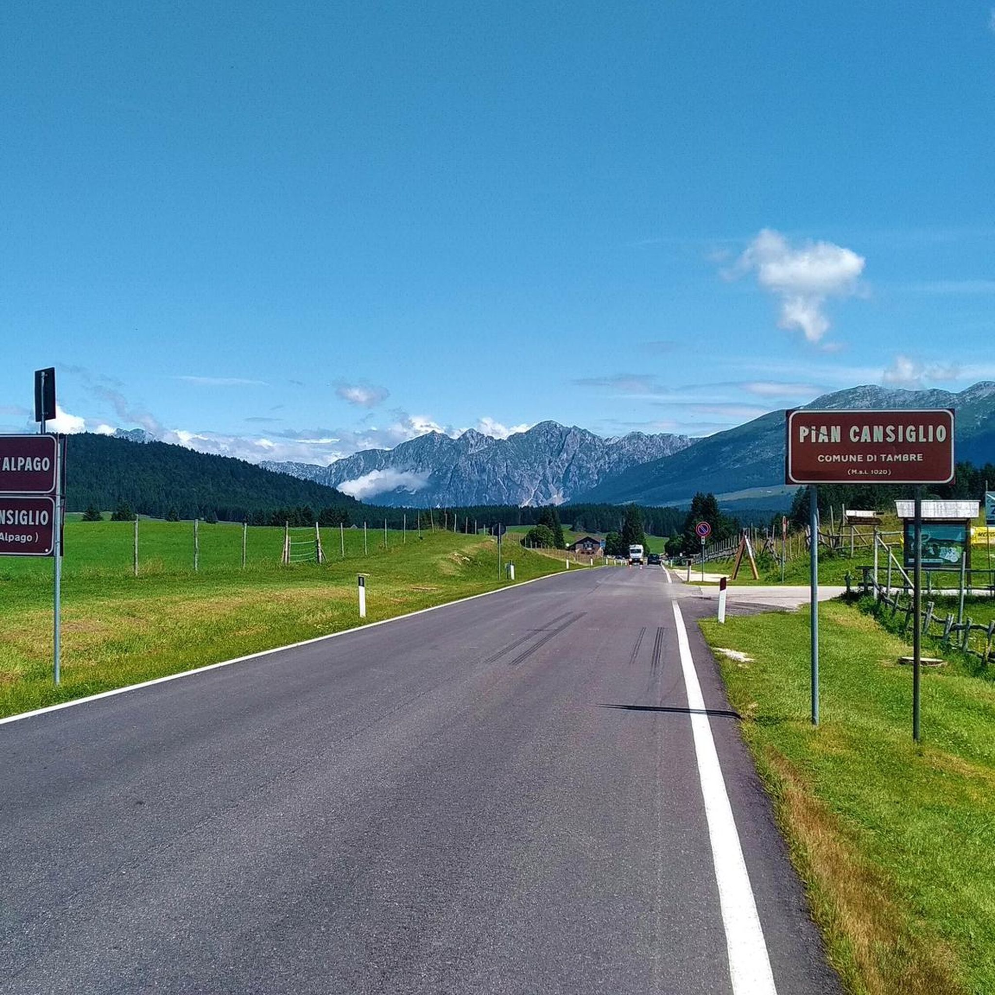
Passo della Crosetta, located at an altitude of 1,127 meters, is a strategic Alpine pass that connects the Treviso plain, in the municipality of Fregona, to the Cansiglio plateau and the province of Belluno. Nestled in a majestic setting of ancient woods, dominated by beech and fir trees, the pass represents a privileged gateway to one of the most fascinating natural areas in the Veneto region. A very popular destination in every season, it is a reference point for motorcyclists and cyclists who appreciate its scenic hairpin bends, but also an ideal starting point for hikers, ski mountaineers, and trekking enthusiasts heading towards Monte Pizzoc or the Cansiglio plain. At the pass, the presence of the historic refreshment area and rest stops allows for a regenerating break, combining the wild beauty of the mountains with the typical hospitality of the area.
0
0
Il Ristoro Crosetta, located at an altitude of 1,118 meters on the homonymous pass that connects the Treviso plain to the Cansiglio plateau, is a historic and unmissable stop for hikers, cyclists, and motorcyclists. This cozy stone and wood structure embodies the quintessence of mountain hospitality, offering a regenerating refuge in every season. The cuisine offers the authentic flavors of the Veneto-Belluno tradition, featuring game dishes, typical Cansiglio cheeses, warm polenta, and fresh mushrooms, all accompanied by homemade desserts and a good glass of local wine. Nestled in a centuries-old beech and fir forest, the establishment boasts a strategic position that makes it the ideal starting point or refreshment stop for exploring the numerous surrounding nature trails, offering an old-world atmosphere for relaxation and good food.
0
0
Section of the cycle path called "GiraMonticano" between Oderzo and Motta di Livenza.
0
0

Beautiful river with a super nice water color
3
0
Super view of the bridge
3
0
Frequently Asked Questions
How many gravel bike trails are available in Pordenone?
Pordenone offers a wide selection of gravel biking routes, with over 340 trails documented on komoot. These routes cater to various skill levels, from easy lowland loops to challenging mountain ascents.
What are the difficulty levels of gravel biking routes in Pordenone?
The routes in Pordenone range from easy to difficult. There are 38 easy routes, 183 moderate routes, and 127 difficult routes, ensuring options for all experience levels. For instance, challenging climbs can be found on the Cansiglio plateau, while gentler paths follow river valleys.
Are there any family-friendly gravel bike trails in Pordenone?
While specific 'family-friendly' routes are not explicitly detailed, the region's lowlands and river valleys, such as those along the Tagliamento and Livenza rivers, offer gentler paths that could be suitable for families. Look for routes with minimal elevation gain in these areas for a more relaxed experience.
Which routes offer scenic views or pass by notable landmarks?
Many routes in Pordenone offer stunning scenery. For expansive views, consider routes on the Cansiglio plateau, like the Ring tour on Cansiglio from La Crosetta. You can also explore routes that pass by historical sites such as Valvasone, a beautiful medieval village, or the Pinzano Castle and View of the Tagliamento River.
Are there any circular gravel bike routes in the Pordenone area?
Yes, Pordenone features several excellent circular gravel routes. A popular option is the Church of San Biagio (Giais) – Tree-lined Route loop from Pordenone, which takes you through picturesque countryside. Another is the Strada della Candaglia – Candaglia Forest Road loop from Passo Crosetta, offering a different mountain experience.
What unique natural landscapes can I explore on a gravel bike in Pordenone?
Pordenone is home to unique natural landscapes. You can explore the "Magredi," a rare Friulian steppe ecosystem where rivers disappear and re-emerge, offering a distinctive, almost lunar terrain. The region also features the vibrant emerald waters of the Pradis Ravine and the blue spring of Gorgazzo, which can be incorporated into your rides.
Are there routes that follow river valleys?
Absolutely. The region is rich in waterways. You can find scenic routes along the Tagliamento River, known for its unique ecosystems, or the Livenza River, which flows past aristocratic buildings in towns like Sacile. The Ponti di Tremeacque – Livenza River Embankment loop from Brugnera is a great example of a river-focused ride.
What is the best time of year for gravel biking in Pordenone?
The diverse terrain of Pordenone means different seasons offer different experiences. Spring and autumn generally provide pleasant temperatures for exploring both the lowlands and foothills. Summer is ideal for higher mountain routes like those in the Friulian Dolomites, while the lowlands might be very warm. Winter can be challenging in the mountains due to snow, but some lowland routes might still be accessible.
Can I find routes that pass through charming towns or villages?
Yes, many routes combine natural beauty with cultural exploration. You can cycle through ancient villages like Erto and Casso, or historical towns such as Valvasone, known for its medieval charm, and Spilimbergo, famous for its mosaic school. The Conegliano Castle – Molinetto della Croda loop from Sacile is an example of a route connecting towns and historical sites.
What do other gravel bikers say about the routes in Pordenone?
The gravel biking routes in Pordenone are highly regarded by the komoot community, holding an average score of 4.4 stars from over 300 reviews. More than 3,000 gravel bikers have used komoot to explore the region, often praising the varied terrain and stunning natural beauty.
Are there any long-distance gravel routes suitable for bikepacking?
Pordenone's strategic location allows for bikepacking adventures that can extend from unspoiled forests to the Adriatic Sea. While specific multi-day routes aren't listed here, the extensive network of over 340 routes, including longer options like the Via dei Casoni – Stalis Mills loop from Cordovado - Sesto (over 113 km), provides ample opportunity to link trails for longer journeys.
Where can I find routes with significant elevation gain for a challenge?
For challenging rides with significant elevation gain, focus on the mountain and foothill regions. The Cansiglio plateau is a prime area, with routes like the Ring tour on Cansiglio from Dardago featuring over 1800 meters of ascent. Piancavallo, a mountain resort, also offers demanding routes.
Most popular routes in Pordenone
Most popular attractions in Pordenone

Get inspired with the komoot mobile app


Didn’t find what you were looking for?
Check out more Gravel rides throughout Pordenone below and find the perfect route in your destination.
Explore more
Browse the best Gravel rides in other regions.
