The best gravel rides around Hochspeyer
4.5
(77)
440
riders
62
rides
Gravel biking around Hochspeyer offers a diverse landscape characterized by dense forests, rolling hills, and scenic valleys within the Palatinate Forest. The region features a network of unpaved roads and forest tracks, providing varied terrain for gravel cyclists. Elevation changes are common, with routes traversing both gentle slopes and more challenging ascents. This area, part of the UNESCO Biosphere Reserve Palatinate Forest-Vosges du Nord, provides extensive opportunities for outdoor activities.
Best gravel bike trails around Hochspeyer
- The most popular gravel…
Last updated: August 27, 2026
5.0
(1)
12
riders
Moderate gravel ride. Good fitness required. Mostly paved surfaces. Suitable for all skill levels.
4.3
(3)
17
riders
41.5km
02:43
390m
390m
Hard gravel ride. Good fitness required. You may need to push your bike for some segments of this route.

Sign up for free
9
riders
56.9km
04:14
680m
680m
Hard gravel ride. Very good fitness required. Mostly paved surfaces. Suitable for all skill levels.
2
riders
45.5km
03:40
750m
750m
Hard gravel ride. Very good fitness required. Mostly paved surfaces. Suitable for all skill levels.
4.7
(3)
8
riders
27.4km
01:53
390m
390m
Moderate gravel ride. Good fitness required. Mostly paved surfaces. Suitable for all skill levels.
Get access to more routes and recommendations from other explorers.
Sign up for free
Already have an account?
Our route recommendations are based on thousands of hikes, rides, and runs completed by other people on komoot.
Start today with a free account
Your next adventure awaits.
Login or Signup


Tips from the Community

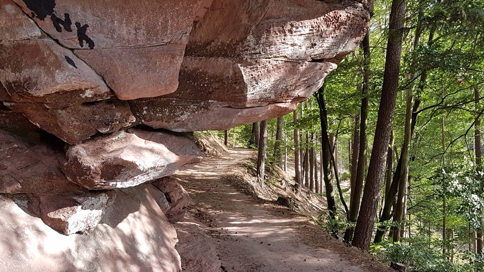
The Buchholz rock is a variegated sandstone rock and is designated as a natural monument (ND-7312-098). Particularly interesting is that a small shelter with a table and bench has been set up under the rock overhang, which blends harmoniously into the natural rock formation.
1
0
The shelter at Erlenbrunneck is located between Ritterstein No. 127 and No. 128
1
0

Picturesque pond in the nature reserve of the Wurzelwooggraben. Once there was a hammer mill here, hence the name. You can cycle or walk around it.
0
0
Several beautiful footpaths and cycle paths run through the Eselsbach valley. The shady forest and the babbling brook ensure a relaxing green tour, especially in summer, not far from the city center.
0
0
Emil Haupt managed the Elmstein-Süd forestry office from 1924 to 1931. "Afterwards, the versatile forester was transferred to Hochspeyer at his own request. Among other things, he advocated for the construction of forest paths to promote hiking, as well as forest roads and forest tracks for more efficient timber extraction. Thus, [in Elmstein] the lower slope path on the Möllberg, which ends at the Rehfelsen with the Möllberg-Häuschen, the Bloskülbstraße from Iggelbach towards Eschkopf, and the connecting road from Iggelbach to the Helmbachtal (both are now designated as K 17) were built, for example. The "Ehrenfels" monument and the Lönshütte were also erected on his initiative. He died in Hochspeyer on August 28, 1949.
1
0
The Woog was created in 1838. Timber rafting in the Palatinate Forest was carried out extensively until the late 19th century. Timber rafting on the Leinbach was discontinued by 1906 at the latest. The Biedenbacher Woog was a transit pond in the timber rafting system. Its essential feature was the impoundment and the sudden release of large quantities of water simultaneously with the passage of the timber load. Accordingly, the dimensions of the dam and outlet structure were aligned with the roughly one-meter-long logs. The rafting transported the logs via Leinbach, Hochspeyerbach, and Speyerbach into the sparsely wooded Vorderpfalz, where they were taken from the Speyerbach for consumption.
1
0

A moss-covered stone cross dating back to 1910, marked as Ritterstein 132 - a peaceful historic waypoint deep in the forest.
0
0

Frequently Asked Questions
How many gravel bike trails are available around Hochspeyer?
Komoot features over 80 gravel bike routes in the Hochspeyer area, offering a wide range of options for different skill levels and preferences. These trails are highly rated by the community, with an average score of 4.6 stars.
Are there easy gravel bike trails suitable for beginners in Hochspeyer?
Yes, Hochspeyer offers several easy gravel bike trails perfect for beginners. The region's extensive forest paths and tranquil valley routes provide a gentle introduction to gravel biking. You can find 5 easy routes listed on komoot, with many more moderate options that are also accessible for those building experience.
What kind of terrain can I expect on gravel bike routes in Hochspeyer?
The terrain around Hochspeyer is characterized by dense forests, rolling hills, and scenic valleys within the Palatinate Forest. You'll primarily encounter a network of unpaved roads and forest tracks. Elevation changes are common, ranging from gentle slopes to more challenging ascents, providing varied riding experiences.
Are there challenging gravel bike routes for experienced riders?
Absolutely. For experienced riders seeking a challenge, Hochspeyer has 35 difficult routes. One notable option is the Eselsbach Forest Path – Blechhammerweiher loop from Enkenbach-Alsenborn, a 25.9-mile (41.8 km) path winding through dense forest with significant elevation changes.
Are there any long-distance gravel cycling routes in the Hochspeyer area?
Yes, for those looking for longer rides, there are several extensive routes. The Palatine World Axis – Beilstein Castle Trail loop from Hochspeyer, for example, spans over 35 miles (56 km) and features substantial elevation gain, making it a great option for a full day out.
Can I find circular gravel bike routes around Hochspeyer?
Many of the gravel bike routes in Hochspeyer are designed as circular loops, allowing you to start and end at the same point. An example is the Eschidler Bank Stone Marker – Esthaler Bänke Rest Area loop from Weidenthal, which is a 7.0-mile (11.3 km) trail through forested areas.
What is the best time of year for gravel biking in Hochspeyer?
The Palatinate Forest region, including Hochspeyer, is beautiful year-round. Spring offers lush greenery and blooming flora, while autumn provides stunning fall foliage. Summer is great for longer days, and even mild winter days can be enjoyable. Always check local weather conditions before heading out.
Are there family-friendly gravel bike trails near Hochspeyer?
While specific 'family-friendly' designations can vary, many of the easier and moderate routes on komoot are suitable for families with older children or those comfortable with longer distances. Look for routes with less elevation gain and smoother surfaces. The region's forest paths generally offer a safe and pleasant environment.
Where can I find parking for gravel bike trails in Hochspeyer?
Many trailheads and starting points in and around Hochspeyer, especially in smaller towns like Enkenbach-Alsenborn or Weidenthal, offer designated parking areas. It's advisable to check the tour details on komoot for specific parking information related to your chosen route, as many routes start from accessible village centers.
Are there scenic viewpoints along the gravel bike routes in Hochspeyer?
Yes, the rolling hills and dense forests of the Palatinate Forest naturally offer numerous scenic spots. While not always explicitly marked as 'viewpoints' on every route, you'll often find picturesque vistas over valleys and through the trees, especially on routes that traverse higher elevations. The Beilstein Castle Ruins – Leinbach Valley loop from Enkenbach-Alsenborn, for instance, passes by historic ruins and through a scenic valley.
What do other gravel bikers enjoy most about gravel biking in Hochspeyer?
The komoot community highly rates the gravel biking experience in Hochspeyer, with an average score of 4.6 stars. Reviewers often praise the diverse landscape, the extensive network of quiet forest paths, and the tranquil atmosphere of the Palatinate Forest. The variety of routes, from easy to challenging, is also frequently highlighted.
Can I access gravel bike trails in Hochspeyer using public transport?
Hochspeyer itself has a train station, and several surrounding towns that serve as route starting points are also accessible by public transport. While direct access to every trailhead might require some planning, it is often possible to reach the general area by train or bus and then cycle to your desired starting point. Check local transport schedules for specific connections.
Most popular routes around Hochspeyer
Most popular attractions around Hochspeyer

Get inspired with the komoot mobile app


Explore more
Browse the best Gravel rides in other regions.
