The best waterfall hikes and walks in Grundy County
4.8
(25)
308
hikers
13
hikes
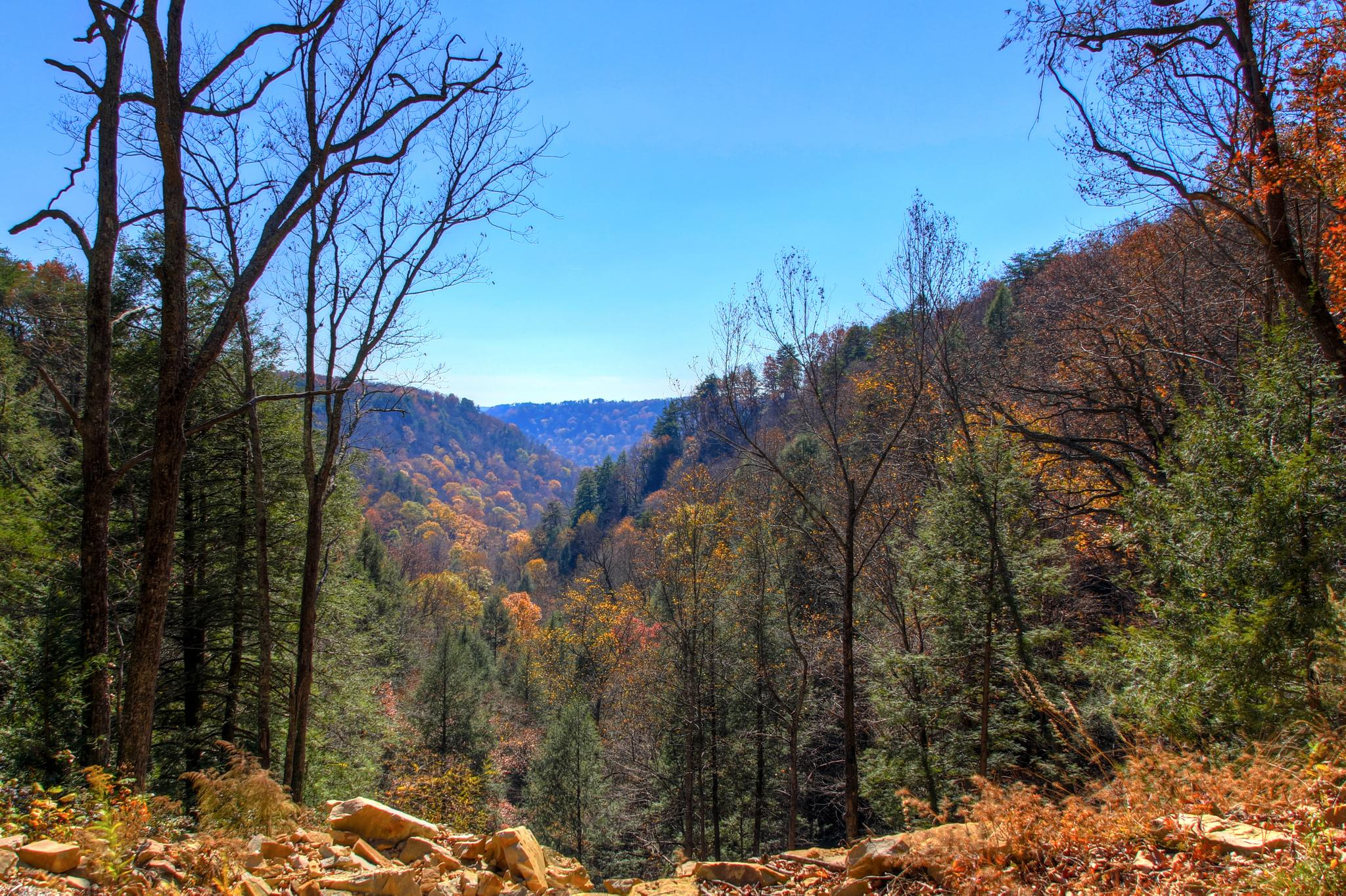
Waterfall hiking trails in Grundy County are characterized by the rugged and diverse landscapes of the Cumberland Plateau. This region features deep gorges, towering sandstone cliffs, and dense forests, providing varied elevation changes and scenic vistas. Numerous cascading waterfalls are a hallmark of the area, enhancing the hiking experience. The terrain includes hemlock cove forests and dry upland pine forests, rich in diverse flora.
Best waterfall hiking trails in Grundy County
- The most popular waterfall hiking route is Savage Falls, a 1.5 miles (2.4 km) trail that takes 38 minutes to complete. This easy path leads to a 30-foot waterfall within the Savage Gulf Natural Area.
- Another top favourite among local hikers is Fiery Gizzard and Dog Hole Trail Loop, a moderate 8.4 miles (13.6 km) path. This route traverses rugged terrain, passing through lush forests and along rocky cliffs, often completed in about 3 hours 53 minutes.
- Local hikers also love the Grundy Forest Day Loop, a 1.2 miles (2.0 km) trail leading through a 234-acre natural area with cascading streams and rockhouses, often completed in about 33 minutes.
- Hiking in Grundy County is defined by deep gorges, sandstone cliffs, and diverse forests. The extensive trail network offers options for various ability levels, from easy strolls to strenuous treks.
- The routes in Grundy County are highly rated by the komoot community with an average score of 4.8 stars from over 20 reviews. More than 300 hikers have used komoot to explore Grundy County's varied terrain.
Last updated: June 25, 2026
4
hikers
2.40km
00:38
10m
40m
Easy hike. Great for any fitness level. Easily-accessible paths. Suitable for all skill levels.
1
hikers
42.2km
11:43
750m
750m
Hard hike. Very good fitness required. Easily-accessible paths. Suitable for all skill levels.

Sign up for free
2.04km
00:33
10m
40m
Easy hike. Great for any fitness level. Easily-accessible paths. Suitable for all skill levels.
1.32km
00:24
50m
30m
Easy hike. Great for any fitness level. Easily-accessible paths. Suitable for all skill levels.
4.0
(3)
63
hikers
13.6km
03:53
300m
300m
Moderate hike. Good fitness required. Easily-accessible paths. Suitable for all skill levels.
Get access to more routes and recommendations from other explorers.
Sign up for free
Already have an account?
Our route recommendations are based on thousands of hikes, rides, and runs completed by other people on komoot.
Start today with a free account
Your next adventure awaits.
Login or Signup


Other adventures in Grundy County

Tips from the Community

Raven Point is the pinnacle of the Fiery Gizzard Trail. You can reach the viewpoint by taking a short spur trail off of the main path. You'll come to the rocky outcrop overlooking the valley and nearby mesas.
0
0
Raven Point is the pinnacle of the Fiery Gizzard Trail. You can reach the viewpoint by taking a short spur trail off of the main path. You'll come to the rocky outcrop overlooking the valley and nearby mesas.
0
0

Grundy Forest is 234 acres in size and is a natural forested area in Grundy County, hence the name. The area features flowing streams, waterfalls, rock formations, hemlock cove forests, dry pine forests, and cliffs. Hikers can enjoy a few waterfalls like Hanes Hole Falls, Blue Hole Falls, and Sycamore Falls. In the Cave Springs Rock House area, there is a 500-year-old hemlock tree.
0
0

Frequently Asked Questions
How many waterfall hiking trails are available in Grundy County?
Grundy County offers a diverse selection of over 10 waterfall hiking trails, catering to various skill levels. These routes explore the rugged landscapes of the Cumberland Plateau, featuring deep gorges, sandstone cliffs, and dense forests.
What are some easy waterfall hikes suitable for beginners or families?
For an easy and rewarding experience, consider the Savage Falls trail, which is about 1.5 miles (2.4 km) long and leads to a beautiful 30-foot waterfall within the Savage Gulf Natural Area. Another excellent option is the Grundy Forest Day Loop, a 1.2-mile (2.0 km) path through a natural area with cascading streams and rockhouses.
Are there any challenging waterfall hikes for experienced trekkers?
Yes, for a more strenuous adventure, the North Rim to South Rim via Collins Loop offers a difficult 26.2-mile (42.2 km) trek with significant elevation changes, providing a comprehensive exploration of the region's rugged beauty and waterfalls.
What unique natural features can I expect to see on these trails?
Beyond the waterfalls, Grundy County's trails showcase dramatic rock formations like the iconic 'Stone Door,' a significant crack in a sandstone cliff. You might also encounter the towering Chimney Rocks, the narrow Black Canyon, and the Cave Springs Rock House, which shelters a remarkable 500-year-old hemlock tree. The diverse forests, including hemlock coves and upland pine, also add to the scenic beauty.
Are there any loop trails that feature waterfalls?
Absolutely. The Greeter Falls Loop Trail is a popular shorter option, leading through forests to the picturesque Greeter Falls. For a moderate, longer loop, the Fiery Gizzard and Dog Hole Trail Loop traverses rugged terrain, passing through lush forests and along rocky cliffs, often including multiple waterfall views.
What do other hikers enjoy most about the waterfall trails in Grundy County?
The waterfall trails in Grundy County are highly rated by the komoot community, with an average score of 4.8 stars from over 20 reviews. Hikers frequently praise the stunning natural beauty, the variety of cascading waterfalls, and the rugged, diverse landscapes that offer both serene walks and challenging treks.
What is the best time of year to visit the waterfalls in Grundy County?
While beautiful year-round, the waterfalls are particularly impressive after periods of rain, typically in spring or late fall, when water flow is at its peak. Spring also brings vibrant wildflowers, while fall offers stunning foliage. Summer provides lush greenery, and even winter can offer unique frozen waterfall views, though trails may be more challenging.
Are the waterfall trails in Grundy County dog-friendly?
Many trails within South Cumberland State Park, which encompasses much of Grundy County's hiking areas, are dog-friendly, provided dogs are kept on a leash. It's always best to check specific trail regulations before heading out, but generally, your leashed canine companion can join you on these scenic waterfall adventures.
What kind of terrain should I expect on these waterfall hikes?
The terrain in Grundy County is characterized by the Cumberland Plateau, meaning you'll encounter a mix of deep gorges, towering sandstone cliffs, and dense forests. Trails can range from relatively flat, easy paths to rugged, rocky sections with varied elevation changes. Expect natural surfaces, and be prepared for some climbs and descents, especially on longer routes.
Are there any specific viewpoints or overlooks to look for on the waterfall trails?
Yes, many trails offer spectacular viewpoints. On the Fiery Gizzard Trail, Raven Point is a notable rocky outcrop providing panoramic views of the valley and mesas. The Stone Door trail also features multiple overlooks before reaching the iconic geological formation itself. These spots provide excellent opportunities to appreciate the vastness of the Cumberland Plateau.
What are the typical distances and durations for waterfall hikes in the area?
Waterfall hikes in Grundy County vary significantly. You can find shorter, easy walks like the Savage Falls trail, which is about 1.5 miles (2.4 km) and takes less than an hour. Moderate trails, such as the Fiery Gizzard and Dog Hole Trail Loop, can be around 8.4 miles (13.6 km) and take nearly 4 hours. There are also difficult, multi-day options for extended adventures.
Most popular routes in Grundy County

Get inspired with the komoot mobile app


Didn’t find what you were looking for?
Check out more Hikes throughout Grundy County below and find the perfect route in your destination.
Explore more
Browse the best Hikes in other regions.
