The best walks and hikes in Gaviota State Park
32
hikers
7
hikes
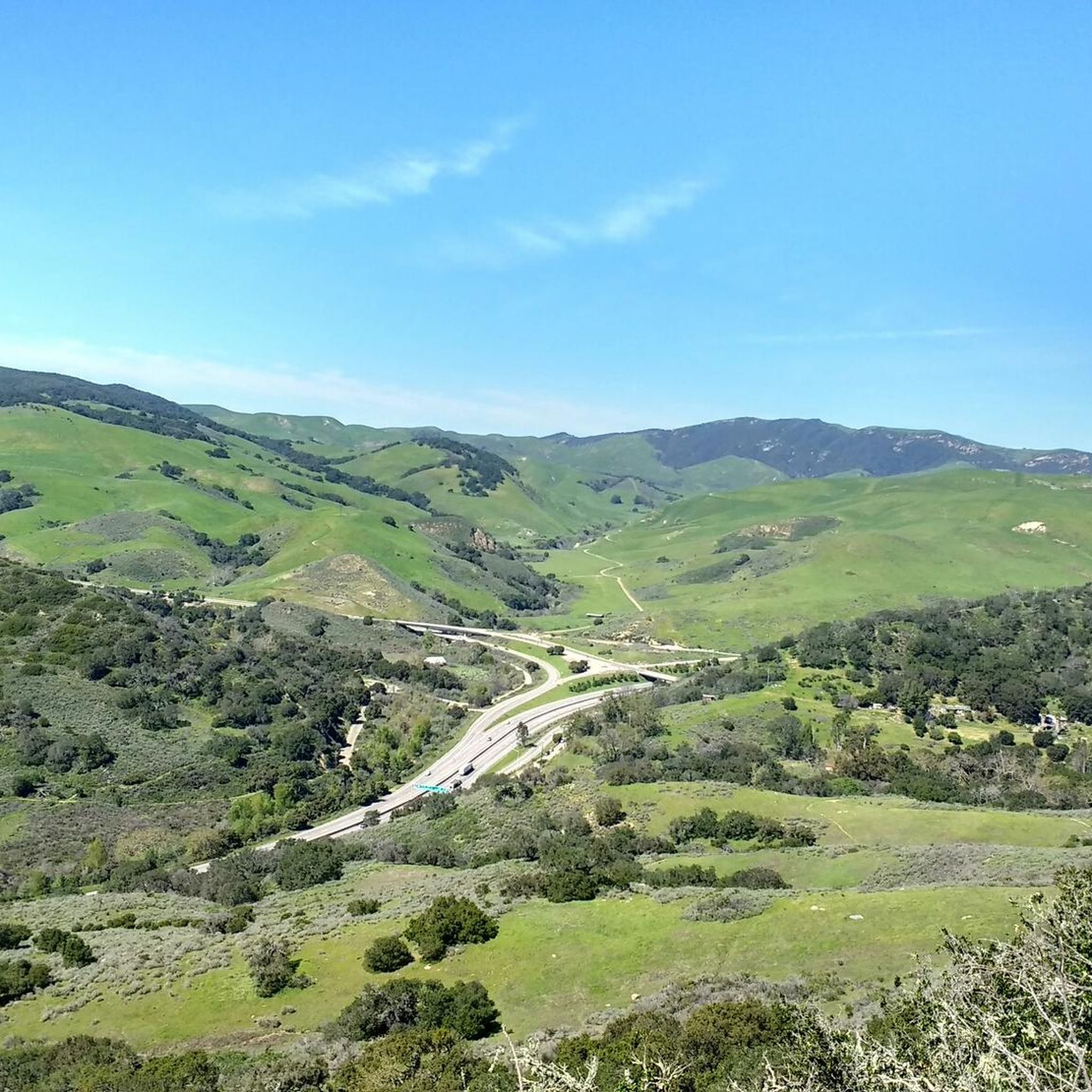
Hiking in Gaviota State Park explores a landscape where the Santa Ynez Mountains meet the Pacific Ocean. The region is characterized by rugged canyons, chaparral-covered hills, and oak woodlands. The trail network offers routes that climb to viewpoints overlooking the coast and others that follow paths through the park's interior. This diverse terrain provides a range of experiences for hikers.
Best hiking trails in Gaviota State Park
- The most popular hiking route is Gaviota Peak – Gaviota Hot Springs loop from Gaviota State Park, a 6.5 miles (10.5 km) trail that takes 3 hours 42 minutes to complete. This moderate route involves a significant climb to Gaviota Peak, which provides panoramic views of the coastline.
- Another top favourite among local hikers is Gaviota Wind Caves Trail, an easy 1.3 miles (2.1 km) path. This path leads to the impressive wind-sculpted sandstone caves, offering ocean views along the way.
- Local hikers also love the Oak Tree on Trespass Trail loop from Gaviota State Park, a 2.6 miles (4.2 km) trail leading through chaparral and oak woodland, often completed in about 1 hour 20 minutes.
- Hiking in Gaviota State Park is defined by coastal mountain ascents, chaparral-covered hills, and paths through oak woodlands. The network of trails provides options for different ability levels, from short, easy walks to more challenging climbs.
- The routes in Gaviota State Park are highly rated by the komoot community with an average score of 5.0 stars from 2 reviews. More than 70 hikers have used komoot to explore Gaviota State Park's varied terrain.
Last updated: October 10, 2026
3
hikers
2.12km
00:44
150m
20m
The Gaviota Wind Caves Trail offers a distinctive hiking experience, leading you to remarkable sandstone formations carved by wind over centuries. This 1.3-mile (2.1 km) route, while rated easy, features a quick, steep ascent of 496 feet (151 metres) that will get your heart pumping, typically taking around 43 minutes. As you climb, you'll be treated to expansive panoramic views of the Pacific Ocean and the rugged Gaviota coastline, culminating in the unique wind caves, some of which feature a prominent circular window.
Planning your visit means considering the trail's exposed nature; there's very little shade, so tackling this hike in cooler weather or during the early morning or late evening is advisable. The trailhead is conveniently located right off Highway 101, making it an accessible stop for a quick adventure. Be prepared for uneven, rocky terrain and steep sections that can feel more challenging than the "easy" rating suggests.
What truly sets this trail apart are the Gaviota Wind Caves themselves, a geological marvel that provides fantastic photo opportunities and a chance to explore natural shelters. The continuous impressive views of the undeveloped Gaviota Coast and the Santa Ynez Mountains further enhance the experience, making it a memorable destination for those seeking unique natural features and stunning vistas in Santa Barbara County.
3.85km
01:13
170m
140m
The Las Cruces to Gaviota Windows Cave trail offers a distinctive hiking experience, leading you through varied terrain to remarkable wind-carved sandstone formations. This easy 2.4-mile (3.9 km) route involves 561 feet (171 metres) of elevation gain, typically taking about 1 hour and 13 minutes to complete. You'll start amidst chaparral and oak, then ascend to open vistas of the Gaviota coastline and the Pacific Ocean, culminating in the unique geological wonders of the Gaviota Wind Caves.
When planning your visit, be aware that the trail has very little shade, making it quite demanding during warmer weather or midday. It's best to tackle this Gaviota Wind Caves trail in cooler conditions or during the early morning or late evening. Always carry ample water, especially given the steep sections you'll encounter on the way to the caves. The Las Cruces Trailhead serves as your starting point, providing straightforward access.
These fascinating Gaviota Wind Caves are a testament to thousands of years of wind erosion on soft Vaqueros sandstone, creating a network of nooks and larger chambers. Beyond the caves, the trail offers sweeping views that include the Gaviota train bridge and Highway 101, with the Channel Islands often visible on clear days. This area also holds historical significance, having been home to the Chumash people for millennia.

3
hikers
4.16km
01:20
170m
170m
Easy hike. Great for any fitness level. Easily-accessible paths. Suitable for all skill levels.
1
hikers
1.47km
00:29
70m
70m
Hike the easy 0.9-mile Nojoqui Falls Trail to a beautiful 70-foot waterfall, perfect for a quick nature escape in Santa Barbara County.
10
hikers
5.45km
01:46
300m
150m
Embark on the Bill Wallace Trail, a moderate 3.4-mile (5.4 km) hike that climbs 999 feet (305 metres) over approximately 1 hour and 46 minutes. You'll follow an old oil road, encountering very steep hills that challenge you while offering expansive coastal views of the Pacific Ocean and the Channel Islands. As you ascend, you might reach "machine-gun mesa", a popular halfway point, where you can pause to take in the sweeping vistas before continuing through chaparral backcountry. The route provides a good workout with rewarding scenery.
Before you head out, be aware that parts of the trail can become overgrown with mustard and thistle, especially after rain. Creek crossings might also present a challenge, particularly if there have been recent fires or floods in the area. It's wise to carry plenty of water, as shade is limited along the route. Consider wearing long trousers to protect your legs from vegetation and bringing hiking poles for stability on steeper sections. For the most current conditions, especially concerning impacts from the 2016 Sherpa Fire, you should check with California State Parks before your visit.
This trail offers a unique blend of coastal and inland perspectives, allowing you to see both the Pacific Ocean and the Santa Barbara Channel, alongside glimpses of the Santa Ynez Mountains. Keep an eye out for local wildlife such as bobcats and deer as you traverse the varied terrain. Depending on the season, you might also find abundant wildflowers, adding a splash of color to the chaparral landscape. The route's history as an old oil road adds an interesting layer to your hiking experience.
Get access to more routes and recommendations from other explorers.
Already have an account?
Our route recommendations are based on thousands of hikes, rides, and runs completed by other people on komoot.
Start today with a free account
Your next adventure awaits.
Popular around Gaviota State Park

Other adventures in Gaviota State Park

Tips from the Community

The top of the trail continues to be steep up to the higher win caves. It is worth the climb.
0
0

The Gaviota Wind Caves are a set of stunning sandstone formations located in Gaviota State Park, just off the Pacific Coast Highway. Take a little time exploring the caves and enjoying the wonderful views across the park and out to the ocean.
0
0

From this trailhead it's only a half-mile walk to the idyllic waterfall.
0
0
Narrow canyon with a tall idyllic waterfall at the end. Even when the water stops running in summer/fall, the moss on the rocks gives a dramatic and beautiful waterfall effect.
0
0
10 minutes walk (or a minute by bike if there are no other people ;-) to a waterfall that's probably most impressive in spring, but is still quite photogenically mossy even when reduced to a trickle in summer.
0
0
Frequently Asked Questions
Are dogs allowed on the trails in Gaviota State Park?
Dogs are generally not permitted on the backcountry trails or dirt roads within Gaviota State Park, including popular routes to Gaviota Peak and the Wind Caves. They are typically allowed only in developed areas like campgrounds and on paved roads, and must be on a leash. For specific regulations, it's best to check the official park website.
Are there any family-friendly or easy hikes in the park?
Yes, the park offers some easier options suitable for families. A great choice is the Oak Tree on Trespass Trail loop from Buellton. This 2.6-mile (4.2 km) walk is relatively short and takes you through pleasant oak woodlands without the strenuous climbs of the park's peak trails.
How difficult is the hike to the Gaviota Wind Caves?
The hike to the Gaviota Wind Caves is considered short but challenging due to its steepness. While the View of the Wind Caves loop from Buellton is only about 2.4 miles (3.8 km), it involves a rapid elevation gain of over 500 feet (154 m). The trail is a dirt singletrack that can be slippery, but the reward is exploring the unique sandstone caves and enjoying views of the coast.
Can I hike to the Gaviota Hot Springs?
Yes, you can hike to the Gaviota Hot Springs. The springs are a popular feature and can be reached via the Gaviota Peak – Gaviota Hot Springs loop from Gaviota State Park. This trail allows you to visit both the summit and the natural thermal pools, which are a great spot to relax after the strenuous part of the hike.
Is there a trail to a waterfall in the area?
Yes, you can hike to a nearby waterfall at Nojoqui Falls County Park. The Nojoqui Falls — Nojoqui Falls County Park trail is a very easy and short walk, less than a mile long, leading to the base of the falls. The flow of the waterfall is best after recent rainfall.
What do other hikers think of the trails in Gaviota State Park?
The trails in this area are very highly rated by the komoot community, earning an average score of 5.0 stars. Hikers frequently praise the stunning panoramic views of the Pacific Ocean and Channel Islands from the higher elevations, as well as the unique geological formations like the Wind Caves.
What is the best time of year for hiking in Gaviota State Park?
Spring is an excellent time to hike in Gaviota State Park, as the hills are green and often covered in wildflowers. Fall and winter also offer pleasant hiking conditions. Summers can be very hot and dry, especially on exposed trails like the Gaviota Peak fire road, so if you hike then, be sure to start early and bring plenty of water.
Can I go swimming or fishing in the park?
Yes, Gaviota State Park provides coastal access for swimming, sunbathing, and fishing. The beach is reached by walking under a scenic railroad trestle from the main day-use area. Fishing is also popular from the park's pier, though access may sometimes be restricted.
Where can I park to hike in Gaviota State Park?
The main parking area for Gaviota State Park is located off Highway 101 and serves the beach, campground, and trailheads for Gaviota Peak and the Hot Springs. There is a day-use fee to park here. For other trails, like the one to the Wind Caves, there are separate turnouts along Gaviota Park Boundary Road.
Are there options for camping or backpacking?
Gaviota State Park has a campground with sites for tents, trailers, and RVs, making it a convenient base for exploring the trails. However, backcountry or trailside camping is generally not permitted. For campground reservations and availability, you should consult the official California State Parks website at parks.ca.gov.
What kind of terrain should I expect on the trails?
The terrain varies significantly. You'll find wide, exposed fire roads on the main route to Gaviota Peak, as well as steeper, more rugged single-track paths like the Trespass Trail. Other trails feature chaparral-covered hillsides, oak woodlands, and the unique sandstone formations of the Wind Caves. Proper hiking footwear is recommended for all trails.
Most popular routes in Gaviota State Park
Most popular attractions in Gaviota State Park

Get inspired with the komoot mobile app


Explore more
Browse the best Hikes in other regions.
